62:
733:
33:
876:
895:
868:
848:
69:
284:, the mandal had a population of 238,962. The total population constitute, 118,820 males and 120,142 females —a sex ratio of 1011 females per 1000 males. 21,272 children are in the age group of 0–6 years, of which 11,037 are boys and 10,235 are girls. The average literacy rate stands at 78.62% with 171,144 literates.
1126:
32:
656:
61:
597:
798:
272:
In March 2023, the state government put forth a proposal for the bifurcation of
Machilipatnam mandal into Machilipatnam North and Machilipatnam South mandals.
958:
1139:
93:
623:
1108:
1116:
438:
430:
1149:
442:
426:
1185:
462:
660:
1154:
1164:
1134:
791:
1144:
682:
135:
1159:
999:
951:
238:
784:
601:
258:
758:
567:
147:
1004:
944:
1009:
915:
904:
708:
266:
510:
1083:
206:
542:
396:
485:
450:
631:
991:
967:
226:
152:
300:
is the most populated village and
Potlapalem is the least populated village in the mandal.
776:
314:
293:
281:
190:
1098:
446:
434:
234:
140:
1179:
1027:
981:
922:
883:
836:
366:
360:
242:
162:
686:
414:
296:, the mandal has 29 settlements. It includes 1 town and 28 villages in the mandal.
1065:
909:
328:
297:
262:
1093:
830:
246:
635:
108:
95:
1073:
202:
197:
1032:
575:
709:"DELIMITATION OF PARLIAMENTARY AND ASSEMBLY CONSTITUENCIES ORDER, 2008"
659:. The Registrar General & Census Commissioner, India. Archived from
1088:
1055:
1078:
1050:
1019:
824:
250:
222:
936:
857:
818:
254:
230:
128:
1042:
940:
780:
488:. The Registrar General & Census Commissioner, India
1125:
1107:
1064:
1041:
1018:
990:
974:
196:
186:
181:
173:
168:
158:
146:
134:
124:
23:
303:The settlements in the mandal are listed below:
759:"Machilipatnam Assembly 2014 Election Results"
952:
792:
574:. National Informatics Centre. Archived from
8:
480:
478:
68:
959:
945:
937:
799:
785:
777:
714:. Election Commission of India. p. 21
657:"Sub-District Details of Krishna District"
20:
505:
503:
807:Places adjacent to Machilipatnam mandal
474:
195:
180:
167:
157:
123:
88:
54:
43:
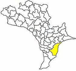
37:Mandal map of Krishna district showing
29:
431:Machilipatnam (Lok Sabha constituency)
241:, and the headquarters are located in
537:
535:
443:Machilipatnam (Assembly constituency)
427:Machilipatnam (Assembly constituency)
185:
172:
145:
133:
7:
814:
685:. censusindia.gov.in. Archived from
548:. Census of India. pp. 517, 531
511:"District Census Handbook - Krishna"
463:List of villages in Krishna district
237:. It is under the administration of
738:Andhra Pradesh Legislature Assembly
14:
600:. aponline.gov.in. Archived from
572:Krishna District Official Website
81:Location in Andhra Pradesh, India
893:
874:
866:
846:
67:
60:
48:Interactive Map Outlining mandal
39:Machilipatnam mandal (in yellow)
31:
245:town. The mandal is bounded by
425:Machilipatnam mandal is under
239:Machilipatnam revenue division
18:Place in Andhra Pradesh, India
1:
894:
847:
624:"Six new urban mandals in AP"
598:"Mandals in Krishna district"
363:(M - Ward 1 to 19, 40 to 50)
875:
867:
1186:Mandals in Krishna district
429:, which in turn represents
1202:
543:"Krishna District Mandals"
812:
401:Sultannagaram Gollapalem
89:
55:
44:
30:
1109:Lok Sabha constituencies
1127:Assembly constituencies
1084:Madhavaram, Mudinepalle
421:Government and politics
568:"Administrative Setup"
325:Chilakalapudi (rural)
975:District headquarters
187: • Official
872:Machilipatnam mandal
683:"Abbreviations used"
369:(M - Ward 20 to 39)
219:Machilipatnam mandal
75:Machilipatnam mandal
25:Machilipatnam mandal
604:on 13 December 2014
357:Machavaram (rural)
105: /
628:The Times of India
578:on 20 October 2014
451:Telugu Desam Party
378:Palletummalapalem
288:Towns and villages
174: • Total
1173:
1172:
992:Revenue divisions
934:
933:
929:
928:
862:Ghantasala mandal
734:"Member's Report"
221:is one of the 25
213:
212:
1193:
968:Krishna district
961:
954:
947:
938:
897:
896:
878:
877:
870:
869:
850:
849:
815:
801:
794:
787:
778:
771:
770:
768:
766:
755:
749:
748:
746:
744:
730:
724:
723:
721:
719:
713:
705:
699:
698:
696:
694:
679:
673:
672:
670:
668:
653:
647:
646:
644:
642:
630:. 2 March 2023.
620:
614:
613:
611:
609:
594:
588:
587:
585:
583:
564:
558:
557:
555:
553:
547:
539:
530:
529:
527:
525:
520:. p. 16,454
515:
507:
498:
497:
495:
493:
482:
319:Borrapothupalem
227:Krishna district
120:
119:
117:
116:
115:
110:
106:
103:
102:
101:
98:
71:
70:
64:
35:
21:
1201:
1200:
1196:
1195:
1194:
1192:
1191:
1190:
1176:
1175:
1174:
1169:
1121:
1103:
1060:
1037:
1014:
986:
970:
965:
935:
930:
908:
879:
861:
834:
808:
805:
775:
774:
764:
762:
757:
756:
752:
742:
740:
732:
731:
727:
717:
715:
711:
707:
706:
702:
692:
690:
689:on 17 June 2007
681:
680:
676:
666:
664:
663:on 18 July 2014
655:
654:
650:
640:
638:
622:
621:
617:
607:
605:
596:
595:
591:
581:
579:
566:
565:
561:
551:
549:
545:
541:
540:
533:
523:
521:
518:Census of India
513:
509:
508:
501:
491:
489:
484:
483:
476:
471:
459:
423:
410:
315:Bhogireddipalle
290:
278:
215:
113:
111:
109:16.17°N 81.13°E
107:
104:
99:
96:
94:
92:
91:
85:
84:
83:
82:
79:
78:
77:
76:
72:
51:
50:
49:
40:
38:
26:
19:
12:
11:
5:
1199:
1197:
1189:
1188:
1178:
1177:
1171:
1170:
1168:
1167:
1162:
1157:
1152:
1147:
1142:
1137:
1131:
1129:
1123:
1122:
1120:
1119:
1113:
1111:
1105:
1104:
1102:
1101:
1099:Yanamalakuduru
1096:
1091:
1086:
1081:
1076:
1070:
1068:
1062:
1061:
1059:
1058:
1053:
1047:
1045:
1039:
1038:
1036:
1035:
1030:
1024:
1022:
1016:
1015:
1013:
1012:
1007:
1002:
996:
994:
988:
987:
985:
984:
978:
976:
972:
971:
966:
964:
963:
956:
949:
941:
932:
931:
927:
926:
919:
913:
901:
900:
898:
891:
888:
887:
880:
865:
863:
854:
853:
851:
844:
841:
840:
828:
822:
813:
810:
809:
806:
804:
803:
796:
789:
781:
773:
772:
761:. Elections.in
750:
725:
700:
674:
648:
615:
589:
559:
531:
499:
473:
472:
470:
467:
466:
465:
458:
455:
447:Kollu Ravindra
437:. The present
435:Andhra Pradesh
422:
419:
409:
408:
405:
402:
399:
394:
391:
388:
385:
382:
379:
376:
373:
370:
364:
358:
355:
352:
349:
346:
343:
340:
337:
336:Gopuvanipalem
334:
331:
326:
323:
320:
317:
312:
309:
305:
289:
286:
277:
274:
235:Andhra Pradesh
211:
210:
200:
194:
193:
188:
184:
183:
179:
178:
175:
171:
170:
166:
165:
160:
156:
155:
150:
144:
143:
141:Andhra Pradesh
138:
132:
131:
126:
122:
121:
87:
86:
80:
74:
73:
66:
65:
59:
58:
57:
56:
53:
52:
47:
46:
45:
42:
41:
36:
28:
27:
24:
17:
13:
10:
9:
6:
4:
3:
2:
1198:
1187:
1184:
1183:
1181:
1166:
1163:
1161:
1158:
1156:
1153:
1151:
1150:Machilipatnam
1148:
1146:
1143:
1141:
1138:
1136:
1133:
1132:
1130:
1128:
1124:
1118:
1117:Machilipatnam
1115:
1114:
1112:
1110:
1106:
1100:
1097:
1095:
1092:
1090:
1087:
1085:
1082:
1080:
1077:
1075:
1072:
1071:
1069:
1067:
1063:
1057:
1054:
1052:
1049:
1048:
1046:
1044:
1040:
1034:
1031:
1029:
1028:Machilipatnam
1026:
1025:
1023:
1021:
1017:
1011:
1008:
1006:
1003:
1001:
1000:Machilipatnam
998:
997:
995:
993:
989:
983:
982:Machilipatnam
980:
979:
977:
973:
969:
962:
957:
955:
950:
948:
943:
942:
939:
925:
924:
923:Bay of Bengal
920:
917:
914:
911:
906:
903:
902:
899:
892:
890:
889:
886:
885:
884:Bay of Bengal
881:
873:
864:
859:
856:
855:
852:
845:
843:
842:
839:
838:
837:Bay of Bengal
832:
829:
826:
823:
820:
817:
816:
811:
802:
797:
795:
790:
788:
783:
782:
779:
760:
754:
751:
739:
735:
729:
726:
710:
704:
701:
688:
684:
678:
675:
662:
658:
652:
649:
637:
633:
629:
625:
619:
616:
603:
599:
593:
590:
577:
573:
569:
563:
560:
544:
538:
536:
532:
519:
512:
506:
504:
500:
487:
486:"Census 2011"
481:
479:
475:
468:
464:
461:
460:
456:
454:
452:
448:
444:
441:representing
440:
436:
432:
428:
420:
418:
417:
416:
406:
403:
400:
398:
395:
392:
389:
386:
383:
380:
377:
374:
371:
368:
367:Machilipatnam
365:
362:
361:Machilipatnam
359:
356:
353:
350:
348:Karagraharam
347:
344:
342:Hussainpalem
341:
338:
335:
332:
330:
327:
324:
322:Buddalapalem
321:
318:
316:
313:
310:
307:
306:
304:
301:
299:
295:
287:
285:
283:
275:
273:
270:
268:
264:
260:
256:
252:
248:
244:
243:Machilipatnam
240:
236:
232:
228:
224:
220:
216:
208:
204:
201:
199:
192:
189:
176:
164:
163:Machilipatnam
161:
154:
151:
149:
142:
139:
137:
130:
127:
118:
90:Coordinates:
63:
34:
22:
16:
1155:Pamarru (SC)
1066:Census towns
921:
882:
871:
835:
763:. Retrieved
753:
741:. Retrieved
737:
728:
716:. Retrieved
703:
691:. Retrieved
687:the original
677:
665:. Retrieved
661:the original
651:
641:27 September
639:. Retrieved
627:
618:
608:12 September
606:. Retrieved
602:the original
592:
580:. Retrieved
576:the original
571:
562:
550:. Retrieved
522:. Retrieved
517:
492:12 September
490:. Retrieved
424:
415:Municipality
412:
411:
387:Polatitippa
372:Manginapudi
302:
291:
279:
276:Demographics
271:
218:
217:
214:
159:Headquarters
114:16.17; 81.13
15:
910:Challapalli
407:Tavisipudi
404:Tallapalem
393:Potlapalem
390:Pothepalli
384:Pedayadara
381:Pedapatnam
339:Gundupalem
329:Chinnapuram
308:Arisepalli
298:Chinnapuram
292:As of 2011
280:As of 2011
263:Challapalli
112: /
1165:Penamaluru
1140:Gannavaram
1135:Avanigadda
1094:Tadigadapa
831:Bantumilli
765:13 October
743:12 October
718:11 October
582:9 February
552:19 January
524:5 February
469:References
397:Rudravaram
354:Kottapudi
333:Gokavaram
259:Ghantasala
247:Bantumilli
169:Population
1074:Kankipadu
636:0971-8257
375:Nelakuru
269:mandals.
233:state of
198:Time zone
182:Languages
1180:Category
1145:Gudivada
1033:Gudivada
1005:Gudivada
457:See also
413:Note: M-
203:UTC+5:30
148:District
1089:Poranki
1056:Vuyyuru
1010:Vuyyuru
907:mandal
860:mandal
833:mandal
345:Kanuru
311:Bandar
229:of the
223:mandals
177:238,962
153:Krishna
125:Country
100:81°08′E
97:16°10′N
1160:Pedana
1079:Kanuru
1051:Pedana
1020:Cities
918:mandal
916:Koduru
912:mandal
905:Koduru
827:mandal
825:Pedana
821:mandal
693:26 May
667:24 May
634:
294:census
282:census
267:Koduru
265:, and
251:Pedana
231:Indian
191:Telugu
1043:Towns
858:Gudur
819:Gudur
712:(pdf)
546:(PDF)
514:(PDF)
351:Kona
255:Gudur
136:State
129:India
767:2014
745:2014
720:2014
695:2014
669:2014
643:2023
632:ISSN
610:2014
584:2015
554:2015
526:2016
494:2014
449:of
445:is
439:MLA
433:of
225:in
207:IST
1182::
736:.
626:.
570:.
534:^
516:.
502:^
477:^
453:.
261:,
257:,
253:,
249:,
960:e
953:t
946:v
800:e
793:t
786:v
769:.
747:.
722:.
697:.
671:.
645:.
612:.
586:.
556:.
528:.
496:.
209:)
205:(
Text is available under the Creative Commons Attribution-ShareAlike License. Additional terms may apply.