141:
859:
134:
33:
249:(solo climb) in March 1894 via the North Face. Today, many climbing routes lie on the mountain, all of which require technical experience and equipment. The classic route is the West Ridge which includes the "Cheval", a knife edge ridge traversed by straddling. Some of the major climbing routes on Malte Brun include:
531:
900:
833:
524:
90:
919:
259:
Two huts servicing climbers used to exist on the lower slopes, The
Beetham hut in the Beetham Valley, and the Malte Brun Hut on moraine terraces above the
362:. London: George Allen & Unwin Ltd. Electronic version by New Zealand Electronic Text Centre, 2009. Wellington, New Zealand. Retrieved 3 January 2010.
934:
929:
517:
276:
76:
222:, it rises to a height of 3,199 metres (10,495 ft), although other sources give heights ranging from 3155 to 3199 m. A list published by the
426:
893:
540:
483:
455:
360:
The conquest of Mount Cook and other climbs : an account of four seasons’ mountaineering on the
Southern Alps of New Zealand
886:
133:
744:
640:
812:
677:
590:
334:
305:
219:
83:
215:
173:
580:
570:
595:
234:
625:
600:
430:
223:
924:
708:
575:
61:
443:
355:
791:
817:
786:
555:
389:
796:
509:
499:
71:
858:
379:. Wellington: Ministry for Culture and Heritage. Updated 2 March 2009. Retrieved 3 January 2010.
866:
687:
635:
479:
451:
207:
359:
656:
356:
Chapter I — A Rèsumè of
Mountaineering — in the Mount Cook District, between — 1862 And 1909
253:
230:
682:
661:
605:
585:
870:
838:
692:
615:
260:
203:
165:
38:
913:
560:
32:
765:
749:
739:
734:
630:
620:
185:
153:
770:
718:
713:
402:
211:
372:
565:
390:
NEW ZEALAND – SOUTH ISLAND: 301 Summits with 600 meters or greater prominence
326:
256:
3+) – South Ridge (NZ Alpine Grade 3) – South Face (NZ Alpine Grades 4 – 4+)
105:
92:
264:
246:
191:
51:
202:
is the highest peak in the Malte Brun Range, which lies between the
513:
226:
ranks Malte Brun as the third highest mountain in New
Zealand.
301:
874:
826:
805:
779:
758:
727:
701:
670:
649:
548:
184:
179:
164:
121:
82:
70:
60:
50:
45:
25:
834:Aoraki Mackenzie International Dark Sky Reserve
469:
467:
894:
525:
450:. Rosedale, North Shore: Raupo. p. 231.
8:
901:
887:
532:
518:
510:
277:List of mountains of New Zealand by height
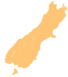
37:Malte Brun (upper right) rises beyond the
22:
377:Te Ara – the Encyclopedia of New Zealand
296:
294:
292:
478:. Craig Potton Publishing. p. 53.
288:
7:
855:
853:
392:Peaklist. Retrieved 3 January 2010.
263:. The Beetham hut was destroyed by
920:Mountains of the Canterbury Region
140:
14:
935:Canterbury Region geography stubs
930:Aoraki / Mount Cook National Park
827:Reserves and World Heritage Sites
541:Aoraki / Mount Cook National Park
500:"ClimbNZ National Route Database"
245:Malte Brun was first ascended by
869:-related geography article is a
857:
139:
132:
31:
373:Mountaineering – Aoraki/Mt Cook
327:"Place name detail: Malte Brun"
1:
446:(2010). Peter Dowling (ed.).
56:3,199 m (10,495 ft)
873:. You can help Knowledge by
813:The Alps 2 Ocean Cycle Trail
476:Classic Peaks of New Zealand
335:New Zealand Geographic Board
306:Land Information New Zealand
233:after the French geographer
220:Land Information New Zealand
433:. Retrieved 5 January 2010.
951:
852:
806:Walking and cycling tracks
502:. New Zealand Alpine Club.
448:Place Names of New Zealand
66:780 m (2,560 ft)
780:Settlements and buildings
759:Other geographic features
403:"Malte Brun, New Zealand"
354:E. Freda Du Faur (1915).
235:Victor Adolphe Malte-Brun
154:South Island, New Zealand
126:
30:
427:Mountains of New Zealand
252:– West Ridge (NZ Alpine
431:New Zealand Alpine Club
224:New Zealand Alpine Club
16:Mountain in New Zealand
576:Mount Elie de Beaumont
388:Jonathan de Ferranti,
331:New Zealand Gazetteer
792:Mount Cook Aerodrome
474:Logan, Hugh (2002).
267:in the early 1990s.
106:43.5640°S 170.3047°E
818:Hooker Valley Track
787:The Hermitage Hotel
556:Aoraki / Mount Cook
102: /
797:Mount Cook Village
208:Murchison Glaciers
172:Malte Brun Range,
111:-43.5640; 170.3047
46:Highest point
882:
881:
867:Canterbury Region
847:
846:
688:Murchison Glacier
636:Mount Teichelmann
302:"LINZ Topo50 map"
197:
196:
942:
903:
896:
889:
861:
854:
657:Mount Cook Range
534:
527:
520:
511:
504:
503:
496:
490:
489:
471:
462:
461:
440:
434:
424:
418:
417:
415:
413:
399:
393:
386:
380:
369:
363:
352:
346:
345:
343:
341:
323:
317:
316:
314:
312:
298:
231:Julius von Haast
229:It was named by
168:
143:
142:
136:
117:
116:
114:
113:
112:
107:
103:
100:
99:
98:
95:
35:
23:
950:
949:
945:
944:
943:
941:
940:
939:
910:
909:
908:
907:
850:
848:
843:
822:
801:
775:
754:
745:Murchison River
723:
697:
683:Mueller Glacier
666:
662:Two Thumb Range
650:Mountain ranges
645:
641:Mount Vancouver
606:Lendenfeld Peak
586:Mount Haidinger
544:
538:
508:
507:
498:
497:
493:
486:
473:
472:
465:
458:
442:
441:
437:
425:
421:
411:
409:
401:
400:
396:
387:
383:
370:
366:
353:
349:
339:
337:
325:
324:
320:
310:
308:
300:
299:
290:
285:
273:
257:
243:
218:. According to
166:
160:
159:
158:
157:
156:
151:
150:
149:
148:
144:
110:
108:
104:
101:
96:
93:
91:
89:
88:
41:
17:
12:
11:
5:
948:
946:
938:
937:
932:
927:
922:
912:
911:
906:
905:
898:
891:
883:
880:
879:
862:
845:
844:
842:
841:
839:Te Wahipounamu
836:
830:
828:
824:
823:
821:
820:
815:
809:
807:
803:
802:
800:
799:
794:
789:
783:
781:
777:
776:
774:
773:
768:
762:
760:
756:
755:
753:
752:
747:
742:
737:
731:
729:
725:
724:
722:
721:
716:
711:
705:
703:
699:
698:
696:
695:
693:Tasman Glacier
690:
685:
680:
678:Hooker Glacier
674:
672:
668:
667:
665:
664:
659:
653:
651:
647:
646:
644:
643:
638:
633:
628:
623:
618:
616:Mount Ollivier
613:
608:
603:
598:
593:
591:Mount Hamilton
588:
583:
578:
573:
568:
563:
558:
552:
550:
546:
545:
539:
537:
536:
529:
522:
514:
506:
505:
491:
484:
463:
456:
435:
419:
407:Peakbagger.com
394:
381:
364:
347:
318:
287:
286:
284:
281:
280:
279:
272:
269:
261:Tasman Glacier
251:
242:
239:
195:
194:
188:
182:
181:
177:
176:
170:
162:
161:
152:
146:
145:
138:
137:
131:
130:
129:
128:
127:
124:
123:
119:
118:
86:
80:
79:
77:New Zealand #3
74:
68:
67:
64:
58:
57:
54:
48:
47:
43:
42:
39:Tasman Glacier
36:
28:
27:
15:
13:
10:
9:
6:
4:
3:
2:
947:
936:
933:
931:
928:
926:
925:Southern Alps
923:
921:
918:
917:
915:
904:
899:
897:
892:
890:
885:
884:
878:
876:
872:
868:
863:
860:
856:
851:
840:
837:
835:
832:
831:
829:
825:
819:
816:
814:
811:
810:
808:
804:
798:
795:
793:
790:
788:
785:
784:
782:
778:
772:
769:
767:
764:
763:
761:
757:
751:
748:
746:
743:
741:
738:
736:
733:
732:
730:
726:
720:
717:
715:
712:
710:
707:
706:
704:
700:
694:
691:
689:
686:
684:
681:
679:
676:
675:
673:
669:
663:
660:
658:
655:
654:
652:
648:
642:
639:
637:
634:
632:
629:
627:
624:
622:
619:
617:
614:
612:
609:
607:
604:
602:
599:
597:
594:
592:
589:
587:
584:
582:
579:
577:
574:
572:
569:
567:
564:
562:
561:Mount Dampier
559:
557:
554:
553:
551:
547:
543:, New Zealand
542:
535:
530:
528:
523:
521:
516:
515:
512:
501:
495:
492:
487:
485:0-908802-88-9
481:
477:
470:
468:
464:
459:
457:9780143204107
453:
449:
445:
439:
436:
432:
428:
423:
420:
408:
404:
398:
395:
391:
385:
382:
378:
374:
371:John Wilson.
368:
365:
361:
357:
351:
348:
336:
332:
328:
322:
319:
307:
303:
297:
295:
293:
289:
282:
278:
275:
274:
270:
268:
266:
262:
255:
250:
248:
240:
238:
236:
232:
227:
225:
221:
217:
216:Southern Alps
213:
209:
205:
201:
193:
189:
187:
183:
178:
175:
174:Southern Alps
171:
169:
163:
155:
135:
125:
120:
115:
87:
85:
81:
78:
75:
73:
69:
65:
63:
59:
55:
53:
49:
44:
40:
34:
29:
24:
21:
19:
875:expanding it
864:
849:
766:Copland Pass
750:Tasman River
740:Hooker River
735:Godley River
631:Mount Tasman
621:Mount Sefton
610:
581:Glacier Peak
571:Douglas Peak
494:
475:
447:
438:
422:
410:. Retrieved
406:
397:
384:
376:
367:
350:
338:. Retrieved
330:
321:
309:. Retrieved
258:
244:
228:
199:
198:
186:First ascent
167:Parent range
20:
18:
771:Sealy Tarns
719:Tasman Lake
714:Hooker Lake
596:Mount Hicks
444:Reed, A. W.
212:New Zealand
109: /
97:170°18′17″E
84:Coordinates
914:Categories
626:Silberhorn
611:Malte Brun
601:La Perouse
566:Dixon Peak
283:References
200:Malte Brun
147:Malte Brun
94:43°33′50″S
62:Prominence
26:Malte Brun
709:Blue Lake
549:Mountains
412:3 January
311:5 January
265:Avalanche
190:1894, by
122:Geography
52:Elevation
671:Glaciers
340:17 March
271:See also
247:Tom Fyfe
241:Climbing
192:Tom Fyfe
180:Climbing
210:within
72:Listing
728:Rivers
482:
454:
204:Tasman
865:This
702:Lakes
358:, in
254:grade
871:stub
480:ISBN
452:ISBN
414:2010
342:2018
313:2010
206:and
214:'s
916::
466:^
429:,
405:.
375:,
333:.
329:.
304:.
291:^
237:.
902:e
895:t
888:v
877:.
533:e
526:t
519:v
488:.
460:.
416:.
344:.
315:.
Text is available under the Creative Commons Attribution-ShareAlike License. Additional terms may apply.