56:
84:
39:
91:
63:
298:
Of the 1,935 hectares of the park's total area, 412.5 ha. are reserved for wildlife habitat, 539.46 ha. for sustainable uses, 57.34 ha. for multiple uses, 15.7 ha. for restoration, and 91.7 ha. for recreation. A series of pathways and foot trails provide access to areas around the park which is
278:
hot springs, near the 923-foot (281 m)-tall extinct volcano Mount
Malabobo, and is located in the rural barangay of Malabobo in Mangatarem municipality, some 180 kilometres (110 mi) north from
586:
262:; it now has a total area of 1,935.17 hectares (4,781.9 acres) and a buffer zone area of 965.09 hectares (2,384.8 acres). It is one of only two protected areas in Pangasinan, the other being the
55:
251:
which was 35 cm (14 in) in diameter at the time. In 1939, the adjoining 32.9-hectare (81-acre) public forest was added to the reserve and on 3 September 1940, through
President
83:
243:
It was originally established in 1934 as the
Manleluag Spring Forest Reserve covering approximately 58.8 hectares (145 acres) through Proclamation No. 659 signed by Governor-General
295:. The area has low to rolling and moderately steep slopes with an average elevation of 1,033 feet (315 m). The park is crossed by two rivers, the Baracbac and Basican rivers.
706:
579:
766:
140:
796:
195:
572:
791:
786:
741:
208:
604:
617:
771:
781:
776:
690:
255:'s Proclamation No. 612, it was re-designated as a national park occupying an area of approximately 91.7 hectares (227 acres).
28:
258:
The park was converted into a protected landscape area on March 10, 2004, through
Proclamation No. 576 signed by President
654:
638:
612:
263:
680:
675:
670:
514:
519:
324:
316:
761:
541:
406:
307:
The protected landscape is an important biodiversity area. It is home to over 90 bird species, including the
431:
381:
292:
259:
128:
352:
308:
299:
surrounded by patrol trails and fire lines in the buffer area for forest fire protection purposes.
38:
252:
356:
340:
320:
312:
223:. It is one of 34 protected landscapes in the Philippines located in the municipality of
564:
248:
755:
596:
216:
546:
283:. It is part of the Mangatarem forest which straddles the provinces of Pangasinan,
244:
487:
465:
336:
220:
212:
118:
622:
275:
228:
224:
114:
155:
142:
348:
344:
284:
332:
328:
288:
280:
247:. The boundaries of the reserve were delineated with reference to an
232:
568:
90:
62:
43:
Mount
Malabobo in the Manleluag Spring Protected Landscape
715:
699:
663:
647:
631:
603:
436:
Official
Gazette of the Republic of the Philippines
411:
Official
Gazette of the Republic of the Philippines
386:
Official
Gazette of the Republic of the Philippines
191:
179:
171:
134:
124:
110:
21:
515:"Rarely seen bird gets limelight in forest plan"
488:"Mount Malabobo – Pangasinan, Philippines"
196:Department of Environment and Natural Resources
580:
542:"Filipinos encouraged to join 'Green Travel'"
8:
587:
573:
565:
509:
507:
505:
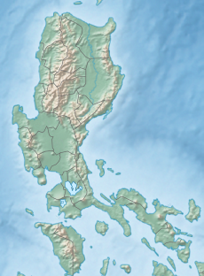
231:in the west-central area of the island of
18:
376:
374:
372:
16:Protected area in Pangasinan, Philippines
460:
458:
456:
454:
452:
767:Protected landscapes of the Philippines
368:
797:1934 establishments in the Philippines
7:
205:Manleluag Spring Protected Landscape
187:March 10, 2004 (Protected landscape)
109:
22:Manleluag Spring Protected Landscape
792:Protected areas established in 1934
742:Protected areas of the Philippines
700:Protected landscapes and seascapes
183:February 17, 1934 (Forest reserve)
14:
787:Tourist attractions in Pangasinan
274:Manleluag spring is a set of two
185:September 3, 1940 (National park)
175:1,935.17 hectares (4,781.9 acres)
89:
82:
61:
54:
37:
31:V (protected landscape/seascape)
432:"Proclamation No. 576, s. 2004"
407:"Proclamation No. 612, s. 1940"
382:"Proclamation No. 399, s. 1939"
339:. Its forest also supports the
178:
123:
772:Hot springs of the Philippines
1:
264:Hundred Islands National Park
98:Location in the Philippines
813:
618:Northern Luzon Heroes Hill
738:
716:Watershed forest reserves
520:Philippine Daily Inquirer
325:flame-breasted fruit dove
317:Philippine hanging parrot
48:
36:
26:
355:, and reptiles like the
782:Landforms of Pangasinan
777:Geography of Pangasinan
595:Protected areas in the
293:Zambales Mountain Range
260:Gloria Macapagal-Arroyo
101:Show map of Philippines
156:15.70306°N 120.28250°E
664:Protected landscapes
353:Philippine warty pig
309:Philippine frogmouth
211:containing natural
192:Governing body
161:15.70306; 120.28250
152: /
722:Ilocos Norte Metro
466:"Manleluag Spring"
253:Manuel Luis Quezon
749:
748:
648:Natural monuments
201:
200:
125:Nearest city
73:Show map of Luzon
70:Location in Luzon
804:
686:Manleluag Spring
639:Kalbario-Patapat
589:
582:
575:
566:
559:
558:
556:
554:
538:
532:
531:
529:
527:
511:
500:
499:
497:
495:
484:
478:
477:
475:
473:
462:
447:
446:
444:
442:
428:
422:
421:
419:
417:
403:
397:
396:
394:
392:
378:
167:
166:
164:
163:
162:
157:
153:
150:
149:
148:
145:
102:
93:
92:
86:
74:
65:
64:
58:
41:
19:
812:
811:
807:
806:
805:
803:
802:
801:
762:IUCN Category V
752:
751:
750:
745:
734:
711:
695:
659:
643:
627:
613:Hundred Islands
599:
593:
563:
562:
552:
550:
540:
539:
535:
525:
523:
513:
512:
503:
493:
491:
486:
485:
481:
471:
469:
468:. Ilocos Hotels
464:
463:
450:
440:
438:
430:
429:
425:
415:
413:
405:
404:
400:
390:
388:
380:
379:
370:
365:
341:Philippine deer
321:Philippine duck
313:rufous hornbill
305:
272:
249:alibanbang tree
241:
186:
184:
160:
158:
154:
151:
146:
143:
141:
139:
138:
106:
105:
104:
103:
100:
99:
96:
95:
94:
77:
76:
75:
72:
71:
68:
67:
66:
44:
32:
17:
12:
11:
5:
810:
808:
800:
799:
794:
789:
784:
779:
774:
769:
764:
754:
753:
747:
746:
739:
736:
735:
733:
732:
729:
726:
723:
719:
717:
713:
712:
710:
709:
703:
701:
697:
696:
694:
693:
688:
683:
678:
673:
667:
665:
661:
660:
658:
657:
651:
649:
645:
644:
642:
641:
635:
633:
629:
628:
626:
625:
620:
615:
609:
607:
605:National parks
601:
600:
594:
592:
591:
584:
577:
569:
561:
560:
533:
501:
479:
448:
423:
398:
367:
366:
364:
361:
304:
301:
271:
268:
240:
237:
209:protected area
199:
198:
193:
189:
188:
181:
177:
176:
173:
169:
168:
136:
132:
131:
126:
122:
121:
112:
108:
107:
97:
88:
87:
81:
80:
79:
78:
69:
60:
59:
53:
52:
51:
50:
49:
46:
45:
42:
34:
33:
27:
24:
23:
15:
13:
10:
9:
6:
4:
3:
2:
809:
798:
795:
793:
790:
788:
785:
783:
780:
778:
775:
773:
770:
768:
765:
763:
760:
759:
757:
744:
743:
737:
730:
727:
724:
721:
720:
718:
714:
708:
707:Agoo–Damortis
705:
704:
702:
698:
692:
689:
687:
684:
682:
679:
677:
674:
672:
669:
668:
666:
662:
656:
653:
652:
650:
646:
640:
637:
636:
634:
632:Natural parks
630:
624:
621:
619:
616:
614:
611:
610:
608:
606:
602:
598:
597:Ilocos Region
590:
585:
583:
578:
576:
571:
570:
567:
549:
548:
543:
537:
534:
522:
521:
516:
510:
508:
506:
502:
489:
483:
480:
467:
461:
459:
457:
455:
453:
449:
437:
433:
427:
424:
412:
408:
402:
399:
387:
383:
377:
375:
373:
369:
362:
360:
358:
357:water monitor
354:
350:
346:
342:
338:
334:
330:
326:
322:
318:
314:
310:
302:
300:
296:
294:
290:
286:
282:
277:
269:
267:
265:
261:
256:
254:
250:
246:
238:
236:
234:
230:
226:
222:
218:
217:Ilocos Region
214:
210:
206:
197:
194:
190:
182:
174:
170:
165:
137:
133:
130:
127:
120:
116:
113:
85:
57:
47:
40:
35:
30:
29:IUCN category
25:
20:
740:
685:
655:Bessang Pass
551:. Retrieved
547:Manila Times
545:
536:
524:. Retrieved
518:
492:. Retrieved
482:
470:. Retrieved
439:. Retrieved
435:
426:
414:. Retrieved
410:
401:
389:. Retrieved
385:
306:
303:Biodiversity
297:
273:
257:
245:Frank Murphy
242:
204:
202:
691:Santa Lucia
337:ashy thrush
270:Description
221:Philippines
213:hot springs
180:Established
159: /
147:120°16′57″E
135:Coordinates
119:Philippines
756:Categories
623:Paoay Lake
553:14 October
526:14 October
494:14 October
472:14 October
441:14 October
416:14 October
391:14 October
363:References
276:ophiolitic
229:Pangasinan
225:Mangatarem
144:15°42′11″N
129:San Carlos
115:Pangasinan
725:Naguilian
490:. Peakery
349:cloud rat
345:wild boar
681:Lidlidda
285:Zambales
111:Location
676:Libunao
671:Bigbiga
333:malkoha
291:in the
239:History
219:of the
215:in the
335:, and
329:coleto
289:Tarlac
281:Manila
731:Tanap
728:Santa
233:Luzon
207:is a
555:2014
528:2014
496:2014
474:2014
443:2014
418:2014
393:2014
287:and
203:The
172:Area
758::
544:.
517:.
504:^
451:^
434:.
409:.
384:.
371:^
359:.
351:,
347:,
343:,
331:,
327:,
323:,
319:,
315:,
311:,
266:.
235:.
227:,
117:,
588:e
581:t
574:v
557:.
530:.
498:.
476:.
445:.
420:.
395:.
Text is available under the Creative Commons Attribution-ShareAlike License. Additional terms may apply.