45:
317:
665:
29:
52:
290:. The pond is non-tidal, except when breached by storms. The water directly receives about 57,219,222 gallons of precipitation per year, though groundwater flow is unknown. No rivers or streams flow into the pond. Maschaug Pond, like others in the region, was "formed after the recession of the glaciers 12,000 years ago".
281:
Its watershed covers 392.57 acres (158.87 ha); 52.08 acres (21.08 ha) is occupied by water. Maschaug itself has a surface area of 34.63 acres (14.01 ha), while nearby Little
Maschaug Pond is 11.69 acres (4.73 ha). The pond averages 6.89 ft (2.10 m) deep, and has a
293:
As a result of certain environmental conditions, including low elevation of surrounding land and dense residential and commercial development, Maschaug Pond is considered particularly susceptible to
229:
696:
946:
829:
874:
814:
555:
266:, it is one of nine such lagoons (often referred to as "salt ponds") in southern Rhode Island. A "small, brackish pond", it is not permanently connected to the
101:
44:
569:
559:
689:
596:
809:
682:
497:
472:
564:
522:
358:
951:
219:
77:
869:
330:
799:
725:
589:
773:
335:
87:
550:
393:
804:
758:
915:
582:
418:
215:
73:
910:
639:
322:
925:
864:
735:
720:
644:
283:
275:
267:
147:
501:
476:
849:
614:
752:
730:
298:
768:
526:
664:
894:
859:
834:
789:
763:
649:
445:
302:
175:
165:
940:
889:
844:
824:
634:
574:
365:
271:
223:
133:
879:
819:
706:
624:
920:
884:
854:
619:
294:
794:
674:
629:
312:
245:
231:
116:
103:
270:, and is largely bordered by the Misquamicut Club golf course. Nests of the
28:
551:
U.S. Geological Survey
Geographic Names Information System: Maschaug Pond
394:"Nitrogen Inputs to Rhode Island Coastal Salt – Too Much of a Good Thing"
287:
148:
211:
139:
446:"Rhode Island's Salt Pond Region: A Special Area Management Plan"
678:
578:
16:
Coastal lagoon, brackish in
Washington County, Rhode Island
305:
and
Maschaug Ponds will likely be significantly changed.
399:. Rhode Island Department of Environmental Management
500:. Rhode Island South Shore Sea Grant. Archived from
475:. Rhode Island South Shore Sea Grant. Archived from
903:
782:
744:
713:
451:. Rhode Island Coastal Resources Management Council
197:
189:
185:
174:
164:
146:
132:
93:
83:
69:
21:
94:
690:
590:
278:, have been documented within the watershed.
8:
353:
351:
440:
438:
274:, which has been federally designated as a
947:Lagoons of Washington County, Rhode Island
697:
683:
675:
597:
583:
575:
387:
385:
18:
364:. Rhode Island Sea Grant. Archived from
560:2008 Waterbody Report for Maschaug Pond
467:
465:
347:
297:. It is projected that during a future
525:. Salt Ponds Coalition. Archived from
498:"Maschaug Pond Freshwater Input Data"
473:"Maschaug Pond General Features Data"
392:S.W. Nixon and B. A. Buckley (2007).
51:
7:
556:U.S. Environmental Protection Agency
286:, too low to sustain the growth of
282:salinity level of approximately 7
14:
663:
315:
50:
43:
33:seen from the Ocean View Highway
27:
558:: National Assessment Database
220:Washington County, Rhode Island
196:
188:
78:Washington County, Rhode Island
417:Peter Lord (January 9, 2005).
1:
745:Canals, estuaries, and rivers
331:List of lakes in Rhode Island
170:392.57 acres (158.87 ha)
68:
359:"Salt Ponds of Rhode Island"
193:34.63 acres (14.01 ha)
968:
774:Thames River (Connecticut)
201:6.89 ft (2.10 m)
88:Salt Ponds of Rhode Island
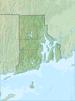
661:
610:
605:Rhode Island's salt ponds
336:Geography of Rhode Island
246:41.3187110°N 71.8309015°W
117:41.3187110°N 71.8309015°W
38:
26:
759:Little Narragansett Bay
251:41.3187110; -71.8309015
122:41.3187110; -71.8309015
952:Westerly, Rhode Island
916:Diamond Hill Reservoir
523:"What is a Salt Pond?"
423:The Providence Journal
911:Burlingame Reservoir
323:Rhode Island portal
241: /
113: /
926:Scituate Reservoir
865:Quonochontaug Pond
736:Rhode Island Sound
721:Block Island Sound
645:Quonochontaug Pond
284:parts per thousand
276:threatened species
268:Block Island Sound
934:
933:
850:Point Judith Pond
672:
671:
615:Point Judith Pond
565:Maschaug Pond map
205:
204:
959:
753:Blackstone Canal
731:Narragansett Bay
699:
692:
685:
676:
667:
599:
592:
585:
576:
538:
537:
535:
534:
519:
513:
512:
510:
509:
504:on July 16, 2011
494:
488:
487:
485:
484:
469:
460:
459:
457:
456:
450:
442:
433:
432:
430:
429:
419:"Shifting sands"
414:
408:
407:
405:
404:
398:
389:
380:
379:
377:
376:
370:
363:
355:
325:
320:
319:
318:
265:
264:
262:
261:
260:
258:
253:
252:
247:
242:
239:
238:
237:
234:
150:
128:
127:
125:
124:
123:
118:
114:
111:
110:
109:
106:
96:
54:
53:
47:
31:
19:
967:
966:
962:
961:
960:
958:
957:
956:
937:
936:
935:
930:
899:
830:Lake Washington
810:Great Salt Pond
783:Lakes and ponds
778:
769:Pawcatuck River
740:
714:Bays and sounds
709:
705:Waterbodies of
703:
673:
668:
659:
640:Green Hill Pond
606:
603:
547:
542:
541:
532:
530:
521:
520:
516:
507:
505:
496:
495:
491:
482:
480:
479:on May 17, 2006
471:
470:
463:
454:
452:
448:
444:
443:
436:
427:
425:
416:
415:
411:
402:
400:
396:
391:
390:
383:
374:
372:
371:on May 17, 2008
368:
361:
357:
356:
349:
344:
321:
316:
314:
311:
256:
254:
250:
248:
244:
243:
240:
235:
232:
230:
228:
227:
178: countries
149:Primary inflows
121:
119:
115:
112:
107:
104:
102:
100:
99:
65:
64:
63:
62:
61:
60:
59:
55:
34:
17:
12:
11:
5:
965:
963:
955:
954:
949:
939:
938:
932:
931:
929:
928:
923:
918:
913:
907:
905:
901:
900:
898:
897:
895:Winnapaug Pond
892:
887:
882:
877:
872:
870:Roosevelt Lake
867:
862:
860:Quicksand Pond
857:
852:
847:
842:
837:
835:Mashapaug Pond
832:
827:
822:
817:
812:
807:
802:
797:
792:
790:Butterfly Pond
786:
784:
780:
779:
777:
776:
771:
766:
764:Mount Hope Bay
761:
756:
748:
746:
742:
741:
739:
738:
733:
728:
723:
717:
715:
711:
710:
704:
702:
701:
694:
687:
679:
670:
669:
662:
660:
658:
657:
652:
650:Winnapaug Pond
647:
642:
637:
632:
627:
622:
617:
611:
608:
607:
604:
602:
601:
594:
587:
579:
573:
572:
567:
562:
553:
546:
545:External links
543:
540:
539:
514:
489:
461:
434:
409:
381:
346:
345:
343:
340:
339:
338:
333:
327:
326:
310:
307:
203:
202:
199:
195:
194:
191:
187:
186:
183:
182:
179:
172:
171:
168:
166:Catchment area
162:
161:
152:
144:
143:
136:
130:
129:
97:
91:
90:
85:
81:
80:
71:
67:
66:
57:
56:
49:
48:
42:
41:
40:
39:
36:
35:
32:
24:
23:
15:
13:
10:
9:
6:
4:
3:
2:
964:
953:
950:
948:
945:
944:
942:
927:
924:
922:
919:
917:
914:
912:
909:
908:
906:
902:
896:
893:
891:
890:Watchaug Pond
888:
886:
883:
881:
878:
876:
873:
871:
868:
866:
863:
861:
858:
856:
853:
851:
848:
846:
845:Ninigret Pond
843:
841:
840:Maschaug Pond
838:
836:
833:
831:
828:
826:
825:Lake Mishnock
823:
821:
818:
816:
813:
811:
808:
806:
803:
801:
800:Edgewood Lake
798:
796:
793:
791:
788:
787:
785:
781:
775:
772:
770:
767:
765:
762:
760:
757:
755:
754:
750:
749:
747:
743:
737:
734:
732:
729:
727:
726:Greenwich Bay
724:
722:
719:
718:
716:
712:
708:
700:
695:
693:
688:
686:
681:
680:
677:
666:
656:
655:Maschaug Pond
653:
651:
648:
646:
643:
641:
638:
636:
635:Ninigret Pond
633:
631:
628:
626:
623:
621:
618:
616:
613:
612:
609:
600:
595:
593:
588:
586:
581:
580:
577:
571:
570:Water quality
568:
566:
563:
561:
557:
554:
552:
549:
548:
544:
529:on 2010-10-09
528:
524:
518:
515:
503:
499:
493:
490:
478:
474:
468:
466:
462:
447:
441:
439:
435:
424:
420:
413:
410:
395:
388:
386:
382:
367:
360:
354:
352:
348:
341:
337:
334:
332:
329:
328:
324:
313:
308:
306:
304:
300:
296:
291:
289:
285:
279:
277:
273:
272:piping plover
269:
263:
257:Maschaug Pond
226:. Located at
225:
224:United States
221:
217:
213:
210:is a coastal
209:
208:Maschaug Pond
200:
198:Average depth
192:
184:
181:United States
180:
177:
173:
169:
167:
163:
160:
156:
155:precipitation
153:
151:
145:
141:
137:
135:
131:
126:
98:
92:
89:
86:
82:
79:
75:
72:
58:Maschaug Pond
46:
37:
30:
25:
22:Maschaug Pond
20:
880:Trustom Pond
839:
820:Lake Bel Air
751:
707:Rhode Island
654:
625:Trustom Pond
531:. Retrieved
527:the original
517:
506:. Retrieved
502:the original
492:
481:. Retrieved
477:the original
453:. Retrieved
426:. Retrieved
422:
412:
401:. Retrieved
373:. Retrieved
366:the original
292:
280:
207:
206:
190:Surface area
158:
154:
921:Miscoe Lake
885:Wallum Lake
875:Silver Lake
855:Potter Pond
815:Indian Lake
620:Potter Pond
295:storm surge
249: /
159:groundwater
120: /
95:Coordinates
941:Categories
904:Reservoirs
795:Cards Pond
630:Cards Pond
533:2009-06-11
508:2009-06-11
483:2009-06-11
455:2009-06-11
428:2009-06-11
403:2009-05-25
375:2009-05-25
342:References
255: (
236:71°49′51″W
233:41°19′07″N
142:, brackish
108:71°49′51″W
105:41°19′07″N
303:Winnapaug
299:hurricane
805:Ell Pond
309:See also
288:eelgrass
216:Westerly
138:coastal
74:Westerly
70:Location
212:lagoon
140:lagoon
449:(PDF)
397:(PDF)
369:(PDF)
362:(PDF)
176:Basin
84:Group
134:Type
214:in
943::
464:^
437:^
421:.
384:^
350:^
301:,
222:,
218:,
157:,
76:,
698:e
691:t
684:v
598:e
591:t
584:v
536:.
511:.
486:.
458:.
431:.
406:.
378:.
259:)
Text is available under the Creative Commons Attribution-ShareAlike License. Additional terms may apply.