53:
1005:
100:
398:
130:
70:
432:, such as Marrowstone Point, at the northern end of Marrowstone Island, Kinney Point, at the southern end of the island, Nodule Point, on the east side, mid island, and Griffiths Point, on the western side of Mystery Bay, which is an inlet on the western side of Marrowstone Island. Other notable features include East Beach, a sandy beach at the northern end of East Marrowstone Road and Scow Bay/Kilisut Harbor, which separates Marrowstone Island from its western neighbor,
406:
414:
137:
107:
77:
589:. It is arguably the focal point of Marrowstone; on maps the town of Nordland (the address of all Marrowstone residents) is usually located at the site of the Nordland General Store. It is located across Flagler Road from Mystery Bay, near the center of Marrowstone Island. It was severely damaged by fire in November 2020, but reopened in May 2024.
597:
For approximately 100 years, Marrowstone has held its annual
Strawberry Festival in June. Residents and visitors enjoy strawberry shortcake at the Nordland Garden Club Building. The Marrowstone Island Community Association hosts the Strawberry Festival each year. It meets about 7 times throughout the
562:
living together, 3.7% had a female householder with no husband present, and 39.8% were non-families. 30.3% of all households were made up of individuals, and 16.0% had someone living alone who was 65 years of age or older. The average household size was 1.95 and the average family size was 2.37.
450:
Flagler Road (SR 116) runs along the western edge of
Marrowstone Island, which is primarily low-lying. East Marrowstone Road runs along the eastern edge of the island, which consists largely of sandy bluffs, with the exception of the area near East Beach.
52:
1551:
566:
In the CDP, the population skewed older with 90.5% 18 and over, 46.3% over 62, and 36.1% who were 65 years of age or older. The median age was 60.5 years. For every 100 males there were 98.1 females.
677:
is another state park on
Marrowstone Island, located on 10 acres (4 hectares) of Mystery Bay shorefront about a half-mile north of the Nordland General Store. It is primarily for boaters.
443:
A narrow causeway connects the southwestern end of
Marrowstone Island with the southern end of Indian Island. A short bridge joins the western side of Indian Island to the mainland of
1556:
943:
569:
The median income for a household in the CDP was $ 48,533, and the median income for a family was $ 54,397. Males had a median income of $ 45,000 versus $ 26,607 for females. The
1571:
1060:
531:
was 133.5 people per square mile (51.5/km). There were 611 housing units at an average density of 96.6/sq mi (37.4/km). The racial makeup of the CDP was 96.4%
1148:
1016:
99:
911:
370:
Marrowstone takes its name from
Marrowstone Point, the northernmost point on Marrowstone Island. It was given the name "Marrow-Stone Point" in 1792 by the
69:
936:
389:
A post office called
Nordland has been in operation since 1898. The community derives its name from Peter Nordby, the original owner of the town site.
1140:
129:
1566:
1561:
772:
162:
318:
1240:
929:
795:
598:
year at the
Nordland Garden Club Building. Strawberries were once grown all over Marrowstone and can be found growing wild on the island.
763:
328:
1034:
921:
768:
650:
620:
on the northern end of
Marrowstone Island from 1958 until 1989. Until 1975, it was called the Pacific Northwest Music Camp.
214:
876:
1460:
702:
609:
536:
1455:
1399:
986:
953:
890:
444:
348:
219:
1490:
1153:
854:
737:
706:
601:
On
Memorial Day weekend, island residents bring their tractors to parade them in front of the Nordland General Store.
544:
422:
1175:
627:
1500:
1233:
1198:
1110:
1100:
1070:
994:
975:
500:
485:
433:
356:
681:
comprises 76 acres (310,000 m) at the south end of the island. Accessible only by boat, it is part of the
1419:
758:
834:
1075:
1039:
678:
646:
558:
There were 432 households, out of which 10.4% had children under the age of 18 living with them, 55.1% were
344:
43:
1480:
1090:
674:
613:
605:
548:
682:
397:
1368:
1226:
1205:
1125:
1115:
1105:
1085:
1050:
631:
552:
303:
1429:
1024:
540:
532:
653:, is situated on 784 acres (314 hectares) at the northern end of Marrowstone Island. It overlooks
1505:
1120:
1080:
1044:
528:
437:
207:
850:
573:
for the CDP was $ 31,146. None of the families and 0.0% of the population were living below the
405:
1263:
1130:
1095:
791:
608:'s Marrowstone Music Festival - now called Marrowstone Summer Music and held on the campus of
570:
374:
293:
1302:
378:
1439:
1424:
1404:
1312:
1281:
658:
527:
of 2010, there were 844 people, 432 households, and 260 families residing in the CDP. The
811:
1530:
1520:
1475:
1414:
1409:
1383:
1378:
1358:
1353:
1297:
1545:
1525:
1515:
1495:
1485:
1470:
1363:
654:
371:
352:
197:
425:, the CDP has a total area of 6.3 square miles (16.4 km), all of it land.
1510:
1465:
1434:
1327:
617:
574:
17:
1373:
1322:
1317:
1307:
1249:
968:
666:
662:
413:
1337:
1332:
1276:
1271:
1164:
670:
177:
164:
624:
586:
429:
284:
1189:‡This populated place also has portions in an adjacent county or counties
559:
364:
1004:
635:
524:
788:
A Discovery
Journal: George Vancouver's First Survey Season – 1792
412:
404:
396:
310:
289:
1222:
925:
673:(on Whidbey Island), that guarded the entrance to Puget Sound.
1218:
916:
1003:
877:"UPDATE: Nordland General Store facing an uncertain future"
585:
The Nordland General Store is Marrowstone's only source of
733:
1552:
Census-designated places in Jefferson County, Washington
401:
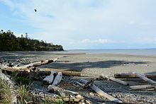
East Beach Park, looking north towards Marrowstone Point
839:. Seattle: University of Washington Press. p. 191.
1448:
1392:
1346:
1290:
1256:
1184:
1163:
1139:
1059:
1015:
985:
327:
317:
300:
283:
275:
267:
262:
254:
246:
238:
230:
225:
213:
203:
193:
34:
665:. Fort Flagler was one of three forts, along with
381:, in describing the area's hard, clay-like soil.
851:"Census Bureau profile: Marrowstone, Washington"
1008:Map of Washington highlighting Jefferson County
891:"Nordland General Store reopens with new model"
136:
106:
76:
1557:Census-designated places in Washington (state)
1234:
937:
8:
1241:
1227:
1219:
944:
930:
922:
703:"US Gazetteer files: 2010, 2000, and 1990"
458:
31:
1572:Landforms of Jefferson County, Washington
555:of any race were 0.9% of the population.
773:United States Department of the Interior
428:Prominent land features include several
694:
316:
282:
261:
253:
224:
192:
157:
61:
49:
478:
917:Marrowstone Island Information Portal
836:Origin of Washington geographic names
728:
726:
724:
326:
299:
274:
266:
245:
237:
229:
212:
202:
7:
790:. Trafford Publishing. p. 36.
764:Geographic Names Information System
547:, and 2.1% from two or more races.
359:. All Marrowstone addresses are in
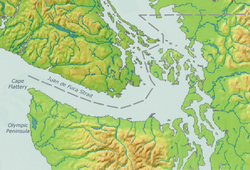
57:Location of Marrowstone, Washington
952:Municipalities and communities of
468:
242:6.3 sq mi (16.4 km)
234:6.3 sq mi (16.4 km)
89:Show map of Strait of Juan de Fuca
25:
250:0.0 sq mi (0.0 km)
355:. The population was 995 at the
135:
128:
105:
98:
75:
68:
51:
29:CDP in Washington, United States
1567:Populated places on Puget Sound
1562:Headlands of Washington (state)
769:United States Geological Survey
347:(CDP) on Marrowstone Island in
119:Show map of Washington (state)
1:
610:Western Washington University
409:Northern side of Nodule Point
149:Show map of the United States
955:Jefferson County, Washington
349:Jefferson County, Washington
1154:Quinault Indian Reservation
855:United States Census Bureau
738:United States Census Bureau
707:United States Census Bureau
423:United States Census Bureau
1588:
814:. Jim Forte Postal History
634:play at Fort Flagler over
628:Aquarian Tabernacle Church
1194:
1001:
966:
833:Meany, Edmond S. (1923).
786:Roberts, John E. (2005).
669:(near Port Townsend) and
514:
499:
484:
477:
472:
467:
464:
158:
62:
50:
41:
679:Kinney Point State Park
417:Marrowstone Point Light
345:census-designated place
143:Marrowstone, Washington
113:Marrowstone, Washington
83:Marrowstone, Washington
36:Marrowstone, Washington
1379:Glacial Lake Sammamish
1149:Hoh Indian Reservation
1009:
675:Mystery Bay State Park
614:Bellingham, Washington
606:Seattle Youth Symphony
418:
410:
402:
279:160/sq mi (61/km)
178:48.05833°N 122.68806°W
1035:Port Hadlock-Irondale
1007:
734:"U.S. Census website"
683:Cascadia Marine Trail
651:Washington state park
460:Historical population
416:
408:
400:
302: • Summer (
258:16 ft (5 m)
1369:Glacial Lake Russell
1207:United States portal
895:Peninsula Daily News
879:. November 11, 2020.
642:Parks and recreation
632:Eleusinian Mysteries
593:Festivals and events
361:Nordland, Washington
276: • Density
183:48.05833; -122.68806
1430:Stillaguamish River
709:. February 12, 2011
638:weekend each year.
515:US Decennial Census
461:
174: /
1506:Marrowstone Island
1141:Indian reservation
1010:
661:, the entrance to
630:performs a modern
529:population density
459:
440:ammunition depot.
419:
411:
403:
268: • Total
247: • Water
231: • Total
18:Marrowstone Island
1539:
1538:
1461:Bainbridge Island
1216:
1215:
1200:Washington portal
797:978-1-4120-7097-3
571:per capita income
521:
520:
421:According to the
338:
337:
239: • Land
16:(Redirected from
1579:
1303:Commencement Bay
1243:
1236:
1229:
1220:
1208:
1201:
1006:
978:
971:
961:
956:
946:
939:
932:
923:
899:
898:
887:
881:
880:
873:
867:
866:
864:
862:
847:
841:
840:
830:
824:
823:
821:
819:
808:
802:
801:
783:
777:
776:
755:
749:
748:
746:
744:
730:
719:
718:
716:
714:
699:
581:Arts and culture
480:
475:
470:
462:
445:Jefferson County
379:George Vancouver
307:
189:
188:
186:
185:
184:
179:
175:
172:
171:
170:
167:
150:
139:
138:
132:
120:
109:
108:
102:
90:
79:
78:
72:
55:
32:
21:
1587:
1586:
1582:
1581:
1580:
1578:
1577:
1576:
1542:
1541:
1540:
1535:
1491:Harstine Island
1456:Anderson Island
1444:
1440:Skokomish River
1425:Snohomish River
1405:Nisqually River
1400:Deschutes River
1388:
1342:
1313:Nisqually Reach
1286:
1282:Admiralty Inlet
1252:
1247:
1217:
1212:
1206:
1199:
1190:
1180:
1159:
1135:
1062:
1055:
1011:
999:
981:
976:
969:
962:
959:
954:
950:
908:
903:
902:
889:
888:
884:
875:
874:
870:
860:
858:
849:
848:
844:
832:
831:
827:
817:
815:
810:
809:
805:
798:
785:
784:
780:
757:
756:
752:
742:
740:
732:
731:
722:
712:
710:
701:
700:
696:
691:
659:Admiralty Inlet
644:
595:
583:
560:married couples
537:Native American
516:
473:
457:
395:
387:
301:
182:
180:
176:
173:
168:
165:
163:
161:
160:
154:
153:
152:
151:
148:
147:
146:
145:
144:
140:
123:
122:
121:
118:
117:
116:
115:
114:
110:
93:
92:
91:
88:
87:
86:
85:
84:
80:
58:
46:
37:
30:
23:
22:
15:
12:
11:
5:
1585:
1583:
1575:
1574:
1569:
1564:
1559:
1554:
1544:
1543:
1537:
1536:
1534:
1533:
1531:Whidbey Island
1528:
1523:
1521:Squaxin Island
1518:
1513:
1508:
1503:
1498:
1493:
1488:
1483:
1478:
1476:Fidalgo Island
1473:
1468:
1463:
1458:
1452:
1450:
1446:
1445:
1443:
1442:
1437:
1432:
1427:
1422:
1417:
1415:Duwamish River
1412:
1410:Puyallup River
1407:
1402:
1396:
1394:
1390:
1389:
1387:
1386:
1384:Lake Skokomish
1381:
1376:
1371:
1366:
1361:
1359:Lake Nisqually
1356:
1350:
1348:
1344:
1343:
1341:
1340:
1335:
1330:
1325:
1320:
1315:
1310:
1305:
1300:
1298:Bellingham Bay
1294:
1292:
1288:
1287:
1285:
1284:
1279:
1274:
1269:
1266:
1260:
1258:
1254:
1253:
1248:
1246:
1245:
1238:
1231:
1223:
1214:
1213:
1211:
1210:
1203:
1195:
1192:
1191:
1188:
1186:
1182:
1181:
1179:
1178:
1176:Port Discovery
1173:
1169:
1167:
1161:
1160:
1158:
1157:
1151:
1145:
1143:
1137:
1136:
1134:
1133:
1128:
1123:
1118:
1113:
1108:
1103:
1098:
1093:
1088:
1083:
1078:
1073:
1067:
1065:
1057:
1056:
1054:
1053:
1048:
1042:
1037:
1032:
1027:
1021:
1019:
1013:
1012:
1002:
1000:
998:
997:
991:
989:
983:
982:
967:
964:
963:
951:
949:
948:
941:
934:
926:
920:
919:
914:
907:
906:External links
904:
901:
900:
882:
868:
842:
825:
812:"Post Offices"
803:
796:
778:
750:
720:
693:
692:
690:
687:
643:
640:
616:– was held at
594:
591:
582:
579:
519:
518:
512:
511:
508:
506:
503:
497:
496:
493:
491:
488:
482:
481:
476:
471:
466:
456:
453:
394:
391:
386:
383:
336:
335:
332:
325:
324:
321:
315:
314:
308:
298:
297:
287:
281:
280:
277:
273:
272:
269:
265:
264:
260:
259:
256:
252:
251:
248:
244:
243:
240:
236:
235:
232:
228:
227:
223:
222:
217:
211:
210:
205:
201:
200:
195:
191:
190:
156:
155:
142:
141:
134:
133:
127:
126:
125:
124:
112:
111:
104:
103:
97:
96:
95:
94:
82:
81:
74:
73:
67:
66:
65:
64:
63:
60:
59:
56:
48:
47:
42:
39:
38:
35:
28:
24:
14:
13:
10:
9:
6:
4:
3:
2:
1584:
1573:
1570:
1568:
1565:
1563:
1560:
1558:
1555:
1553:
1550:
1549:
1547:
1532:
1529:
1527:
1526:Vashon Island
1524:
1522:
1519:
1517:
1516:McNeil Island
1514:
1512:
1509:
1507:
1504:
1502:
1501:Indian Island
1499:
1497:
1496:Herron Island
1494:
1492:
1489:
1487:
1486:Guemes Island
1484:
1482:
1479:
1477:
1474:
1472:
1471:Camano Island
1469:
1467:
1464:
1462:
1459:
1457:
1454:
1453:
1451:
1447:
1441:
1438:
1436:
1433:
1431:
1428:
1426:
1423:
1421:
1418:
1416:
1413:
1411:
1408:
1406:
1403:
1401:
1398:
1397:
1395:
1391:
1385:
1382:
1380:
1377:
1375:
1372:
1370:
1367:
1365:
1364:Lake Puyallup
1362:
1360:
1357:
1355:
1352:
1351:
1349:
1347:Glacial lakes
1345:
1339:
1336:
1334:
1331:
1329:
1326:
1324:
1321:
1319:
1316:
1314:
1311:
1309:
1306:
1304:
1301:
1299:
1296:
1295:
1293:
1289:
1283:
1280:
1278:
1275:
1273:
1272:Whidbey Basin
1270:
1268:Central Basin
1267:
1265:
1262:
1261:
1259:
1255:
1251:
1244:
1239:
1237:
1232:
1230:
1225:
1224:
1221:
1209:
1204:
1202:
1197:
1196:
1193:
1187:
1183:
1177:
1174:
1171:
1170:
1168:
1166:
1162:
1155:
1152:
1150:
1147:
1146:
1144:
1142:
1138:
1132:
1129:
1127:
1124:
1122:
1119:
1117:
1114:
1112:
1111:Indian Island
1109:
1107:
1104:
1102:
1101:Discovery Bay
1099:
1097:
1094:
1092:
1089:
1087:
1084:
1082:
1079:
1077:
1074:
1072:
1071:Beckett Point
1069:
1068:
1066:
1064:
1058:
1052:
1049:
1046:
1043:
1041:
1038:
1036:
1033:
1031:
1028:
1026:
1023:
1022:
1020:
1018:
1014:
996:
995:Port Townsend
993:
992:
990:
988:
984:
980:
979:
977:Port Townsend
972:
965:
960:United States
957:
947:
942:
940:
935:
933:
928:
927:
924:
918:
915:
913:
910:
909:
905:
896:
892:
886:
883:
878:
872:
869:
856:
852:
846:
843:
838:
837:
829:
826:
813:
807:
804:
799:
793:
789:
782:
779:
774:
770:
766:
765:
760:
759:"Marrowstone"
754:
751:
739:
735:
729:
727:
725:
721:
708:
704:
698:
695:
688:
686:
684:
680:
676:
672:
668:
664:
660:
656:
655:Port Townsend
652:
648:
641:
639:
637:
633:
629:
626:
621:
619:
615:
611:
607:
602:
599:
592:
590:
588:
580:
578:
576:
572:
567:
564:
561:
556:
554:
550:
546:
542:
538:
534:
530:
526:
513:
509:
507:
504:
502:
498:
494:
492:
489:
487:
483:
463:
454:
452:
448:
446:
441:
439:
435:
434:Indian Island
431:
426:
424:
415:
407:
399:
392:
390:
384:
382:
380:
376:
373:
368:
366:
362:
358:
354:
353:United States
350:
346:
342:
333:
330:
322:
320:
312:
309:
305:
295:
294:Pacific (PST)
291:
288:
286:
278:
270:
257:
249:
241:
233:
221:
218:
216:
209:
206:
199:
198:United States
196:
187:
159:Coordinates:
131:
101:
71:
54:
45:
40:
33:
27:
19:
1511:Maury Island
1466:Blake Island
1435:Skagit River
1328:Port Gardner
1029:
974:
912:Fort Flagler
894:
885:
871:
859:. Retrieved
845:
835:
828:
816:. Retrieved
806:
787:
781:
762:
753:
741:. Retrieved
711:. Retrieved
697:
647:Fort Flagler
645:
622:
618:Fort Flagler
603:
600:
596:
584:
575:poverty line
568:
565:
557:
543:, 0.1% from
522:
455:Demographics
449:
442:
427:
420:
388:
369:
360:
340:
339:
26:
1420:Cedar River
1374:Lake Tacoma
1323:Padilla Bay
1318:Oakland Bay
1308:Elliott Bay
1264:South Basin
1250:Puget Sound
1165:Ghost towns
1076:Cape George
1063:communities
1040:Port Ludlow
1030:Marrowstone
970:County seat
743:January 31,
667:Fort Worden
663:Puget Sound
545:other races
517:2020 Census
357:2020 census
341:Marrowstone
181: /
169:122°41′17″W
1546:Categories
1481:Fox Island
1338:Skagit Bay
1333:Port Susan
1277:Hood Canal
1091:Clearwater
857:. May 2023
818:August 19,
689:References
671:Fort Casey
523:As of the
367:is 98358.
363:, and the
331:feature ID
263:Population
208:Washington
1354:Lake Hood
1185:Footnotes
713:April 23,
625:neo-pagan
587:groceries
393:Geography
319:FIPS code
285:Time zone
255:Elevation
220:Jefferson
166:48°3′30″N
1126:Nordland
1116:Kalaloch
1106:Gardiner
1086:Chimacum
1051:Quilcene
657:Bay and
549:Hispanic
375:explorer
365:ZIP code
323:53-43762
1449:Islands
1025:Brinnon
861:May 12,
539:, 0.8%
535:, 0.4%
385:History
372:British
334:1852949
194:Country
1393:Rivers
1257:Basins
1172:McGees
1121:Leland
1081:Center
1045:Queets
794:
636:Easter
553:Latino
525:census
465:Census
430:points
215:County
1131:Shine
1096:Coyle
1061:Other
612:, in
541:Asian
533:White
510:17.9%
343:is a
313:(PDT)
311:UTC-7
290:UTC-8
204:State
1291:Bays
1017:CDPs
987:City
863:2024
820:2016
792:ISBN
745:2008
715:2011
649:, a
623:The
604:The
501:2020
486:2010
474:Note
469:Pop.
438:Navy
436:, a
329:GNIS
226:Area
551:or
505:995
490:844
304:DST
271:995
44:CDP
1548::
973::
958:,
893:.
853:.
771:,
767:.
761:.
736:.
723:^
705:.
685:.
577:.
479:%±
447:.
377:,
351:,
1242:e
1235:t
1228:v
1156:‡
1047:‡
945:e
938:t
931:v
897:.
865:.
822:.
800:.
775:.
747:.
717:.
495:—
306:)
296:)
292:(
20:)
Text is available under the Creative Commons Attribution-ShareAlike License. Additional terms may apply.