283:
57:
1006:
333:, who purchased land and envisioned a community there shortly after the turn of the 20th century. Earlier the area was known as "Columbia" or "Columbus". In 1909, the Klickitat County commissioners had accepted the town's name as "Maryland" - proposed by Sam Hill and Associates who had laid out the town. However, this name was rejected by postal authorities as they would not accept a name corresponding to a state, so it was renamed "Maryhill".
606:
42:
601:
In the CDP, the population was spread out, with 22.4% under the age of 18, 4.1% from 18 to 24, 27.6% from 25 to 44, 29.6% from 45 to 64, and 16.3% who were 65 years of age or older. The median age was 40 years. For every 100 females, there were 113.0 males. For every 100 females age 18 and over,
597:
living together, 5.0% had a female householder with no husband present, and 35.0% were non-families. 22.5% of all households were made up of individuals, and 10.0% had someone living alone who was 65 years of age or older. The average household size was 2.45 and the average family size was 2.92.
282:
56:
1225:
1200:
367:
Hill intended the
Stonehenge replica to express that modern warfare was a form of needless human sacrifice, referencing the contemporary belief that Stonehenge was a sacrificial site.
1205:
934:
615:
The median income for a household in the CDP was $ 37,250, and the median income for a family was $ 48,529. Males had a median income of $ 36,103 versus $ 28,750 for females. The
1215:
1080:
364:, Hill hoped to attract a Quaker community to eastern Washington. His plans never materialized and the town buildings he constructed burned down several years later.
1017:
562:
was 35.0 people per square mile (13.5/km). There were 49 housing units at an average density of 17.5/sq mi (6.8/km). The racial makeup of the CDP was 77.55%
1220:
927:
831:
1138:
694:
252:
1040:
70:
920:
715:
685:
632:
353:
262:
378:
1115:
904:
768:
912:
690:
575:
567:
124:
1210:
805:
571:
977:
944:
310:
129:
865:
809:
781:"Altar stone of Stonehenge replica built to memorialize World War I soldiers is dedicated at Maryhill on July 4, 1918"
659:
579:
460:
425:
41:
839:
1170:
1146:
531:
516:
501:
441:
318:
995:
445:
429:
302:
240:
102:
680:
729:
1030:
306:
32:
593:
There were 40 households, out of which 30.0% had children under the age of 18 living with them, 57.5% were
1095:
1065:
1035:
990:
966:
583:
463:, the Maryhill CDP has a total area of 2.8 square miles (7.3 km), all land. The community is home to
433:
341:
1123:
1105:
1060:
1045:
1025:
1177:
1090:
587:
453:
213:
1070:
609:
563:
464:
345:
47:
1128:
985:
559:
314:
117:
375:
Maryhill is located along the southern edge of
Klickitat County and the state of Washington at
1100:
900:
616:
357:
337:
203:
861:
1050:
780:
415:
411:
605:
558:
of 2000, there were 98 people, 40 households, and 26 families residing in the CDP. The
419:
407:
1194:
893:
832:"Geographic Identifiers: 2010 Census Summary File 1 (G001), Maryhill CDP, Washington"
449:
437:
245:
444:
travels east–west through the area along the
Columbia River, connecting Maryhill to
620:
959:
349:
330:
112:
393:
380:
85:
72:
619:
for the CDP was $ 18,939. None of the population or families were below the
194:
1161:‡This populated place also has portions in an adjacent county or counties
594:
228:
1005:
336:
Hill used his
Maryhill property to build the first paved roads in the
555:
361:
604:
220:
199:
916:
329:
Maryhill is named after the wife and daughter of regional icon
410:, 209 miles (336 km) by river upstream from its mouth at
1004:
406:(45.685649, -120.817232). It sits on the north bank of the
344:(originally intended as a grand residence for the Hills),
289:
Maryhill from the
Stonehenge replica location, but in 1913
1226:
Washington (state) populated places on the
Columbia River
655:
1201:
Census-designated places in
Klickitat County, Washington
734:. Seattle: University of Washington Press. p. 160.
428:(US 97) crosses the Columbia at Maryhill via the
273:
61:
Location of
Maryhill in Klickitat County, Washington
18:
Census-designated place in
Washington, United States
1156:
1137:
1114:
1079:
1016:
976:
261:
251:
239:
227:
210:
193:
185:
177:
172:
164:
156:
148:
140:
135:
123:
111:
101:
23:
892:
352:casualties of Klickitat County in the form of a
1009:Map of Washington highlighting Klickitat County
1206:Census-designated places in Washington (state)
317:, United States. The population was 55 at the
928:
862:"Census Bureau profile: Maryhill, Washington"
8:
935:
921:
913:
806:"US Gazetteer files: 2010, 2000, and 1990"
590:of any race were 9.18% of the population.
474:
418:, and 17 miles (27 km) upstream from
20:
1216:Planned communities in the United States
695:United States Department of the Interior
414:, 103 miles (166 km) upstream from
644:
250:
226:
192:
171:
163:
134:
100:
65:
53:
38:
895:Sam Hill: The Prince of Castle Nowhere
759:, June 27, 1909: SECTION FOUR, Page 9.
494:
800:
798:
731:Origin of Washington geographic names
706:
704:
650:
648:
260:
238:
209:
184:
176:
155:
147:
139:
122:
110:
7:
838:. U.S. Census Bureau. Archived from
744:
582:, and 9.18% from two or more races.
716:Washington State Historical Society
686:Geographic Names Information System
633:Stonehenge replicas and derivatives
943:Municipalities and communities of
899:, Portland, Oregon: Timber Press,
484:
14:
1221:Utopian communities in Washington
160:0.0 sq mi (0.0 km)
152:2.8 sq mi (7.3 km)
144:2.8 sq mi (7.3 km)
769:Google map of Stonehenge replica
281:
55:
40:
691:United States Geological Survey
436:and south across the river to
432:. US 97 travels north towards
1:
946:Klickitat County, Washington
866:United States Census Bureau
810:United States Census Bureau
660:United States Census Bureau
461:United States Census Bureau
1242:
1166:
1147:Yakama Indian Reservation
1002:
957:
728:Meany, Edmond S. (1923).
712:Place Names of Washington
545:
530:
515:
500:
493:
488:
483:
480:
66:
54:
39:
30:
602:there were 123.5 males.
430:Sam Hill Memorial Bridge
303:unincorporated community
307:census-designated place
168:187 ft (57 m)
33:Census-designated place
1010:
891:Tuhy, John E. (1983),
612:
394:45.68556°N 120.81722°W
342:Maryhill Museum of Art
189:20/sq mi (7.5/km)
86:45.68556°N 120.81722°W
1008:
656:"U.S. Census website"
608:
476:Historical population
212: • Summer (
1211:Columbia River Gorge
1179:United States portal
842:on February 13, 2020
757:The Sunday Oregonian
467:along the Columbia.
399:45.68556; -120.81722
348:, a monument to the
186: • Density
91:45.68556; -120.81722
25:Maryhill, Washington
836:American FactFinder
812:. February 12, 2011
610:Maryhill Stonehenge
546:US Decennial Census
477:
465:Maryhill State Park
390: /
346:Maryhill Stonehenge
82: /
1139:Indian reservation
1011:
710:Hitchman, Robert.
613:
560:population density
475:
354:Stonehenge replica
178: • Total
157: • Water
141: • Total
48:Stonehenge replica
46:Maryhill from the
1188:
1187:
1172:Washington portal
617:per capita income
552:
551:
459:According to the
358:planned community
338:Pacific Northwest
296:
295:
272:
271:
149: • Land
1233:
1180:
1173:
1007:
969:
962:
952:
947:
937:
930:
923:
914:
909:
898:
878:
877:
875:
873:
858:
852:
851:
849:
847:
828:
822:
821:
819:
817:
802:
793:
792:
790:
788:
777:
771:
766:
760:
754:
748:
742:
736:
735:
725:
719:
708:
699:
698:
677:
671:
670:
668:
666:
652:
576:Pacific Islander
568:African American
496:
491:
486:
478:
405:
404:
402:
401:
400:
395:
391:
388:
387:
386:
383:
311:Klickitat County
285:
274:
217:
97:
96:
94:
93:
92:
87:
83:
80:
79:
78:
75:
59:
44:
21:
1241:
1240:
1236:
1235:
1234:
1232:
1231:
1230:
1191:
1190:
1189:
1184:
1178:
1171:
1162:
1152:
1133:
1110:
1082:
1075:
1012:
1000:
972:
967:
960:
953:
950:
945:
941:
907:
890:
887:
882:
881:
871:
869:
860:
859:
855:
845:
843:
830:
829:
825:
815:
813:
804:
803:
796:
786:
784:
779:
778:
774:
767:
763:
755:
751:
743:
739:
727:
726:
722:
709:
702:
679:
678:
674:
664:
662:
654:
653:
646:
641:
629:
595:married couples
572:Native American
547:
489:
473:
398:
396:
392:
389:
384:
381:
379:
377:
376:
373:
327:
292:
291:
290:
287:
286:
235:
211:
90:
88:
84:
81:
76:
73:
71:
69:
68:
62:
50:
35:
26:
19:
12:
11:
5:
1239:
1237:
1229:
1228:
1223:
1218:
1213:
1208:
1203:
1193:
1192:
1186:
1185:
1183:
1182:
1175:
1167:
1164:
1163:
1160:
1158:
1154:
1153:
1151:
1150:
1143:
1141:
1135:
1134:
1132:
1131:
1126:
1120:
1118:
1112:
1111:
1109:
1108:
1103:
1098:
1093:
1087:
1085:
1081:Unincorporated
1077:
1076:
1074:
1073:
1068:
1063:
1058:
1053:
1048:
1043:
1038:
1033:
1028:
1022:
1020:
1014:
1013:
1003:
1001:
999:
998:
993:
988:
982:
980:
974:
973:
958:
955:
954:
942:
940:
939:
932:
925:
917:
911:
910:
905:
886:
883:
880:
879:
853:
823:
794:
772:
761:
749:
737:
720:
700:
672:
643:
642:
640:
637:
636:
635:
628:
625:
550:
549:
543:
542:
539:
537:
534:
528:
527:
524:
522:
519:
513:
512:
509:
507:
504:
498:
497:
492:
487:
482:
472:
469:
442:State Route 14
420:The Dalles Dam
408:Columbia River
372:
369:
326:
323:
294:
293:
288:
280:
279:
278:
277:
270:
269:
266:
259:
258:
255:
249:
248:
243:
237:
236:
233:
231:
225:
224:
218:
208:
207:
197:
191:
190:
187:
183:
182:
179:
175:
174:
170:
169:
166:
162:
161:
158:
154:
153:
150:
146:
145:
142:
138:
137:
133:
132:
127:
121:
120:
115:
109:
108:
105:
99:
98:
64:
63:
60:
52:
51:
45:
37:
36:
31:
28:
27:
24:
17:
13:
10:
9:
6:
4:
3:
2:
1238:
1227:
1224:
1222:
1219:
1217:
1214:
1212:
1209:
1207:
1204:
1202:
1199:
1198:
1196:
1181:
1176:
1174:
1169:
1168:
1165:
1159:
1155:
1148:
1145:
1144:
1142:
1140:
1136:
1130:
1127:
1125:
1122:
1121:
1119:
1117:
1113:
1107:
1104:
1102:
1099:
1097:
1094:
1092:
1089:
1088:
1086:
1084:
1078:
1072:
1069:
1067:
1064:
1062:
1059:
1057:
1054:
1052:
1049:
1047:
1044:
1042:
1039:
1037:
1034:
1032:
1029:
1027:
1024:
1023:
1021:
1019:
1015:
997:
994:
992:
989:
987:
984:
983:
981:
979:
975:
971:
970:
963:
956:
951:United States
948:
938:
933:
931:
926:
924:
919:
918:
915:
908:
906:0-917304-77-2
902:
897:
896:
889:
888:
884:
867:
863:
857:
854:
841:
837:
833:
827:
824:
811:
807:
801:
799:
795:
783:. HistoryLink
782:
776:
773:
770:
765:
762:
758:
753:
750:
747:, p. 197
746:
741:
738:
733:
732:
724:
721:
717:
713:
707:
705:
701:
696:
692:
688:
687:
682:
676:
673:
661:
657:
651:
649:
645:
638:
634:
631:
630:
626:
624:
622:
618:
611:
607:
603:
599:
596:
591:
589:
585:
581:
578:, 1.02% from
577:
573:
569:
565:
561:
557:
544:
540:
538:
535:
533:
529:
525:
523:
520:
518:
514:
510:
508:
505:
503:
499:
479:
470:
468:
466:
462:
457:
455:
451:
450:Interstate 82
447:
443:
439:
438:Wasco, Oregon
435:
431:
427:
426:U.S. Route 97
423:
421:
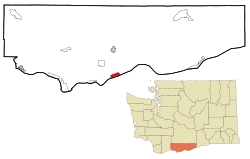
417:
413:
409:
403:
370:
368:
365:
363:
359:
355:
351:
347:
343:
339:
334:
332:
324:
322:
320:
316:
312:
308:
304:
300:
284:
276:
275:
267:
264:
256:
254:
247:
244:
242:
232:
230:
222:
219:
215:
205:
204:Pacific (PST)
201:
198:
196:
188:
180:
167:
159:
151:
143:
131:
128:
126:
119:
116:
114:
107:United States
106:
104:
95:
67:Coordinates:
58:
49:
43:
34:
29:
22:
16:
1055:
996:White Salmon
965:
894:
870:. Retrieved
856:
844:. Retrieved
840:the original
835:
826:
814:. Retrieved
785:. Retrieved
775:
764:
756:
752:
740:
730:
723:
711:
684:
675:
663:. Retrieved
621:poverty line
614:
600:
592:
553:
471:Demographics
458:
446:White Salmon
424:
374:
366:
335:
328:
298:
297:
15:
1116:Ghost towns
1083:communities
1031:Centerville
961:County seat
665:January 31,
580:other races
548:2020 Census
397: /
350:World War I
319:2020 census
89: /
1195:Categories
1096:Blockhouse
1066:Trout Lake
1036:Dallesport
991:Goldendale
968:Goldendale
885:References
868:. May 2023
681:"Maryhill"
554:As of the
434:Goldendale
385:120°49′2″W
315:Washington
265:feature ID
173:Population
118:Washington
77:120°49′2″W
1157:Footnotes
1124:Alderdale
1106:Wahkiacus
1061:Roosevelt
1046:Klickitat
1026:Bickleton
816:April 23,
787:March 30,
745:Tuhy 1983
382:45°41′8″N
371:Geography
360:. Born a
309:(CDP) in
253:FIPS code
241:Area code
195:Time zone
165:Elevation
130:Klickitat
74:45°41′8″N
1091:Appleton
1056:Maryhill
1041:Glenwood
846:July 11,
627:See also
584:Hispanic
574:, 1.02%
570:, 2.04%
566:, 9.18%
454:Plymouth
416:Portland
356:, and a
331:Sam Hill
299:Maryhill
257:53-43885
229:ZIP code
1071:Wishram
872:May 13,
718:. 1985.
412:Astoria
325:History
268:1522785
103:Country
1129:Gilmer
986:Bingen
978:Cities
903:
588:Latino
556:census
526:−40.8%
481:Census
362:Quaker
340:, the
301:is an
125:County
1101:Husum
639:Notes
564:White
541:−5.2%
234:98620
223:(PDT)
221:UTC-7
200:UTC-8
113:State
1051:Lyle
1018:CDPs
901:ISBN
874:2024
848:2019
818:2011
789:2008
667:2008
532:2020
517:2010
502:2000
490:Note
485:Pop.
448:and
305:and
263:GNIS
136:Area
586:or
452:at
246:509
214:DST
1197::
964::
949:,
864:.
834:.
808:.
797:^
714:.
703:^
693:,
689:.
683:.
658:.
647:^
623:.
536:55
521:58
506:98
495:%±
456:.
440:.
422:.
321:.
313:,
181:55
1149:‡
936:e
929:t
922:v
876:.
850:.
820:.
791:.
697:.
669:.
511:—
216:)
206:)
202:(
Text is available under the Creative Commons Attribution-ShareAlike License. Additional terms may apply.

.jpeg)