50:
1220:
103:
1055:
123:
696:
living together, 10.2% had a female householder with no husband present, 3.9% had a male householder with no wife present, and 30.3% were non-families. 28.0% of all households were made up of individuals, and 11.2% had someone living alone who was 65 years of age or older. The average household size
749:
In the city, the population was spread out, with 31.2% under the age of 18, 5.7% from 18 to 24, 27.9% from 25 to 44, 17.8% from 45 to 64, and 17.5% who were 65 years of age or older. The median age was 36 years. For every 100 females, there were 113.6 males. For every 100 females age 18 and over,
745:
living together, 7.5% had a female householder with no husband present, and 27.5% were non-families. 24.3% of all households were made up of individuals, and 12.9% had someone living alone who was 65 years of age or older. The average household size was 2.69 and the average family size was 3.24.
713:
of 2000, there were 754 people, 280 households, and 203 families living in the city. The population density was 1,739.5 inhabitants per square mile (671.6/km). There were 294 housing units at an average density of 678.3 per square mile (261.9/km). The racial makeup of the city was 98.41%
700:
The median age in the city was 39.7 years. 26.1% of residents were under the age of 18; 7.3% were between the ages of 18 and 24; 23.2% were from 25 to 44; 27.4% were from 45 to 64; and 15.9% were 65 years of age or older. The gender makeup of the city was 52.2% male and 47.8% female.
49:
753:
The median income for a household in the city was $ 43,333, and the median income for a family was $ 50,000. Males had a median income of $ 31,620 versus $ 21,845 for females. The
669:
was 1,324.6 inhabitants per square mile (511.4/km). There were 317 housing units at an average density of 556.1 per square mile (214.7/km). The racial makeup of the city was 97.9%
1102:
1312:
1307:
919:
286:
879:
A History of the Origin of the Place Names
Connected with the Chicago & North Western and Chicago, St. Paul, Minneapolis & Omaha Railways
1095:
296:
63:
793:
850:
770:
825:
237:
379:
1088:
719:
354:
893:
674:
1080:
1028:
1000:
975:
923:
897:
727:
630:
411:
611:
598:
585:
572:
559:
546:
533:
520:
507:
494:
481:
468:
455:
350:
338:
643:
274:
135:
95:
1302:
741:
There were 280 households, out of which 37.5% had children under the age of 18 living with them, 63.2% were
731:
682:
927:
1112:
1021:
692:
There were 304 households, of which 35.5% had children under the age of 18 living with them, 55.6% were
419:
358:
326:
147:
140:
1279:
1231:
735:
686:
247:
1272:
723:
715:
678:
670:
414:, the city has a total area of 0.57 square miles (1.48 km), all land. It is located near the
666:
949:
877:
754:
1198:
1158:
800:
757:
for the city was $ 15,656. About 2.1% of families and 4.1% of the population were below the
423:
365:
1209:
665:
of 2010, there were 755 people, 304 households, and 212 families living in the city. The
1239:
1173:
368:
public relations seniors to research and develop strategies to attract new residents.
1296:
1204:
1178:
1134:
279:
108:
1193:
1168:
758:
1074:
1249:
1244:
1188:
1163:
1153:
1127:
1060:
415:
334:
1050:
115:
394:
381:
78:
65:
228:
1263:‡This populated place also has portions in an adjacent county or counties
761:, including 2.2% of those under age 18 and 5.1% of those age 65 or over.
742:
693:
262:
710:
662:
254:
233:
1219:
1145:
448:
330:
128:
32:
1084:
1068:
1218:
443:
996:
971:
626:
311:
1077:
Comprehensive statistical data and more about
Merrill
1258:
1230:
1144:
306:
295:
285:
273:
261:
244:
227:
219:
211:
206:
198:
190:
182:
174:
169:
161:
156:
146:
134:
114:
94:
23:
876:Chicago and North Western Railway Company (1908).
697:was 2.48 and the average family size was 3.02.
1096:
8:
434:
337:. The population was 717 at the time of the
1103:
1089:
1081:
894:"US Gazetteer files: 2010, 2000, and 1990"
738:of any race were 1.46% of the population.
433:
20:
845:
843:
799:. Iowa Secretary of State. Archived from
788:
786:
689:of any race were 0.9% of the population.
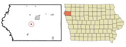
1223:Map of Iowa highlighting Plymouth County
782:
305:
284:
260:
226:
205:
197:
168:
155:
145:
93:
58:
46:
38:
851:"2020 Census State Redistricting Data"
294:
272:
243:
218:
210:
189:
181:
173:
160:
133:
113:
7:
1313:Populated places established in 1894
773:operates local area public schools.
730:, and 0.27% from two or more races.
681:, and 0.9% from two or more races.
194:0.00 sq mi (0.00 km)
186:0.52 sq mi (1.34 km)
178:0.52 sq mi (1.34 km)
1111:Municipalities and communities of
950:"Census of Population and Housing"
14:
771:Le Mars Community School District
1053:
121:
101:
48:
1308:Cities in Plymouth County, Iowa
223:1,381.50/sq mi (533.73/km)
1071:Portal style community website
349:Merrill was named in 1872 for
1:
857:. United states Census Bureau
828:. United States Census Bureau
794:"LIST OF INCORPORATED CITIES"
1029:Iowa Department of Education
351:the seventh Governor of Iowa
42:The Heart of Plymouth County
1001:United States Census Bureau
976:United States Census Bureau
924:United States Census Bureau
898:United States Census Bureau
826:"2020 U.S. Gazetteer Files"
631:United States Census Bureau
412:United States Census Bureau
333:, United States, along the
18:City in Iowa, United States
1329:
1232:Unincorporated communities
202:1,175 ft (358 m)
1268:
1216:
1125:
920:"US Gazetteer files 2010"
623:
463:—
407:(42.721461, -96.250779).
59:
54:Location of Merrill, Iowa
47:
39:
30:
750:there were 105.1 males.
364:In 2007, the city hired
1224:
435:Historical populations
422:, 20 minutes north of
376:Merrill is located at
1222:
1114:Plymouth County, Iowa
997:"U.S. Census website"
972:"U.S. Census website"
649:U.S. Decennial Census
627:"U.S. Census website"
395:42.72139°N 96.25083°W
246: • Summer (
79:42.72139°N 96.25083°W
1281:United States portal
220: • Density
930:on January 25, 2012
900:. February 12, 2011
436:
400:42.72139; -96.25083
391: /
361:on April 24, 1894.
357:. It and became an
84:42.72139; -96.25083
75: /
1225:
667:population density
212: • Total
191: • Water
175: • Total
1290:
1289:
755:per capita income
654:
653:
410:According to the
359:incorporated city
320:
319:
183: • Land
162: • Type
1320:
1282:
1275:
1221:
1137:
1130:
1120:
1115:
1105:
1098:
1091:
1082:
1063:
1058:
1057:
1056:
1040:
1039:
1037:
1035:
1026:
1018:
1012:
1011:
1009:
1007:
993:
987:
986:
984:
982:
968:
962:
961:
959:
957:
946:
940:
939:
937:
935:
926:. Archived from
916:
910:
909:
907:
905:
890:
884:
883:
873:
867:
866:
864:
862:
847:
838:
837:
835:
833:
822:
816:
815:
813:
811:
806:on June 27, 2011
805:
798:
790:
720:African American
644:Iowa Data Center
641:
639:
637:
450:
445:
437:
406:
405:
403:
402:
401:
396:
392:
389:
388:
387:
384:
366:Drake University
316:
313:
251:
127:
125:
124:
107:
105:
104:
90:
89:
87:
86:
85:
80:
76:
73:
72:
71:
68:
52:
21:
1328:
1327:
1323:
1322:
1321:
1319:
1318:
1317:
1293:
1292:
1291:
1286:
1280:
1273:
1264:
1254:
1226:
1214:
1140:
1135:
1128:
1121:
1118:
1113:
1109:
1059:
1054:
1052:
1049:
1044:
1043:
1033:
1031:
1024:
1020:
1019:
1015:
1005:
1003:
995:
994:
990:
980:
978:
970:
969:
965:
955:
953:
948:
947:
943:
933:
931:
918:
917:
913:
903:
901:
892:
891:
887:
875:
874:
870:
860:
858:
849:
848:
841:
831:
829:
824:
823:
819:
809:
807:
803:
796:
792:
791:
784:
779:
767:
743:married couples
707:
694:married couples
675:Native American
659:
650:
646:
635:
633:
625:
432:
399:
397:
393:
390:
385:
382:
380:
378:
377:
374:
347:
327:Plymouth County
310:
269:
245:
152:April 24, 1894
122:
120:
102:
100:
83:
81:
77:
74:
69:
66:
64:
62:
61:
55:
43:
40:Nickname:
35:
26:
19:
12:
11:
5:
1326:
1324:
1316:
1315:
1310:
1305:
1303:Cities in Iowa
1295:
1294:
1288:
1287:
1285:
1284:
1277:
1269:
1266:
1265:
1262:
1260:
1256:
1255:
1253:
1252:
1247:
1242:
1236:
1234:
1228:
1227:
1217:
1215:
1213:
1212:
1207:
1202:
1196:
1191:
1186:
1181:
1176:
1171:
1166:
1161:
1156:
1150:
1148:
1142:
1141:
1126:
1123:
1122:
1110:
1108:
1107:
1100:
1093:
1085:
1079:
1078:
1072:
1065:
1064:
1048:
1047:External links
1045:
1042:
1041:
1013:
988:
963:
941:
911:
885:
882:. p. 183.
868:
839:
817:
781:
780:
778:
775:
766:
763:
706:
703:
658:
655:
652:
651:
648:
621:
620:
617:
614:
608:
607:
604:
601:
595:
594:
591:
588:
582:
581:
578:
575:
569:
568:
565:
562:
556:
555:
552:
549:
543:
542:
539:
536:
530:
529:
526:
523:
517:
516:
513:
510:
504:
503:
500:
497:
491:
490:
487:
484:
478:
477:
474:
471:
465:
464:
461:
458:
452:
451:
446:
441:
431:
428:
373:
370:
355:Samuel Merrill
346:
343:
318:
317:
308:
304:
303:
300:
293:
292:
289:
283:
282:
277:
271:
270:
267:
265:
259:
258:
252:
242:
241:
231:
225:
224:
221:
217:
216:
213:
209:
208:
204:
203:
200:
196:
195:
192:
188:
187:
184:
180:
179:
176:
172:
171:
167:
166:
163:
159:
158:
154:
153:
150:
144:
143:
138:
132:
131:
118:
112:
111:
98:
92:
91:
57:
56:
53:
45:
44:
41:
37:
36:
31:
28:
27:
24:
17:
13:
10:
9:
6:
4:
3:
2:
1325:
1314:
1311:
1309:
1306:
1304:
1301:
1300:
1298:
1283:
1278:
1276:
1271:
1270:
1267:
1261:
1257:
1251:
1248:
1246:
1243:
1241:
1238:
1237:
1235:
1233:
1229:
1211:
1208:
1206:
1203:
1200:
1197:
1195:
1192:
1190:
1187:
1185:
1182:
1180:
1177:
1175:
1172:
1170:
1167:
1165:
1162:
1160:
1157:
1155:
1152:
1151:
1149:
1147:
1143:
1139:
1138:
1131:
1124:
1119:United States
1116:
1106:
1101:
1099:
1094:
1092:
1087:
1086:
1083:
1076:
1073:
1070:
1067:
1066:
1062:
1051:
1046:
1030:
1023:
1017:
1014:
1002:
998:
992:
989:
977:
973:
967:
964:
951:
945:
942:
929:
925:
921:
915:
912:
899:
895:
889:
886:
881:
880:
872:
869:
856:
852:
846:
844:
840:
827:
821:
818:
802:
795:
789:
787:
783:
776:
774:
772:
764:
762:
760:
756:
751:
747:
744:
739:
737:
733:
729:
726:, 0.66% from
725:
721:
717:
712:
704:
702:
698:
695:
690:
688:
684:
680:
676:
672:
668:
664:
656:
645:
632:
628:
622:
618:
615:
613:
610:
609:
605:
602:
600:
597:
596:
592:
589:
587:
584:
583:
579:
576:
574:
571:
570:
566:
563:
561:
558:
557:
553:
550:
548:
545:
544:
540:
537:
535:
532:
531:
527:
524:
522:
519:
518:
514:
511:
509:
506:
505:
501:
498:
496:
493:
492:
488:
485:
483:
480:
479:
475:
472:
470:
467:
466:
462:
459:
457:
454:
453:
447:
442:
439:
438:
429:
427:
425:
421:
420:U.S. Route 75
417:
413:
408:
404:
371:
369:
367:
362:
360:
356:
352:
344:
342:
340:
336:
332:
328:
325:is a city in
324:
315:
309:
301:
298:
290:
288:
281:
278:
276:
266:
264:
256:
253:
249:
239:
238:Central (CST)
235:
232:
230:
222:
214:
201:
193:
185:
177:
165:Mayor-council
164:
151:
149:
142:
139:
137:
130:
119:
117:
110:
109:United States
99:
97:
88:
60:Coordinates:
51:
34:
29:
25:Merrill, Iowa
22:
16:
1183:
1133:
1069:Merrill Iowa
1032:. Retrieved
1016:
1004:. Retrieved
991:
979:. Retrieved
966:
954:. Retrieved
952:. Census.gov
944:
932:. Retrieved
928:the original
914:
902:. Retrieved
888:
878:
871:
859:. Retrieved
854:
830:. Retrieved
820:
808:. Retrieved
801:the original
768:
759:poverty line
752:
748:
740:
708:
699:
691:
660:
634:. Retrieved
430:Demographics
418:, and is on
409:
375:
363:
348:
322:
321:
148:Incorporated
15:
1274:Iowa portal
1129:County seat
1061:Iowa portal
1006:January 31,
728:other races
705:2000 census
657:2010 census
416:Floyd River
398: /
339:2020 census
335:Floyd River
312:merrilliowa
82: /
1297:Categories
1199:Sioux City
1159:Brunsville
861:August 12,
855:census.gov
777:References
709:As of the
661:As of the
424:Sioux City
383:42°43′17″N
299:feature ID
207:Population
157:Government
67:42°43′17″N
1259:Footnotes
1210:Westfield
1075:City-Data
1034:August 6,
1022:"LE MARS"
904:April 23,
832:March 16,
765:Education
636:March 29,
386:96°15′3″W
372:Geography
287:FIPS code
275:Area code
229:Time zone
199:Elevation
70:96°15′3″W
1240:Adaville
1174:Kingsley
732:Hispanic
722:, 0.27%
718:, 0.40%
683:Hispanic
647:Source:
291:19-51375
263:ZIP code
141:Plymouth
1205:Struble
1184:Merrill
1179:Le Mars
1136:Le Mars
981:May 11,
956:June 4,
934:May 11,
810:July 4,
677:, 0.5%
673:, 0.7%
624:Source:
345:History
323:Merrill
307:Website
302:0459005
96:Country
1194:Remsen
1169:Hinton
1146:Cities
736:Latino
711:census
687:Latino
663:census
554:+22.5%
528:+10.6%
489:+21.7%
476:+33.7%
136:County
126:
106:
1250:Seney
1245:James
1189:Oyens
1164:Craig
1154:Akron
1025:(PDF)
804:(PDF)
797:(PDF)
724:Asian
716:White
679:Asian
671:White
619:−5.0%
606:+0.1%
593:+3.4%
580:−1.1%
567:−6.7%
541:+6.6%
515:−9.6%
502:−4.4%
268:51038
257:(CDT)
255:UTC-5
234:UTC-6
116:State
1036:2020
1008:2008
983:2012
958:2015
936:2012
906:2011
863:2021
834:2022
812:2011
769:The
642:and
638:2020
612:2020
599:2010
586:2000
573:1990
560:1980
547:1970
534:1960
521:1950
508:1940
495:1930
482:1920
469:1910
456:1900
444:Pop.
440:Year
331:Iowa
314:.com
297:GNIS
170:Area
129:Iowa
33:City
734:or
685:or
616:717
603:755
590:754
577:729
564:737
551:790
538:645
525:605
512:547
499:605
486:633
473:520
460:389
280:712
248:DST
215:717
1299::
1132::
1117:,
1027:.
999:.
974:.
922:.
896:.
853:.
842:^
785:^
629:.
449:±%
426:.
353:,
341:.
329:,
1201:‡
1104:e
1097:t
1090:v
1038:.
1010:.
985:.
960:.
938:.
908:.
865:.
836:.
814:.
640:.
250:)
240:)
236:(
Text is available under the Creative Commons Attribution-ShareAlike License. Additional terms may apply.