585:
490:
758:
572:'s (NOAA) satellite analysis branch. Cloud tops surrounding the eye averaged −80 to −90 °C (−112 to −130 °F), with some areas even deeper. Some automated models initialized its intensity at T#8.1, exceeding the scale's upper bounds. Through satellite estimates, NOAA also estimated that Haiyan may have achieved a minimum pressure as low as 858 mbar (hPa; 25.34 inHg). This would have possibly made Haiyan the strongest tropical cyclone worldwide, however due to lack of hurricane hunters in the West Pacific, this is hard to verify, so
714:
2113:
434:, estimated at 29.5 to 30.5 °C (85.1 to 86.9 °F) which extended to an unusually great depth. At 100 m (330 ft) below the surface, temperatures were 4 to 5 °C (39 to 41 °F) above average. In light of the formation of an eye, the JTWC estimated Haiyan to have achieved typhoon status around 0000 UTC that day. The JMA followed suit 12 hours later, by which time the JTWC estimated one-minute sustained winds to have reached 165 km/h (105 mph).
334:
2737:
301:(JMA) upgraded the storm's maximum ten-minute sustained winds to 230 km/h (64 m/s; 140 mph), the highest in relation to the cyclone. At 1800 UTC, the JTWC estimated the system's one-minute sustained winds to 315 km/h (88 m/s; 196 mph), unofficially making Haiyan the fourth most intense tropical cyclone ever observed. Several hours later, the eye of the cyclone made its first
26:
553:(345 km/h) in 2015. However, due to the fact the wind recordings in typhoons were erroneously high during the 1950s and 1960s, it can be said that Haiyan made its way as the second strongest tropical cyclone on record, second only to Hurricane Patricia in 2015. (It is important to note, however, that Patricia's winds were directly measured by
734:. Rapid weakening ensued as Haiyan approached its final landfall in Vietnam, with increasing wind shear displacing convection to the north of the center of circulation. The storm had also turned more northerly by this point as the subtropical ridge began to erode. Around 2100 UTC, Haiyan made landfall in
721:
By
November 9, some structural reorganization took place with banding features wrapping tightly around a developing eye. Environmental conditions ahead of the storm soon became less favorable, as cool stable air began wrapping into the western side of the circulation. This resulted in shallowing
656:
As Haiyan moved further into Leyte, it reached the
Nacolod mountain range. As the core traversed the Nacolod, its 1500 m peaks significantly disrupted the storm's low- and mid-level circulation. This caused the northern half of Haiyan's central core to collapse. Convection shallowed somewhat, and the
623:
slightly past peak intensity with 305 km/h (85 m/s; 190 mph) sustained winds. Upon doing so, it became one of the strongest landfalling tropical cyclones on record. In terms of one-minute sustained winds from the JTWC, Haiyan was the most powerful storm to strike land on record, later
722:
convecting over the center. Continuing across the South China Sea, Haiyan turned more northwesterly late on
November 9 and through November 10 as it moved around the southwestern edge of the subtropical ridge previously steering it westward. Throughout November 10, interaction with
632:
in 2020. The mountainous terrain of the
Philippines disrupted the cyclone's low-level inflow, slightly degrading the storm's structure, prompting slow weakening. Radar data indicates that at 2108 UTC, the northern eye was over the village of Guiuan. Around this time, the dome of the Guiuan radar
704:
late on
November 8. The storm's core had been substantially disrupted during its passage through the Philippines, with only a partial eyewall remaining intact around a ragged cloud-filled eye. In contrast to the appearance, the JTWC estimated it to have retained winds of 230 km/h
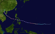
636:
At 2300 UTC, the storm made another landfall on the island of Leyte. The northern eyewall, the most powerful part of the storm, hit
Tacloban City. Despite continued land interaction, the storm remained exceptionally powerful as it hit Leyte. Shortly after the storm moved onshore, around
568:, reached the maximum level on the scale: T#8.0. The storm's structure exceeded the maximum intensity on the scale as the "Dvorak technique makes no allowance for an eye embedded so deeply in cloud tops as cold as ," as noted by the
450:
533:. Six hours later, the JTWC estimated Haiyan to have attained one-minute sustained winds of 315 km/h (88 m/s; 196 mph) and gusts up to 378 km/h (105 m/s; 235 mph). This officially ties Haiyan with
381:(JMA) classified the system as a tropical depression. Owing to a consolidating low-level circulation center with building deep convection, the JTWC also classified the system as a tropical depression, shortly after issuing a
1346:
705:(64 m/s; 140 mph) at this time. Similarly the PAGASA maintained its strength as 215 km/h (60 m/s; 134 mph) while the JMA estimated winds at 165 km/h (46 m/s; 103 mph).
2766:
696:. The storm weakens to category 4 strength shortly thereafter. After its lengthiest land crossing yet, Haiyan emerges over the Mindoro Strait. At 1200 UTC, the storm makes its last Philippine landfall at
557:
aircraft, observations which were not available for Haiyan, so the record is uncertain and comparing the intensities of the two storms is problematic.) The storm displayed some characteristics of an
2079:
437:
A small typhoon, with a core roughly 110 km (68 mi) across, rapid intensification continued through
November 6 as an 11 km (6.8 mi) wide pin-hole eye formed. Upper-level
410:') at 0000 UTC on November 4. Meanwhile, the JTWC also upgraded it to a tropical storm, when the expansive system was steadily consolidating in an area of weak to moderate vertical
1640:
1524:
445:
to the northeast. Intense banding features along the southern periphery of Haiyan wrapped into the system as well. Early on
November 6, the JTWC estimated the system to have achieved
469:
around 1200 UTC. At this time, Haiyan displayed a 15 km (9.3 mi) wide eye surrounded by a ring of deep convection. Later, the eye of the typhoon passed over the island of
1531:
649:
about 1.6 km (0.99 mi) south of the chasers measured a pressure of 955.6 mb (hPa; 28.22 inHg). Based on the gradient between these positions, Dr. Jeff
Masters of
1377:
1123:
930:
1615:
2072:
738:
as a severe tropical storm with ten-minute sustained winds of 110 km/h (31 m/s; 68 mph). Once onshore, Haiyan turned more easterly as the mid-latitude
569:
497:
Around 1200 UTC on
November 7, Haiyan attained its peak intensity with ten-minute sustained winds of 230 km/h (64 m/s; 140 mph) and a
804:
is a joint United States Navy – United States Air Force task force that issues tropical cyclone warnings for the western Pacific Ocean and other regions.
2065:
2100:
1564:
839:
Cold dark gray refers to the temperature of cloud tops seen on enhanced infrared satellite imagery and indicates values below −81 °C (−114 °F).
818:
645:(24 km (15 mi) north of the center of circulation) measured a pressure of 960.3 mbar (hPa; 28.36 inHg). At 2315 UTC, a barometer at
584:
1650:
1411:
1097:
771:
466:
283:
1535:
217:
1986:
1956:
1926:
1896:
1866:
1836:
669:, still at category 5 strength. Haiyan then crossed another mountain range to the west of Ormoc before emerging over the Cebu Strait. Marked
650:
2761:
2740:
509:). This made it the second-most intense tropical cyclone in the Northwest Pacific Ocean on record, based on wind speeds alone, along with
1810:
1780:
1750:
1672:
1265:
1183:
1153:
1070:
1037:
1007:
977:
889:
742:
became the primary steering factor. By 1200 UTC on November 11, Haiyan had dissipated as a tropical cyclone, as it moved over
859:
830:
A super typhoon is defined as a tropical cyclone with one-minute sustained winds of at least 240 km/h (67 m/s; 150 mph).
2776:
1589:
1239:
442:
2655:
952:
676:
During Haiyan's passage over the Cebu Strait, the core reorganized somewhat. At 0133 UTC, the eyewall began to hit the island of
382:
661:
to under 10 nm, also becoming cloud-filled. Despite this synoptic weakening, the shrinking eye kept windspeeds high due to
1616:"Super Typhoon Goni slams into Philippines as strongest landfalling tropical cyclone on record » Yale Climate Connections"
229:
266:
and the system developed into a tropical depression the following day. After becoming a tropical storm and attaining the name
2451:
354:
325:
as a severe tropical storm on November 10. Haiyan was last noted as a tropical depression by the JMA the following day.
259:
688:
radar station's last scan before it is disabled by the storm. After crossing the mountains, Haiyan made another landfall on
2247:
2211:
2033:
926:
2223:
801:
489:
370:
342:
279:
122:
2722:
2698:
2686:
2619:
2559:
2547:
2523:
2499:
2487:
2475:
2427:
2415:
2403:
2391:
2379:
2367:
2355:
2343:
2331:
2319:
2307:
2259:
2199:
2187:
2175:
2163:
2151:
2139:
2127:
2089:
814:
781:
776:
530:
522:
514:
378:
298:
251:
70:
2271:
1295:
271:
653:
estimated that Haiyan may have had a central pressure of 888 mb (hPa; 26.2 inHg) when it struck Leyte.
1592:. Philippine Atmospheric, Geophysical and Astronomical Services Administration. November 7, 2013. Archived from
1438:
1242:. Philippine Atmospheric, Geophysical and Astronomical Services Administration. November 6, 2013. Archived from
118:
2607:
763:
692:
at 0240 UTC, then quickly emerging over the Visayan sea. At 0400 UTC, the storm makes another landfall at
558:
2771:
2283:
431:
386:
1728:
1415:
1101:
458:
423:
362:
2018:
2631:
2439:
2235:
2112:
542:
438:
419:
366:
317:. Gradually weakening, the storm made five additional landfalls in the country before emerging over the
306:
275:
263:
2057:
461:. Intensification slowed somewhat during the day, though the JTWC estimated the storm to have attained
1702:
713:
2643:
2595:
2511:
2463:
546:
462:
1994:
1964:
1934:
1904:
1874:
1844:
1814:
1788:
1758:
1680:
1385:
1273:
1191:
1161:
1131:
1074:
1045:
1015:
985:
893:
2583:
629:
537:
in 2016 as the fifth-strongest tropical cyclone on record in terms of wind speed, only exceeded by
518:
510:
498:
314:
1467:
278:
that brought it to typhoon intensity by 1800 UTC on November 5. By November 6, the
1593:
1243:
693:
681:
573:
550:
538:
1493:
1320:
554:
415:
385:. Subsequent intensification resulted in the JMA upgrading the system to a tropical storm and
346:
333:
255:
242:'s meteorological history began with its origins as a tropical disturbance east-southeast of
2024:
867:
662:
646:
565:
393:
374:
313:
as the second strongest landfall on record by maximum sustained 1-minute wind speeds, after
246:
and lasted until its degeneration as a tropical cyclone over southern China. The thirteenth
2571:
701:
689:
670:
625:
534:
506:
318:
310:
151:
99:
2039:
1590:"Tropical Cyclone Warning: Typhoon "Yolanda" (Haiyan) Severe Weather Bulletin Number Six"
1240:"Tropical Cyclone Warning: Typhoon "Yolanda" (Haiyan) Severe Weather Bulletin Number One"
561:, though a strong convective band remained present along the western side of the system.
2667:
731:
697:
239:
2045:
633:
station was blown into the sea. The storm crossed into Leyte Gulf shortly thereafter.
2755:
2710:
2535:
1214:
658:
620:
600:
589:
446:
427:
143:
91:
929:(RSMC Tropical Cyclone Best Track). Japan Meteorological Agency. December 18, 2013.
309:, with an intensity of 305 km/h (85 m/s; 190 mph). This ties it with
2295:
1645:
592:
478:
1565:"Winston's 180 mph Winds in Fiji: Southern Hemisphere's Strongest Storm on Record"
262:
on November 2. Tracking generally westward, environmental conditions favored
297:
Thereafter, it continued to intensify; at 12:00 UTC on November 7, the
890:"Significant Tropical Weather Advisory for the Western and South Pacific Oceans"
526:
282:(JTWC) assessed the system as a Category 5-equivalent super typhoon on the
185:
180:
25:
2051:
1098:"Super Typhoon Haiyan's Intensification and Unusually Warm Sub-Surface Waters"
753:
739:
666:
411:
170:
147:
95:
978:"Prognostic Reasoning for Tropical Depression 31W (Thirty-One) Warning Nr 01"
685:
638:
451:
Philippine Atmospheric, Geophysical and Astronomical Services Administration
953:"Annual Report on Activities of the RSMC Tokyo – Typhoon Center 2000"
441:
favored further strengthening of the system and was further enhanced by a
735:
642:
612:
470:
358:
302:
287:
1641:"Super Typhoon Haiyan: Strongest Landfalling Tropical Cyclone on Record"
1412:"Super Typhoon Haiyan: Strongest Landfalling Tropical Cyclone on Record"
743:
727:
604:
350:
322:
247:
243:
190:
723:
616:
407:
337:
Haiyan becoming organized as a tropical depression on November 3
1038:"Prognostic Reasoning for Tropical Storm 31W (Haiyan) Warning Nr 04"
1751:"Prognostic Reasoning for Super Typhoon 31W (Haiyan) Warning Nr 21"
1673:"Prognostic Reasoning for Super Typhoon 31W (Haiyan) Warning Nr 20"
1500:. National Oceanic and Atmospheric Administration. November 8, 2013
1474:. National Oceanic and Atmospheric Administration. November 8, 2013
1213:
Gary Padgett; Kevin Boyle & Simon Clarke (February 21, 2007).
717:
Typhoon Haiyan near central Vietnam and Hainan on November 10
712:
596:
583:
488:
477:. Development continued throughout November 7, and at times,
474:
332:
291:
175:
1439:"Typhoon 31W (Haiyan) November 7, 2013 1430z Satellite Bulletin"
1073:. Joint Typhoon Warning Center. November 5, 2013. Archived from
892:. Joint Typhoon Warning Center. November 2, 2013. Archived from
677:
502:
321:. Turning northwestward, the typhoon eventually struck northern
2061:
1813:. Japan Meteorological Agency. November 8, 2013. Archived from
377:
would form within 72 hours. Early on November 3, the
1957:"Prognostic Reasoning for Typhoon 31W (Haiyan) Warning Nr 31"
1927:"Prognostic Reasoning for Typhoon 31W (Haiyan) Warning Nr 30"
1897:"Prognostic Reasoning for Typhoon 31W (Haiyan) Warning Nr 28"
1867:"Prognostic Reasoning for Typhoon 31W (Haiyan) Warning Nr 25"
1837:"Prognostic Reasoning for Typhoon 31W (Haiyan) Warning Nr 24"
1781:"Prognostic Reasoning for Typhoon 31W (Haiyan) Warning Nr 23"
1184:"Prognostic Reasoning for Typhoon 31W (Haiyan) Warning Nr 12"
1154:"Prognostic Reasoning for Typhoon 31W (Haiyan) Warning Nr 11"
1071:"Prognostic Reasoning for Typhoon 31W (Haiyan) Warning Nr 08"
365:. Environmental conditions ahead of the disturbance favored
258:
several hundred kilometers east-southeast of Pohnpei in the
1378:"Prognostic Reasoning for Super Typhoon 31W (Haiyan) Nr 19"
1266:"Prognostic Reasoning for Super Typhoon 31W (Haiyan) Nr 14"
1325:
Cooperative Institute for Meteorological Satellite Studies
430:
began developing. This intensification was fueled by high
611:
At 2040 UTC on November 7, Typhoon Haiyan made
2767:
Meteorological histories of individual tropical cyclones
1215:"Monthly Global Tropical Cyclone Summary – October 2006"
414:
and tracking westward along the southern periphery of a
1993:. United States Navy. November 10, 2013. Archived from
1963:. United States Navy. November 10, 2013. Archived from
1933:. United States Navy. November 10, 2013. Archived from
1903:. United States Navy. November 10, 2013. Archived from
1532:
National Disaster Risk Reduction and Management Council
1008:"Tropical Cyclone Formation Alert (WTPN22 PGTW 030530)"
958:. Japan Meteorological Agency. February 2001. p. 3
1873:. United States Navy. November 9, 2013. Archived from
1843:. United States Navy. November 9, 2013. Archived from
1787:. United States Navy. November 8, 2013. Archived from
1757:. United States Navy. November 8, 2013. Archived from
1729:"Haiyan's True Intensity and Death Toll Still Unknown"
1679:. United States Navy. November 7, 2013. Archived from
1384:. United States Navy. November 7, 2013. Archived from
1272:. United States Navy. November 6, 2013. Archived from
1190:. United States Navy. November 6, 2013. Archived from
1160:. United States Navy. November 5, 2013. Archived from
1130:. United States Navy. November 5, 2013. Archived from
1044:. United States Navy. November 4, 2013. Archived from
984:. United States Navy. November 3, 2013. Archived from
700:
as a strong category 4 storm. Haiyan emerged over the
1525:"SitRep No. 17 Effects of Typhoon "Yolanda" (Haiyan)"
1987:"Tropical Storm 31W (Haiyan) Warning Nr 032 (Final)"
665:. At 0006 UTC, the eye crosses the Nacolod and hits
1811:"WTPQ21 RJTD 082100 RSMC Tropical Cyclone Advisory"
493:
Typhoon Haiyan at peak intensity on November 7
163:
158:
137:
129:
106:
85:
77:
58:
50:
42:
35:
1296:"Palau assesses damage after Super Typhoon Haiyan"
349:about 425 km (264 mi) east-southeast of
1445:. National Oceanic and Atmospheric Administration
418:. By November 5, the storm began to undergo
274:on November 4, the system began a period of
860:"Joint Typhoon Warning Center Mission Statement"
730:further weakened the storm as it moved over the
673:over this terrain is evident on radar imagery.
570:National Oceanic and Atmospheric Administration
2073:
2021:of Typhoon Haiyan (1330) from Digital Typhoon
8:
1405:
1403:
1372:
1370:
1368:
1327:. University of Wisconsin. November 11, 2013
1315:
1313:
18:
1519:
1517:
1515:
1462:
1460:
1065:
1063:
921:
919:
917:
915:
913:
911:
564:Satellite estimates at the time, using the
453:(PAGASA) assigned the storm the local name
401:
2080:
2066:
2058:
1468:"Typhoon 31W (Haiyan) ADT History Listing"
1298:. Australia Network News. November 7, 2013
866:. United States Navy. 2011. Archived from
819:Regional Specialized Meteorological Center
24:
17:
2570:
2565:
2138:
2133:
772:Meteorological history of Typhoon Durian
2709:
2704:
2654:
2649:
2042:from the U.S. Naval Research Laboratory
851:
793:
294:shortly after attaining this strength.
607:, the most powerful part of the storm.
286:; the storm passed over the island of
2721:
2716:
2618:
2613:
2606:
2601:
2450:
2445:
2366:
2361:
2318:
2313:
2282:
2277:
2150:
2145:
1703:"iCyclone Chase Report – Preliminary"
1558:
1556:
1414:. Weather Underground. Archived from
1124:"Typhoon 31W (Haiyan) Warning Nr 010"
1100:. Weather Underground. Archived from
7:
2697:
2692:
2558:
2553:
2498:
2493:
2486:
2481:
2402:
2397:
2390:
2385:
2306:
2301:
2258:
2253:
2246:
2241:
2210:
2205:
2186:
2181:
2162:
2157:
1014:. United States Navy. Archived from
481:were apparent in the typhoon's eye.
2378:
2373:
1534:. November 13, 2013. Archived from
467:Saffir–Simpson hurricane wind scale
284:Saffir–Simpson hurricane wind scale
108:Category 5-equivalent super typhoon
2685:
2680:
2666:
2661:
2630:
2625:
2522:
2517:
2354:
2349:
2234:
2229:
2198:
2193:
1727:Jeff Masters (November 15, 2013).
1649:. November 7, 2013. Archived from
1096:Jeff Masters (November 13, 2013).
595:loop of Haiyan making landfall on
443:tropical upper tropospheric trough
14:
2594:
2589:
2546:
2541:
2462:
2457:
2426:
2421:
2414:
2409:
2222:
2217:
2174:
2169:
2126:
2121:
1437:Michael Turk (November 7, 2013).
1410:Jeff Masters (November 7, 2013).
933:from the original on May 22, 2024
361:alongside steadily consolidating
30:Track of Typhoon Haiyan (Yolanda)
2736:
2735:
2474:
2469:
2438:
2433:
2330:
2325:
2294:
2289:
2111:
756:
663:conservation of angular momentum
383:Tropical Cyclone Formation Alert
345:(JTWC) began monitoring a broad
2642:
2637:
2534:
2529:
2510:
2505:
2342:
2337:
2270:
2265:
709:South China Sea and dissipation
371:dynamic weather forecast models
2582:
2577:
821:for the western Pacific Ocean.
373:predicted that a well-defined
355:Federated States of Micronesia
260:Federated States of Micronesia
1:
2048:from the CIMSS Satellite Blog
2036:of Super Typhoon 31W (Haiyan)
1708:. iCyclone. November 13, 2013
641:deployed by storm chasers in
357:. The system featured broken
1991:Joint Typhoon Warning Center
1961:Joint Typhoon Warning Center
1931:Joint Typhoon Warning Center
1901:Joint Typhoon Warning Center
1871:Joint Typhoon Warning Center
1841:Joint Typhoon Warning Center
1785:Joint Typhoon Warning Center
1755:Joint Typhoon Warning Center
1677:Joint Typhoon Warning Center
1382:Joint Typhoon Warning Center
1270:Joint Typhoon Warning Center
1188:Joint Typhoon Warning Center
1158:Joint Typhoon Warning Center
1128:Joint Typhoon Warning Center
1042:Joint Typhoon Warning Center
1012:Joint Typhoon Warning Center
982:Joint Typhoon Warning Center
864:Joint Typhoon Warning Center
802:Joint Typhoon Warning Center
549:(345 km/h) in 1961 and
343:Joint Typhoon Warning Center
280:Joint Typhoon Warning Center
254:, Haiyan originated from an
133:315 km/h (195 mph)
81:230 km/h (145 mph)
2762:2013 Pacific typhoon season
2090:2013 Pacific typhoon season
2052:The track of Typhoon Haiyan
815:Japan Meteorological Agency
782:Typhoons in the Philippines
777:2013 Pacific typhoon season
603:was struck by the northern
379:Japan Meteorological Agency
353:, one of the states in the
329:Origins and intensification
299:Japan Meteorological Agency
252:2013 Pacific typhoon season
2793:
1494:"Position History for 31W"
463:Category 5-equivalent
2777:Tropical cyclones in 2013
2731:
2118:
2109:
2096:
2088:Tropical cyclones of the
2027:of Typhoon Haiyan (1330)
1498:Satellite Analysis Branch
1472:Satellite Analysis Branch
1443:Satellite Analysis Branch
545:(335 km/h) in 1961,
541:(325 km/h) in 1958,
397:
199:
113:
65:
23:
1620:Yale Climate Connections
764:Tropical cyclones portal
559:annular tropical cyclone
432:sea surface temperatures
341:On November 2, the
19:Typhoon Haiyan (Yolanda)
2019:JMA General Information
457:as it approached their
426:(CDO) with an embedded
1321:"Super Typhoon Haiyan"
817:(JMA) is the official
718:
671:orographic enhancement
628:in 2016 and broken by
608:
494:
459:area of responsibility
449:status. That day, the
424:central dense overcast
338:
305:in the Philippines at
230:Commons: Haiyan images
206:Meteorological history
37:Meteorological history
1731:. Weather Underground
716:
587:
492:
420:rapid intensification
387:assigning it the name
367:tropical cyclogenesis
336:
307:Guiuan, Eastern Samar
276:rapid intensification
264:tropical cyclogenesis
218:Humanitarian response
2046:Super Typhoon Haiyan
2034:JTWC Best Track Data
1997:on November 12, 2013
1967:on November 12, 2013
1937:on November 12, 2013
1907:on November 12, 2013
1877:on November 12, 2013
1847:on November 12, 2013
1541:on November 13, 2013
1104:on November 14, 2013
580:Philippine landfalls
256:area of low pressure
138:Lowest pressure
86:Lowest pressure
2025:JMA Best Track Data
1817:on November 9, 2013
1791:on November 9, 2013
1761:on November 9, 2013
1683:on November 8, 2013
1653:on November 8, 2013
1596:on November 8, 2013
1569:Weather Underground
1418:on November 8, 2013
1276:on November 7, 2013
1246:on November 9, 2013
1194:on November 6, 2013
1164:on November 6, 2013
1077:on November 5, 2013
1048:on November 4, 2013
1018:on November 3, 2013
988:on November 4, 2013
896:on November 2, 2013
657:eye shrank from 20
651:Weather Underground
574:Typhoon Tip of 1979
499:barometric pressure
67:10-minute sustained
20:
719:
694:Concepcion, Iloilo
609:
576:holds the record.
551:Hurricane Patricia
495:
339:
130:Highest winds
115:1-minute sustained
78:Highest winds
2749:
2748:
637:2320 UTC, a
555:hurricane hunters
505:(hPa; 26.43
416:subtropical ridge
404:
347:low-pressure area
237:
236:
54:November 11, 2013
2784:
2739:
2738:
2719:
2707:
2695:
2683:
2676:
2664:
2652:
2640:
2628:
2616:
2604:
2592:
2580:
2568:
2556:
2544:
2532:
2520:
2508:
2496:
2484:
2472:
2460:
2448:
2436:
2424:
2412:
2400:
2388:
2376:
2364:
2352:
2340:
2328:
2316:
2304:
2292:
2280:
2268:
2256:
2244:
2232:
2220:
2208:
2196:
2184:
2172:
2160:
2148:
2136:
2124:
2115:
2082:
2075:
2068:
2059:
2030:
2007:
2006:
2004:
2002:
1983:
1977:
1976:
1974:
1972:
1953:
1947:
1946:
1944:
1942:
1923:
1917:
1916:
1914:
1912:
1893:
1887:
1886:
1884:
1882:
1863:
1857:
1856:
1854:
1852:
1833:
1827:
1826:
1824:
1822:
1807:
1801:
1800:
1798:
1796:
1777:
1771:
1770:
1768:
1766:
1747:
1741:
1740:
1738:
1736:
1724:
1718:
1717:
1715:
1713:
1707:
1699:
1693:
1692:
1690:
1688:
1669:
1663:
1662:
1660:
1658:
1637:
1631:
1630:
1628:
1627:
1612:
1606:
1605:
1603:
1601:
1586:
1580:
1579:
1577:
1575:
1560:
1551:
1550:
1548:
1546:
1540:
1529:
1521:
1510:
1509:
1507:
1505:
1490:
1484:
1483:
1481:
1479:
1464:
1455:
1454:
1452:
1450:
1434:
1428:
1427:
1425:
1423:
1407:
1398:
1397:
1395:
1393:
1374:
1363:
1362:
1360:
1358:
1343:
1337:
1336:
1334:
1332:
1317:
1308:
1307:
1305:
1303:
1292:
1286:
1285:
1283:
1281:
1262:
1256:
1255:
1253:
1251:
1236:
1230:
1229:
1227:
1225:
1219:
1210:
1204:
1203:
1201:
1199:
1180:
1174:
1173:
1171:
1169:
1150:
1144:
1143:
1141:
1139:
1120:
1114:
1113:
1111:
1109:
1093:
1087:
1086:
1084:
1082:
1067:
1058:
1057:
1055:
1053:
1034:
1028:
1027:
1025:
1023:
1004:
998:
997:
995:
993:
974:
968:
967:
965:
963:
957:
949:
943:
942:
940:
938:
923:
906:
905:
903:
901:
886:
880:
879:
877:
875:
870:on July 26, 2007
856:
840:
837:
831:
828:
822:
811:
805:
798:
766:
761:
760:
759:
744:Guangxi Province
647:Tacloban Airport
566:Dvorak technique
405:
402:
399:
375:tropical cyclone
359:banding features
154:
109:
102:
61:
46:November 3, 2013
38:
28:
21:
2792:
2791:
2787:
2786:
2785:
2783:
2782:
2781:
2752:
2751:
2750:
2745:
2727:
2726:
2725:
2720:
2717:
2714:
2713:
2708:
2705:
2702:
2701:
2696:
2693:
2690:
2689:
2684:
2681:
2678:
2677:
2670:
2665:
2662:
2659:
2658:
2653:
2650:
2647:
2646:
2641:
2638:
2635:
2634:
2629:
2626:
2623:
2622:
2617:
2614:
2611:
2610:
2605:
2602:
2599:
2598:
2593:
2590:
2587:
2586:
2581:
2578:
2575:
2574:
2569:
2566:
2563:
2562:
2557:
2554:
2551:
2550:
2545:
2542:
2539:
2538:
2533:
2530:
2527:
2526:
2521:
2518:
2515:
2514:
2509:
2506:
2503:
2502:
2497:
2494:
2491:
2490:
2485:
2482:
2479:
2478:
2473:
2470:
2467:
2466:
2461:
2458:
2455:
2454:
2449:
2446:
2443:
2442:
2437:
2434:
2431:
2430:
2425:
2422:
2419:
2418:
2413:
2410:
2407:
2406:
2401:
2398:
2395:
2394:
2389:
2386:
2383:
2382:
2377:
2374:
2371:
2370:
2365:
2362:
2359:
2358:
2353:
2350:
2347:
2346:
2341:
2338:
2335:
2334:
2329:
2326:
2323:
2322:
2317:
2314:
2311:
2310:
2305:
2302:
2299:
2298:
2293:
2290:
2287:
2286:
2281:
2278:
2275:
2274:
2269:
2266:
2263:
2262:
2257:
2254:
2251:
2250:
2245:
2242:
2239:
2238:
2233:
2230:
2227:
2226:
2221:
2218:
2215:
2214:
2209:
2206:
2203:
2202:
2197:
2194:
2191:
2190:
2185:
2182:
2179:
2178:
2173:
2170:
2167:
2166:
2161:
2158:
2155:
2154:
2149:
2146:
2143:
2142:
2137:
2134:
2131:
2130:
2125:
2122:
2116:
2105:
2092:
2086:
2028:
2015:
2010:
2000:
1998:
1985:
1984:
1980:
1970:
1968:
1955:
1954:
1950:
1940:
1938:
1925:
1924:
1920:
1910:
1908:
1895:
1894:
1890:
1880:
1878:
1865:
1864:
1860:
1850:
1848:
1835:
1834:
1830:
1820:
1818:
1809:
1808:
1804:
1794:
1792:
1779:
1778:
1774:
1764:
1762:
1749:
1748:
1744:
1734:
1732:
1726:
1725:
1721:
1711:
1709:
1705:
1701:
1700:
1696:
1686:
1684:
1671:
1670:
1666:
1656:
1654:
1639:
1638:
1634:
1625:
1623:
1614:
1613:
1609:
1599:
1597:
1588:
1587:
1583:
1573:
1571:
1563:Masters, Jeff.
1562:
1561:
1554:
1544:
1542:
1538:
1527:
1523:
1522:
1513:
1503:
1501:
1492:
1491:
1487:
1477:
1475:
1466:
1465:
1458:
1448:
1446:
1436:
1435:
1431:
1421:
1419:
1409:
1408:
1401:
1391:
1389:
1388:on May 22, 2024
1376:
1375:
1366:
1356:
1354:
1351:Digital Typhoon
1345:
1344:
1340:
1330:
1328:
1319:
1318:
1311:
1301:
1299:
1294:
1293:
1289:
1279:
1277:
1264:
1263:
1259:
1249:
1247:
1238:
1237:
1233:
1223:
1221:
1217:
1212:
1211:
1207:
1197:
1195:
1182:
1181:
1177:
1167:
1165:
1152:
1151:
1147:
1137:
1135:
1134:on May 22, 2024
1122:
1121:
1117:
1107:
1105:
1095:
1094:
1090:
1080:
1078:
1069:
1068:
1061:
1051:
1049:
1036:
1035:
1031:
1021:
1019:
1006:
1005:
1001:
991:
989:
976:
975:
971:
961:
959:
955:
951:
950:
946:
936:
934:
925:
924:
909:
899:
897:
888:
887:
883:
873:
871:
858:
857:
853:
849:
844:
843:
838:
834:
829:
825:
812:
808:
799:
795:
790:
762:
757:
755:
752:
711:
702:South China Sea
690:Bantayan Island
626:Typhoon Meranti
582:
535:Typhoon Meranti
487:
422:as a prominent
331:
319:South China Sea
311:Typhoon Meranti
195:
159:Overall effects
141:
107:
89:
60:Violent typhoon
59:
36:
31:
12:
11:
5:
2790:
2788:
2780:
2779:
2774:
2772:Typhoon Haiyan
2769:
2764:
2754:
2753:
2747:
2746:
2744:
2743:
2732:
2729:
2728:
2715:
2703:
2691:
2679:
2660:
2648:
2636:
2624:
2612:
2600:
2588:
2576:
2564:
2552:
2540:
2528:
2516:
2504:
2492:
2480:
2468:
2456:
2444:
2432:
2420:
2408:
2396:
2384:
2372:
2360:
2348:
2336:
2324:
2312:
2300:
2288:
2276:
2264:
2252:
2240:
2228:
2216:
2204:
2192:
2180:
2168:
2156:
2144:
2132:
2120:
2119:
2117:
2110:
2107:
2106:
2104:
2103:
2097:
2094:
2093:
2087:
2085:
2084:
2077:
2070:
2062:
2056:
2055:
2049:
2043:
2037:
2031:
2022:
2014:
2013:External links
2011:
2009:
2008:
1978:
1948:
1918:
1888:
1858:
1828:
1802:
1772:
1742:
1719:
1694:
1664:
1632:
1607:
1581:
1552:
1511:
1485:
1456:
1429:
1399:
1364:
1347:"Typhoon List"
1338:
1309:
1287:
1257:
1231:
1220:. Typhoon 2000
1205:
1175:
1145:
1115:
1088:
1059:
1029:
999:
969:
944:
927:Typhoon Haiyan
907:
881:
850:
848:
845:
842:
841:
832:
823:
806:
792:
791:
789:
786:
785:
784:
779:
774:
768:
767:
751:
748:
732:Gulf of Tonkin
710:
707:
698:Coron, Palawan
684:. This is the
581:
578:
543:Typhoon Violet
486:
485:Peak intensity
483:
465:status on the
330:
327:
240:Typhoon Haiyan
235:
234:
233:
232:
221:
220:
209:
208:
197:
196:
194:
193:
188:
183:
178:
173:
167:
165:
164:Areas affected
161:
160:
156:
155:
150:); 26.43
139:
135:
134:
131:
127:
126:
111:
110:
104:
103:
98:); 26.43
87:
83:
82:
79:
75:
74:
63:
62:
56:
55:
52:
48:
47:
44:
40:
39:
33:
32:
29:
13:
10:
9:
6:
4:
3:
2:
2789:
2778:
2775:
2773:
2770:
2768:
2765:
2763:
2760:
2759:
2757:
2742:
2734:
2733:
2730:
2724:
2712:
2700:
2688:
2674:
2669:
2657:
2645:
2633:
2621:
2609:
2597:
2585:
2573:
2561:
2549:
2537:
2525:
2513:
2501:
2489:
2477:
2465:
2453:
2441:
2429:
2417:
2405:
2393:
2381:
2369:
2357:
2345:
2333:
2321:
2309:
2297:
2285:
2273:
2261:
2249:
2237:
2225:
2213:
2201:
2189:
2177:
2165:
2153:
2141:
2129:
2114:
2108:
2102:
2099:
2098:
2095:
2091:
2083:
2078:
2076:
2071:
2069:
2064:
2063:
2060:
2053:
2050:
2047:
2044:
2041:
2038:
2035:
2032:
2029:(in Japanese)
2026:
2023:
2020:
2017:
2016:
2012:
1996:
1992:
1988:
1982:
1979:
1966:
1962:
1958:
1952:
1949:
1936:
1932:
1928:
1922:
1919:
1906:
1902:
1898:
1892:
1889:
1876:
1872:
1868:
1862:
1859:
1846:
1842:
1838:
1832:
1829:
1816:
1812:
1806:
1803:
1790:
1786:
1782:
1776:
1773:
1760:
1756:
1752:
1746:
1743:
1730:
1723:
1720:
1704:
1698:
1695:
1682:
1678:
1674:
1668:
1665:
1652:
1648:
1647:
1642:
1636:
1633:
1621:
1617:
1611:
1608:
1595:
1591:
1585:
1582:
1570:
1566:
1559:
1557:
1553:
1537:
1533:
1526:
1520:
1518:
1516:
1512:
1499:
1495:
1489:
1486:
1473:
1469:
1463:
1461:
1457:
1444:
1440:
1433:
1430:
1417:
1413:
1406:
1404:
1400:
1387:
1383:
1379:
1373:
1371:
1369:
1365:
1352:
1348:
1342:
1339:
1326:
1322:
1316:
1314:
1310:
1297:
1291:
1288:
1275:
1271:
1267:
1261:
1258:
1245:
1241:
1235:
1232:
1216:
1209:
1206:
1193:
1189:
1185:
1179:
1176:
1163:
1159:
1155:
1149:
1146:
1133:
1129:
1125:
1119:
1116:
1103:
1099:
1092:
1089:
1076:
1072:
1066:
1064:
1060:
1047:
1043:
1039:
1033:
1030:
1017:
1013:
1009:
1003:
1000:
987:
983:
979:
973:
970:
954:
948:
945:
932:
928:
922:
920:
918:
916:
914:
912:
908:
895:
891:
885:
882:
869:
865:
861:
855:
852:
846:
836:
833:
827:
824:
820:
816:
810:
807:
803:
797:
794:
787:
783:
780:
778:
775:
773:
770:
769:
765:
754:
749:
747:
745:
741:
737:
733:
729:
725:
724:Hainan Island
715:
708:
706:
703:
699:
695:
691:
687:
683:
679:
674:
672:
668:
664:
660:
654:
652:
648:
644:
643:Tacloban City
640:
634:
631:
627:
622:
621:Eastern Samar
618:
614:
606:
602:
601:Tacloban City
598:
594:
591:
590:Weather radar
586:
579:
577:
575:
571:
567:
562:
560:
556:
552:
548:
547:Typhoon Nancy
544:
540:
536:
532:
528:
525:, only after
524:
520:
516:
512:
508:
504:
500:
491:
484:
482:
480:
476:
472:
468:
464:
460:
456:
452:
448:
447:super typhoon
444:
440:
435:
433:
429:
425:
421:
417:
413:
409:
395:
391:
388:
384:
380:
376:
372:
368:
364:
360:
356:
352:
348:
344:
335:
328:
326:
324:
320:
316:
312:
308:
304:
300:
295:
293:
289:
285:
281:
277:
273:
270:at 0000
269:
265:
261:
257:
253:
249:
245:
241:
231:
228:
227:
226:
225:
219:
216:
215:
214:
213:
207:
204:
203:
202:
198:
192:
189:
187:
184:
182:
179:
177:
174:
172:
169:
168:
166:
162:
157:
153:
149:
145:
140:
136:
132:
128:
124:
120:
116:
112:
105:
101:
97:
93:
88:
84:
80:
76:
72:
68:
64:
57:
53:
49:
45:
41:
34:
27:
22:
16:
2672:
2054:from YouTube
2001:November 12,
1999:. Retrieved
1995:the original
1990:
1981:
1971:November 10,
1969:. Retrieved
1965:the original
1960:
1951:
1941:November 10,
1939:. Retrieved
1935:the original
1930:
1921:
1911:November 10,
1909:. Retrieved
1905:the original
1900:
1891:
1881:November 10,
1879:. Retrieved
1875:the original
1870:
1861:
1851:November 10,
1849:. Retrieved
1845:the original
1840:
1831:
1819:. Retrieved
1815:the original
1805:
1793:. Retrieved
1789:the original
1784:
1775:
1763:. Retrieved
1759:the original
1754:
1745:
1735:November 16,
1733:. Retrieved
1722:
1712:November 13,
1710:. Retrieved
1697:
1685:. Retrieved
1681:the original
1676:
1667:
1655:. Retrieved
1651:the original
1646:Wunderground
1644:
1635:
1624:. Retrieved
1622:. 2020-11-01
1619:
1610:
1598:. Retrieved
1594:the original
1584:
1572:. Retrieved
1568:
1545:November 13,
1543:. Retrieved
1536:the original
1502:. Retrieved
1497:
1488:
1476:. Retrieved
1471:
1447:. Retrieved
1442:
1432:
1420:. Retrieved
1416:the original
1390:. Retrieved
1386:the original
1381:
1355:. Retrieved
1350:
1341:
1331:November 13,
1329:. Retrieved
1324:
1300:. Retrieved
1290:
1278:. Retrieved
1274:the original
1269:
1260:
1248:. Retrieved
1244:the original
1234:
1222:. Retrieved
1208:
1196:. Retrieved
1192:the original
1187:
1178:
1166:. Retrieved
1162:the original
1157:
1148:
1136:. Retrieved
1132:the original
1127:
1118:
1108:November 13,
1106:. Retrieved
1102:the original
1091:
1079:. Retrieved
1075:the original
1050:. Retrieved
1046:the original
1041:
1032:
1020:. Retrieved
1016:the original
1011:
1002:
990:. Retrieved
986:the original
981:
972:
960:. Retrieved
947:
937:December 21,
935:. Retrieved
898:. Retrieved
894:the original
884:
872:. Retrieved
868:the original
863:
854:
835:
826:
809:
796:
720:
682:Daanbantayan
675:
655:
635:
630:Typhoon Goni
610:
593:reflectivity
563:
496:
479:mesovortices
454:
436:
389:
340:
315:Typhoon Goni
296:
267:
238:
223:
222:
211:
210:
205:
200:
114:
66:
15:
1821:November 9,
1795:November 9,
1765:November 9,
1687:November 9,
1657:November 7,
1600:November 9,
1504:November 8,
1478:November 8,
1449:November 8,
1422:November 8,
1392:November 8,
1357:November 8,
1302:November 7,
1280:November 8,
1250:November 8,
1224:November 8,
1198:November 8,
1168:November 8,
1138:November 8,
1081:November 6,
1052:November 6,
1022:November 6,
992:November 6,
962:November 8,
900:November 8,
874:November 8,
539:Typhoon Ida
224:Other wikis
186:South China
181:Philippines
2756:Categories
2040:31W.HAIYAN
1626:2020-11-02
1574:5 February
847:References
740:westerlies
667:Ormoc City
624:tied with
412:wind shear
363:convection
171:Micronesia
51:Dissipated
2608:Francisco
746:, China.
686:Cebu City
639:barometer
2741:Category
2380:Kong-rey
2284:Mangkhut
2152:Shanshan
2101:Timeline
1218:(Report)
931:Archived
750:See also
736:Haiphong
613:landfall
599:Island.
471:Kayangel
303:landfall
288:Kayangel
212:Response
2673:history
2572:Phailin
2248:Cimaron
2212:Bebinca
728:Vietnam
605:eyewall
588:PAGASA
501:of 895
455:Yolanda
439:outflow
394:Chinese
351:Pohnpei
323:Vietnam
250:of the
248:typhoon
244:Pohnpei
201:History
191:Vietnam
2668:Haiyan
2632:Lekima
2440:Man-yi
2428:Toraji
2236:Soulik
2224:Rumbia
2140:Bising
2128:Sonamu
1353:. 2013
617:Guiuan
408:petrel
396::
390:Haiyan
268:Haiyan
43:Formed
2711:Lehar
2687:Podul
2656:Wilma
2644:Krosa
2596:Wipha
2548:Danas
2536:Fitow
2524:Sepat
2512:Wutip
2476:Pabuk
2464:Usagi
2356:Unala
2332:Trami
2200:Leepi
1706:(PDF)
1539:(PDF)
1528:(PDF)
956:(PDF)
788:Notes
680:, at
597:Leyte
475:Palau
406:'
292:Palau
176:Palau
119:SSHWS
2663:VITY
2627:VITY
2603:VITY
2591:VSTY
2584:Nari
2543:VSTY
2459:VITY
2416:Yutu
2344:Pewa
2296:Utor
2291:VITY
2272:Jebi
2231:VSTY
2176:Yagi
2003:2013
1973:2013
1943:2013
1913:2013
1883:2013
1853:2013
1823:2013
1797:2013
1767:2013
1737:2013
1714:2013
1689:2013
1659:2013
1602:2013
1576:2018
1547:2013
1506:2013
1480:2013
1451:2013
1424:2013
1394:2013
1359:2013
1333:2013
1304:2013
1282:2013
1252:2013
1226:2013
1200:2013
1170:2013
1140:2013
1110:2013
1083:2013
1054:2013
1024:2013
994:2013
964:2013
939:2013
902:2013
876:2013
813:The
800:The
726:and
678:Cebu
531:1979
523:2010
519:Megi
517:and
515:1982
511:Bess
507:inHg
503:mbar
403:lit.
369:and
152:inHg
148:mbar
142:895
123:JTWC
100:inHg
96:mbar
90:895
2723:33W
2620:27W
2471:STS
2452:18W
2423:STS
2375:STS
2368:03C
2339:STS
2327:STS
2320:13W
2267:STS
2219:STS
2123:STS
615:in
529:in
527:Tip
521:in
513:in
473:in
428:eye
290:in
272:UTC
144:hPa
92:hPa
71:JMA
2758::
2718:TD
2706:TD
2699:TD
2694:TD
2682:TS
2651:TD
2639:TY
2615:TD
2579:TY
2567:TD
2560:TD
2555:TD
2531:TY
2519:TS
2507:TY
2500:TD
2495:TD
2488:TD
2483:TD
2447:TD
2435:TY
2411:TS
2404:TD
2399:TD
2392:TD
2387:TD
2363:TD
2351:TS
2315:TD
2308:TD
2303:TD
2279:TS
2260:TD
2255:TD
2243:TS
2207:TS
2195:TS
2188:TD
2183:TD
2171:TS
2164:TD
2159:TD
2147:TS
2135:TD
1989:.
1959:.
1929:.
1899:.
1869:.
1839:.
1783:.
1753:.
1675:.
1643:.
1618:.
1567:.
1555:^
1530:.
1514:^
1496:.
1470:.
1459:^
1441:.
1402:^
1380:.
1367:^
1349:.
1323:.
1312:^
1268:.
1186:.
1156:.
1126:.
1062:^
1040:.
1010:.
980:.
910:^
862:.
659:nm
619:,
400:;
398:海燕
2675:)
2671:(
2081:e
2074:t
2067:v
2005:.
1975:.
1945:.
1915:.
1885:.
1855:.
1825:.
1799:.
1769:.
1739:.
1716:.
1691:.
1661:.
1629:.
1604:.
1578:.
1549:.
1508:.
1482:.
1453:.
1426:.
1396:.
1361:.
1335:.
1306:.
1284:.
1254:.
1228:.
1202:.
1172:.
1142:.
1112:.
1085:.
1056:.
1026:.
996:.
966:.
941:.
904:.
878:.
392:(
146:(
125:)
121:/
117:(
94:(
73:)
69:(
Text is available under the Creative Commons Attribution-ShareAlike License. Additional terms may apply.