36:
261:
43:
205:
in Japan. The dam is used for flood control, irrigation and power production. The catchment area of the dam is 359 km. The dam impounds about 181 ha of land when full and can store 46000 thousand cubic meters of water. The construction of the dam was started on 1964 and completed in 1970.
35:
302:
83:
321:
295:
326:
288:
215:
202:
70:
192:
260:
235:
272:
165:
315:
98:
85:
179:
268:
276:
174:
164:
156:
151:
143:
135:
130:
122:
114:
77:
66:
58:
24:
296:
8:
42:
303:
289:
21:
267:This article about a dam or floodgate on
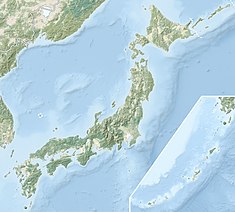
50:Location of Midorikawa Hojo Dam in Japan
227:
236:"Midorikawa Hojo Dam - Dams in Japan"
7:
257:
255:
14:
19:Dam in Kumamoto Prefecture, Japan
16:Dam in Kumamoto Prefecture, Japan
259:
41:
34:
1:
201:is a rockfill dam located in
275:. You can help Knowledge by
322:Dams in Kumamoto Prefecture
160:46000 thousand cubic meters
343:
254:
196:
29:
115:Construction began
99:32.62972°N 130.90639°E
216:List of dams in Japan
203:Kumamoto Prefecture
188:Midorikawa Hojo Dam
166:Catchment area
157:Total capacity
104:32.62972; 130.90639
95: /
71:Kumamoto Prefecture
25:Midorikawa Hojo Dam
284:
283:
185:
184:
175:Surface area
131:Dam and spillways
123:Opening date
334:
327:Kyushu dam stubs
305:
298:
291:
263:
256:
246:
245:
243:
242:
232:
200:
198:
110:
109:
107:
106:
105:
100:
96:
93:
92:
91:
88:
45:
44:
38:
22:
342:
341:
337:
336:
335:
333:
332:
331:
312:
311:
310:
309:
252:
250:
249:
240:
238:
234:
233:
229:
224:
212:
190:
103:
101:
97:
94:
89:
86:
84:
82:
81:
54:
53:
52:
51:
48:
47:
46:
20:
17:
12:
11:
5:
340:
338:
330:
329:
324:
314:
313:
308:
307:
300:
293:
285:
282:
281:
264:
248:
247:
226:
225:
223:
220:
219:
218:
211:
208:
183:
182:
176:
172:
171:
168:
162:
161:
158:
154:
153:
149:
148:
145:
141:
140:
137:
133:
132:
128:
127:
124:
120:
119:
116:
112:
111:
79:
75:
74:
68:
64:
63:
60:
56:
55:
49:
40:
39:
33:
32:
31:
30:
27:
26:
18:
15:
13:
10:
9:
6:
4:
3:
2:
339:
328:
325:
323:
320:
319:
317:
306:
301:
299:
294:
292:
287:
286:
280:
278:
274:
271:, Japan is a
270:
265:
262:
258:
253:
237:
231:
228:
221:
217:
214:
213:
209:
207:
204:
194:
189:
181:
177:
173:
169:
167:
163:
159:
155:
150:
146:
142:
138:
134:
129:
125:
121:
117:
113:
108:
80:
76:
72:
69:
65:
61:
59:Official name
57:
37:
28:
23:
277:expanding it
266:
251:
239:. Retrieved
230:
187:
186:
102: /
90:130°54′23″E
78:Coordinates
316:Categories
241:2022-02-22
222:References
170:359 sq. km
87:32°37′47″N
152:Reservoir
210:See also
193:Japanese
180:hectares
67:Location
73:, Japan
269:Kyushu
197:緑川補助ダム
144:Length
136:Height
62:緑川補助ダム
273:stub
178:181
147:244m
126:1970
118:1964
139:35m
318::
195::
304:e
297:t
290:v
279:.
244:.
199:)
191:(
Text is available under the Creative Commons Attribution-ShareAlike License. Additional terms may apply.