56:
112:
975:
96:
761:
330:
81:
1109:
71:
929:
684:
659:
751:
776:
119:
553:
with the establishment of the modern municipalities system on
October 1, 1889. Kōwa was raised to town status on May 6, 1903. Noma was raised to town status on July 1, 1942. The town of Mihama was established on April 1, 1955 through the merger of the towns of Kōwa and Noma. On March 31, 1957, the
541:). The average annual temperature in Mihama is 15.6 °C. The average annual rainfall is 1737 mm with September as the wettest month. The temperatures are highest on average in August, at around 27.4 °C, and lowest in January, at around 4.8 °C.
55:
593:
Mihama has five public elementary schools and two public junior high schools operated by the town government, and one high school operated by the Aichi
Prefectural Board of Education.
555:
111:
554:
area of the town expanded when the neighboring town of
Kosugaya was dissolved, and divided between Mihama and Tokoname. During March 2006, discussions were held to
1589:
143:
974:
559:
95:
1553:
1584:
562:, but the merger proposal was strongly opposed by the majority of the inhabitants of Minamichita, and the merger did not take place.
535:
964:
558:
Mihama with the town of
Minamichita to the south to form the new city of “Minamicentrair” named after the popular nickname for
400:
1108:
80:
942:
438:
Per
Japanese census data, the population of Mihama peaked at around the year 2005 and has been in slow decline since.
992:
736:
1558:
764:
587:
187:
175:
70:
1505:
1150:
691:
17:
1579:
1525:
701:
356:
1433:
550:
360:
220:
666:
379:
of 491 persons per km². The total area of the town was 46.20 square kilometres (17.84 sq mi)
641:
Minami-Kōwa
Elementary school (School closed and merged with Kōwa Elementary School on March 31, 2022)
329:
1520:
1510:
1411:
1117:
672:
203:
1079:
1074:
1064:
1039:
957:
792:
787:
705:
270:
1535:
1530:
1029:
1024:
575:
425:
376:
215:
1350:
1140:
1059:
1054:
1049:
1044:
1019:
855:
1500:
1084:
978:
754:
697:
534:
The town has a climate characterized by hot and humid summers, and relatively mild winters (
364:
281:
208:
1490:
1485:
1462:
1324:
1319:
1299:
1069:
1034:
420:
415:
388:
1309:
1249:
867:
676:
196:
192:
1467:
1450:
1421:
1416:
1379:
1345:
1269:
1254:
1224:
1219:
1158:
1125:
1011:
950:
571:
46:
1573:
1540:
1495:
1445:
1294:
1229:
1135:
937:
844:
1515:
1357:
1204:
1194:
721:
709:
683:
658:
933:
1399:
1384:
1284:
1199:
1089:
1389:
1279:
1234:
1179:
1094:
775:
392:
372:
158:
145:
1372:
1289:
1130:
893:
261:
1455:
1189:
1438:
1404:
1367:
1304:
1259:
807:
732:
687:
662:
1314:
1214:
1209:
1184:
396:
920:
319:
1426:
1329:
1264:
1244:
1239:
1002:
987:
894:"Minami-Kowa Elementary School closes, the last 7 children graduates"
830:
291:
266:
1274:
1362:
1174:
774:
399:
to the west. Part of the town’s area is within the borders of the
368:
328:
180:
455:
946:
450:
371:. As of 1 October 2019, the town had an estimated
549:
The villages of Kōwa and Noma were established within
1478:
1338:
1167:
1149:
1116:
1010:
1001:
313:
305:
297:
287:
277:
260:
252:
244:
239:
231:
226:
214:
202:
186:
174:
28:
603:Nihon Fukushi University Affiliated High School
348:
309:Kowa, Mihama-chō, Chita-gun, Aichi-ken 470-2406
342:
34:
958:
8:
441:
1007:
965:
951:
943:
440:
391:in southern Aichi Prefecture, bordered by
25:
574:dominates the economy of Mihama, notably
823:
312:
296:
259:
238:
225:
173:
138:
104:
92:
64:
52:
100:Location of Mihama in Aichi Prefecture
784:Minami-Chita Beachland - beach resort
304:
286:
276:
251:
243:
235:46.20 km (17.84 sq mi)
230:
213:
201:
185:
7:
560:Chūbu Centrair International Airport
375:of 22,701 in 8852 households, and a
1554:List of mergers in Aichi Prefecture
387:Mihama is located in the center of
14:
1590:Populated coastal places in Japan
797:Tylek & Tylecek Mihama Museum
1107:
973:
927:
759:
749:
682:
657:
117:
110:
94:
79:
69:
54:
831:Mihama Town official statistics
810:, Edo period Japanese castaway
401:Mikawa Wan Quasi-National Park
118:
1:
536:Köppen climate classification
845:Mihama population statistics
932:Geographic data related to
349:
1606:
813:Souichi, Japanese comedian
632:Kaminoma Elementary School
407:Neighboring municipalities
15:
1585:Towns in Aichi Prefecture
1549:
1105:
985:
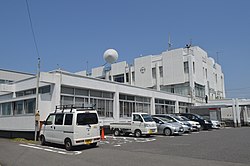
872:Mihama official home page
468:—
343:
256:490/km (1,300/sq mi)
139:
105:
93:
65:
53:
44:
35:
1559:Aichi Prefectural Police
588:Nihon Fukushi University
159:34.778861°N 136.908222°E
32:
1506:Higashikasugai District
765:National Route 247
638:Noma Elementary School
626:Okuda Elementary School
616:Noma Junior High School
613:Kōwa Junior High School
18:Mihama (disambiguation)
1526:Minamishitara District
780:
635:Futo Elementary School
629:Kōwa Elementary School
334:
60:Minami-Chita Beachland
1434:Nishikasugai District
778:
551:Chita District, Aichi
442:Historical population
332:
164:34.778861; 136.908222
1521:Kitashitara District
1511:Higashikamo District
1412:Kitashitara District
728:Kōwa - Morozaki port
253: • Density
16:For other uses, see
856:Mihama climate data
793:Sugimoto Art Museum
788:Nomazaki Lighthouse
779:Nomazaki Lighthouse
739:- Tokoname Hospital
608:Junior high schools
443:
271:Japan Standard Time
155: /
1536:Nishikamo District
1531:Nakashima District
781:
621:Elementary schools
576:commercial fishing
377:population density
335:
245: • Total
232: • Total
1567:
1566:
1103:
1102:
771:Local attractions
578:and agriculture.
527:
526:
412:Aichi Prefecture
327:
326:
298:Phone number
1597:
1501:Hekikai District
1479:Former Districts
1111:
1008:
996:
979:Aichi Prefecture
977:
967:
960:
953:
944:
931:
930:
924:
923:
921:Official website
906:
905:
903:
901:
890:
884:
883:
881:
879:
864:
858:
853:
847:
842:
836:
835:
828:
763:
762:
755:Minamichita Road
753:
752:
686:
661:
457:
452:
444:
395:to the east and
365:Aichi Prefecture
354:
352:
346:
345:
333:Mihama town hall
323:
322:
320:Official website
282:Pinus thunbergii
170:
169:
167:
166:
165:
160:
156:
153:
152:
151:
148:
121:
120:
114:
98:
83:
73:
58:
39:
38:
37:
26:
1605:
1604:
1600:
1599:
1598:
1596:
1595:
1594:
1570:
1569:
1568:
1563:
1545:
1491:Haguri District
1486:Atsumi District
1474:
1463:Nukata District
1334:
1163:
1145:
1112:
1099:
997:
990:
981:
971:
928:
919:
918:
915:
910:
909:
899:
897:
892:
891:
887:
877:
875:
866:
865:
861:
854:
850:
843:
839:
833:
829:
825:
820:
804:
773:
760:
750:
746:
725:
718:
655:
650:
623:
610:
600:
590:– Mihama Campus
584:
568:
547:
532:
436:
409:
389:Chita Peninsula
385:
340:
318:
317:
195:
163:
161:
157:
154:
149:
146:
144:
142:
141:
135:
134:
133:
132:
129:
128:
127:
126:
122:
101:
89:
88:
87:
86:
77:
76:
61:
49:
40:
33:
31:
24:
21:
12:
11:
5:
1603:
1601:
1593:
1592:
1587:
1582:
1572:
1571:
1565:
1564:
1562:
1561:
1556:
1550:
1547:
1546:
1544:
1543:
1538:
1533:
1528:
1523:
1518:
1513:
1508:
1503:
1498:
1493:
1488:
1482:
1480:
1476:
1475:
1473:
1472:
1471:
1470:
1460:
1459:
1458:
1453:
1443:
1442:
1441:
1431:
1430:
1429:
1424:
1419:
1409:
1408:
1407:
1402:
1397:
1392:
1387:
1380:Chita District
1377:
1376:
1375:
1370:
1365:
1355:
1354:
1353:
1346:Aichi District
1342:
1340:
1336:
1335:
1333:
1332:
1327:
1322:
1317:
1312:
1307:
1302:
1297:
1292:
1287:
1282:
1277:
1272:
1267:
1262:
1257:
1252:
1247:
1242:
1237:
1232:
1227:
1222:
1217:
1212:
1207:
1202:
1197:
1192:
1187:
1182:
1177:
1171:
1169:
1165:
1164:
1162:
1161:
1155:
1153:
1147:
1146:
1144:
1143:
1138:
1133:
1128:
1122:
1120:
1114:
1113:
1106:
1104:
1101:
1100:
1098:
1097:
1092:
1087:
1082:
1077:
1072:
1067:
1062:
1057:
1052:
1047:
1042:
1037:
1032:
1027:
1022:
1016:
1014:
1005:
999:
998:
986:
983:
982:
972:
970:
969:
962:
955:
947:
941:
940:
925:
914:
913:External links
911:
908:
907:
885:
859:
848:
837:
822:
821:
819:
816:
815:
814:
811:
803:
802:Notable people
800:
799:
798:
795:
790:
785:
772:
769:
768:
767:
757:
745:
742:
741:
740:
737:Rinkū Tokoname
729:
724:
719:
717:
714:
713:
712:
702:Mihama Ryokuen
692:Chita New Line
680:
679:
654:
651:
649:
648:Transportation
646:
645:
644:
643:
642:
636:
633:
630:
627:
622:
619:
618:
617:
614:
609:
606:
605:
604:
599:
596:
595:
594:
591:
583:
580:
572:primary sector
567:
564:
546:
543:
531:
528:
525:
524:
521:
518:
514:
513:
510:
507:
503:
502:
499:
496:
492:
491:
488:
485:
481:
480:
477:
474:
470:
469:
466:
463:
459:
458:
453:
448:
435:
432:
431:
430:
429:
428:
423:
418:
408:
405:
384:
381:
361:Chita District
325:
324:
315:
311:
310:
307:
303:
302:
299:
295:
294:
289:
285:
284:
279:
275:
274:
264:
258:
257:
254:
250:
249:
246:
242:
241:
237:
236:
233:
229:
228:
224:
223:
218:
212:
211:
206:
200:
199:
190:
184:
183:
178:
172:
171:
137:
136:
130:
124:
123:
116:
115:
109:
108:
107:
106:
103:
102:
99:
91:
90:
84:
78:
74:
68:
67:
66:
63:
62:
59:
51:
50:
45:
42:
41:
29:
22:
13:
10:
9:
6:
4:
3:
2:
1602:
1591:
1588:
1586:
1583:
1581:
1580:Mihama, Aichi
1578:
1577:
1575:
1560:
1557:
1555:
1552:
1551:
1548:
1542:
1541:Yana District
1539:
1537:
1534:
1532:
1529:
1527:
1524:
1522:
1519:
1517:
1514:
1512:
1509:
1507:
1504:
1502:
1499:
1497:
1496:Hazu District
1494:
1492:
1489:
1487:
1484:
1483:
1481:
1477:
1469:
1466:
1465:
1464:
1461:
1457:
1454:
1452:
1449:
1448:
1447:
1446:Niwa District
1444:
1440:
1437:
1436:
1435:
1432:
1428:
1425:
1423:
1420:
1418:
1415:
1414:
1413:
1410:
1406:
1403:
1401:
1398:
1396:
1393:
1391:
1388:
1386:
1383:
1382:
1381:
1378:
1374:
1371:
1369:
1366:
1364:
1361:
1360:
1359:
1356:
1352:
1349:
1348:
1347:
1344:
1343:
1341:
1337:
1331:
1328:
1326:
1323:
1321:
1318:
1316:
1313:
1311:
1308:
1306:
1303:
1301:
1298:
1296:
1293:
1291:
1288:
1286:
1283:
1281:
1278:
1276:
1273:
1271:
1268:
1266:
1263:
1261:
1258:
1256:
1253:
1251:
1248:
1246:
1243:
1241:
1238:
1236:
1233:
1231:
1228:
1226:
1223:
1221:
1218:
1216:
1213:
1211:
1208:
1206:
1203:
1201:
1198:
1196:
1193:
1191:
1188:
1186:
1183:
1181:
1178:
1176:
1173:
1172:
1170:
1166:
1160:
1157:
1156:
1154:
1152:
1148:
1142:
1139:
1137:
1134:
1132:
1129:
1127:
1124:
1123:
1121:
1119:
1115:
1110:
1096:
1093:
1091:
1088:
1086:
1083:
1081:
1078:
1076:
1073:
1071:
1068:
1066:
1063:
1061:
1058:
1056:
1053:
1051:
1048:
1046:
1043:
1041:
1038:
1036:
1033:
1031:
1028:
1026:
1023:
1021:
1018:
1017:
1015:
1013:
1009:
1006:
1004:
1000:
994:
989:
984:
980:
976:
968:
963:
961:
956:
954:
949:
948:
945:
939:
938:OpenStreetMap
935:
934:Mihama, Aichi
926:
922:
917:
916:
912:
896:(in Japanese)
895:
889:
886:
874:(in Japanese)
873:
869:
863:
860:
857:
852:
849:
846:
841:
838:
834:(in Japanese)
832:
827:
824:
817:
812:
809:
806:
805:
801:
796:
794:
791:
789:
786:
783:
782:
777:
770:
766:
758:
756:
748:
747:
743:
738:
734:
730:
727:
726:
723:
720:
715:
711:
707:
703:
699:
696:
695:
694:
693:
689:
685:
678:
674:
671:
670:
669:
668:
664:
660:
652:
647:
640:
639:
637:
634:
631:
628:
625:
624:
620:
615:
612:
611:
607:
602:
601:
597:
592:
589:
586:
585:
581:
579:
577:
573:
565:
563:
561:
557:
552:
544:
542:
540:
537:
529:
522:
519:
516:
515:
511:
508:
505:
504:
500:
497:
494:
493:
489:
486:
483:
482:
478:
475:
472:
471:
467:
464:
461:
460:
454:
449:
446:
445:
439:
433:
427:
424:
422:
419:
417:
414:
413:
411:
410:
406:
404:
402:
398:
394:
390:
382:
380:
378:
374:
370:
366:
362:
358:
351:
339:
331:
321:
316:
308:
301:0569-82-1111
300:
293:
290:
283:
280:
272:
268:
265:
263:
255:
247:
234:
222:
219:
217:
210:
207:
205:
198:
194:
191:
189:
182:
179:
177:
168:
150:136°54′29.6″E
140:Coordinates:
113:
97:
82:
72:
57:
48:
43:
27:
23:Town in Japan
19:
1516:Hoi District
1394:
1358:Ama District
1151:Special city
898:. Retrieved
888:
876:. Retrieved
871:
862:
851:
840:
826:
722:Chita Noriai
681:
656:
569:
548:
538:
533:
437:
434:Demographics
386:
337:
336:
197:Tōkai region
193:Chūbu region
147:34°46′43.9″N
1400:Minamichita
1118:Core cities
878:28 December
706:Chita-Okuda
598:High school
426:Minamichita
359:located in
162: /
1574:Categories
1390:Higashiura
1280:Owariasahi
1235:Kitanagoya
1141:Ichinomiya
818:References
673:Kōwaguchi
393:Mikawa Bay
373:population
350:Mihama-chō
240:Population
204:Prefecture
1373:Tobishima
1339:Districts
1290:Shinshiro
1131:Toyohashi
900:April 25,
731:Uenoma -
667:Kōwa Line
582:Education
383:Geography
262:Time zone
1439:Toyoyama
1405:Taketoyo
1325:Tsushima
1320:Toyokawa
1305:Tokoname
1300:Takahama
1260:Nagakute
1200:Gamagōri
1080:Nakamura
1075:Nakagawa
1065:Moriyama
868:"美浜町の概要"
808:Otokichi
733:Tokoname
698:Kaminoma
688:Meitetsu
663:Meitetsu
421:Tokoname
416:Taketoyo
288:- Flower
216:District
1417:Shitara
1315:Toyoake
1270:Nisshin
1255:Miyoshi
1225:Iwakura
1220:Inuyama
1215:Inazawa
1210:Hekinan
1159:Kasugai
1126:Okazaki
1095:Tenpaku
1030:Higashi
1025:Chikusa
993:capital
744:Highway
653:Railway
566:Economy
545:History
530:Climate
397:Ise Bay
314:Website
306:Address
176:Country
1456:Ōguchi
1427:Toyone
1395:Mihama
1330:Yatomi
1295:Tahara
1265:Nishio
1245:Komaki
1240:Kiyosu
1230:Kariya
1190:Chiryū
1168:Cities
1136:Toyota
1060:Mizuho
1055:Minato
1050:Minami
1045:Midori
1020:Atsuta
1003:Nagoya
988:Nagoya
520:25,180
509:26,083
501:+18.5%
498:24,669
487:20,820
476:19,227
465:19,327
338:Mihama
292:Azalea
278:- Tree
248:22,701
188:Region
131:
125:Mihama
30:Mihama
1368:Ōharu
1363:Kanie
1310:Tōkai
1250:Kōnan
1205:Handa
1195:Chita
1175:Aisai
1090:Shōwa
1085:Nishi
1040:Meitō
1012:Wards
716:Buses
677:Kōwa
556:merge
523:−3.5%
517:2010
512:+5.7%
506:2000
495:1990
490:+8.3%
484:1980
479:−0.5%
473:1970
462:1960
369:Japan
355:is a
267:UTC+9
221:Chita
209:Aichi
181:Japan
1468:Kōta
1451:Fusō
1422:Tōei
1385:Agui
1351:Tōgō
1285:Seto
1185:Anjō
1070:Naka
1035:Kita
902:2023
880:2015
710:Noma
570:The
451:Pop.
447:Year
357:town
227:Area
85:Seal
75:Flag
47:Town
1275:Ōbu
1180:Ama
936:at
539:Cfa
344:美浜町
36:美浜町
1576::
870:.
735:-
708:-
704:-
700:-
690:–
675:-
665:–
456:±%
403:.
367:,
363:,
347:,
995:)
991:(
966:e
959:t
952:v
904:.
882:.
353:)
341:(
273:)
269:(
20:.
Text is available under the Creative Commons Attribution-ShareAlike License. Additional terms may apply.