157:
124:
31:
482:
164:
131:
231:. The highest point on the pass is 1,569 metres (5,148 ft). The pass is accessible by car via a forestry road from the Gifu side; however, due to the danger of falling rocks, the road on the Nagano side of the pass is closed to vehicular traffic. The modern 8600-meter Enayama Tunnel on the
282:
on his return journey. This legend was a reflection of the evil reputation of the pass, which was steep, isolated, and long, and often plagued by bandits who preyed on travelers. The pass is mentioned in
156:
123:
409:
506:
501:
85:
441:
536:
521:
78:
464:
511:
526:
346:
311:
486:
531:
385:
and other supernatural forces when attempting to cross the summit of the pass. The pass was designated a
278:
on his way to conquer eastern Japan, and where he shot and killed a white deer which was an avatar of the
516:
232:
355:
tumulus with a diameter of four meters and height of 0.7 meters. Artifacts ranged from fragments of
41:
386:
284:
252:
191:
293:
437:
317:
224:
54:
381:
and are presumed to have been ritual offerings from travelers for safety from the malevolent
305:
299:
248:
330:
58:
220:
71:
66:
495:
356:
269:
256:
244:
390:
378:
374:
288:
228:
322:
460:
326:
264:
260:
100:
87:
397:
364:
30:
481:
369:
360:
342:
394:
345:
pottery and other artifacts were discovered in the pass, and per an
351:
274:
349:
in 1967, more than 1300 artifacts were discovered, including a
235:
is located approximately a kilometer north of the pass.
367:
pottery, and beads, including cylindrical, spherical,
325:
highway avoided Misaka Pass by detouring through the
268:
chronicles as a location where the legendary warrior
243:
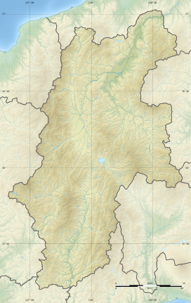
The Misaka Pass is the highest point on the ancient
219:is a mountain pass through the southern end of the
77:
65:
50:
40:
21:
389:in 1981. It is located about one hour by car from
212:
206:
434:(国指定史跡事典) National Historic Site Encyclopedia
333:the original route was gradually abandoned.
8:
463:[Misaka-tōge iseki] (in Japanese).
373:and others. These artifacts dated from the
18:
427:
425:
410:List of Historic Sites of Japan (Nagano)
421:
432:Isomura, Yukio; Sakai, Hideya (2012).
359:, knives and swords, various types of
7:
247:highway connecting Ina District in
163:
130:
291:poetry anthologies, including the
14:
480:
162:
155:
129:
122:
29:
387:National Historic Site of Japan
192:National Historic Site of Japan
507:Landforms of Nagano Prefecture
1:
146:Show map of Nagano Prefecture
502:Landforms of Gifu Prefecture
35:Highest point of Misaka Pass
465:Agency for Cultural Affairs
213:
553:
347:archaeological excavation
321:. The route of the later
272:was harassed by mountain
259:. It is mentioned in the
223:, connecting the city of
207:
188:
116:
28:
537:Mountain passes of Japan
522:Historic Sites of Japan
341:In 1921, fragments of
337:National Historic Site
101:35.47194°N 137.63194°E
16:Mountain pass in Japan
489:at Wikimedia Commons
312:Konjaku Monogatarishū
227:with the village of
176:Misaka Pass (Japan)
106:35.47194; 137.63194
97: /
377:through the early
46:1,569 m (5,148 ft)
512:Nakatsugawa, Gifu
485:Media related to
318:Ugetsu Monogatari
225:Nakatsugawa, Gifu
199:
198:
179:Show map of Japan
544:
527:Shinano Province
484:
469:
468:
457:
451:
450:
447:
429:
306:Genji Monogatari
249:Shinano Province
218:
216:
210:
209:
180:
166:
165:
159:
147:
133:
132:
126:
112:
111:
109:
108:
107:
102:
98:
95:
94:
93:
90:
33:
19:
552:
551:
547:
546:
545:
543:
542:
541:
492:
491:
478:
473:
472:
459:
458:
454:
448:
444:
431:
430:
423:
418:
406:
339:
331:Kamakura period
241:
233:Chūō Expressway
204:
195:
194:
184:
183:
182:
181:
178:
177:
174:
173:
172:
171:
167:
150:
149:
148:
145:
144:
141:
140:
139:
138:
134:
105:
103:
99:
96:
91:
88:
86:
84:
83:
36:
23:
17:
12:
11:
5:
550:
548:
540:
539:
534:
529:
524:
519:
514:
509:
504:
494:
493:
477:
476:External links
474:
471:
470:
452:
443:978-4311750403
442:
420:
419:
417:
414:
413:
412:
405:
402:
357:bronze mirrors
338:
335:
240:
237:
221:Kiso Mountains
197:
196:
190:
189:
186:
185:
175:
169:
168:
161:
160:
154:
153:
152:
151:
142:
136:
135:
128:
127:
121:
120:
119:
118:
117:
114:
113:
81:
75:
74:
72:Kiso Mountains
69:
63:
62:
52:
48:
47:
44:
38:
37:
34:
26:
25:
15:
13:
10:
9:
6:
4:
3:
2:
549:
538:
535:
533:
532:Mino Province
530:
528:
525:
523:
520:
518:
515:
513:
510:
508:
505:
503:
500:
499:
497:
490:
488:
483:
475:
466:
462:
456:
453:
449:(in Japanese)
445:
439:
435:
428:
426:
422:
415:
411:
408:
407:
403:
401:
399:
396:
392:
388:
384:
380:
376:
372:
371:
366:
362:
358:
354:
353:
348:
344:
336:
334:
332:
329:, and by the
328:
324:
320:
319:
314:
313:
308:
307:
302:
301:
300:Kokin Wakashū
296:
295:
290:
286:
281:
277:
276:
271:
270:Yamato Takeru
267:
266:
262:
258:
257:Mino Province
254:
250:
246:
238:
236:
234:
230:
226:
222:
215:
203:
193:
187:
158:
125:
115:
110:
82:
80:
76:
73:
70:
68:
64:
61:border, Japan
60:
56:
53:
49:
45:
43:
39:
32:
27:
20:
517:Achi, Nagano
479:
455:
433:
391:Iida Station
382:
379:Heian period
375:Kofun period
368:
350:
340:
316:
310:
304:
298:
292:
289:Heian period
279:
273:
263:
253:Ena District
242:
229:Achi, Nagano
201:
200:
22:Misaka Pass
487:Misaka-toge
327:Kiso Valley
265:Nihon Shoki
261:Nara period
214:Misaka-tōge
202:Misaka Pass
170:Misaka Pass
143:Misaka Pass
137:Misaka Pass
104: /
92:137°37′55″E
79:Coordinates
496:Categories
416:References
89:35°28′19″N
398:Iida Line
365:Haji ware
323:Nakasendō
294:Man'yōshū
42:Elevation
404:See also
370:magatama
361:Sue ware
343:Sue ware
239:Overview
51:Location
461:"神坂峠遺跡"
436:. 学生社.
395:JR East
393:on the
245:Tōsandō
440:
315:, and
303:, the
55:Nagano
352:kofun
251:with
67:Range
438:ISBN
383:kami
363:and
297:and
287:and
285:Nara
280:kami
275:kami
59:Gifu
255:in
208:神坂峠
24:神坂峠
498::
424:^
400:.
309:,
211:,
467:.
446:.
217:)
205:(
57:–
Text is available under the Creative Commons Attribution-ShareAlike License. Additional terms may apply.