191:
29:
274:
The stratigraphic framework for the
Mogollon-Datil volcanic field has undergone many revisions. The Datil Formation was originally defined by Winchester in 1920 to include all the extrusive units from the field. The Datil Formation was later promoted to group rank with the addition of some related
207:
about 36.2 million years ago (mya) with the eruption of the Cueva Tuff from the Organ
Caldera. Activity spread to the northwest to the Mogollon caldera by 34.0 mya, and this first pulse of activity died down around 33.5 mya. A second short pulse of activity occurred between 32.1 and 31.4 mya, with
470:
Cather, Chamberlin, and Ratte find that the Alum
Mountain Formation in the southern part of the field may span the lacuna between the Mogollon and Datil Groups, though they suggest a tentative assignment to the Mogollon Group. Still further south, voluminous volcanic activity in northern
1536:
Rentz, Shannon P.; Michelfelder, Gary S.; Coble, Matthew A.; Salings, Emily (2018). "U-Pb zircon geochronology of calc-alkaline ash flow tuff units in the
Mogollon-Datil volcanic field, southern New Mexico". In Poland, Michael P.; Garcia, Michael O.; Camp, Victor E.;
219:
across the region. The first two pulses of activity produced a total volume of 3,000 cubic kilometers (720 cu mi) of tuffs, while the third pulse produced over 6,000 cubic kilometers (1,400 cu mi) of tuffs.
298:
The stratigraphic framework proposed by Cather, Chamberlin, and Ratte in 1994 divides the units associated with the
Mogollon-Datil volcanic field into three groups and removes the Baca Formation:
1506:
Chapin, Charles E.; McIntosh, William C.; Chamberlin, Richard M. (2004). "The late Eocene-Oligocene peak of
Cenozoic volcanism in southwestern New Mexico". In Mack, G.H.; Giles, K.A. (eds.).
1947:
Poster: Westward
Migrating Ignimbrite Calderas and a Large Radiating Mafi Dike Swarm of Oligocene Age, Central Rio Grande Rift, New Mexico: Surface Expression of an Upper Mantle Diapir?
1128:
966:
1471:
McIntosh, W. C.; Chapin, C. E.; Ratte, J. C.; Sutter, J. F. (1992). "Time-stratigraphic framework for the Eocene-Oligocene
Mogollon-Datil volcanic field, southwest New Mexico".
665:
239:) in later eruptive pulses. The third eruptive pulse was also accompanied by less explosive rhyolite eruptions of the Taylor Creek Rhyolite, which may have come from a single
769:
1074:
717:
613:
1186:
1824:
1300:
912:
1020:
821:
1873:"Oligocene calderas, mafic lavas and radiating mafic dikes of the Socorro-Magdalena magmatic system, Rio Grande rift, New Mexico: surface expression of a miniplume?"
1240:
2113:
187:
of western Mexico. The
Mogollon-Datil volcanic field was formed in "four discrete pulses representing synchronized activity of two separate cauldron complexes".
1885:
51:
1399:
1976:
Ratté, J. C.; Marvin, R. F.; Naeser, C. W.; Bikerman, M. (1984). "Calderas and ash flow tuffs of the
Mogollon Mountains, southwestern New Mexico".
2108:
1385:"Space-time patterns of Late Cretaceous to present magmatism in New Mexico—comparison with Andean volcanism and potential for future volcanism"
1355:
1452:
1886:"40Ar/39Ar geochronology and eruptive history of the eastern sector of the Oligocene Socorro caldera, central Rio Grande rift, New Mexico"
490:. These suggest that the outflow sheets of the Datil-Mogollon volcanic field reached as far north as the northern edge of the younger
1558:
1515:
212:. The third and most extensive pulse of activity lasted from 29.0 to 27.4 mya. A fourth small pulse occurred from 26.1 to 24.3 mya.
1840:"Clues from the Santa Fe Group for Oligocene-Miocene paleogeography of the southeastern Colorado Plateau near Grants, New Mexico"
2123:
523:
2046:"Geochronologic evidence of upper-crustal in situ differentiation: Silicic magmatism at the Organ caldera complex, New Mexico"
1384:
318:
44:
1666:
2133:
550:
1715:
Geology of Alamosa Creek Valley, Socorro County, New Mexico with special reference to the occurrence of oil and gas
164:
2012:
545:
2118:
1908:
1872:
491:
2080:
Elston, W. E. (1976) "Glossary of stratigraphic terms of the Mogollon-Datil volcanic province" pp. 135–145
1492:
190:
2128:
1791:
1615:
478:
Clasts of the Vicks Peak and La Jencia Tuffs have been found in the gravel beds of the Benavidez Member of the
292:
228:
176:
1945:
540:
507:
244:
184:
156:
1360:
894:
875:
595:
479:
204:
114:
576:
208:
activity both in the existing southern part of the field and at a new caldera complex centered west of
1985:
1480:
879:
374:
572:
378:
284:
209:
104:
2013:"Reconnaissance geologic map of the Quemado 30 x 60 Minute Quadrangle, Catron County, New Mexico"
1900:
1648:
Weber, Robert H (1971). "K-Ar ages of Tertiary igneous rocks in central and western New Mexico".
1564:
384:
288:
140:
2086:
Cenozoic volcanism in southwestern New Mexico: A Volume in Memory of Rodney C. Rhodes, 1943–1975
2089:
1839:
1818:
1718:
1698:
1554:
1511:
1508:
The geology of New Mexico. A geologic history: New Mexico Geological Society Special Volume 11
1448:
580:
472:
439:
236:
144:
535:
2057:
1993:
1546:
1488:
495:
280:
1695:
Field guide to selected cauldrons and mining districts of the Datil-Mogollon volcanic field
1284:
1669:
Open File Report 94 (1977), New Mexico Bureau of Geology & Mineral Resources, page 88
1989:
1484:
503:
276:
263:
132:
119:
1685:(1978) "Exploration framework of the Socorro geothermal area, New Mexico" pp. 114–129
2102:
2011:
Chamberlin, Richard M.; Cather, Steven M.; Anderson, Orin J.; Jones, Glen E. (1994).
1904:
1568:
1538:
251:
240:
223:
The silica-rich caldera eruptions were accompanied by eruptions of less silica-rich (
1813:, vol. 11, New Mexico Geological Society Special Publication, pp. 271–294
1616:"Tertiary stratigraphy and nomenclature for western New Mexico and eastern Arizona"
259:
255:
1807:"The Late Eocene—Oligocene peak of Cenozoic volcanism in southwestern New Mexico"
487:
1806:
250:
The initial mafic to intermediate volcanism has chemical signatures typical of
33:
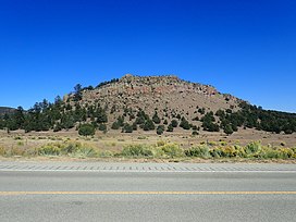
Andesite-capped mesa in White House Canyon in the Mogollon-Datil volcanic field
2088:
New Mexico Geological Society Special Publication No. 5, Socorro, New Mexico,
483:
136:
91:
28:
1953:. Socorro, NM: New Mexico Bureau of Geology and Mineral Resources. p. 22
1316:
1302:
1256:
1242:
1202:
1188:
1144:
1130:
1090:
1076:
1036:
1022:
982:
968:
928:
914:
837:
823:
785:
771:
733:
719:
681:
667:
629:
615:
66:
53:
1997:
861:
152:
283:. The base of the group, as originally defined, rests unconformably on the
506:. This outflow sheet was subsequently completely eroded away north of the
1944:
Chamberlin, Richard M.; Chapin, Charles E.; McIntosh, William C. (2002).
1580:
1578:
232:
160:
2093:
1884:
Chamberlin, Richard M.; McIntosh, William C.; Eggleston, Ted L. (2004).
1722:
1702:
2062:
2045:
1543:
Field Volcanology: A Tribute to the Distinguished Career of Don Swanson
180:
131:
is a large (40,000 square kilometers (15,000 sq mi)) silicic
1871:
Chamberlin, Richard M., McIntosh, William C., and Chapin, Charles E.,
1424:
Elston, W.E. (1989). "Overview of the Mogollon-Datil volcanic field".
172:
148:
1550:
235:
during the first eruptive pulse, becoming less silica-rich (mostly
203:
The volcanic activity of the Mogollon-Datil began near present-day
499:
224:
189:
168:
2020:
New Mexico Bureau of Mines and Mineral Resources Open-file Report
179:
in the bootheel of southwestern New Mexico and adjacent areas of
216:
1838:
Koning, Daniel J.; Heizler, Mattew; Jochems, Andrew (2020).
1893:
New Mexico Bureau of Geology and Mineral Resources Bulletin
1805:
Chapin, C.E., McIntosh, W.C., and Chamberlin, R.M. (2004),
1493:
10.1130/0016-7606(1992)104<0851:TSFFTE>2.3.CO;2
1392:
New Mexico Bureau of Geology and Mineral Resources Bulletin
1697:
Special Publication NO. 7, New Mexico Geological Society,
1614:
Cather, Steven M.; Chamberlin, R.M.; Ratte, J.C. (1994).
1596:
1584:
1426:
New Mexico Bureau of Mines and Mineral Resources Memoir
1794:. New Mexico Bureau of Geology & Mineral Resources
258:. The later eruptions have been attributed to a "mini-
1623:
New Mexico Geological Society Field Conference Series
475:
took place in this time period and no lacuna exists.
1545:. Geological Society of America. pp. 409–434.
1510:. New Mexico Geological Society. pp. 271–290.
215:The caldera eruptions produced enormous volumes of
113:
103:
98:
87:
82:
43:
38:
21:
16:
Volcanic field in western New Mexico, United States
1971:
1969:
1967:
1609:
1607:
1605:
1466:
1464:
1378:
1376:
494:volcanic field, where they interfingered with the
1939:
1937:
1935:
1933:
1931:
1929:
1531:
1529:
1527:
2044:Zimmerer, Matthew; McIntosh, William C. (2013).
1847:New Mexico Geoloical Society Special Publication
1383:Chapin, C.E.; Wilks, M.; McIntosh, W.C. (2004).
183:and Mexico; and the vast volcanic field of the
1174:(just one fragment in the Bursum Caldera wall)
1811:The Geology of New Mexico, a Geologic History
1786:
1784:
1782:
1780:
1778:
1776:
1774:
1772:
1770:
1768:
1766:
1764:
1762:
1760:
1758:
1756:
1754:
1752:
1750:
8:
1823:: CS1 maint: multiple names: authors list (
1748:
1746:
1744:
1742:
1740:
1738:
1736:
1734:
1732:
1730:
18:
2061:
1677:
1675:
1667:"Tertiary and Quaternary: Baca Formation"
194:Calderas of Mogollon-Datil volcanic field
1792:"Gila Cliff Dwellings National Monument"
884:
585:
300:
262:" produced by the disintegration of the
1717:U.S. Geological Survey Bulletin 716-A,
1372:
2114:Landforms of Catron County, New Mexico
1816:
1597:Chapin, McIntosh & Chamberlin 2004
1585:Chapin, McIntosh & Chamberlin 2004
1356:List of volcanoes in the United States
1809:, in Mack, G.H.; Giles, K.A. (eds.),
444:Bell Top Formation (#3: 35.0 Ma)
435:Rock House Canyon Tuff (34.2 Ma)
400:volcaniclastic unit of Canon del Leon
316:tuff of Turkey Springs (24.3 Ma)
287:, and the series is succeeded by the
7:
275:sedimentary formations, such as the
358:basaltic andesite of Poverty Creek
231:) volcanic rock. These were mostly
2084:Elston, W. E. and Northrop, S. A.
460:Achenbach Park Tuff (35.8 Ma)
458:Squaw Mountain Tuff (35.8 Ma)
437:tuff of Bishop Peak (34.8 Ma)
402:volcaniclastic unit of Largo Creek
334:Apache Springs Tuff (28.0 Ma)
155:volcanic event which includes the
14:
1445:Geology of the American Southwest
567:Socorro-Magdalena caldera cluster
418:Tadpole Ridge Tuff (31.4 Ma)
352:Davis Canyon Tuff (29.0 Ma)
343:Shelley Peak Tuff (28.1 Ma)
147:). It is a part of an extensive
27:
1978:Journal of Geophysical Research
1447:. Cambridge. pp. 218–223.
1405:from the original on 2010-06-09
433:andesite of Dray Leggett Canyon
429:Blue Canyon Tuff (33.7 Ma)
398:sandstone of Escondido Mountain
454:andesite of White House Canyon
452:Datil Well Tuff (35.0 Ma)
427:Box Canyon Tuff (33.5 Ma)
325:La Jara Peak Basaltic Andesite
1:
2109:Volcanic fields of New Mexico
350:La Jencia Tuff (28.7 Ma)
129:Mogollon-Datil volcanic field
22:Mogollon-Datil volcanic field
1443:Baldridge, W. Scott (2004).
1120:Schoolhouse Mountain Caldera
956:Gila Cliff Dwellings Caldera
319:Bearwallow Mountain Andesite
1713:Winchester, Dean E. (1920)
1282:
1228:
1170:
1118:
1062:
1010:
954:
902:
811:
759:
707:
655:
603:
551:GPX (secondary coordinates)
366:South Crosby Peak Formation
332:Lemitar Tuff (28.0 Ma)
2150:
1283:
1229:
1171:
1119:
1063:
1011:
955:
903:
812:
760:
708:
656:
604:
431:Cooney Tuff (34.0 Ma)
396:sandstone of Monument Park
165:Trans-Pecos volcanic field
546:GPX (primary coordinates)
521:Map all coordinates using
462:Cueva Tuff (36.2 Ma)
408:
368:Rincon Windmill Formation
364:
361:
341:Squirrel Springs Andesite
306:
303:
26:
657:Mount Withington Caldera
529:Download coordinates as:
390:Red Rock Ranch Formation
354:Sawmill Canyon Formation
177:Boot Heel volcanic field
1998:10.1029/JB089iB10p08713
502:gravels eroded off the
394:unit of East Red Canyon
370:Chavez Canyon Formation
185:Sierra Madre Occidental
157:San Juan volcanic field
2124:Calderas of New Mexico
1361:Datil-Mogollon Section
761:Sawmill Canyon Caldera
608:tuff of Turkey Springs
480:Cerro Conejo Formation
409:lacuna (31.4-29.0 Ma)
388:Rock Springs Formation
382:Pueblo Creek Formation
323:Uvas Basaltic Andesite
205:Las Cruces, New Mexico
195:
907:Bloodgood Canyon Tuff
541:GPX (all coordinates)
372:Dog Springs Formation
337:Bloodgood Canyon Tuff
193:
1156:Schoolhouse Mountain
1064:Twin Sisters Caldera
994:Gila Cliff Dwellings
392:Piloncillo Sediments
375:Rubio Peak Formation
356:Luis Lopez Formation
1990:1984JGR....89.8713R
1689:Chapin, Charles E.
1681:Chapin, Charles E.
1599:, pp. 275–280.
1485:1992GSAB..104..851M
1312: /
1292:Achenback Park Tuff
1290:Squaw Mountain Tuff
1252: /
1198: /
1181:Apache Springs Tuff
1140: /
1086: /
1069:Caballo Blanco Tuff
1032: /
978: /
924: /
833: /
781: /
729: /
709:Hardy Ridge Caldera
677: /
625: /
579:, and Southeast of
420:Caballo Blanco Tuff
379:Palm Park Formation
285:Mesaverde Formation
210:Socorro, New Mexico
63: /
2134:Oligocene calderas
2063:10.1130/GES00841.1
1067:Tadpole Ridge Tuff
571:Location: West of
450:tuff of Farr Ranch
385:Bell Top Formation
307:Sedimentary Units
289:Popotosa Formation
196:
171:and north central
141:Mogollon Mountains
67:33.500°N 108.000°W
39:Highest point
1454:978-0-521-01666-7
1347:
1346:
1233:Kneeling Nun Tuff
961:Davis Canyon Tuff
959:Shelley Peak Tuff
867:
866:
660:South Canyon Tuff
605:Bear Trap Caldera
468:
467:
440:Kneeling Nun Tuff
328:South Canyon Tuff
254:volcanic rock of
243:less enriched in
237:basaltic andesite
145:Datil, New Mexico
125:
124:
2141:
2119:Colorado Plateau
2068:
2067:
2065:
2041:
2035:
2034:
2032:
2030:
2017:
2008:
2002:
2001:
1973:
1962:
1961:
1959:
1958:
1952:
1941:
1924:
1923:
1921:
1919:
1913:
1907:. Archived from
1890:
1881:
1875:
1869:
1863:
1862:
1860:
1858:
1844:
1835:
1829:
1828:
1822:
1814:
1802:
1800:
1799:
1788:
1725:
1711:
1705:
1679:
1670:
1664:
1658:
1657:
1645:
1639:
1638:
1636:
1634:
1620:
1611:
1600:
1594:
1588:
1582:
1573:
1572:
1533:
1522:
1521:
1503:
1497:
1496:
1468:
1459:
1458:
1440:
1434:
1433:
1421:
1415:
1414:
1412:
1410:
1404:
1389:
1380:
1336:
1335:
1333:
1332:
1331:
1329:
1324:
1323:
1318:
1313:
1310:
1309:
1308:
1305:
1276:
1275:
1273:
1272:
1271:
1269:
1264:
1263:
1258:
1253:
1250:
1249:
1248:
1245:
1235:Fall Canyon Tuff
1222:
1221:
1219:
1218:
1217:
1215:
1210:
1209:
1204:
1199:
1196:
1195:
1194:
1191:
1172:Mogollon Caldera
1164:
1163:
1161:
1160:
1159:
1157:
1152:
1151:
1146:
1141:
1138:
1137:
1136:
1133:
1110:
1109:
1107:
1106:
1105:
1103:
1098:
1097:
1092:
1087:
1084:
1083:
1082:
1079:
1056:
1055:
1053:
1052:
1051:
1049:
1044:
1043:
1038:
1033:
1030:
1029:
1028:
1025:
1002:
1001:
999:
998:
997:
995:
990:
989:
984:
979:
976:
975:
974:
971:
948:
947:
945:
944:
943:
941:
936:
935:
930:
925:
922:
921:
920:
917:
885:
870:Southern complex
857:
856:
854:
853:
852:
850:
845:
844:
839:
834:
831:
830:
829:
826:
805:
804:
802:
801:
800:
798:
793:
792:
787:
782:
779:
778:
777:
774:
753:
752:
750:
749:
748:
746:
741:
740:
735:
730:
727:
726:
725:
722:
701:
700:
698:
697:
696:
694:
693:Mount Withington
689:
688:
683:
678:
675:
674:
673:
670:
649:
648:
646:
645:
644:
642:
637:
636:
631:
626:
623:
622:
621:
618:
586:
562:Northern complex
514:Notable Calderas
496:Chuska Sandstone
301:
281:Spears Formation
199:Geologic history
159:in southwestern
78:
77:
75:
74:
73:
72:33.500; -108.000
68:
64:
61:
60:
59:
56:
31:
19:
2149:
2148:
2144:
2143:
2142:
2140:
2139:
2138:
2129:Eocene calderas
2099:
2098:
2077:
2075:Further reading
2072:
2071:
2043:
2042:
2038:
2028:
2026:
2015:
2010:
2009:
2005:
1975:
1974:
1965:
1956:
1954:
1950:
1943:
1942:
1927:
1917:
1915:
1911:
1888:
1883:
1882:
1878:
1870:
1866:
1856:
1854:
1842:
1837:
1836:
1832:
1815:
1804:
1797:
1795:
1790:
1789:
1728:
1712:
1708:
1680:
1673:
1665:
1661:
1647:
1646:
1642:
1632:
1630:
1618:
1613:
1612:
1603:
1595:
1591:
1583:
1576:
1561:
1535:
1534:
1525:
1518:
1505:
1504:
1500:
1470:
1469:
1462:
1455:
1442:
1441:
1437:
1423:
1422:
1418:
1408:
1406:
1402:
1387:
1382:
1381:
1374:
1369:
1352:
1342:
1340:
1327:
1325:
1321:
1319:
1317:32.5°N 106.75°W
1315:
1314:
1311:
1306:
1303:
1301:
1299:
1298:
1293:
1291:
1267:
1265:
1261:
1259:
1255:
1254:
1251:
1246:
1243:
1241:
1239:
1238:
1234:
1213:
1211:
1207:
1205:
1201:
1200:
1197:
1192:
1189:
1187:
1185:
1184:
1180:
1179:Fanney Rhyolite
1178:
1173:
1155:
1153:
1149:
1147:
1145:32.75°N 108.6°W
1143:
1142:
1139:
1134:
1131:
1129:
1127:
1126:
1123:Box Canyon Tuff
1114:
1101:
1099:
1095:
1093:
1089:
1088:
1085:
1080:
1077:
1075:
1073:
1072:
1068:
1047:
1045:
1041:
1039:
1035:
1034:
1031:
1026:
1023:
1021:
1019:
1018:
1015:Vicks Peak Tuff
1006:
993:
991:
987:
985:
983:33.5°N 108.25°W
981:
980:
977:
972:
969:
967:
965:
964:
960:
939:
937:
933:
931:
927:
926:
923:
918:
915:
913:
911:
910:
891:Associated tuff
872:
848:
846:
842:
840:
836:
835:
832:
827:
824:
822:
820:
819:
816:Hells Mesa Tuff
813:Socorro Caldera
796:
794:
790:
788:
784:
783:
780:
775:
772:
770:
768:
767:
744:
742:
738:
736:
732:
731:
728:
723:
720:
718:
716:
715:
692:
690:
686:
684:
680:
679:
676:
671:
668:
666:
664:
663:
640:
638:
634:
632:
630:33.75°N 107.6°W
628:
627:
624:
619:
616:
614:
612:
611:
592:Associated tuff
564:
559:
558:
557:
556:
555:
516:
486:valley west of
463:
461:
459:
457:
455:
453:
451:
449:
445:
443:
438:
436:
434:
432:
430:
428:
426:
423:Hells Mesa Tuff
421:
419:
403:
401:
399:
397:
395:
393:
391:
389:
387:
383:
381:
377:
373:
371:
369:
367:
357:
355:
353:
351:
349:
346:Vicks Peak Tuff
344:
342:
340:
335:
333:
331:
326:
324:
322:
317:
312:Mogollon Group
304:Volcanic Units
272:
201:
109:Middle Tertiary
94:, United States
71:
69:
65:
62:
57:
54:
52:
50:
49:
34:
17:
12:
11:
5:
2147:
2145:
2137:
2136:
2131:
2126:
2121:
2116:
2111:
2101:
2100:
2097:
2096:
2076:
2073:
2070:
2069:
2036:
2003:
1963:
1925:
1876:
1864:
1830:
1726:
1706:
1671:
1659:
1640:
1601:
1589:
1587:, p. 275.
1574:
1559:
1551:10.1130/SPE538
1539:Grunder, Anita
1523:
1516:
1498:
1479:(7): 851–871.
1460:
1453:
1435:
1416:
1371:
1370:
1368:
1365:
1364:
1363:
1358:
1351:
1348:
1345:
1344:
1337:
1296:
1287:
1281:
1280:
1277:
1236:
1231:
1227:
1226:
1223:
1203:33.5°N 108.5°W
1182:
1175:
1169:
1168:
1165:
1124:
1121:
1117:
1116:
1111:
1070:
1065:
1061:
1060:
1057:
1037:33.6°N 107.4°W
1016:
1013:
1009:
1008:
1003:
962:
957:
953:
952:
949:
929:33.5°N 108.5°W
908:
905:
904:Bursum Caldera
901:
900:
897:
892:
889:
871:
868:
865:
864:
858:
817:
814:
810:
809:
806:
797:Sawmill Canyon
765:
764:La Jencia Tuff
762:
758:
757:
754:
734:33.9°N 107.3°W
713:
710:
706:
705:
702:
682:33.8°N 107.5°W
661:
658:
654:
653:
650:
609:
606:
602:
601:
598:
593:
590:
563:
560:
554:
553:
548:
543:
538:
532:
526:
519:
518:
517:
515:
512:
504:Zuni Mountains
466:
465:
447:Sugarlump Tuff
442:(34.9 Ma)
425:(32.0 Ma)
415:
411:
410:
406:
405:
363:
360:
348:(28.4 Ma)
339:(28.0 Ma)
330:(27.4 Ma)
313:
309:
308:
305:
293:Santa Fe Group
277:Baca Formation
271:
268:
264:Farallon plate
200:
197:
133:volcanic field
123:
122:
120:Volcanic field
117:
111:
110:
107:
101:
100:
96:
95:
89:
85:
84:
80:
79:
47:
41:
40:
36:
35:
32:
24:
23:
15:
13:
10:
9:
6:
4:
3:
2:
2146:
2135:
2132:
2130:
2127:
2125:
2122:
2120:
2117:
2115:
2112:
2110:
2107:
2106:
2104:
2095:
2091:
2087:
2083:
2079:
2078:
2074:
2064:
2059:
2055:
2051:
2047:
2040:
2037:
2025:
2021:
2014:
2007:
2004:
1999:
1995:
1991:
1987:
1984:(B10): 8713.
1983:
1979:
1972:
1970:
1968:
1964:
1949:
1948:
1940:
1938:
1936:
1934:
1932:
1930:
1926:
1914:on 2020-02-15
1910:
1906:
1902:
1898:
1894:
1887:
1880:
1877:
1874:
1868:
1865:
1852:
1848:
1841:
1834:
1831:
1826:
1820:
1812:
1808:
1793:
1787:
1785:
1783:
1781:
1779:
1777:
1775:
1773:
1771:
1769:
1767:
1765:
1763:
1761:
1759:
1757:
1755:
1753:
1751:
1749:
1747:
1745:
1743:
1741:
1739:
1737:
1735:
1733:
1731:
1727:
1724:
1720:
1716:
1710:
1707:
1704:
1700:
1696:
1692:
1688:
1684:
1678:
1676:
1672:
1668:
1663:
1660:
1655:
1651:
1650:Isochron/West
1644:
1641:
1628:
1624:
1617:
1610:
1608:
1606:
1602:
1598:
1593:
1590:
1586:
1581:
1579:
1575:
1570:
1566:
1562:
1560:9780813725383
1556:
1552:
1548:
1544:
1540:
1532:
1530:
1528:
1524:
1519:
1517:9781585460106
1513:
1509:
1502:
1499:
1494:
1490:
1486:
1482:
1478:
1474:
1467:
1465:
1461:
1456:
1450:
1446:
1439:
1436:
1431:
1427:
1420:
1417:
1401:
1397:
1393:
1386:
1379:
1377:
1373:
1366:
1362:
1359:
1357:
1354:
1353:
1349:
1343:36.2 Ma
1338:
1334:
1322:32.5; -106.75
1297:
1295:
1288:
1286:
1285:Organ Caldera
1279:34.9 Ma
1278:
1274:
1257:33°N 107.75°W
1237:
1232:
1230:Emory Caldera
1225:34.0 Ma
1224:
1220:
1183:
1176:
1167:33.5 Ma
1166:
1162:
1150:32.75; -108.6
1125:
1122:
1115:31.7 Ma
1112:
1108:
1091:33°N 108.25°W
1071:
1066:
1059:28.4 Ma
1058:
1054:
1017:
1014:
1012:Nogal Caldera
1007:29.0 Ma
1004:
1000:
988:33.5; -108.25
963:
958:
951:28.0 Ma
950:
946:
909:
906:
898:
896:
893:
890:
887:
886:
883:
881:
877:
874:Located from
869:
863:
859:
855:
818:
815:
808:28.7 Ma
807:
803:
766:
763:
755:
751:
714:
711:
704:27.4 Ma
703:
699:
662:
659:
652:24.3 Ma
651:
647:
635:33.75; -107.6
610:
607:
599:
597:
594:
591:
588:
587:
584:
582:
578:
574:
569:
568:
561:
552:
549:
547:
544:
542:
539:
537:
534:
533:
531:
530:
525:
524:OpenStreetMap
522:
513:
511:
509:
505:
501:
497:
493:
489:
485:
481:
476:
474:
464:
456:Dona Ana Tuff
448:
441:
424:
416:
413:
412:
407:
404:
386:
380:
376:
362:Spears Group
359:
347:
338:
329:
321:(27 to 23 Ma)
320:
314:
311:
310:
302:
299:
296:
294:
290:
286:
282:
278:
269:
267:
265:
261:
257:
256:volcanic arcs
253:
252:calc-alkaline
248:
246:
242:
241:magma chamber
238:
234:
230:
226:
221:
218:
213:
211:
206:
198:
192:
188:
186:
182:
178:
174:
170:
166:
162:
158:
154:
150:
146:
142:
138:
134:
130:
121:
118:
116:
115:Mountain type
112:
108:
106:
102:
97:
93:
90:
86:
81:
76:
48:
46:
42:
37:
30:
25:
20:
2085:
2081:
2053:
2049:
2039:
2027:. Retrieved
2023:
2019:
2006:
1981:
1977:
1955:. Retrieved
1946:
1916:. Retrieved
1909:the original
1896:
1892:
1879:
1867:
1855:. Retrieved
1850:
1846:
1833:
1810:
1803:citing from
1796:. Retrieved
1714:
1709:
1694:
1690:
1686:
1682:
1662:
1653:
1649:
1643:
1631:. Retrieved
1626:
1622:
1592:
1542:
1507:
1501:
1476:
1473:GSA Bulletin
1472:
1444:
1438:
1429:
1425:
1419:
1407:. Retrieved
1395:
1391:
1341:35.8 Ma
1339:35.8 Ma
1289:
1208:33.5; -108.5
1113:31.4 Ma
1102:Twin Sisters
1042:33.6; -107.4
1005:28.1 Ma
934:33.5; -108.5
873:
838:34°N 107.1°W
786:34°N 107.3°W
739:33.9; -107.3
712:Lemitar Tuff
687:33.8; -107.5
570:
566:
565:
528:
527:
520:
492:Mount Taylor
477:
469:
446:
422:
417:
414:Datil Group
365:
345:
336:
327:
315:
297:
273:
249:
229:intermediate
222:
214:
202:
128:
126:
1899:: 251–279.
1656:(1): 33–45.
1320: /
1294:Cueva Tuff
1262:33; -107.75
1260: /
1206: /
1177:Cooney Tuff
1148: /
1096:33; -108.25
1094: /
1040: /
986: /
932: /
895:Coordinates
841: /
789: /
756:28 Ma
745:Hardy Ridge
737: /
685: /
633: /
596:Coordinates
575:, South of
488:Albuquerque
135:in western
105:Age of rock
70: /
45:Coordinates
2103:Categories
2056:(1): 155.
1957:2010-04-29
1857:23 October
1798:2010-04-29
1693:(editors)
1326: (
1266: (
1212: (
1154: (
1100: (
1046: (
992: (
938: (
876:Las Cruces
847: (
843:34; -107.1
795: (
791:34; -107.3
743: (
691: (
639: (
508:Rio Salado
484:Rio Puerco
270:Formations
137:New Mexico
92:New Mexico
2050:Geosphere
2029:30 August
1918:30 August
1905:130665150
1853:: 153–166
1633:27 August
1629:: 259–266
1569:214521258
1409:19 August
1398:: 13–40.
641:Bear Trap
577:Magdalena
498:and with
473:Chihuahua
245:volatiles
153:Oligocene
83:Geography
1819:citation
1541:(eds.).
1400:Archived
1350:See also
1307:106°45′W
1247:107°45′W
1214:Mogollon
1193:108°30′W
1135:108°36′W
1081:108°15′W
1027:107°24′W
973:108°15′W
919:108°30′W
880:Mogollon
860:32
828:107°06′W
776:107°18′W
724:107°18′W
672:107°30′W
620:107°36′W
279:and the
233:andesite
167:in west
161:Colorado
88:Location
58:108°00′W
2094:2841953
1986:Bibcode
1723:6007605
1703:4960990
1481:Bibcode
1304:32°30′N
1244:33°00′N
1190:33°30′N
1132:32°45′N
1078:33°00′N
1024:33°36′N
970:33°30′N
916:33°30′N
849:Socorro
825:34°00′N
773:34°00′N
721:33°54′N
669:33°48′N
617:33°45′N
573:Socorro
482:in the
291:of the
181:Arizona
99:Geology
55:33°30′N
2092:
1903:
1721:
1701:
1691:et al.
1683:et al.
1567:
1557:
1514:
1451:
940:Bursum
500:cherty
175:, the
173:Mexico
163:, the
149:Eocene
2016:(PDF)
1951:(PDF)
1912:(PDF)
1901:S2CID
1889:(PDF)
1843:(PDF)
1619:(PDF)
1565:S2CID
1432:: 43.
1403:(PDF)
1388:(PDF)
1367:Notes
1328:Organ
1268:Emory
1048:Nogal
581:Datil
260:plume
225:mafic
217:tuffs
169:Texas
2090:OCLC
2031:2020
1920:2020
1859:2020
1825:link
1719:OCLC
1699:OCLC
1635:2020
1555:ISBN
1512:ISBN
1449:ISBN
1411:2021
899:Age
888:Name
600:Age
589:Name
127:The
2058:doi
2024:406
1994:doi
1897:160
1547:doi
1489:doi
1477:104
1396:160
878:to
536:KML
227:to
151:to
2105::
2082:In
2052:.
2048:.
2022:.
2018:.
1992:.
1982:89
1980:.
1966:^
1928:^
1895:.
1891:.
1851:14
1849:.
1845:.
1821:}}
1817:{{
1729:^
1687:In
1674:^
1652:.
1627:45
1625:.
1621:.
1604:^
1577:^
1563:.
1553:.
1526:^
1487:.
1475:.
1463:^
1430:46
1428:.
1394:.
1390:.
1375:^
882::
862:Ma
583:.
510:.
295:.
266:.
247:.
2066:.
2060::
2054:9
2033:.
2000:.
1996::
1988::
1960:.
1922:.
1861:.
1827:)
1801:.
1654:1
1637:.
1571:.
1549::
1520:.
1495:.
1491::
1483::
1457:.
1413:.
1330:)
1270:)
1216:)
1158:)
1104:)
1050:)
996:)
942:)
851:)
799:)
747:)
695:)
643:)
143:-
139:(
Text is available under the Creative Commons Attribution-ShareAlike License. Additional terms may apply.