63:
56:
40:
377:
249:
The oval fort is about 160 metres (520 ft) north–south and 140 metres (460 ft) east–west, enclosing an area of 1.8 hectares (4.4 acres). There are two large banks and ditches to the north, where the hill slope is not steep; above the steep south-west, south and east slopes there is a single
256:
There was excavation in 1849 by Wynne
Ffoulkes. He found "coarse red Roman pottery" which has not been preserved; it is not known if it was Roman, which would suggest occupation into the Roman period, or prehistoric. He found traces of a drystone construction, destroyed during the excavation, near
250:
bank. At the north-east, at the edge of the steeper slopes, there is a narrow inturned entrance with an oblique approach. The form of entrance, and the simple plan of the fort, suggest that it is an early example.
333:
253:
Within the fortifications, there is a rounded summit. In the north and east of the interior there is a broad terrace, and building platforms have been found.
412:
407:
275:
128:
134:
96:
55:
402:
359:
397:
381:
294:
270:
234:
258:
356:
39:
204:
192:
226:
391:
230:
238:
215:
237:
skirts the hill. It is about 1 mile (1.6 km) south-east of the hillfort of
17:
211:
111:
98:
376:
325:
207:
145:
225:
It is on a prominent hill, height 455.8 metres (1,495 ft), in the
219:
83:
188:
183:
175:
167:
159:
151:
141:
127:
90:
78:
257:the south of the entrance. In 1962, three copper
8:
32:
38:
31:
320:
318:
316:
276:List of Scheduled Monuments in Flintshire
297:Hill Bagging. Retrieved 22 August 2019.
287:
352:
350:
218:, about 5 miles (8.0 km) east of
27:Iron age hillfort in Flintshire, Wales
261:axes were found within the defences.
7:
62:
360:Clwydian Range and Dee Valley AONB
25:
413:Mountains and hills of Flintshire
408:Scheduled monuments in Flintshire
310:. Faber and Faber, 1978. Page 74.
375:
326:"Moel Arthur, hillfort (306899)"
61:
54:
308:Wales: An Archaeological Guide
214:, Wales, at the boundary with
1:
179:455.8 metres (1,495 ft)
362:. Retrieved 22 August 2019.
429:
44:Viewed from the south-east
403:Hillforts in Denbighshire
49:
37:
203:("Arthur's Hill") is an
171:1.8 hectares (4.4 acres)
163:140 metres (460 ft)
155:160 metres (520 ft)
398:Hillforts in Flintshire
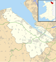
70:Shown within Flintshire
306:Christopher Houlder.
384:at Wikimedia Commons
271:Hillforts in Britain
112:53.18444°N 3.28056°W
229:; it overlooks the
108: /
34:
117:53.18444; -3.28056
380:Media related to
198:
197:
129:OS grid reference
16:(Redirected from
420:
379:
363:
354:
345:
344:
342:
340:
322:
311:
304:
298:
292:
235:Offa's Dyke Path
137:
123:
122:
120:
119:
118:
113:
109:
106:
105:
104:
101:
65:
64:
58:
42:
35:
21:
18:Moel Arthur Camp
428:
427:
423:
422:
421:
419:
418:
417:
388:
387:
372:
367:
366:
355:
348:
338:
336:
324:
323:
314:
305:
301:
293:
289:
284:
267:
247:
133:
116:
114:
110:
107:
102:
99:
97:
95:
94:
74:
73:
72:
71:
68:
67:
66:
45:
28:
23:
22:
15:
12:
11:
5:
426:
424:
416:
415:
410:
405:
400:
390:
389:
386:
385:
371:
370:External links
368:
365:
364:
346:
312:
299:
286:
285:
283:
280:
279:
278:
273:
266:
263:
246:
243:
227:Clwydian Range
196:
195:
190:
186:
185:
181:
180:
177:
173:
172:
169:
165:
164:
161:
157:
156:
153:
149:
148:
143:
139:
138:
135:SJ 14529 66034
131:
125:
124:
92:
88:
87:
80:
76:
75:
69:
60:
59:
53:
52:
51:
50:
47:
46:
43:
26:
24:
14:
13:
10:
9:
6:
4:
3:
2:
425:
414:
411:
409:
406:
404:
401:
399:
396:
395:
393:
383:
378:
374:
373:
369:
361:
358:
357:"Moel Arthur"
353:
351:
347:
335:
331:
327:
321:
319:
317:
313:
309:
303:
300:
296:
295:"Moel Arthur"
291:
288:
281:
277:
274:
272:
269:
268:
264:
262:
260:
254:
251:
244:
242:
240:
236:
233:to the west.
232:
231:Vale of Clwyd
228:
223:
221:
217:
213:
209:
206:
202:
194:
191:
187:
182:
178:
174:
170:
166:
162:
158:
154:
150:
147:
144:
140:
136:
132:
130:
126:
121:
93:
89:
85:
81:
77:
57:
48:
41:
36:
30:
19:
337:. Retrieved
329:
307:
302:
290:
255:
252:
248:
239:Penycloddiau
224:
216:Denbighshire
200:
199:
29:
382:Moel Arthur
245:Description
201:Moel Arthur
115: /
91:Coordinates
33:Moel Arthur
392:Categories
282:References
259:Bronze Age
212:Flintshire
339:22 August
103:3°16′50″W
100:53°11′4″N
265:See also
208:hillfort
205:Iron Age
193:Iron Age
146:Hillfort
79:Location
330:Coflein
220:Denbigh
189:Periods
184:History
86:, Wales
84:Denbigh
334:RCAHMW
176:Height
152:Length
160:Width
82:Near
341:2019
168:Area
142:Type
210:in
394::
349:^
332:.
328:.
315:^
241:.
222:.
343:.
20:)
Text is available under the Creative Commons Attribution-ShareAlike License. Additional terms may apply.