39:
46:
264:
38:
349:
375:
233:
with dense undergrowth, while the western side the undergrowth is less dense or even absent and contains endemic species in the canopy.
522:
100:
450:
455:
248:. As of 2014, around twenty plant species new to science and not yet described have been discovered around the mountain.
478:
93:
229:
There is a remarkable difference between the eastern and western slope of the mountain. The eastern slope has an open
323:
238:
183:
83:
244:
187:
517:
403:"Environmental determinants of leaf littwer ant community composition along an elevational gradient"
206:. Often the top of the mountain is literally covered in clouds. To the west of the mountain are the
223:
432:
171:
422:
414:
230:
211:
512:
402:
222:. Even though the mountain stands in a very remote area, some trees bear witness to the
506:
436:
427:
219:
203:
175:
148:
215:
207:
290:
168:
144:
115:
102:
191:
418:
179:
164:
163:) is an 826-metre high (2,710 ft) mountain on the border of the
140:
73:
350:"De retour sur le mont Itoupé, à la recherche des Anomaloglossus"
236:
More than 130 plant species have identified including the rare
182:. It is the second highest mountain in French Guiana after
210:
Plains, a vast nearly unexplored land. To the south is an
190:, and is about 80 kilometres (50 mi) south of
136:
131:
92:
82:
72:
67:
21:
291:"Mont Itoupe-Sommet Tabulaire, French Guiana"
8:
18:
426:
317:
315:
313:
311:
322:Pierre-Olivier Jay & Lise Landrin.
256:
226:harvesting of the late 19th century.
202:Mont Itoupé is a mountain covered in
7:
324:"Itoupé: le sommet oublié de Guyane"
45:
14:
186:. The mountain is located in the
451:"Une mission sur le mont Itoupé"
44:
37:
1:
376:"Infographie du Mont Itoupé"
539:
523:Mountains of French Guiana
88:637 m (2,090 ft)
78:826 m (2,710 ft)
428:10067/1726680151162165141
58:Location in French Guiana
31:
26:
16:Mountain in French Guiana
401:Mélanie Fichaux (2020).
239:Chamaecostus curcumoides
456:National Forests Office
214:trail which links the
380:Parc Amazonien Guyane
354:Parc Amazonien Guyane
265:"Carte IGN classique"
188:Guiana Amazonian Park
328:Une Saison de Guyane
116:3.02278°N 53.08387°W
184:Bellevue de l'Inini
112: /
479:"Sommet Tabulaire"
245:Pitcairnia sastrei
121:3.02278; -53.08387
68:Highest point
419:10.1111/btp.12849
154:
153:
530:
498:
497:
495:
493:
483:
475:
469:
468:
466:
464:
447:
441:
440:
430:
398:
392:
391:
389:
387:
372:
366:
365:
363:
361:
346:
340:
339:
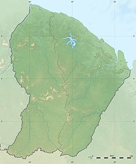
337:
335:
319:
306:
305:
303:
301:
287:
281:
280:
278:
276:
261:
161:Sommet Tabulaire
127:
126:
124:
123:
122:
117:
113:
110:
109:
108:
105:
48:
47:
41:
27:Sommet Tabulaire
19:
538:
537:
533:
532:
531:
529:
528:
527:
503:
502:
501:
491:
489:
481:
477:
476:
472:
462:
460:
449:
448:
444:
400:
399:
395:
385:
383:
374:
373:
369:
359:
357:
348:
347:
343:
333:
331:
321:
320:
309:
299:
297:
289:
288:
284:
274:
272:
263:
262:
258:
254:
200:
120:
118:
114:
111:
106:
103:
101:
99:
98:
63:
62:
61:
60:
59:
56:
55:
54:
53:
49:
17:
12:
11:
5:
536:
534:
526:
525:
520:
515:
505:
504:
500:
499:
486:DEAL de Guyane
470:
442:
393:
367:
341:
307:
282:
255:
253:
250:
199:
196:
152:
151:
138:
134:
133:
129:
128:
96:
90:
89:
86:
80:
79:
76:
70:
69:
65:
64:
57:
51:
50:
43:
42:
36:
35:
34:
33:
32:
29:
28:
24:
23:
15:
13:
10:
9:
6:
4:
3:
2:
535:
524:
521:
519:
516:
514:
511:
510:
508:
487:
480:
474:
471:
458:
457:
452:
446:
443:
438:
434:
429:
424:
420:
416:
413:: Abstracts.
412:
408:
404:
397:
394:
381:
377:
371:
368:
355:
351:
345:
342:
329:
325:
318:
316:
314:
312:
308:
296:
292:
286:
283:
270:
266:
260:
257:
251:
249:
247:
246:
241:
240:
234:
232:
227:
225:
221:
220:Oyapock River
217:
213:
209:
205:
204:cloud forests
197:
195:
193:
189:
185:
181:
177:
176:French Guiana
173:
170:
166:
162:
158:
150:
149:French Guiana
146:
142:
139:
135:
130:
125:
97:
95:
91:
87:
85:
81:
77:
75:
71:
66:
40:
30:
25:
20:
490:. Retrieved
485:
473:
461:. Retrieved
454:
445:
410:
406:
396:
384:. Retrieved
379:
370:
358:. Retrieved
353:
344:
332:. Retrieved
327:
298:. Retrieved
294:
285:
273:. Retrieved
268:
259:
243:
237:
235:
228:
201:
160:
156:
155:
518:Maripasoula
488:(in French)
459:(in French)
382:(in French)
356:(in French)
330:(in French)
295:Peak Bagger
271:(in French)
169:Maripasoula
157:Mont Itoupé
145:Maripasoula
119: /
94:Coordinates
52:Mont Itoupé
22:Mont Itoupé
507:Categories
407:Biotropica
269:Géoportail
252:References
107:53°05′02″W
84:Prominence
437:225137692
212:Emerillon
132:Geography
104:3°01′22″N
74:Elevation
492:20 March
463:20 March
386:20 March
360:20 March
334:20 March
300:20 March
275:20 March
198:Overview
172:communes
137:Location
218:to the
513:Camopi
435:
242:, and
231:canopy
224:Balatá
216:Maroni
180:France
165:Camopi
159:(also
141:Camopi
482:(PDF)
433:S2CID
494:2021
465:2021
388:2021
362:2021
336:2021
302:2021
277:2021
208:Waki
192:Saül
167:and
423:hdl
415:doi
174:in
509::
484:.
453:.
431:.
421:.
411:34
409:.
405:.
378:.
352:.
326:.
310:^
293:.
267:.
194:.
178:,
147:,
496:.
467:.
439:.
425::
417::
390:.
364:.
338:.
304:.
279:.
143:/
Text is available under the Creative Commons Attribution-ShareAlike License. Additional terms may apply.