54:
105:
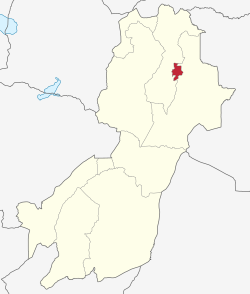
170:, capital of the Morogoro Region, and no villages. Morogoro Urban District covers 260 square kilometres (100 sq mi). It is bordered to the east and south by the
475:
67:
53:
416:
193:
For parliamentary elections, Tanzania is divided into constituencies. As of the 2010 elections
Morogoro Urban District had four constituencies:
549:
224:
468:
461:
381:
387:. The Planning Commission, Dar es Salaam, and The Regional Commissioner's Office, Morogoro. 1997. Archived from
447:
Note: the
Mvomero Constituency is in Morogoro Urban District even though it is primarily for Mvomero District.
358:
171:
484:
155:
44:
420:
117:
508:
518:
523:
434:
175:
147:
528:
513:
488:
159:
122:
453:
503:
353:
543:
17:
82:
69:
388:
492:
223:
The
Morogoro Urban District is administratively divided into twenty nine
167:
163:
110:
180:
As of 2012, the population of the
Morogoro Urban District was 315,866.
457:
435:"Organisations located in Morogoro Mjini District - Tanzania"
417:"2012 Population and Housing General Report: Morogoro: Urban"
215:
Morogoro Urban
District has six administrative division.
133:
128:
116:
98:
32:
411:
409:
376:
374:
469:
8:
476:
462:
454:
29:
382:"Morogoro Region Socio-Economic Profile"
370:
127:
97:
62:
50:
197:Morogoro-Kusini-Mashariki Constituency
58:Morogoro Municipal of Morogoro Region
132:
115:
27:District in Morogoro Region, Tanzania
7:
437:. African Development Information.
25:
103:
52:
256:Kilakala (Luguru word meaning:
1:
174:and to the north and west by
550:Districts of Morogoro Region
200:Morogoro Kusini Constituency
326:Sabasaba (English Meaning:
303:Mji Mpya (English Meaning:
203:Morogoro Mjini Constituency
184:Administrative subdivisions
566:
313:Mlimani (English Meaning:
296:Mji Kuu (English Meaning:
499:
63:
51:
42:
152:Wilaya ya Morogoro Mjini
37:Wilaya ya Morogoro Mjini
359:Morogoro Rural District
234:Boma (English Meaning:
172:Morogoro Rural District
166:. It contains the city
144:Morogoro Urban District
34:Morogoro Urban District
258:Kilchoungua in SWAHILI
151:
206:Mvomero Constituency
154:) is one of the six
83:6.82222°S 37.66528°E
79: /
253:Kihonda Magorofani
134: • Total
88:-6.82222; 37.66528
537:
536:
423:on 20 March 2004.
269:Kiwanja cha Ndege
141:
140:
18:Morogoro District
16:(Redirected from
557:
478:
471:
464:
455:
448:
445:
439:
438:
431:
425:
424:
419:. Archived from
413:
404:
403:
401:
399:
393:
386:
378:
176:Mvomero District
109:
107:
106:
94:
93:
91:
90:
89:
84:
80:
77:
76:
75:
72:
56:
30:
21:
565:
564:
560:
559:
558:
556:
555:
554:
540:
539:
538:
533:
495:
489:Morogoro Region
482:
452:
451:
446:
442:
433:
432:
428:
415:
414:
407:
397:
395:
391:
384:
380:
379:
372:
367:
350:
343:Uwanja wa Taifa
315:on the mountain
221:
213:
191:
186:
160:Morogoro Region
123:Morogoro Region
104:
102:
87:
85:
81:
78:
73:
70:
68:
66:
65:
59:
47:
38:
35:
28:
23:
22:
15:
12:
11:
5:
563:
561:
553:
552:
542:
541:
535:
534:
532:
531:
526:
521:
516:
511:
506:
500:
497:
496:
483:
481:
480:
473:
466:
458:
450:
449:
440:
426:
405:
394:on 30 May 2004
369:
368:
366:
363:
362:
361:
356:
354:Mazimbu Graves
349:
346:
345:
344:
341:
338:
335:
324:
321:
318:
311:
308:
301:
294:
291:
288:
285:
282:
279:
276:
273:
270:
267:
264:
261:
254:
251:
248:
245:
242:
239:
232:
220:
217:
212:
209:
208:
207:
204:
201:
198:
190:
189:Constituencies
187:
185:
182:
139:
138:
135:
131:
130:
126:
125:
120:
114:
113:
100:
96:
95:
61:
60:
57:
49:
48:
43:
40:
39:
36:
33:
26:
24:
14:
13:
10:
9:
6:
4:
3:
2:
562:
551:
548:
547:
545:
530:
527:
525:
522:
520:
517:
515:
512:
510:
507:
505:
502:
501:
498:
494:
490:
486:
479:
474:
472:
467:
465:
460:
459:
456:
444:
441:
436:
430:
427:
422:
418:
412:
410:
406:
390:
383:
377:
375:
371:
364:
360:
357:
355:
352:
351:
347:
342:
339:
336:
333:
329:
325:
322:
319:
316:
312:
309:
306:
302:
299:
295:
292:
289:
286:
283:
280:
277:
274:
271:
268:
265:
262:
259:
255:
252:
249:
246:
243:
240:
237:
233:
230:
229:
228:
226:
218:
216:
210:
205:
202:
199:
196:
195:
194:
188:
183:
181:
178:
177:
173:
169:
165:
161:
157:
153:
149:
145:
136:
124:
121:
119:
112:
101:
92:
64:Coordinates:
55:
46:
41:
31:
19:
443:
429:
421:the original
396:. Retrieved
389:the original
331:
327:
314:
304:
297:
257:
236:headquarters
235:
222:
214:
192:
179:
143:
142:
398:3 September
337:Sultan Area
320:Mwembesongo
298:center city
86: /
74:037°39′55″E
266:Kingolwira
247:Kichangani
129:Population
71:06°49′20″S
509:Kilombero
485:Districts
211:Divisions
156:districts
544:Category
519:Morogoro
493:Tanzania
348:See also
332:July 7th
305:new city
241:Chamwino
168:Morogoro
164:Tanzania
111:Tanzania
45:District
524:Mvomero
290:Mbuyuni
287:Mazimbu
272:Luhungo
250:Kihonda
244:Kauzeni
158:of the
148:Swahili
137:315,866
99:Country
529:Ulanga
514:Kilosa
323:Mzinga
310:Mkundi
284:Magadu
281:Mafisa
278:Mafiga
275:Lukobe
118:Region
108:
504:Gairo
392:(pdf)
385:(PDF)
365:Notes
340:Tungi
293:Mindu
263:Kingo
231:Bigwa
225:wards
219:Wards
400:2012
487:of
330:or
328:7/7
162:of
546::
491:,
408:^
373:^
227::
150::
477:e
470:t
463:v
402:.
334:)
317:)
307:)
300:)
260:)
238:)
146:(
20:)
Text is available under the Creative Commons Attribution-ShareAlike License. Additional terms may apply.