41:
34:
374:
243:
The mountain has an elliptical base (about 30 by 20 kilometers), whose major axis lies NNE-SSW or parallel to the predominant tectonic trend. Chilalo rises with gentle slopes for more than 1500 meters from the top of the plateau. At the summit, there is a large, almost circular
419:
443:
95:
255:
One authority identifies Mount
Chilalo as a late Trap Series volcano. The geologist Erik Nilsson claimed to have identified traces of
33:
328:
248:
about 6 kilometers in diameter, whose southern rim is considered to be the mountain's summit. Mount
Chilalo last erupted in the
458:
438:
412:
453:
448:
195:
88:
263:
down to about 3400 meters, which he dated to the "Last
Pluvial Period". Although this mountain is located south of the
212:
405:
155:
78:
357:
272:
260:
271:
to the north and Mount Kaka to the south, it is considered, geologically speaking, part of the
264:
389:
373:
183:
432:
381:
203:
191:
175:
160:
139:
249:
295:
268:
256:
227:
214:
110:
97:
187:
135:
353:"Traces of Ancient Changes of Climate in East Africa: Preliminary Report"
315:
385:
179:
143:
245:
352:
206:
199:
172:
68:
393:
154:
149:
131:
126:
87:
77:
67:
62:
21:
318:, Volcano Live website (accessed 1 November 2009)
413:
8:
420:
406:
18:
182:. Its highest point (4036 m or 13,241 ft
334:. The Nordic Africa Institute. p. 3
284:
259:on Chilalo, as well as on its neighbor
380:This article about a location in the
290:
288:
7:
370:
368:
392:. You can help Knowledge (XXG) by
14:
372:
39:
32:
83:610.01 m (2,001.3 ft)
40:
1:
73:4,071 m (13,356 ft)
316:Cilallo Volcano - John Seach
196:Arsi Mountains National Park
444:Stratovolcanoes of Ethiopia
329:"Local History in Ethiopia"
475:
367:
298:. Global Volcanism Program
198:on the border between the
26:
171:is an isolated, extinct
459:Oromia geography stubs
439:Mountains of Ethiopia
361:, 17 (1935), pp. 13f
53:Location in Ethiopia
16:Mountain in Ethiopia
454:Geography of Oromia
449:Ethiopian Highlands
358:Geografiska Annaler
273:Ethiopian Highlands
224: /
107: /
63:Highest point
401:
400:
265:East African Rift
166:
165:
466:
422:
415:
408:
376:
369:
362:
349:
343:
342:
340:
339:
333:
325:
319:
313:
307:
306:
304:
303:
292:
239:
238:
236:
235:
234:
229:
228:7.917°N 39.267°E
225:
222:
221:
220:
217:
194:, is located in
178:in southeastern
122:
121:
119:
118:
117:
112:
111:7.917°N 39.267°E
108:
105:
104:
103:
100:
43:
42:
36:
19:
474:
473:
469:
468:
467:
465:
464:
463:
429:
428:
427:
426:
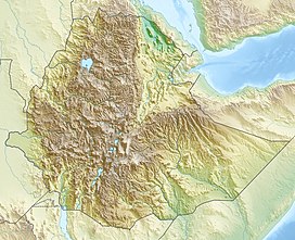
366:
365:
350:
346:
337:
335:
331:
327:
326:
322:
314:
310:
301:
299:
294:
293:
286:
281:
232:
230:
226:
223:
218:
215:
213:
211:
210:
115:
113:
109:
106:
101:
98:
96:
94:
93:
58:
57:
56:
55:
54:
51:
50:
49:
48:
44:
17:
12:
11:
5:
472:
470:
462:
461:
456:
451:
446:
441:
431:
430:
425:
424:
417:
410:
402:
399:
398:
377:
364:
363:
351:Erik Nilsson,
344:
320:
308:
283:
282:
280:
277:
164:
163:
158:
152:
151:
147:
146:
133:
129:
128:
124:
123:
91:
85:
84:
81:
75:
74:
71:
65:
64:
60:
59:
52:
46:
45:
38:
37:
31:
30:
29:
28:
27:
24:
23:
15:
13:
10:
9:
6:
4:
3:
2:
471:
460:
457:
455:
452:
450:
447:
445:
442:
440:
437:
436:
434:
423:
418:
416:
411:
409:
404:
403:
397:
395:
391:
387:
383:
382:Oromia Region
378:
375:
371:
360:
359:
354:
348:
345:
330:
324:
321:
317:
312:
309:
297:
291:
289:
285:
278:
276:
274:
270:
267:, along with
266:
262:
258:
253:
251:
247:
241:
237:
233:7.917; 39.267
208:
205:
201:
197:
193:
192:Oromia Region
189:
185:
181:
177:
176:stratovolcano
174:
170:
169:Mount Chilalo
162:
161:Stratovolcano
159:
157:
156:Mountain type
153:
148:
145:
141:
140:Oromia Region
137:
134:
130:
125:
120:
116:7.917; 39.267
92:
90:
86:
82:
80:
76:
72:
70:
66:
61:
35:
25:
20:
394:expanding it
379:
356:
347:
336:. Retrieved
323:
311:
300:. Retrieved
254:
242:
168:
167:
250:Pleistocene
231: /
114: /
89:Coordinates
433:Categories
338:2019-05-13
302:2024-08-31
296:"Ch'llalo"
269:Mount Gugu
261:Mount Kaka
257:glaciation
186:), in the
79:Prominence
188:Arsi Zone
136:Arsi Zone
127:Geography
69:Elevation
386:Ethiopia
180:Ethiopia
144:Ethiopia
132:Location
246:caldera
219:39°16′E
216:07°55′N
190:of the
173:silicic
150:Geology
102:39°16′E
47:Chilalo
22:Chilalo
207:woreda
200:Hitosa
184:a.s.l.
99:7°55′N
388:is a
332:(PDF)
279:Notes
390:stub
204:Tiyo
202:and
384:of
240:).
435::
355:,
287:^
275:.
252:.
142:,
138:,
421:e
414:t
407:v
396:.
341:.
305:.
209:(
Text is available under the Creative Commons Attribution-ShareAlike License. Additional terms may apply.