41:
48:
98:
432:
207:
40:
210:) had formerly occupied the summit of Mount Ferguson. Dismantling of the fire tower took place in around 1975 after being abandoned since 1966.
422:
202:
who staked mining claims on Mount
Ferguson in the 1880s. He is also the namesake for Ferguson Bay, Ferguson Island and Ferguson Point. A
427:
160:
352:
Lightfoot, P. C.; Souza, H. De; Douerty, W. (1993). "Differentiation and source of the
Nipissing Diabase intrusions, Ontario, Canada".
354:
157:
20:
407:
412:
91:
417:
300:
154:
191:
above sea level, making it one of the highest mountains in the area. Mount
Ferguson is situated near the boundary of
269:
274:
367:
180:
332:
264:
363:
203:
307:
383:
221:
214:
192:
375:
199:
149:
371:
241:
401:
184:
198:
The mountain is named after Peter A. Ferguson, a gold prospector from the town of
387:
113:
100:
213:
Like the other highest peaks of this area, Mount
Ferguson is underlain by
176:
138:
142:
60:
81:
64:
379:
218:
301:
Geology of
Northwestern Timagami Area, District of Nipissing
206:
set up by the
Department of Lands and Forests (now the
148:
134:
129:
90:
80:
75:
28:
8:
208:Ministry of Natural Resources and Forestry
25:
217:. This forms a 2.2 billion year old
19:For other places with the same name, see
259:
257:
253:
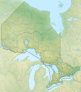
183:, Canada. It overlooks Ferguson Bay of
47:
433:Mountains of Canada under 1000 metres
7:
327:
325:
294:
292:
290:
224:with an east–west extent of almost
355:Canadian Journal of Earth Sciences
228:and a north–south extent of up to
14:
46:
39:
1:
423:Igneous petrology of Ontario
270:Geographical Names Data Base
16:Mountain in Ontario, Canada
449:
428:Paleoproterozoic magmatism
189:415 m (1,362 ft)
86:415 m (1,362 ft)
18:
230:350 km (220 mi)
226:450 km (280 mi)
33:
275:Natural Resources Canada
177:Municipality of Temagami
175:, is a mountain in the
299:Simony, P. S. (1964).
408:Landforms of Temagami
187:with an elevation of
114:47.13639°N 80.05861°W
413:Mountains of Ontario
193:geographic townships
181:Northeastern Ontario
372:1993CaJES..30.1123L
195:Cynthia and Aston.
171:, sometimes called
119:47.13639; -80.05861
110: /
418:Igneous intrusions
364:NRC Research Press
204:fire lookout tower
76:Highest point
215:Nipissing diabase
173:Ferguson Mountain
166:
165:
440:
392:
391:
349:
343:
342:
340:
339:
329:
320:
319:
317:
315:
305:
296:
285:
284:
282:
281:
265:"Mount Ferguson"
261:
231:
227:
190:
125:
124:
122:
121:
120:
115:
111:
108:
107:
106:
103:
50:
49:
43:
26:
448:
447:
443:
442:
441:
439:
438:
437:
398:
397:
396:
395:
380:10.1139/e93-095
351:
350:
346:
337:
335:
331:
330:
323:
313:
311:
308:Queen's Printer
303:
298:
297:
288:
279:
277:
263:
262:
255:
250:
238:
229:
225:
188:
118:
116:
112:
109:
104:
101:
99:
97:
96:
71:
70:
69:
68:
67:
58:
57:
56:
55:
51:
24:
17:
12:
11:
5:
446:
444:
436:
435:
430:
425:
420:
415:
410:
400:
399:
394:
393:
344:
333:"Mt. Ferguson"
321:
286:
252:
251:
249:
246:
245:
244:
242:Devil Mountain
237:
234:
169:Mount Ferguson
164:
163:
152:
146:
145:
136:
132:
131:
127:
126:
94:
88:
87:
84:
78:
77:
73:
72:
59:
54:Mount Ferguson
53:
52:
45:
44:
38:
37:
36:
35:
34:
31:
30:
29:Mount Ferguson
21:Mount Ferguson
15:
13:
10:
9:
6:
4:
3:
2:
445:
434:
431:
429:
426:
424:
421:
419:
416:
414:
411:
409:
406:
405:
403:
389:
385:
381:
377:
373:
369:
365:
361:
357:
356:
348:
345:
334:
328:
326:
322:
309:
302:
295:
293:
291:
287:
276:
272:
271:
266:
260:
258:
254:
247:
243:
240:
239:
235:
233:
223:
220:
216:
211:
209:
205:
201:
196:
194:
186:
185:Lake Temagami
182:
178:
174:
170:
162:
159:
156:
153:
151:
147:
144:
140:
137:
133:
128:
123:
95:
93:
89:
85:
83:
79:
74:
66:
62:
42:
32:
27:
22:
359:
353:
347:
336:. Retrieved
314:September 9,
312:. Retrieved
278:. Retrieved
268:
212:
197:
172:
168:
167:
161:Obabika Lake
310:. p. 3
117: /
92:Coordinates
402:Categories
338:2016-11-02
306:(Report).
280:2023-08-18
248:References
388:1480-3313
130:Geography
105:80°3′31″W
102:47°8′11″N
82:Elevation
366:: 1124.
236:See also
222:province
219:magmatic
150:Topo map
139:Temagami
135:Location
368:Bibcode
200:Mattawa
143:Ontario
61:Ontario
386:
65:Canada
362:(6).
304:(PDF)
384:ISSN
316:2024
158:41P1
376:doi
155:NTS
404::
382:.
374:.
360:30
358:.
324:^
289:^
273:.
267:.
256:^
232:.
179:,
141:,
63:,
390:.
378::
370::
341:.
318:.
283:.
23:.
Text is available under the Creative Commons Attribution-ShareAlike License. Additional terms may apply.