124:
156:
31:
163:
131:
305:
275:
No scientific survey has yet been conducted in the area but recent expedition to the mountain by the Nueva
Vizcaya Mountaineering Society, Inc. led by NVMSI Founder Gene Basilio Jr. and President Raymond Zamora in September 2012 proved that civets, monkeys, and other wildlife still thrive in the
279:
In
October 2012, Basilio and Zamora, with guides from the Bugkalot tribe, returned and successfully summitted the mountain passing through a mossy forest and a route they called Zamora trail. It took them three days to hike from the jump-off point in Alfonso Castaneda.
283:
Underneath Mount Guiwan, a tunnel that diverts water from the
Casecnan River in Brgy. Pelaway to Pantabangan Dam in Nueva Ecija was constructed by the Casecnan Multi-Purpose Transbasin and Power project contracted by California Energy.
276:
forests of Mount Guiwan. Its streams still have abundant eels. A waterfalls estimated to be one km long from its first drop down to the bottom flows from near the summit of the mountain.
268:. It is probably the highest peak of Sierra Madre mountain range with a height of 1,915 metres (6,283 ft) above sea level according to NAMRIA topographic map.
123:
346:
155:
79:
365:
380:
375:
370:
261:
231:
339:
226:
332:
293:
210:
72:
257:
245:
198:
222:
30:
62:
37:
304:
316:
238:
203:
359:
215:
312:
265:
191:
94:
81:
269:
52:
272:
have long established trails which they use when hunting.
320:
237:
221:
209:
197:
187:
110:
71:
61:
51:
46:
21:
340:
8:
347:
333:
18:
16:Mountain in Nueva Vizcaya, Philippines
311:This article about a location in the
7:
301:
299:
162:
130:
14:
303:
262:Alfonso Castañeda, Nueva Vizcaya
161:
154:
129:
122:
29:
35:The mountain as seen from the
1:
366:Mountains of the Philippines
319:. You can help Knowledge by
294:Casecnan Protected Landscape
67:1,059 m (3,474 ft)
57:1,915 m (6,283 ft)
381:Philippines geography stubs
397:
376:Landforms of Nueva Vizcaya
371:Sierra Madre (Philippines)
298:
115:
28:
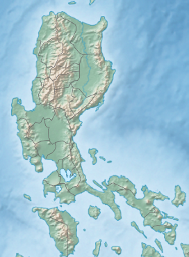
177:Show map of Philippines
95:15.94528°N 121.28639°E
256:is a mountain in the
100:15.94528; 121.28639
91: /
47:Highest point
328:
327:
251:
250:
232:Alfonso Castañeda
145:Show map of Luzon
38:Alfonso Castañeda
388:
349:
342:
335:
307:
300:
241:
178:
171:
165:
164:
158:
146:
139:
133:
132:
126:
106:
105:
103:
102:
101:
96:
92:
89:
88:
87:
84:
40:
33:
24:
19:
396:
395:
391:
390:
389:
387:
386:
385:
356:
355:
354:
353:
290:
239:
183:
182:
181:
180:
179:
176:
175:
174:
173:
172:
169:
166:
149:
148:
147:
144:
143:
142:
141:
140:
137:
134:
99:
97:
93:
90:
85:
82:
80:
78:
77:
42:
36:
22:
17:
12:
11:
5:
394:
392:
384:
383:
378:
373:
368:
358:
357:
352:
351:
344:
337:
329:
326:
325:
308:
297:
296:
289:
286:
249:
248:
243:
235:
234:
229:
219:
218:
213:
207:
206:
204:Cagayan Valley
201:
195:
194:
189:
185:
184:
168:
167:
160:
159:
153:
152:
151:
150:
136:
135:
128:
127:
121:
120:
119:
118:
117:
116:
113:
112:
108:
107:
75:
69:
68:
65:
59:
58:
55:
49:
48:
44:
43:
41:municipal hall
34:
26:
25:
15:
13:
10:
9:
6:
4:
3:
2:
393:
382:
379:
377:
374:
372:
369:
367:
364:
363:
361:
350:
345:
343:
338:
336:
331:
330:
324:
322:
318:
314:
309:
306:
302:
295:
292:
291:
287:
285:
281:
277:
273:
271:
267:
263:
259:
255:
247:
244:
242:
236:
233:
230:
228:
224:
220:
217:
216:Nueva Vizcaya
214:
212:
208:
205:
202:
200:
196:
193:
190:
186:
157:
125:
114:
109:
104:
76:
74:
70:
66:
64:
60:
56:
54:
50:
45:
39:
32:
27:
20:
321:expanding it
310:
282:
278:
274:
258:Sierra Madre
254:Mount Guiwan
253:
252:
246:Sierra Madre
240:Parent range
227:municipality
170:Mount Guiwan
138:Mount Guiwan
23:Mount Guiwan
313:Philippines
266:Philippines
192:Philippines
98: /
86:121°17′11″E
73:Coordinates
360:Categories
83:15°56′43″N
63:Prominence
270:Bugkalots
260:range in
111:Geography
53:Elevation
288:See also
211:Province
188:Country
199:Region
315:is a
317:stub
223:City
362::
264:,
348:e
341:t
334:v
323:.
225:/
Text is available under the Creative Commons Attribution-ShareAlike License. Additional terms may apply.