42:
54:
888:
755:
772:
747:
352:
730:
342:
332:
416:
There were 1,105 households, out of which 26.20% had children under the age of 18 living with them, 41.18% were married couples living together, 11.76% had a female householder with no spouse present, and 45.97% were non-families. 38.20% of all households were made up of individuals, and 13.00% had
420:
The township's age distribution consisted of 15.6% under the age of 18, 10.9% from 18 to 24, 37.9% from 25 to 44, 25.1% from 45 to 64, and 10.6% who were 65 years of age or older. The median age was 36.3 years. For every 100 females, there were 244.3 males. For every 100 females age 18 and over,
380:
there were 4,297 people, 1,105 households, and 597 families residing in the township. The population density was 115.37 inhabitants per square mile (44.54/km). There were 1,268 housing units at an average density of 34.04 per square mile (13.14/km). The racial makeup of the township was 67.74%
285:
According to the 2010 census, the township has a total area of 37.24 square miles (96.5 km), of which 37.19 square miles (96.3 km) (or 99.87%) is land and 0.06 square miles (0.16 km) (or 0.16%) is water.
424:
The median income for a household in the township was $ 55,464, and the median income for a family was $ 77,198. Males had a median income of $ 42,930 versus $ 33,094 for females. The
67:
41:
826:
321:
The township contains these ten cemeteries: Greenwell, Harbour, Hersman, Icabod Perry, Keifer, Means, Mount
Sterling Catholic, Mount Sterling City, Putnam and Wilson.
689:
1116:
53:
1111:
940:
761:
607:
975:
791:
965:
709:
955:
935:
781:
714:
513:
1126:
945:
786:
662:
546:
247:
970:
719:
560:
950:
819:
739:
537:
682:
1035:
417:
someone living alone who was 65 years of age or older. The average household size was 2.26 and the average family size was 3.04.
229:
208:
812:
542:
1121:
1063:
398:
386:
608:"Population, Housing Units, Area, and Density: 2010 - County -- County Subdivision and Place -- 2010 Census Summary File 1"
804:
675:
390:
121:
611:
1068:
402:
667:
476:
461:
377:
877:
858:
295:
99:
532:
1081:
907:
565:
836:
406:
266:
126:
1040:
1005:
1088:
917:
410:
218:
985:
394:
382:
1020:
1000:
995:
899:
657:
428:
for the township was $ 17,193. About 5.2% of families and 11.0% of the population were below the
355:
633:
582:
1025:
425:
345:
307:
1045:
1030:
912:
1015:
1010:
869:
277:. As of the 2020 census, its population was 4,297 and it contained 1,268 housing units.
927:
262:
32:
1105:
274:
429:
851:
335:
1055:
109:
82:
69:
199:
432:, including 11.4% of those under age 18 and 5.7% of those age 65 or over.
351:
270:
114:
341:
313:(This list is based on USGS data and may include former settlements.)
698:
Places adjacent to Mount
Sterling Township, Brown County, Illinois
225:
204:
887:
331:
808:
671:
886:
561:
United States Census Bureau 2007 TIGER/Line
Shapefiles
1054:
984:
926:
898:
868:
246:
236:
215:
198:
190:
182:
177:
169:
161:
153:
145:
140:
132:
120:
108:
98:
23:
533:"Mount Sterling Township, Brown County, Illinois"
165:0.06 sq mi (0.2 km) 0.16%
820:
683:
503:Brown County Community Unit School District 1
8:
827:
813:
805:
690:
676:
668:
434:
413:of any race were 6.21% of the population.
20:
891:Map of Illinois highlighting Brown County
547:United States Department of the Interior
571:
245:
235:
197:
176:
168:
139:
131:
97:
62:
38:
610:. United States Census. Archived from
514:Illinois's 18th congressional district
454:
214:
189:
181:
160:
152:
144:
119:
107:
50:
7:
1117:Populated places established in 1853
705:
577:
575:
405:, and 2.70% from two or more races.
157:37.19 sq mi (96.3 km)
149:37.24 sq mi (96.5 km)
1112:Townships in Brown County, Illinois
538:Geographic Names Information System
58:Brown County's location in Illinois
18:Township in Illinois, United States
835:Municipalities and communities of
634:"Census of Population and Housing"
444:
14:
770:
753:
745:
728:
350:
340:
330:
52:
40:
1127:1853 establishments in Illinois
543:United States Geological Survey
1:
771:
729:
754:
746:
566:United States National Atlas
1143:
1077:
884:
849:
703:
490:
475:
460:
453:
448:
443:
440:
63:
51:
39:
30:
521:State Senate District 47
421:there were 267.3 males.
173:705 ft (215 m)
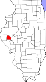
46:Location in Brown County
751:Mount Sterling Township
663:Illinois State Archives
518:State House District 93
259:Mount Sterling Township
25:Mount Sterling Township
892:
838:Brown County, Illinois
194:120/sq mi (45/km)
1122:Townships in Illinois
890:
583:"Explore Census Data"
491:U.S. Decennial Census
436:Historical population
217: • Summer (
83:39.97278°N 90.74833°W
1090:United States portal
762:Cooperstown Township
614:on February 12, 2020
302:Unincorporated towns
191: • Density
792:Versailles Township
508:Political districts
437:
88:39.97278; -90.74833
79: /
893:
710:Pea Ridge Township
435:
356:Illinois Route 107
183: • Total
162: • Water
146: • Total
1099:
1098:
1069:White Oak Springs
802:
801:
797:
796:
782:Buckhorn Township
715:Missouri Township
495:
494:
426:per capita income
346:Illinois Route 99
256:
255:
154: • Land
1134:
1091:
1084:
889:
861:
854:
844:
839:
829:
822:
815:
806:
787:Elkhorn Township
774:
773:
757:
756:
749:
748:
732:
731:
706:
692:
685:
678:
669:
646:
645:
643:
641:
630:
624:
623:
621:
619:
604:
598:
597:
595:
593:
579:
557:
555:
553:
498:School districts
456:
451:
446:
438:
399:Pacific Islander
387:African American
354:
344:
334:
222:
136:November 8, 1853
94:
93:
91:
90:
89:
84:
80:
77:
76:
75:
72:
56:
44:
21:
1142:
1141:
1137:
1136:
1135:
1133:
1132:
1131:
1102:
1101:
1100:
1095:
1089:
1083:Illinois portal
1082:
1073:
1050:
987:
980:
922:
894:
882:
864:
859:
852:
845:
842:
837:
833:
803:
798:
758:
720:Ripley Township
699:
696:
654:
649:
639:
637:
632:
631:
627:
617:
615:
606:
605:
601:
591:
589:
587:data.census.gov
581:
580:
573:
551:
549:
531:
528:
510:
500:
449:
391:Native American
374:
364:
327:
319:
304:
292:
283:
261:is one of nine
242:
216:
87:
85:
81:
78:
73:
70:
68:
66:
65:
59:
47:
35:
26:
19:
12:
11:
5:
1140:
1138:
1130:
1129:
1124:
1119:
1114:
1104:
1103:
1097:
1096:
1094:
1093:
1086:
1078:
1075:
1074:
1072:
1071:
1066:
1060:
1058:
1052:
1051:
1049:
1048:
1043:
1038:
1033:
1028:
1023:
1018:
1013:
1008:
1003:
998:
992:
990:
986:Unincorporated
982:
981:
979:
978:
973:
968:
963:
961:Mount Sterling
958:
953:
948:
943:
938:
932:
930:
924:
923:
921:
920:
915:
910:
904:
902:
896:
895:
885:
883:
881:
880:
878:Mount Sterling
874:
872:
866:
865:
860:Mount Sterling
850:
847:
846:
834:
832:
831:
824:
817:
809:
800:
799:
795:
794:
789:
784:
778:
777:
775:
768:
765:
764:
759:
744:
742:
736:
735:
733:
726:
723:
722:
717:
712:
704:
701:
700:
697:
695:
694:
687:
680:
672:
666:
665:
660:
653:
652:External links
650:
648:
647:
625:
599:
570:
569:
568:
563:
558:
527:
524:
523:
522:
519:
516:
509:
506:
505:
504:
499:
496:
493:
492:
488:
487:
484:
482:
479:
473:
472:
469:
467:
464:
458:
457:
452:
447:
442:
373:
370:
369:
368:
363:
360:
359:
358:
348:
338:
326:
325:Major highways
323:
318:
315:
311:
310:
303:
300:
299:
298:
296:Mount Sterling
291:
288:
282:
279:
254:
253:
250:
244:
243:
240:
238:
234:
233:
223:
213:
212:
202:
196:
195:
192:
188:
187:
184:
180:
179:
175:
174:
171:
167:
166:
163:
159:
158:
155:
151:
150:
147:
143:
142:
138:
137:
134:
130:
129:
124:
118:
117:
112:
106:
105:
102:
96:
95:
61:
60:
57:
49:
48:
45:
37:
36:
31:
28:
27:
24:
17:
13:
10:
9:
6:
4:
3:
2:
1139:
1128:
1125:
1123:
1120:
1118:
1115:
1113:
1110:
1109:
1107:
1092:
1087:
1085:
1080:
1079:
1076:
1070:
1067:
1065:
1062:
1061:
1059:
1057:
1053:
1047:
1044:
1042:
1039:
1037:
1034:
1032:
1029:
1027:
1024:
1022:
1019:
1017:
1014:
1012:
1009:
1007:
1004:
1002:
999:
997:
994:
993:
991:
989:
983:
977:
974:
972:
969:
967:
964:
962:
959:
957:
954:
952:
949:
947:
944:
942:
939:
937:
934:
933:
931:
929:
925:
919:
916:
914:
911:
909:
908:Mound Station
906:
905:
903:
901:
897:
879:
876:
875:
873:
871:
867:
863:
862:
855:
848:
843:United States
840:
830:
825:
823:
818:
816:
811:
810:
807:
793:
790:
788:
785:
783:
780:
779:
776:
769:
767:
766:
763:
760:
752:
743:
741:
738:
737:
734:
727:
725:
724:
721:
718:
716:
713:
711:
708:
707:
702:
693:
688:
686:
681:
679:
674:
673:
670:
664:
661:
659:
658:City-Data.com
656:
655:
651:
635:
629:
626:
613:
609:
603:
600:
588:
584:
578:
576:
572:
567:
564:
562:
559:
548:
544:
540:
539:
534:
530:
529:
525:
520:
517:
515:
512:
511:
507:
502:
501:
497:
489:
485:
483:
480:
478:
474:
470:
468:
465:
463:
459:
439:
433:
431:
427:
422:
418:
414:
412:
408:
404:
401:, 4.86% from
400:
396:
392:
388:
384:
379:
371:
366:
365:
361:
357:
353:
349:
347:
343:
339:
337:
333:
329:
328:
324:
322:
316:
314:
309:
306:
305:
301:
297:
294:
293:
289:
287:
280:
278:
276:
272:
268:
264:
260:
251:
249:
239:
231:
227:
224:
220:
210:
206:
203:
201:
193:
185:
172:
164:
156:
148:
135:
128:
125:
123:
116:
113:
111:
104:United States
103:
101:
92:
64:Coordinates:
55:
43:
34:
29:
22:
16:
960:
857:
750:
740:Lee Township
638:. Retrieved
636:. Census.gov
628:
616:. Retrieved
612:the original
602:
590:. Retrieved
586:
550:. Retrieved
536:
430:poverty line
423:
419:
415:
375:
372:Demographics
320:
312:
284:
267:Brown County
258:
257:
252:17-009-51167
241:62353, 62378
15:
1056:Ghost towns
1041:Morrelville
1006:Cooperstown
988:communities
941:Cooperstown
853:County seat
592:January 22,
403:other races
378:2020 census
336:US Route 24
133:Established
86: /
1106:Categories
976:Versailles
918:Versailles
552:January 4,
526:References
376:As of the
367:Fairground
317:Cemeteries
178:Population
74:90°44′54″W
71:39°58′22″N
1036:La Grange
966:Pea Ridge
928:Townships
385:, 24.46%
362:Landmarks
281:Geography
263:townships
248:FIPS code
237:ZIP codes
200:Time zone
170:Elevation
1021:Gilbirds
1001:Buckhorn
996:Benville
956:Missouri
936:Buckhorn
900:Villages
407:Hispanic
397:, 0.00%
393:, 0.12%
389:, 0.12%
271:Illinois
115:Illinois
33:Township
1026:Hersman
946:Elkhorn
640:June 4,
618:May 28,
308:Hersman
100:Country
1064:Milton
1046:Siloam
1031:Jaques
971:Ripley
913:Ripley
870:Cities
441:Census
411:Latino
290:Cities
122:County
1016:Fargo
1011:Damon
486:−8.0%
481:4,297
466:4,673
395:Asian
383:White
226:UTC-5
205:UTC-6
186:4,297
127:Brown
110:State
642:2016
620:2013
594:2023
554:2010
477:2020
462:2010
450:Note
445:Pop.
141:Area
951:Lee
409:or
275:USA
265:in
230:CDT
219:DST
209:CST
1108::
856::
841:,
585:.
574:^
545:,
541:.
535:.
455:%±
273:,
269:,
828:e
821:t
814:v
691:e
684:t
677:v
644:.
622:.
596:.
556:.
471:—
232:)
228:(
221:)
211:)
207:(
Text is available under the Creative Commons Attribution-ShareAlike License. Additional terms may apply.