49:
893:
738:
61:
321:
to the northern part of the Kiowa, Comanche and Apache
Reservation in 1899. It terminated about two miles from an existing tent city called Oakdale, consisting of a store and post office on the former Cheyenne and Arapaho Reservation. The Oakdale post office was renamed Mountain View, honoring the
620:
living together, 10.5% had a female householder with no husband present, and 36.2% were non-families. 34.4% of all households were made up of individuals, and 19.9% had someone living alone who was 65 years of age or older. The average household size was 2.25 and the average family size was 2.88.
624:
In the town, the population was spread out, with 22.8% under the age of 18, 6.8% from 18 to 24, 22.4% from 25 to 44, 23.5% from 45 to 64, and 24.4% who were 65 years of age or older. The median age was 44 years. For every 100 females, there were 77.1 males. For every 100 females age 18 and over,
329:
In 1903, the entire town relocated to a site closer to the railroad. The move was completed in 1904. Nicknaming itself "the City in the Woods," the town became a point for transshipping Texas cattle on the Rock Island. Cattle were unloaded from trains and allowed to graze on Kiowa, Comanche and
584:
of 2010, there were 795 people, 381 households, and 243 families residing in the town. The population density was 1,775.3 inhabitants per square mile (685.4/km). There were 452 housing units at an average density of 911.9 per square mile (352.1/km). The racial makeup of the town was 85.68%
48:
628:
The median income for a household in the town was $ 21,583, and the median income for a family was $ 33,333. Males had a median income of $ 23,250 versus $ 19,375 for females. The
831:
314:
1020:
716:
74:
256:
824:
266:
652:
60:
207:
817:
337:
590:
17:
809:
594:
128:
695:
602:
357:
1025:
302:
972:
559:
544:
529:
514:
499:
484:
469:
454:
439:
424:
409:
394:
290:
298:
244:
106:
676:
330:
Apache
Reservation land before resuming their journey to markets. By 1910, the town had a population of 855.
990:
927:
616:
There were 381 households, out of which 25.7% had children under the age of 18 living with them, 51.2% were
841:
606:
282:
133:
333:
997:
610:
217:
952:
937:
922:
912:
779:
763:
598:
586:
318:
792:
632:
for the town was $ 16,677. About 19.1% of families and 20.3% of the population were below the
629:
323:
967:
942:
917:
882:
863:
294:
977:
962:
1014:
249:
677:
U.S. Geological Survey
Geographic Names Information System: Mountain View, Oklahoma
633:
856:
116:
360:, the town has a total area of 0.5 square mile (1.3 km), all land.
89:
76:
345:
198:
636:, including 14.8% of those under age 18 and 26.9% of those age 65 or over.
617:
341:
286:
232:
121:
581:
224:
203:
892:
904:
874:
39:
813:
891:
336:(Delf A. 'Jelly' Bryce), born 1906 at Mountain View, was an
293:. It is situated about 23 miles east of the county seat of
691:
782:, Oklahoma Historical Society. Retrieved October 2, 2019
951:
903:
873:
758:
756:
265:
255:
243:
231:
214:
197:
189:
181:
176:
168:
160:
152:
144:
139:
127:
115:
105:
30:
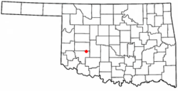
289:, United States. Its population was 740 as of the
825:
739:"Hobart, Oklahoma to Mountain View, Oklahoma"
16:For other places called "Mountain View", see
8:
768:Encyclopedia of Oklahoma History and Culture
340:agent significant for being an exceptional
832:
818:
810:
613:of any race were 2.50% of the population.
367:
27:
896:Map of Oklahoma highlighting Kiowa County
315:Chicago, Rock Island and Pacific Railroad
644:
254:
230:
196:
175:
167:
138:
104:
69:
57:
45:
672:
670:
387:
686:
684:
264:
242:
213:
188:
180:
159:
151:
143:
126:
114:
7:
780:"Bryce, Jacob Aldolphus (1906-1974)"
605:, and 2.73% from two or more races.
317:(Rock Island) extended a line from
164:0.00 sq mi (0.00 km)
156:0.57 sq mi (1.47 km)
148:0.57 sq mi (1.47 km)
65:Location of Mountain View, Oklahoma
840:Municipalities and communities of
793:"Census of Population and Housing"
377:
14:
717:"Mountain View (town), Oklahoma"
653:"ArcGIS REST Services Directory"
59:
47:
1021:Towns in Kiowa County, Oklahoma
193:1,300.53/sq mi (502.09/km)
25:Town in Oklahoma, United States
18:Mountain View (disambiguation)
1:
655:. United States Census Bureau
770:, Accessed January 26, 2016.
696:United States Census Bureau
358:United States Census Bureau
348:, and for his dress sense.
1042:
303:Oklahoma State Highway 115
172:1,339 ft (408 m)
15:
986:
889:
854:
573:
558:
543:
528:
513:
498:
483:
468:
453:
438:
423:
408:
393:
386:
381:
376:
373:
297:, at the intersection of
291:2020 United States census
70:
58:
46:
37:
299:Oklahoma State Highway 9
625:there were 71.9 males.
32:Mountain View, Oklahoma
897:
843:Kiowa County, Oklahoma
326:, on October 9, 1900.
895:
762:Taylor, Ethel Crisp.
692:"U.S. Census website"
574:U.S. Decennial Census
369:Historical population
334:Jacob Aldolphus Bryce
216: • Summer (
90:35.09944°N 98.74972°W
53:Mountain View in 1930
999:United States portal
719:. U.S. Census Bureau
190: • Density
370:
95:35.09944; -98.74972
86: /
898:
368:
182: • Total
161: • Water
145: • Total
1026:Towns in Oklahoma
1008:
1007:
630:per capita income
578:
577:
356:According to the
324:Wichita Mountains
276:
275:
153: • Land
1033:
1000:
993:
894:
866:
859:
849:
844:
834:
827:
820:
811:
805:
804:
802:
800:
789:
783:
777:
771:
764:"Mountain View,"
760:
751:
750:
748:
746:
735:
729:
728:
726:
724:
713:
707:
706:
704:
702:
688:
679:
674:
665:
664:
662:
660:
649:
591:African American
389:
384:
379:
371:
221:
101:
100:
98:
97:
96:
91:
87:
84:
83:
82:
79:
63:
51:
28:
1041:
1040:
1036:
1035:
1034:
1032:
1031:
1030:
1011:
1010:
1009:
1004:
998:
992:Oklahoma portal
991:
982:
973:Saddle Mountain
954:
947:
899:
887:
869:
864:
857:
850:
847:
842:
838:
808:
798:
796:
791:
790:
786:
778:
774:
761:
754:
744:
742:
737:
736:
732:
722:
720:
715:
714:
710:
700:
698:
690:
689:
682:
675:
668:
658:
656:
651:
650:
646:
642:
618:married couples
595:Native American
382:
366:
354:
311:
239:
215:
94:
92:
88:
85:
80:
77:
75:
73:
72:
66:
54:
42:
33:
26:
21:
12:
11:
5:
1039:
1037:
1029:
1028:
1023:
1013:
1012:
1006:
1005:
1003:
1002:
995:
987:
984:
983:
981:
980:
975:
970:
965:
959:
957:
953:Unincorporated
949:
948:
946:
945:
940:
935:
930:
925:
920:
915:
909:
907:
901:
900:
890:
888:
886:
885:
879:
877:
871:
870:
855:
852:
851:
839:
837:
836:
829:
822:
814:
807:
806:
784:
772:
752:
730:
708:
680:
666:
643:
641:
638:
576:
575:
571:
570:
567:
565:
562:
556:
555:
552:
550:
547:
541:
540:
537:
535:
532:
526:
525:
522:
520:
517:
511:
510:
507:
505:
502:
496:
495:
492:
490:
487:
481:
480:
477:
475:
472:
466:
465:
462:
460:
457:
451:
450:
447:
445:
442:
436:
435:
432:
430:
427:
421:
420:
417:
415:
412:
406:
405:
402:
400:
397:
391:
390:
385:
380:
375:
365:
362:
353:
350:
310:
307:
274:
273:
270:
263:
262:
259:
253:
252:
247:
241:
240:
237:
235:
229:
228:
222:
212:
211:
201:
195:
194:
191:
187:
186:
183:
179:
178:
174:
173:
170:
166:
165:
162:
158:
157:
154:
150:
149:
146:
142:
141:
137:
136:
131:
125:
124:
119:
113:
112:
109:
103:
102:
68:
67:
64:
56:
55:
52:
44:
43:
38:
35:
34:
31:
24:
13:
10:
9:
6:
4:
3:
2:
1038:
1027:
1024:
1022:
1019:
1018:
1016:
1001:
996:
994:
989:
988:
985:
979:
976:
974:
971:
969:
966:
964:
961:
960:
958:
956:
950:
944:
941:
939:
936:
934:
933:Mountain View
931:
929:
928:Mountain Park
926:
924:
921:
919:
916:
914:
911:
910:
908:
906:
902:
884:
881:
880:
878:
876:
872:
868:
867:
860:
853:
848:United States
845:
835:
830:
828:
823:
821:
816:
815:
812:
794:
788:
785:
781:
776:
773:
769:
765:
759:
757:
753:
741:. Google Maps
740:
734:
731:
718:
712:
709:
697:
693:
687:
685:
681:
678:
673:
671:
667:
659:September 20,
654:
648:
645:
639:
637:
635:
631:
626:
622:
619:
614:
612:
608:
604:
601:, 0.45% from
600:
596:
592:
588:
583:
572:
568:
566:
563:
561:
557:
553:
551:
548:
546:
542:
538:
536:
533:
531:
527:
523:
521:
518:
516:
512:
508:
506:
503:
501:
497:
493:
491:
488:
486:
482:
478:
476:
473:
471:
467:
463:
461:
458:
456:
452:
448:
446:
443:
441:
437:
433:
431:
428:
426:
422:
418:
416:
413:
411:
407:
403:
401:
398:
396:
392:
372:
363:
361:
359:
351:
349:
347:
343:
339:
335:
331:
327:
325:
320:
316:
308:
306:
304:
300:
296:
292:
288:
284:
281:is a town in
280:
279:Mountain View
271:
268:
260:
258:
251:
248:
246:
236:
234:
226:
223:
219:
209:
208:Central (CST)
205:
202:
200:
192:
184:
171:
163:
155:
147:
135:
132:
130:
123:
120:
118:
111:United States
110:
108:
99:
71:Coordinates:
62:
50:
41:
36:
29:
23:
19:
932:
862:
797:. Retrieved
795:. Census.gov
787:
775:
767:
743:. Retrieved
733:
721:. Retrieved
711:
699:. Retrieved
657:. Retrieved
647:
634:poverty line
627:
623:
615:
579:
364:Demographics
355:
332:
328:
312:
283:Kiowa County
278:
277:
22:
955:communities
858:County seat
701:January 31,
603:other races
93: /
1015:Categories
640:References
580:As of the
269:feature ID
177:Population
81:98°44′59″W
78:35°05′58″N
938:Roosevelt
923:Lone Wolf
913:Cooperton
745:March 19,
723:March 19,
593:, 10.57%
352:Geography
346:fast draw
319:Chickasha
257:FIPS code
245:Area code
199:Time zone
169:Elevation
607:Hispanic
597:, 0.23%
589:, 0.34%
342:marksman
287:Oklahoma
261:40-49650
233:ZIP code
122:Oklahoma
799:June 4,
322:nearby
309:History
272:2413022
107:Country
968:Lugert
943:Snyder
918:Gotebo
883:Hobart
865:Hobart
611:Latino
582:census
539:−19.0%
479:−14.4%
374:Census
295:Hobart
129:County
978:Sedan
963:Babbs
905:Towns
599:Asian
587:White
569:−6.9%
554:−9.7%
524:−8.7%
519:1,086
504:1,189
494:28.5%
489:1,110
464:−6.1%
459:1,009
444:1,075
434:11.8%
429:1,025
238:73062
227:(CDT)
225:UTC-5
204:UTC-6
134:Kiowa
117:State
875:City
801:2015
747:2024
725:2024
703:2008
661:2022
560:2020
545:2010
530:2000
515:1990
509:7.1%
500:1980
485:1970
470:1960
455:1950
449:4.9%
440:1940
425:1930
419:7.3%
410:1920
395:1910
383:Note
378:Pop.
344:and
313:The
301:and
267:GNIS
140:Area
40:Town
609:or
564:740
549:795
534:880
474:864
414:917
399:855
338:FBI
250:580
218:DST
185:740
1017::
861::
846:,
766:,
755:^
694:.
683:^
669:^
388:%±
305:.
285:,
833:e
826:t
819:v
803:.
749:.
727:.
705:.
663:.
404:—
220:)
210:)
206:(
20:.
Text is available under the Creative Commons Attribution-ShareAlike License. Additional terms may apply.