122:
253:
130:
biomass is generally low with 16 macro invertebrate species encountered in a 2007 field study, including teleost fishes, isopods, amphipods, and crangon shrimps. During the summer 2007, Nushagak Bay was found to have a
Shannon Diversity (H’) value of 1.54, ranking it below similar subarctic estuaries such as Ungava Bay, near Labrador (60°34’N, 67°35’W) and Lower Herring Bay in Price William Sound (60°30’N, 147°13’W) where the Shannon Diversity values are H’=2.11 and H’=2.5, respectively. This lower diversity of Nushagak Bay is most likely due to its low salinity, high turbidity, and silty sediments.
20:
36:
28:
129:
Bristol Bay residents have historically valued the estuary resources for both subsistence gains and commercial profits. However, given the estuary's importance, there have been few comprehensive scientific studies conducted in the bay. Species diversity as measured through richness and total
318:
121:
294:
287:
214:
323:
280:
260:
252:
152:
to
Bristol Bay some 30 miles (48 km) southward. The bay is also fed by several additional rivers, including the
186:
161:
313:
153:
35:
19:
138:
111:
264:
104:
55:
145:'s tributaries. Villages on the Nushagak are among the major opponents of the proposal.
149:
142:
115:
307:
201:
157:
134:
96:
180:
100:
88:
40:
229:
216:
27:
182:
Protect
Bristol Bay | No Pebble Mine | Nushagak River Adventures Lodge
87:
is a large estuary covering over 100 km in southwest part of the
92:
206:
120:
34:
26:
18:
137:, whose tailings storage lake would sit at the headwaters of the
125:
Cannery worker making boxes at Clarks Point, Nushagak Bay in 1918
114:, and the bay hosts one of the world's last great sustainable
64:
67:
148:
The bay runs primarily north–south from the mouth of the
76:
73:
70:
268:
79:
61:
39:
Salting station of C.E. Whitney and Co., loading the
58:
319:Bodies of water of Dillingham Census Area, Alaska
288:
8:
133:Nushagak Bay is downstream of the proposed
295:
281:
173:
110:It is home to the area's largest city,
99:, a large body of water in the eastern
259:This article about a location in the
207:Pebble Mine environmental information
7:
249:
247:
267:. You can help Knowledge (XXG) by
14:
251:
54:
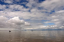
23:Satellite image of Nushagak Bay
261:Dillingham Census Area, Alaska
1:
340:
246:
31:Packrafts in Nushagak Bay
16:Bay in the United States
324:Alaska geography stubs
230:58.62222°N 158.59111°W
202:Photos from the Region
126:
47:
32:
24:
124:
38:
30:
22:
235:58.62222; -158.59111
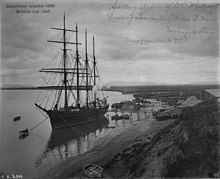
46:, Nushagak Bay, 1900
226: /
127:
48:
33:
25:
276:
275:
331:
297:
290:
283:
255:
248:
241:
240:
238:
237:
236:
231:
227:
224:
223:
222:
219:
189:
183:
178:
105:Alaska Peninsula
86:
85:
82:
81:
78:
75:
72:
69:
66:
63:
60:
339:
338:
334:
333:
332:
330:
329:
328:
304:
303:
302:
301:
244:
234:
232:
228:
225:
220:
217:
215:
213:
212:
198:
193:
192:
181:
179:
175:
170:
57:
53:
17:
12:
11:
5:
337:
335:
327:
326:
321:
316:
314:Bays of Alaska
306:
305:
300:
299:
292:
285:
277:
274:
273:
256:
210:
209:
204:
197:
196:External links
194:
191:
190:
172:
171:
169:
166:
150:Nushagak River
143:Nushagak River
116:sockeye salmon
95:. It opens to
44:Willie R. Hume
15:
13:
10:
9:
6:
4:
3:
2:
336:
325:
322:
320:
317:
315:
312:
311:
309:
298:
293:
291:
286:
284:
279:
278:
272:
270:
266:
262:
257:
254:
250:
245:
242:
239:
208:
205:
203:
200:
199:
195:
188:
184:
177:
174:
167:
165:
163:
159:
155:
151:
146:
144:
141:, one of the
140:
139:Koktuli River
136:
131:
123:
119:
117:
113:
108:
106:
103:north of the
102:
98:
94:
90:
84:
52:
45:
42:
37:
29:
21:
269:expanding it
258:
243:
211:
176:
147:
132:
128:
109:
51:Nushagak Bay
50:
49:
43:
233: /
221:158°35′28″W
135:Pebble Mine
118:fisheries.
97:Bristol Bay
308:Categories
218:58°37′20″N
168:References
112:Dillingham
101:Bering Sea
89:U.S. state
41:barkentine
164:rivers.
187:YouTube
158:Igushik
160:, and
93:Alaska
263:is a
162:Snake
265:stub
154:Wood
185:on
91:of
310::
156:,
107:.
65:uː
296:e
289:t
282:v
271:.
83:/
80:k
77:æ
74:ɡ
71:ɪ
68:ʃ
62:n
59:ˈ
56:/
Text is available under the Creative Commons Attribution-ShareAlike License. Additional terms may apply.