52:
492:
426:
392:
39:
534:
749:
59:
459:
Robert McLean, The New atlas of
Australia : the complete work containing over one hundred maps and full descriptive geography of New South Wales, Victoria, Queensland, South Australia and Western Australia, together with numerous illustrations and copious indices (Sydney :J. Sands, [1886) Map
522:
500:
793:
228:
216:
515:
51:
350:. It is located northwest of the current locality of Nanima in the Murrumbateman area, although there is also a Murrumbateman parish that lies further north.
832:
478:
412:
343:
188:
508:
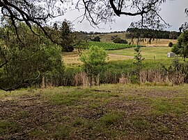
786:
730:
164:
822:
779:
89:
812:
200:
370:
347:
221:
193:
827:
817:
623:
470:
404:
288:
283:
176:
82:
718:
708:
638:
261:
256:
678:
653:
648:
668:
597:
587:
703:
683:
633:
209:
673:
613:
592:
293:
643:
438:
374:
333:
205:
133:
125:
557:
339:
155:
756:
538:
313:
181:
169:
618:
233:
38:
491:
425:
542:
533:
391:
317:
29:
763:
806:
582:
321:
268:
251:
748:
693:
698:
104:
91:
759:
713:
663:
628:
577:
562:
329:
325:
276:
149:
567:
572:
320:, Australia. It lies on both sides of the Murrumbateman Road between
658:
504:
767:
606:
550:
227:
215:
199:
187:
175:
163:
142:
132:
120:
81:
23:
240:
787:
516:
8:
479:Geographical Names Board of New South Wales
413:Geographical Names Board of New South Wales
794:
780:
523:
509:
501:
490:
424:
390:
37:
20:
731:Local government areas of New South Wales
475:Geographical Names Register (GNR) of NSW
409:Geographical Names Register (GNR) of NSW
365:
363:
359:
281:
266:
249:
242:
7:
745:
743:
833:Southern Tablelands geography stubs
18:Town in New South Wales, Australia
14:
747:
532:
57:
50:
371:Australian Bureau of Statistics
336:, it had a population of 252.
154:31 km (19 mi) SE of
58:
1:
823:Localities in New South Wales
148:37 km (23 mi) N of
766:. You can help Knowledge by
328:, about 37 km north of
551:Towns and residential areas
72:Location in New South Wales
849:
742:
727:
299:
245:Localities around Nanima:
243:
239:
45:
36:
813:Towns in New South Wales
379:2021 Census QuickStats
105:35.00889°S 149.12944°E
312:is a locality in the
156:Yass, New South Wales
110:-35.00889; 149.12944
828:Southern Tablelands
818:Yass Valley Council
757:Southern Tablelands
539:Yass Valley Council
314:Yass Valley Council
229:Federal division(s)
217:State electorate(s)
182:Southern Tablelands
170:Yass Valley Council
101: /
775:
774:
737:
736:
307:
306:
303:
302:
840:
796:
789:
782:
751:
744:
619:Bellmount Forest
537:
536:
525:
518:
511:
502:
495:
494:
489:
487:
485:
467:
461:
457:
451:
450:
448:
446:
435:
429:
428:
423:
421:
419:
401:
395:
394:
389:
387:
385:
373:(28 June 2022).
367:
241:
116:
115:
113:
112:
111:
106:
102:
99:
98:
97:
94:
61:
60:
54:
41:
32:
26:
21:
848:
847:
843:
842:
841:
839:
838:
837:
803:
802:
801:
800:
740:
738:
733:
723:
602:
546:
543:New South Wales
531:
529:
499:
498:
483:
481:
469:
468:
464:
458:
454:
444:
442:
441:. OpenStreetMap
437:
436:
432:
417:
415:
403:
402:
398:
383:
381:
369:
368:
361:
356:
318:New South Wales
109:
107:
103:
100:
95:
92:
90:
88:
87:
77:
76:
75:
74:
73:
69:
68:
67:
66:
62:
30:New South Wales
28:
27:
24:
19:
12:
11:
5:
846:
844:
836:
835:
830:
825:
820:
815:
805:
804:
799:
798:
791:
784:
776:
773:
772:
752:
735:
734:
729:Main Article:
728:
725:
724:
722:
721:
716:
711:
706:
701:
696:
691:
686:
681:
676:
671:
666:
661:
656:
651:
646:
641:
636:
631:
626:
621:
616:
610:
608:
604:
603:
601:
600:
595:
590:
585:
580:
575:
570:
565:
560:
554:
552:
548:
547:
530:
528:
527:
520:
513:
505:
497:
496:
462:
452:
430:
396:
358:
357:
355:
352:
305:
304:
301:
300:
297:
296:
291:
286:
280:
279:
274:
271:
265:
264:
259:
254:
248:
247:
237:
236:
231:
225:
224:
219:
213:
212:
203:
197:
196:
191:
185:
184:
179:
173:
172:
167:
161:
160:
159:
158:
152:
144:
140:
139:
136:
130:
129:
122:
118:
117:
85:
79:
78:
71:
70:
64:
63:
56:
55:
49:
48:
47:
46:
43:
42:
34:
33:
17:
13:
10:
9:
6:
4:
3:
2:
845:
834:
831:
829:
826:
824:
821:
819:
816:
814:
811:
810:
808:
797:
792:
790:
785:
783:
778:
777:
771:
769:
765:
762:article is a
761:
758:
753:
750:
746:
741:
732:
726:
720:
717:
715:
712:
710:
707:
705:
702:
700:
697:
695:
692:
690:
687:
685:
682:
680:
677:
675:
672:
670:
667:
665:
662:
660:
657:
655:
652:
650:
647:
645:
642:
640:
637:
635:
632:
630:
627:
625:
622:
620:
617:
615:
612:
611:
609:
605:
599:
596:
594:
591:
589:
586:
584:
583:Murrumbateman
581:
579:
576:
574:
571:
569:
566:
564:
561:
559:
556:
555:
553:
549:
544:
540:
535:
526:
521:
519:
514:
512:
507:
506:
503:
493:
480:
476:
472:
466:
463:
456:
453:
440:
434:
431:
427:
414:
410:
406:
400:
397:
393:
380:
376:
372:
366:
364:
360:
353:
351:
349:
348:Murray County
345:
341:
337:
335:
331:
327:
323:
322:Murrumbateman
319:
315:
311:
298:
295:
292:
290:
287:
285:
282:
278:
275:
272:
270:
269:Murrumbateman
267:
263:
260:
258:
255:
253:
252:Murrumbateman
250:
246:
238:
235:
232:
230:
226:
223:
220:
218:
214:
211:
207:
204:
202:
198:
195:
192:
190:
186:
183:
180:
178:
174:
171:
168:
166:
162:
157:
153:
151:
147:
146:
145:
141:
137:
135:
131:
127:
123:
119:
114:
86:
84:
80:
53:
44:
40:
35:
31:
22:
16:
768:expanding it
754:
739:
694:Narrangullen
688:
482:. Retrieved
474:
465:
455:
443:. Retrieved
433:
416:. Retrieved
408:
399:
382:. Retrieved
378:
344:civil parish
338:
309:
308:
244:
15:
699:Springrange
624:Brindabella
545:, Australia
334:2021 census
289:Springrange
284:Springrange
134:Postcode(s)
126:2021 census
108: /
96:149°07′46″E
83:Coordinates
807:Categories
719:Yass River
709:Wee Jasper
669:Laverstock
639:Burrinjuck
607:Localities
354:References
342:is also a
262:Yass River
257:Yass River
124:252 (
121:Population
93:35°00′32″S
760:geography
714:Woolgarlo
679:Marchmont
654:Good Hope
649:Collector
484:1 January
418:1 January
384:1 January
332:. At the
210:Bedulluck
664:Kangiara
629:Boambolo
598:Wallaroo
588:Parkwood
578:Gundaroo
563:Binalong
471:"Nanima"
445:17 April
439:"Nanima"
405:"Nanima"
375:"Nanima"
330:Canberra
326:Gundaroo
277:Gundaroo
222:Goulburn
150:Canberra
143:Location
704:Uriarra
684:Mullion
634:Bookham
568:Bowning
689:Nanima
674:Manton
593:Sutton
573:Bywong
340:Nanima
316:area,
310:Nanima
294:Sutton
273:Nanima
201:Parish
194:Murray
189:County
177:Region
165:LGA(s)
65:Nanima
25:Nanima
755:This
644:Cavan
614:Bango
206:Toual
764:stub
659:Jeir
558:Yass
486:2022
447:2018
420:2022
386:2023
324:and
234:Hume
138:2582
460:11.
346:of
809::
541:,
477:.
473:.
411:.
407:.
377:.
362:^
208:,
795:e
788:t
781:v
770:.
524:e
517:t
510:v
488:.
449:.
422:.
388:.
128:)
Text is available under the Creative Commons Attribution-ShareAlike License. Additional terms may apply.