526:
599:
514:
623:
539:
551:
587:
611:
563:
368:
490:
29:
502:
575:
525:
1465:
378:
The James L. Goodwin State Forest is named for, and occupies land donated by its namesake. James L. Goodwin was one of the first Yale
University School of Forestry graduates and began using modern forest management practices in the northeastern part of Connecticut. He also created and donated the
408:
There are several letterboxes cached along both trails including two official State of
Connecticut Department of Environmental Protection (DEP) letterboxes. One is in Natchaug State Forest on the CCC Trail and the other is in the James L. Goodwin State Forest near Pine Acres Lake close by a
284:. For most of the southern two thirds of the trail's length it follows both Connecticut Route 198 and the Natchaug River through the Natchaug and James L. Goodwin State Forests to the southern end at the James L. Goodwin Conservation Center at the southern end of Pine Acres Lake.
279:
1200 feet south of
Eastford Road in Ashford, Connecticut in northern Natchaug State Forest. After crossing the unpaved Moon Road, the northern third of the trail generally parallels Bigelow Brook until it merges with the Stones and Stills brooks to become the
433:
Much of the trail is close to public roads. There are camping facilities along the trail in the two state forests. Otherwise camping is generally prohibited in the other areas along the trail. There are nearby commercial camping accommodations available on
513:
531:
General Lyon
Cemetery in Eastford, Connecticut. Established circa 1805. Contains the grave and monument for General Nathaniel Lyon (first Union general to die in the US Civil War.) as well as many mid to late 19th century and Civil War casualty
347:
is used as a geographical place name throughout
Eastern Connecticut and particularly in Tolland and Windham counties in Northeastern Connecticut. It was not the name of a native American tribe or group, but of a particular area in Connecticut.
207:
is being (or has been) re-blazed as a blue-white trail named the "Pine Acres Lake View Trail". A CFPA blue-orange blazed trail also intersects with the
Natchaug Trail during the stretch between Pine Acres Lake and Black Spruce Pond.
461:
is a hazard on exposed summits and ledges during thunderstorms. Snow is common in the winter and may necessitate the use of snowshoes. Ice can form on exposed ledges and summits, making hiking dangerous without special equipment.
396:
General
Nathaniel Lyon Memorial in General Lyon Cemetery (established 1805) is located in the Phoenixville section of Eastford just north of the northern end of a portion of General Lyon Road overlaps with the Natchaug Trail.
202:
Two of the several trails inside the James L. Goodwin State Forest are connected to the
Natchaug Trail have recently been blazed as official CFPA trails. According to signs at the James L. Goodwin State Forest the
477:
Almost all of the trail is adjacent to, or is on lands where hunting and the use of firearms are permitted. Wearing bright orange clothing during the hunting season (Fall through
December) is recommended.
622:
538:
3154:
550:
598:
610:
1496:
424:
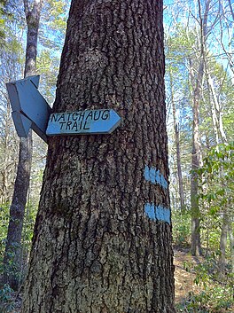
The mainline trail is blazed with blue rectangles. Trail descriptions are available from a number of commercial and non-commercial sources, and a complete guidebook is published by the
3181:
713:
669:
489:
586:
999:
1117:
562:
2840:
1543:
2805:
1576:
1429:
412:
There is a trail register notebook in a can affixed to the northern end of a foot bridge over Stones Brook on the
Natchaug Trail approximately 0.6 mile south of
2360:
501:
409:
three-sided cellar hole where the local legend says that the smell of wood smoke can often still be detected on cold January nights from a long gone chimney.
1548:
1489:
2428:
967:
574:
2067:
2603:
1482:
1110:
425:
318:
139:
2598:
2082:
1634:
1586:
1023:
379:
James L. Goodwin Conservation Center to the state to educate the people of Connecticut regarding "general, wildlife and forest conservation."
3176:
3047:
2147:
1712:
908:
375:
The Natchaug state forest occupies a portion of the former hunting grounds of the Wabbaquasset Indians between the Bigelow and Still Rivers.
2172:
1505:
2911:
2860:
2770:
2413:
1672:
1151:
176:
there are several smaller hiking trails which connect to the Natchaug Trail as well as several park and forest roads and the multi-use
2870:
1525:
1103:
2558:
2483:
519:
Great 4-fireplace chimney is all that is left of General Nathaniel Lyon's birthplace homestead at Nathaniel Lyon Memorial State Park.
2210:
2192:
1772:
1757:
1717:
1571:
1324:
935:
887:
860:
698:
1004:. Vol. II (1818 printing ed.). New Haven, Connecticut: Maltby, Goldsmith & Co. and Samuel Wadsworth. pp. 1–1166.
953:
169:
as well as the much smaller Nathaniel Lyons Memorial Park. Camping permits may be obtained by backpackers for both state forests.
2613:
2568:
990:. Vol. I (1818 printing ed.). New Haven, Connecticut: Maltby, Goldsmith & Co. and Samuel Wadsworth. pp. 1–1166.
1797:
1404:
2618:
2478:
2473:
2443:
2433:
1912:
1837:
1727:
1644:
2643:
2553:
2503:
2453:
2418:
292:
The official Blue-Blazed Natchaug Trail passes through land located within the following municipalities, from south to north:
165:
For much of its length the Natchaug Trail travels through two Connecticut state forests—the James L. Goodwin State Forest and
3196:
2775:
2458:
2438:
2393:
1972:
1667:
1289:
839:
818:
430:
It is regularly maintained, and is considered easy hiking, with very few sections of rugged and moderately difficult hiking.
2623:
2573:
2523:
2518:
2408:
393:
Nathaniel Lyon Memorial State Park contains the birthplace of General Lyon, although only the very large fireplace remains.
2638:
2513:
2508:
2468:
2378:
2368:
1058:
3201:
3191:
3186:
2810:
2563:
2543:
2538:
2423:
2388:
2383:
2225:
1867:
1842:
1752:
1732:
1702:
1018:
664:
96:
3090:
2653:
2593:
2498:
2493:
2448:
3135:
2588:
2548:
2533:
2398:
2205:
2097:
1967:
1942:
1832:
1827:
1677:
1419:
1239:
1161:
413:
2628:
2608:
2583:
2578:
2373:
405:
There are remains of foundations for stone houses, dams and cisterns along both the Natchaug Trail and CCC side trail.
3085:
2780:
2648:
2528:
2403:
2182:
2137:
2037:
1937:
1722:
1349:
192:
135:
50:
2633:
2488:
2463:
3075:
2880:
3130:
2679:
2177:
2167:
2157:
2152:
2112:
2102:
2087:
2062:
2042:
2022:
1927:
1887:
1847:
1807:
1219:
1156:
1066:
1038:
2885:
2330:
2122:
2032:
1982:
1902:
1872:
1857:
1817:
1682:
1657:
1624:
1444:
1269:
1284:
1146:
963:
3065:
2850:
2739:
2270:
2215:
2162:
2117:
2072:
1957:
1907:
1812:
1762:
1535:
1414:
221:
1053:
1043:
735:
3026:
2875:
2815:
2734:
2350:
2310:
2295:
2260:
2245:
2230:
2142:
2107:
2092:
1952:
1917:
1802:
1787:
1697:
1662:
1439:
2825:
3110:
2936:
2890:
2729:
2335:
2320:
2275:
2240:
2200:
2077:
2002:
1997:
1932:
1922:
1882:
1862:
1747:
1737:
1692:
1558:
1224:
1204:
3095:
2916:
2714:
2694:
2674:
2340:
2325:
2280:
2265:
2235:
2127:
2052:
2047:
2012:
1987:
1947:
1897:
1892:
1822:
1767:
1687:
1517:
1379:
1254:
1166:
659:
644:
435:
307:
184:
166:
159:
155:
1334:
1199:
1033:
969:
New England Gazetteer: Containing Descriptions of the States, Counties, Cities and Towns of New England
3125:
3120:
3100:
2689:
2865:
2315:
2305:
2300:
2290:
2255:
2057:
1992:
1707:
1652:
1409:
1359:
1249:
1176:
1171:
325:
and it appears in the 1973 version it would appear to have been created during the 1969-1973 period.
303:
299:
295:
236:
147:
143:
76:
367:
2931:
2835:
2790:
2760:
2724:
2345:
2285:
2250:
2220:
2027:
1962:
1852:
1792:
1742:
1449:
1214:
1194:
28:
3140:
3006:
2961:
2921:
2845:
2765:
2719:
2669:
2132:
2017:
2007:
1977:
1389:
1299:
1141:
639:
387:
177:
123:
1294:
1229:
834:(19 ed.). Rockfall, Connecticut: Connecticut Forest and Park Association. pp. 1–353.
813:(19 ed.). Rockfall, Connecticut: Connecticut Forest and Park Association. pp. 1–261.
2951:
2946:
2895:
2699:
1566:
1314:
1274:
1259:
1189:
995:
981:
931:
904:
883:
879:
872:
856:
835:
814:
694:
467:
105:
457:. Conditions on exposed ridge tops and summits may be harsher during cold or stormy weather.
3021:
2996:
2986:
2941:
1614:
1609:
1604:
1434:
1374:
1344:
1244:
927:
920:
850:
495:
View of Pine Acres Lake looking north from close to the southern start of the Natchaug Trail
256:
3105:
3011:
3001:
2971:
2956:
2926:
2800:
2709:
2684:
1877:
1619:
1599:
1399:
1394:
1384:
1369:
1364:
1309:
1279:
1264:
1209:
1184:
356:
2855:
1028:
749:
724:
130:
trail "system" which meanders through 19.5 miles (31.4 km) of forests in northeast
3115:
3080:
3070:
2976:
2830:
2704:
1319:
788:
654:
383:
281:
903:(1 ed.). Guilford, Connecticut: Appalachian Mountain Club Books. pp. 1–320.
142:. Its southern trailhead begins in the James L. Goodwin State Forest in the towns of
3170:
2981:
2795:
1782:
1777:
1629:
1594:
1339:
1329:
1234:
649:
276:
264:
244:
173:
151:
628:
Natchaug Trail northern trailhead at intersection with Nipmuck Trail in Ashford, CT.
616:
Natchaug Trail northern trailhead at intersection with Nipmuck Trail in Ashford, CT.
3016:
2991:
1424:
1354:
471:
33:
Natchaug Trail northern trailhead at intersection with Nipmuck Trail in Ashford, CT
1474:
985:
829:
808:
2785:
1509:
1130:
898:
454:
131:
80:
54:
1095:
544:
Natchaug Trail sign on Connecticut Route 44. Entrance south to middle sections.
3031:
2820:
1454:
973:
260:
240:
225:
109:
88:
1081:
1068:
2744:
955:
History of the Indians of Connecticut from the earliest known period to 1850
855:(1 ed.). Mechanicsburg, Pennsylvania: Stackpole Books. pp. 1–304.
458:
556:
Natchaug Trail sign on Connecticut Route 44. Entrance to northern sections.
371:
General Nathaniel Lyon gravesite with monument and cannon in Eastford, CT.
761:
229:
568:
Paul Newman's Own Hole In The Wall Gang Camp campsite off Natchaug Trail
507:
View from the southern end of Black Spruce Pond off the Natchaug Trail.
446:
in Chaplin (visible on the western bank of the Natchaug River from the
252:
248:
84:
1039:
State of Connecticut James L. Goodwin State Forest Black and White Map
745:
743:
337:
217:
127:
101:
72:
321:. As it did not appear in the 1969 version of the CFPA Connecticut
1464:
1126:
852:
Hikes in southern New England: Connecticut, Massachusetts, Vermont
580:
Bigelow Brook in Eastford, CT along Natchaug Trail. Looking South.
366:
926:(2 ed.). Guilford, Connecticut: Falcon Publishing. pp.
878:(7 ed.). Guilford, Connecticut: Falcon Publishing. pp.
466:
Biting insects can be bothersome during warm weather. Parasitic
1478:
1099:
3155:
Connecticut Department of Energy and Environmental Protection
1034:
State of Connecticut James L. Goodwin State Forest Color Map
1001:
A Complete History of Connecticut - Civil and Ecclesiastical
987:
A Complete History of Connecticut - Civil and Ecclesiastical
958:. Hartford, Connecticut: Wm. Jas. Hamersley. pp. 1–509.
1029:
State of Connecticut James L. Goodwin State Forest web page
778:
604:
Tall Conifers on both sides of northernmost Natchaug Trail.
243:. Site-specific activities enjoyed along the route include
693:(19th ed.). Connecticut Forest and Park Association.
235:
Portions of the trail are suitable for, and are used for,
150:
and the northern terminus is at its intersection with the
592:
Tree with wood block foot and hand holds at a small pond.
275:
The northern end of the Natchaug Trail connects with the
340:
Native American word meaning "land between the rivers".
714:
List of place names in New England of aboriginal origin
670:
List of place names in New England of aboriginal origin
1054:
Joshua's Tract Conservation and Historic Trust, Inc.
3056:
3040:
2904:
2753:
2662:
2359:
2191:
1643:
1585:
1557:
1534:
1516:
1044:
State of Connecticut Natchaug State Forest web page
870:Keyarts, Eugene (2002). Cindi Dale Pietrzyk (ed.).
95:
68:
60:
46:
38:
21:
919:
871:
317:The Blue-Blazed Natchaug Trail was created by the
191:is a historic loop trail which was built by the
2806:Connecticut Audubon Society Center at Fairfield
3182:Protected areas of Windham County, Connecticut
2841:Joshua's Tract Conservation and Historic Trust
1490:
1111:
355:appears as the name of a trail, road, river,
8:
897:Laubach, Rene; Smith, Charles W. G. (2007).
918:Ostertag, Rhonda; Ostertag, George (2002).
750:James L. Goodwin State Forest DEP Letterbox
386:, the first Union general to die in the US
1497:
1483:
1475:
1118:
1104:
1096:
1024:Town of Mansfield - Schoolhouse Brook Park
874:Short Nature Walks: Connecticut Guide Book
1577:Washington–Rochambeau Revolutionary Route
1430:Washington–Rochambeau Revolutionary Route
946:Books – Connecticut History and Geography
789:Connecticut Forest & Park Association
216:The Natchaug Trail is primarily used for
681:
485:
426:Connecticut Forest and Park Association
319:Connecticut Forest and Park Association
140:Connecticut Forest and Park Association
453:Weather along the route is typical of
18:
3048:List of nature centers in Connecticut
2599:Salmon River Cove and Haddam Neck WMA
2068:Satan's Kingdom State Recreation Area
1059:Joshua's Tract/Tract Trails Walk Book
972:(2 ed.). Boston, Massachusetts:
7:
2173:Windsor Locks Canal State Park Trail
3091:Happy Landings Protected Open Space
2912:American Legion State Forest Trails
2871:Stamford Museum & Nature Center
2771:Audubon Center at Bent of the River
2499:Little River Fish and Wildlife Area
1673:Beckley Furnace Industrial Monument
900:AMC's Best Day Hikes in Connecticut
736:Natchaug State Forest DEP Letterbox
1526:Weir Farm National Historical Park
14:
2579:Roger Tory Peterson Wildlife Area
1572:New England National Scenic Trail
3086:Gurski Farm Protected Open Space
1463:
1019:Town of Mansfield - Trail Guides
621:
609:
597:
585:
573:
561:
549:
537:
524:
512:
500:
488:
444:Nickerson Park Family Campground
27:
3076:Burr Farm Protected Open Space
2881:Weantinoge Heritage Land Trust
2776:Bartlett Arboretum and Gardens
1973:Moosup Valley State Park Trail
1668:Becket Hill State Park Reserve
1049:Land and Conservation trusts:
1:
2811:Connecticut College Arboretum
725:James L. Goodwin State Forest
665:James L. Goodwin State Forest
359:, hospital and state forest.
3177:Hiking trails in Connecticut
3136:Webb Mountain Discovery Zone
1733:Connecticut Valley Railroad
922:Hiking Southern New England
382:There are two memorials to
193:Civilian Conservation Corps
3218:
2559:Quinnipiac River Marsh WMA
2063:Salt Rock State Campground
1848:Hop River State Park Trail
831:Connecticut Walk Book West
810:Connecticut Walk Book East
801:Books – Connecticut Hiking
766:charliebrowncampground.com
691:Connecticut Walk Book West
474:) are a potential hazard.
470:(which are known to carry
390:along the Natchaug Trail.
138:. It is maintained by the
42:19.5 miles (31.4 km)
3149:
3066:Bear Mountain Reservation
2886:White Memorial Foundation
2740:West Pequonnock Reservoir
2361:Wildlife Management Areas
1778:Fort Griswold Battlefield
1536:National Wildlife Refuges
1461:
1205:Farmington Canal Heritage
1137:
791:Cited September 13, 2008.
26:
2851:New Canaan Nature Center
952:De Forest, John (1853).
849:Emblidge, David (1998).
440:Charlie Brown Campground
3027:Whitestone Cliffs Trail
2735:West Hartford Reservoir
2614:Skiff Mountain Coop WMA
2569:Raymond Brook Marsh WMA
1918:Larkin State Park Trail
828:Colson, Ann T. (2006).
807:Colson, Ann T. (2005).
689:Colson, Ann T. (2006).
2937:Housatonic Range Trail
2891:Woodcock Nature Center
2876:Steep Rock Association
2484:King's Island Coop WMA
2429:Charles E. Wheeler WMA
1738:Dart Island State Park
1587:Wild and Scenic Rivers
372:
64:CFPA Blue-Blazed Trail
3197:Eastford, Connecticut
3096:Lighthouse Point Park
2917:Aspetuck Valley Trail
2861:Pine Mountain Reserve
2826:Great Mountain Forest
2715:Mansfield Hollow Lake
2675:Barkhamsted Reservoir
2619:James V. Spignesi WMA
1798:George Dudley Seymour
1518:National Park Service
1420:Sunny Valley Preserve
660:Natchaug State Forest
645:Connecticut Route 198
436:Connecticut Route 198
370:
308:Eastford, Connecticut
228:, and in the winter,
185:Natchaug State Forest
167:Natchaug State Forest
160:Eastford, Connecticut
156:Natchaug State Forest
3202:Hampton, Connecticut
3192:Chaplin, Connecticut
3187:Ashford, Connecticut
3111:Old Bridge Sanctuary
2866:Saltonstall Mountain
2816:Devil's Den Preserve
2730:Trap Falls Reservoir
2479:Housatonic River WMA
2474:Higganum Meadows WMA
2444:East River Marsh WMA
2434:Cromwell Meadows WMA
2211:Centennial Watershed
1913:Lamentation Mountain
1728:Collis P. Huntington
1410:Still River Greenway
1181:Charter Oak Greenway
442:in Eastford and the
438:, in particular the
414:Connecticut Route 44
313:History and folklore
304:Ashford, Connecticut
300:Chaplin, Connecticut
296:Hampton, Connecticut
237:cross-country skiing
148:Hampton, Connecticut
144:Chaplin, Connecticut
77:cross-country skiing
2932:Hancock Brook Trail
2836:Highstead Arboretum
2791:Branford Land Trust
2761:Aspetuck Land Trust
2725:Saugatuck Reservoir
2644:Wangunk Meadows WMA
2554:Quinebaug River WMA
2454:Eightmile River WMA
2419:Candlewood Hill WMA
2083:Seth Low Pierrepont
1549:Stewart B. McKinney
1195:East Coast Greenway
1147:Alain and May White
1078: /
172:In addition to the
3141:Webb Mountain Park
3007:Salmon River Trail
2962:Narragansett Trail
2922:Blue-Blazed Trails
2846:McLean Game Refuge
2695:Far Mill Reservoir
2670:Aspetuck Reservoir
2604:Sessions Woods WMA
2459:Franklin Swamp WMA
2439:Durham Meadows WMA
2394:Bartlett Brook WMA
2148:Trout Brook Valley
1868:Housatonic Meadows
1843:Higganum Reservoir
1703:Brainard Homestead
1415:Stony Creek Quarry
1270:McLean Game Refuge
1014:Government links:
996:Trumbull, Benjamin
982:Trumbull, Benjamin
640:Blue-Blazed Trails
373:
178:Airline State Park
3164:
3163:
2952:Menunkatuck Trail
2947:Mattabesett Trail
2896:Yale-Myers Forest
2700:Hemlock Reservoir
2624:Stanley Works WMA
2574:Robbins Swamp WMA
2524:Messerschmidt WMA
2519:Menunketesuck WMA
2409:Bishops Swamp WMA
1943:Mashamoquet Brook
1838:Haystack Mountain
1833:Harkness Memorial
1828:Hammonasset Beach
1567:Appalachian Trail
1472:
1471:
1440:Whitestone Cliffs
1082:41.999°N 72.132°W
976:. pp. 1–704.
910:978-1-934028-10-0
357:elementary school
288:Trail communities
115:
114:
3209:
3126:Salt Meadow Park
3121:Roosevelt Forest
3101:Lillinonah Woods
3057:Local Government
3022:Westwoods Trails
2997:Quinnipiac Trail
2987:Paugussett Trail
2942:Lillinonah Trail
2690:Easton Reservoir
2639:Tankerhoosen WMA
2514:Meadow Brook WMA
2509:Maromas Coop WMA
2469:Great Harbor WMA
2379:Babcock Pond WMA
2369:Aldo Leopold WMA
2226:James L. Goodwin
2183:Wooster Mountain
2138:Talcott Mountain
2038:Quinnipiac River
1938:Mansfield Hollow
1773:Farmington Canal
1723:Chatfield Hollow
1615:Housatonic River
1610:Green Fall River
1605:Farmington River
1499:
1492:
1485:
1476:
1467:
1225:Housatonic Range
1162:Arthur A. Harris
1120:
1113:
1106:
1097:
1093:
1092:
1090:
1089:
1088:
1083:
1079:
1076:
1075:
1074:
1071:
1005:
991:
977:
959:
941:
925:
914:
893:
877:
866:
845:
824:
781:
776:
770:
769:
758:
752:
747:
738:
733:
727:
722:
716:
711:
705:
704:
686:
625:
613:
601:
589:
577:
565:
553:
541:
528:
516:
504:
492:
257:horseback riding
251:(very limited),
197:Great Depression
55:Connecticut, USA
31:
19:
3217:
3216:
3212:
3211:
3210:
3208:
3207:
3206:
3167:
3166:
3165:
3160:
3145:
3106:Mill River Park
3058:
3052:
3036:
3012:Shenipsit Trail
3002:Regicides Trail
2972:Naugatuck Trail
2957:Metacomet Trail
2927:Chatfield Trail
2900:
2801:Cathedral Pines
2749:
2710:Lake Lillinonah
2685:Candlewood Lake
2680:Beaver Dam Lake
2658:
2564:Ragged Rock WMA
2544:Pease Brook WMA
2539:Nott Island WMA
2504:Lord's Cove WMA
2424:Cedar Swamp WMA
2389:Barn Island WMA
2384:Barber Pond WMA
2355:
2206:American Legion
2187:
2178:Windsor Meadows
2168:Whittemore Glen
2158:West Rock Ridge
2153:Wadsworth Falls
2113:Stillwater Pond
2103:Southford Falls
2088:Sherwood Island
2043:River Highlands
2023:Putnam Memorial
1963:Mohawk Mountain
1928:Macedonia Brook
1888:John A. Minetto
1808:Gillette Castle
1753:Devil's Hopyard
1639:
1620:Pawcatuck River
1600:Eightmile River
1581:
1559:National Trails
1553:
1544:Silvio O. Conte
1530:
1512:
1506:Protected areas
1503:
1473:
1468:
1459:
1380:Ragged Mountain
1255:Macedonia Brook
1167:Aspetuck Valley
1152:American Legion
1133:
1124:
1087:41.999; -72.132
1086:
1084:
1080:
1077:
1072:
1069:
1067:
1065:
1064:
1012:
994:
980:
962:
951:
938:
917:
911:
896:
890:
869:
863:
848:
842:
827:
821:
806:
798:
796:Further reading
785:
784:
777:
773:
760:
759:
755:
748:
741:
734:
730:
723:
719:
712:
708:
701:
688:
687:
683:
678:
636:
629:
626:
617:
614:
605:
602:
593:
590:
581:
578:
569:
566:
557:
554:
545:
542:
533:
529:
520:
517:
508:
505:
496:
493:
484:
465:
422:
403:
365:
351:Today the name
331:
329:Origin and name
315:
290:
273:
214:
34:
17:
12:
11:
5:
3215:
3213:
3205:
3204:
3199:
3194:
3189:
3184:
3179:
3169:
3168:
3162:
3161:
3159:
3158:
3150:
3147:
3146:
3144:
3143:
3138:
3133:
3128:
3123:
3118:
3116:Pleasure Beach
3113:
3108:
3103:
3098:
3093:
3088:
3083:
3081:East Rock Park
3078:
3073:
3071:Beardsley Park
3068:
3062:
3060:
3054:
3053:
3051:
3050:
3044:
3042:
3041:Nature centers
3038:
3037:
3035:
3034:
3029:
3024:
3019:
3014:
3009:
3004:
2999:
2994:
2989:
2984:
2979:
2977:Nehantic Trail
2974:
2969:
2967:Natchaug Trail
2964:
2959:
2954:
2949:
2944:
2939:
2934:
2929:
2924:
2919:
2914:
2908:
2906:
2902:
2901:
2899:
2898:
2893:
2888:
2883:
2878:
2873:
2868:
2863:
2858:
2853:
2848:
2843:
2838:
2833:
2831:Higby Mountain
2828:
2823:
2818:
2813:
2808:
2803:
2798:
2793:
2788:
2783:
2778:
2773:
2768:
2763:
2757:
2755:
2751:
2750:
2748:
2747:
2742:
2737:
2732:
2727:
2722:
2717:
2712:
2707:
2705:Hop Brook Lake
2702:
2697:
2692:
2687:
2682:
2677:
2672:
2666:
2664:
2660:
2659:
2657:
2656:
2654:Zemko Pond WMA
2651:
2646:
2641:
2636:
2631:
2626:
2621:
2616:
2611:
2606:
2601:
2596:
2594:Ross Marsh WMA
2591:
2586:
2581:
2576:
2571:
2566:
2561:
2556:
2551:
2546:
2541:
2536:
2531:
2526:
2521:
2516:
2511:
2506:
2501:
2496:
2494:Larson Lot WMA
2491:
2486:
2481:
2476:
2471:
2466:
2461:
2456:
2451:
2449:East Swamp WMA
2446:
2441:
2436:
2431:
2426:
2421:
2416:
2414:Black Pond WMA
2411:
2406:
2401:
2396:
2391:
2386:
2381:
2376:
2371:
2365:
2363:
2357:
2356:
2354:
2353:
2348:
2343:
2338:
2333:
2328:
2323:
2318:
2313:
2308:
2303:
2298:
2293:
2288:
2283:
2278:
2273:
2268:
2263:
2258:
2253:
2248:
2243:
2238:
2233:
2228:
2223:
2218:
2213:
2208:
2203:
2197:
2195:
2189:
2188:
2186:
2185:
2180:
2175:
2170:
2165:
2160:
2155:
2150:
2145:
2140:
2135:
2130:
2125:
2123:Stratton Brook
2120:
2115:
2110:
2105:
2100:
2098:Sleeping Giant
2095:
2090:
2085:
2080:
2075:
2070:
2065:
2060:
2055:
2050:
2045:
2040:
2035:
2033:Quinebaug Lake
2030:
2025:
2020:
2015:
2010:
2005:
2000:
1995:
1990:
1985:
1983:Mount Bushnell
1980:
1975:
1970:
1965:
1960:
1955:
1950:
1945:
1940:
1935:
1930:
1925:
1920:
1915:
1910:
1905:
1903:Killingly Pond
1900:
1895:
1890:
1885:
1880:
1875:
1873:Humaston Brook
1870:
1865:
1860:
1858:Hopeville Pond
1855:
1850:
1845:
1840:
1835:
1830:
1825:
1820:
1818:Haddam Meadows
1815:
1810:
1805:
1800:
1795:
1790:
1785:
1780:
1775:
1770:
1765:
1760:
1755:
1750:
1745:
1740:
1735:
1730:
1725:
1720:
1718:Campbell Falls
1715:
1710:
1705:
1700:
1695:
1690:
1685:
1683:Bigelow Hollow
1680:
1678:Bennett's Pond
1675:
1670:
1665:
1660:
1655:
1649:
1647:
1641:
1640:
1638:
1637:
1632:
1627:
1622:
1617:
1612:
1607:
1602:
1597:
1591:
1589:
1583:
1582:
1580:
1579:
1574:
1569:
1563:
1561:
1555:
1554:
1552:
1551:
1546:
1540:
1538:
1532:
1531:
1529:
1528:
1522:
1520:
1514:
1513:
1504:
1502:
1501:
1494:
1487:
1479:
1470:
1469:
1462:
1460:
1458:
1457:
1452:
1447:
1442:
1437:
1432:
1427:
1422:
1417:
1412:
1407:
1405:Sleeping Giant
1402:
1397:
1392:
1387:
1382:
1377:
1372:
1367:
1362:
1357:
1352:
1347:
1342:
1337:
1332:
1327:
1322:
1317:
1312:
1307:
1302:
1297:
1292:
1287:
1282:
1277:
1272:
1267:
1262:
1257:
1252:
1247:
1242:
1237:
1232:
1227:
1222:
1217:
1212:
1207:
1202:
1197:
1192:
1187:
1182:
1179:
1174:
1172:Bigelow Hollow
1169:
1164:
1159:
1154:
1149:
1144:
1138:
1135:
1134:
1125:
1123:
1122:
1115:
1108:
1100:
1062:
1061:
1056:
1047:
1046:
1041:
1036:
1031:
1026:
1021:
1011:
1010:External links
1008:
1007:
1006:
992:
978:
960:
943:
942:
936:
915:
909:
894:
888:
867:
861:
846:
840:
825:
819:
797:
794:
793:
792:
783:
782:
771:
753:
739:
728:
717:
706:
699:
680:
679:
677:
674:
673:
672:
667:
662:
657:
655:Natchaug River
652:
647:
642:
635:
632:
631:
630:
627:
620:
618:
615:
608:
606:
603:
596:
594:
591:
584:
582:
579:
572:
570:
567:
560:
558:
555:
548:
546:
543:
536:
534:
530:
523:
521:
518:
511:
509:
506:
499:
497:
494:
487:
483:
480:
421:
418:
402:
399:
384:Nathaniel Lyon
364:
363:Historic sites
361:
330:
327:
314:
311:
289:
286:
282:Natchaug River
272:
269:
213:
210:
199:in the 1930s.
180:Linear Trail.
136:Windham County
134:—primarily in
119:Natchaug Trail
113:
112:
99:
93:
92:
70:
66:
65:
62:
58:
57:
51:Windham County
48:
44:
43:
40:
36:
35:
32:
24:
23:
22:Natchaug Trail
15:
13:
10:
9:
6:
4:
3:
2:
3214:
3203:
3200:
3198:
3195:
3193:
3190:
3188:
3185:
3183:
3180:
3178:
3175:
3174:
3172:
3157:
3156:
3152:
3151:
3148:
3142:
3139:
3137:
3134:
3132:
3129:
3127:
3124:
3122:
3119:
3117:
3114:
3112:
3109:
3107:
3104:
3102:
3099:
3097:
3094:
3092:
3089:
3087:
3084:
3082:
3079:
3077:
3074:
3072:
3069:
3067:
3064:
3063:
3061:
3055:
3049:
3046:
3045:
3043:
3039:
3033:
3030:
3028:
3025:
3023:
3020:
3018:
3015:
3013:
3010:
3008:
3005:
3003:
3000:
2998:
2995:
2993:
2990:
2988:
2985:
2983:
2982:Nipmuck Trail
2980:
2978:
2975:
2973:
2970:
2968:
2965:
2963:
2960:
2958:
2955:
2953:
2950:
2948:
2945:
2943:
2940:
2938:
2935:
2933:
2930:
2928:
2925:
2923:
2920:
2918:
2915:
2913:
2910:
2909:
2907:
2903:
2897:
2894:
2892:
2889:
2887:
2884:
2882:
2879:
2877:
2874:
2872:
2869:
2867:
2864:
2862:
2859:
2857:
2854:
2852:
2849:
2847:
2844:
2842:
2839:
2837:
2834:
2832:
2829:
2827:
2824:
2822:
2819:
2817:
2814:
2812:
2809:
2807:
2804:
2802:
2799:
2797:
2796:Case Mountain
2794:
2792:
2789:
2787:
2784:
2782:
2781:Bear Mountain
2779:
2777:
2774:
2772:
2769:
2767:
2764:
2762:
2759:
2758:
2756:
2752:
2746:
2743:
2741:
2738:
2736:
2733:
2731:
2728:
2726:
2723:
2721:
2718:
2716:
2713:
2711:
2708:
2706:
2703:
2701:
2698:
2696:
2693:
2691:
2688:
2686:
2683:
2681:
2678:
2676:
2673:
2671:
2668:
2667:
2665:
2661:
2655:
2652:
2650:
2647:
2645:
2642:
2640:
2637:
2635:
2632:
2630:
2627:
2625:
2622:
2620:
2617:
2615:
2612:
2610:
2607:
2605:
2602:
2600:
2597:
2595:
2592:
2590:
2589:Rose Hill WMA
2587:
2585:
2582:
2580:
2577:
2575:
2572:
2570:
2567:
2565:
2562:
2560:
2557:
2555:
2552:
2550:
2549:Plum Bank WMA
2547:
2545:
2542:
2540:
2537:
2535:
2534:Nod Brook WMA
2532:
2530:
2527:
2525:
2522:
2520:
2517:
2515:
2512:
2510:
2507:
2505:
2502:
2500:
2497:
2495:
2492:
2490:
2487:
2485:
2482:
2480:
2477:
2475:
2472:
2470:
2467:
2465:
2462:
2460:
2457:
2455:
2452:
2450:
2447:
2445:
2442:
2440:
2437:
2435:
2432:
2430:
2427:
2425:
2422:
2420:
2417:
2415:
2412:
2410:
2407:
2405:
2402:
2400:
2399:Bear Hill WMA
2397:
2395:
2392:
2390:
2387:
2385:
2382:
2380:
2377:
2375:
2372:
2370:
2367:
2366:
2364:
2362:
2358:
2352:
2349:
2347:
2344:
2342:
2339:
2337:
2334:
2332:
2329:
2327:
2324:
2322:
2319:
2317:
2314:
2312:
2309:
2307:
2304:
2302:
2299:
2297:
2294:
2292:
2289:
2287:
2284:
2282:
2279:
2277:
2274:
2272:
2269:
2267:
2264:
2262:
2259:
2257:
2254:
2252:
2249:
2247:
2244:
2242:
2239:
2237:
2234:
2232:
2229:
2227:
2224:
2222:
2219:
2217:
2214:
2212:
2209:
2207:
2204:
2202:
2199:
2198:
2196:
2194:
2193:State Forests
2190:
2184:
2181:
2179:
2176:
2174:
2171:
2169:
2166:
2164:
2163:Wharton Brook
2161:
2159:
2156:
2154:
2151:
2149:
2146:
2144:
2141:
2139:
2136:
2134:
2131:
2129:
2126:
2124:
2121:
2119:
2118:Stoddard Hill
2116:
2114:
2111:
2109:
2106:
2104:
2101:
2099:
2096:
2094:
2091:
2089:
2086:
2084:
2081:
2079:
2076:
2074:
2073:Scantic River
2071:
2069:
2066:
2064:
2061:
2059:
2056:
2054:
2051:
2049:
2046:
2044:
2041:
2039:
2036:
2034:
2031:
2029:
2026:
2024:
2021:
2019:
2016:
2014:
2011:
2009:
2006:
2004:
2001:
1999:
1996:
1994:
1991:
1989:
1986:
1984:
1981:
1979:
1976:
1974:
1971:
1969:
1966:
1964:
1961:
1959:
1958:Minnie Island
1956:
1954:
1951:
1949:
1946:
1944:
1941:
1939:
1936:
1934:
1931:
1929:
1926:
1924:
1921:
1919:
1916:
1914:
1911:
1909:
1908:Lake Waramaug
1906:
1904:
1901:
1899:
1896:
1894:
1891:
1889:
1886:
1884:
1881:
1879:
1876:
1874:
1871:
1869:
1866:
1864:
1861:
1859:
1856:
1854:
1851:
1849:
1846:
1844:
1841:
1839:
1836:
1834:
1831:
1829:
1826:
1824:
1821:
1819:
1816:
1814:
1813:Haddam Island
1811:
1809:
1806:
1804:
1801:
1799:
1796:
1794:
1791:
1789:
1786:
1784:
1783:Fort Trumbull
1781:
1779:
1776:
1774:
1771:
1769:
1766:
1764:
1763:Eagle Landing
1761:
1759:
1756:
1754:
1751:
1749:
1746:
1744:
1741:
1739:
1736:
1734:
1731:
1729:
1726:
1724:
1721:
1719:
1716:
1714:
1713:Camp Columbia
1711:
1709:
1706:
1704:
1701:
1699:
1696:
1694:
1691:
1689:
1686:
1684:
1681:
1679:
1676:
1674:
1671:
1669:
1666:
1664:
1661:
1659:
1656:
1654:
1651:
1650:
1648:
1646:
1642:
1636:
1633:
1631:
1630:Shunock River
1628:
1626:
1623:
1621:
1618:
1616:
1613:
1611:
1608:
1606:
1603:
1601:
1598:
1596:
1595:Ashaway River
1593:
1592:
1590:
1588:
1584:
1578:
1575:
1573:
1570:
1568:
1565:
1564:
1562:
1560:
1556:
1550:
1547:
1545:
1542:
1541:
1539:
1537:
1533:
1527:
1524:
1523:
1521:
1519:
1515:
1511:
1507:
1500:
1495:
1493:
1488:
1486:
1481:
1480:
1477:
1466:
1456:
1453:
1451:
1448:
1446:
1443:
1441:
1438:
1436:
1433:
1431:
1428:
1426:
1423:
1421:
1418:
1416:
1413:
1411:
1408:
1406:
1403:
1401:
1398:
1396:
1393:
1391:
1388:
1386:
1383:
1381:
1378:
1376:
1373:
1371:
1368:
1366:
1363:
1361:
1358:
1356:
1353:
1351:
1348:
1346:
1343:
1341:
1338:
1336:
1333:
1331:
1328:
1326:
1323:
1321:
1318:
1316:
1313:
1311:
1308:
1306:
1303:
1301:
1298:
1296:
1293:
1291:
1290:Moosup Valley
1288:
1286:
1283:
1281:
1278:
1276:
1273:
1271:
1268:
1266:
1263:
1261:
1258:
1256:
1253:
1251:
1248:
1246:
1243:
1241:
1238:
1236:
1233:
1231:
1228:
1226:
1223:
1221:
1218:
1216:
1215:Hancock Brook
1213:
1211:
1208:
1206:
1203:
1201:
1198:
1196:
1193:
1191:
1188:
1186:
1183:
1180:
1178:
1177:Case Mountain
1175:
1173:
1170:
1168:
1165:
1163:
1160:
1158:
1155:
1153:
1150:
1148:
1145:
1143:
1140:
1139:
1136:
1132:
1128:
1127:Hiking trails
1121:
1116:
1114:
1109:
1107:
1102:
1101:
1098:
1094:
1091:
1060:
1057:
1055:
1052:
1051:
1050:
1045:
1042:
1040:
1037:
1035:
1032:
1030:
1027:
1025:
1022:
1020:
1017:
1016:
1015:
1009:
1003:
1002:
997:
993:
989:
988:
983:
979:
975:
971:
970:
965:
964:Hayward, John
961:
957:
956:
950:
949:
948:
947:
939:
937:0-7627-2246-0
933:
929:
924:
923:
916:
912:
906:
902:
901:
895:
891:
889:0-7627-2310-6
885:
881:
876:
875:
868:
864:
862:0-8117-2669-X
858:
854:
853:
847:
843:
837:
833:
832:
826:
822:
816:
812:
811:
805:
804:
803:
802:
795:
790:
787:
786:
780:
775:
772:
767:
763:
757:
754:
751:
746:
744:
740:
737:
732:
729:
726:
721:
718:
715:
710:
707:
702:
700:0-9619052-6-3
696:
692:
685:
682:
675:
671:
668:
666:
663:
661:
658:
656:
653:
651:
650:Nipmuck Trail
648:
646:
643:
641:
638:
637:
633:
624:
619:
612:
607:
600:
595:
588:
583:
576:
571:
564:
559:
552:
547:
540:
535:
527:
522:
515:
510:
503:
498:
491:
486:
482:Image gallery
481:
479:
475:
473:
469:
463:
460:
456:
451:
450:side trail).
449:
445:
441:
437:
431:
428:
427:
419:
417:
415:
410:
406:
400:
398:
394:
391:
389:
385:
380:
376:
369:
362:
360:
358:
354:
349:
346:
341:
339:
335:
328:
326:
324:
320:
312:
310:
309:
305:
301:
297:
293:
287:
285:
283:
278:
277:Nipmuck Trail
270:
268:
266:
265:rock climbing
262:
258:
254:
250:
246:
245:bird watching
242:
238:
233:
231:
227:
223:
219:
211:
209:
206:
200:
198:
194:
190:
186:
181:
179:
175:
174:Nipmuck Trail
170:
168:
163:
161:
157:
153:
152:Nipmuck Trail
149:
145:
141:
137:
133:
129:
126:
125:
120:
111:
107:
103:
100:
98:
94:
90:
86:
82:
78:
74:
71:
67:
63:
59:
56:
52:
49:
45:
41:
37:
30:
25:
20:
3153:
3131:Seaside Park
3059:Forest/Parks
3017:Tunxis Trail
2992:Pequot Trail
2966:
2856:Peter's Rock
2629:Suffield WMA
2609:Simsbury WMA
2584:Roraback WMA
2374:Assekonk WMA
2331:Salmon River
2143:Tri-Mountain
2108:Squantz Pond
2093:Silver Sands
1953:Millers Pond
1948:Mianus River
1803:George Waldo
1788:Gardner Lake
1698:Bolton Notch
1663:Beaver Brook
1625:Salmon Brook
1390:Salmon River
1304:
1300:Narragansett
1063:
1048:
1013:
1000:
986:
968:
954:
945:
944:
921:
899:
873:
851:
830:
809:
800:
799:
774:
765:
756:
731:
720:
709:
690:
684:
532:gravestones.
476:
472:Lyme disease
464:
452:
447:
443:
439:
432:
429:
423:
411:
407:
404:
395:
392:
381:
377:
374:
352:
350:
344:
342:
333:
332:
322:
316:
294:
291:
274:
234:
215:
204:
201:
196:
188:
182:
171:
164:
122:
118:
116:
16:Hiking trail
2786:Beckley Bog
2766:Aton Forest
2720:Means Brook
2649:Wopowog WMA
2529:Newgate WMA
2404:Belding WMA
2271:Nathan Hale
2216:Cockaponset
2078:Selden Neck
2003:Osbornedale
1998:Old Furnace
1933:Machimoodus
1923:Lovers Leap
1883:Indian Well
1863:Horse Guard
1748:Dennis Hill
1693:Bluff Point
1645:State Parks
1510:Connecticut
1335:Old Furnace
1325:New England
1315:Nayantaquit
1275:Menunkatuck
1260:Mattabesett
1200:Falls Brook
1190:Cockaponset
1157:Appalachian
1131:Connecticut
1085: /
455:Connecticut
267:(limited).
230:snowshoeing
222:backpacking
212:Description
205:White Trail
195:during the
132:Connecticut
124:Blue-Blazed
81:snowshoeing
61:Designation
3171:Categories
3032:Zoar Trail
2821:Earthplace
2663:Reservoirs
2634:Talbot WMA
2489:Kollar WMA
2464:Goshen WMA
2351:Wyantenock
2311:Paugussett
2296:Nye-Holman
2261:Nassahegon
2246:Meshomasic
2231:Housatonic
2128:Sunnybrook
2053:Rocky Neck
2048:Rocky Glen
2013:Platt Hill
1988:Mount Riga
1898:Kettletown
1893:Kent Falls
1823:Haley Farm
1768:Farm River
1688:Black Rock
1635:Wood River
1375:Quinnipiac
1345:Paugussett
1245:Lillinonah
1240:Kettletown
1073:72°07′55″W
1070:41°59′56″N
974:Otis Clapp
841:0961905263
820:0961905255
676:References
468:deer ticks
261:bouldering
241:geocaching
226:picnicking
110:poison ivy
106:deer ticks
89:geocaching
2745:Lake Zoar
2336:Shenipsit
2321:Pootatuck
2276:Naugatuck
2241:Mattatuck
2201:Algonquin
2058:Ross Pond
1993:Mount Tom
1968:Mono Pond
1708:Burr Pond
1653:Above All
1435:Westwoods
1400:Shenipsit
1395:Saugatuck
1385:Regicides
1370:Quinebaug
1365:Pomperaug
1360:Pine Knob
1310:Naugatuck
1280:Metacomet
1265:Mattatuck
1250:Lone Pine
1220:Hop River
1185:Chatfield
459:Lightning
388:Civil War
343:The name
323:Walk Book
189:CCC Trail
2341:Topsmead
2326:Quaddick
2316:People's
2281:Nehantic
2266:Natchaug
2236:Massacoe
2028:Quaddick
1853:Hopemead
1793:Gay City
1758:Dinosaur
1743:Day Pond
1658:Air Line
1445:Williams
1320:Nehantic
1305:Natchaug
1210:Gay City
998:(1797).
984:(1797).
966:(1857).
634:See also
401:Folklore
353:Natchaug
345:Natchaug
334:Natchaug
47:Location
2754:Private
2306:Paugnut
2301:Pachaug
2291:Nipmuck
2256:Mohegan
2133:Sunrise
2018:Pomeroy
2008:Penwood
1978:Mooween
1450:Wolcott
1350:Peoples
1340:Pachaug
1330:Nipmuck
1235:Jericho
1142:Airline
253:fishing
249:hunting
102:hunters
97:Hazards
91:, other
85:fishing
2905:Trails
2346:Tunxis
2286:Nepaug
2251:Mohawk
2221:Enders
1425:Tunxis
1355:Pequot
1285:Mohawk
934:
907:
886:
859:
838:
817:
762:"Home"
697:
420:Hiking
338:Nipmuc
218:hiking
128:hiking
73:hiking
39:Length
928:1–336
880:1–192
336:is a
271:Route
121:is a
1878:Hurd
1455:Zoar
1295:Muir
1230:Iron
932:ISBN
905:ISBN
884:ISBN
857:ISBN
836:ISBN
815:ISBN
779:NOAA
695:ISBN
263:and
239:and
187:the
146:and
117:The
1508:of
1129:in
448:CCC
259:,
183:In
158:in
154:in
69:Use
3173::
930:.
882:.
764:.
742:^
416:.
306:,
302:,
298:,
255:,
247:,
232:.
224:,
220:,
162:.
108:,
104:,
87:,
83:,
79:,
75:,
53:,
1498:e
1491:t
1484:v
1119:e
1112:t
1105:v
940:.
913:.
892:.
865:.
844:.
823:.
768:.
703:.
Text is available under the Creative Commons Attribution-ShareAlike License. Additional terms may apply.