164:
29:
171:
235:
One branch of the fire was prevented from spreading westwards before it reached Dry Creek Canyon and the town of
Tridell. Another branch spread north into the Uintah mountains via Uintah Canyon, in land devoid of residential homes.
244:
The cause of the wildfire is currently under investigation. An early report by public safety officials claimed, it was caused by a faulty power line or transformer. However, a later announcement by
201:. It was blamed for three fatalities, the destruction of at least 12 homes, the burning of 43,511 acres (176 km) of land, and led to the evacuation of about 500 local residents.
204:
At its peak the wildfire was fought by more than 700 firefighters, and gained extensive media attention in the United States and limited attention internationally.
282:
444:
74:
429:
287:
258:. But having taken photos of the early fire and offered assistance to contain it they were refused access to the land by a Ute tribal member.
163:
262:
424:
434:
67:
245:
439:
330:
266:
194:
56:
449:
357:
213:
394:
White Rocks residents returning home. Did tribal member stop 2 from putting out blaze in early stages?
381:
270:
225:
369:
261:
As of July 11, 2007, the investigation into the cause of the wildfire was being conducted by the
254:
Witnesses later came forward to state they had seen the nebulous wildfire as they traveled along
229:
358:
Utah wildfire, spreading in national forest, might burn all summer, incident commander says
405:
393:
345:
255:
34:
418:
306:
318:
217:
212:
The fire broke out on Friday, June 29, 2007, at around 9:00 a.m. local time in
28:
89:
76:
221:
224:
tribal land next to state route 121. It proceeded to spread eastward into
406:
Funerals today for Neola fire victims; investigators probe cause of blaze
190:
198:
60:
248:
331:
Interstates closed again for record setting Utah wildfire
152:
144:
139:
131:
123:
118:
110:
105:
66:
52:
42:
21:
8:
216:, north of the unincorporated community of
228:, and threatened the small communities of
18:
341:
339:
170:
299:
307:Quick-Moving Utah Wildfire Kills 3 Men
319:Neola North wildfire contained at 50%
7:
16:2007 wildfire in Utah, United States
445:2007 wildfires in the United States
384:, Guardian Unlimited, July 10, 2007
382:Dozens of Wildfires Ravage the West
33:The Neola North fire raging in the
333:, SignOnSanDiego.com, July 9, 2007
14:
321:, Associated Press, July 4, 2007
169:
162:
27:
430:Features of the Uinta Mountains
263:Federal Bureau of Investigation
37:north of Neola, July 3rd, 2007.
246:Moon Lake Electric Association
1:
346:Killer Utah fire still raging
220:. The source of the fire was
114:43,511 acres (176.08 km)
408:, Deseret News, July 5, 2007
348:, Deseret News, July 1, 2007
232:, Farm Creek, and Paradise.
466:
396:Deseret News, July 2, 2007
372:, USA Today, June 30, 2007
251:Grant Earl disputed this.
360:, USA Today, July 4, 2007
309:, Fox News, June 30, 2007
157:
26:
267:Bureau of Indian Affairs
370:3 dead in Utah wildfire
195:Ashley National Forest
193:which occurred in the
57:Ashley National Forest
425:Duchesne County, Utah
132:Structures destroyed
435:Uintah County, Utah
271:U.S. Forest Service
148:Under Investigation
86: /
440:Wildfires in Utah
183:
182:
457:
409:
403:
397:
391:
385:
379:
373:
367:
361:
355:
349:
343:
334:
328:
322:
316:
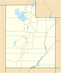
310:
304:
283:Wikinews article
197:in northeastern
187:Neola North Fire
173:
172:
166:
101:
100:
98:
97:
96:
91:
87:
84:
83:
82:
79:
48:
31:
22:Neola North Fire
19:
465:
464:
460:
459:
458:
456:
455:
454:
415:
414:
413:
412:
404:
400:
392:
388:
380:
376:
368:
364:
356:
352:
344:
337:
329:
325:
317:
313:
305:
301:
296:
279:
256:State Route 121
242:
214:Duchesne County
210:
179:
178:
177:
176:
175:
174:
94:
92:
88:
85:
80:
77:
75:
73:
72:
47:June 29, 2007 -
46:
38:
35:Uinta Mountains
17:
12:
11:
5:
463:
461:
453:
452:
447:
442:
437:
432:
427:
417:
416:
411:
410:
398:
386:
374:
362:
350:
335:
323:
311:
298:
297:
295:
292:
291:
290:
288:Utah Fire Info
285:
278:
277:External links
275:
241:
238:
209:
206:
181:
180:
168:
167:
161:
160:
159:
158:
155:
154:
150:
149:
146:
142:
141:
137:
136:
133:
129:
128:
125:
121:
120:
116:
115:
112:
108:
107:
103:
102:
90:40.5°N 110.0°W
70:
64:
63:
54:
50:
49:
44:
40:
39:
32:
24:
23:
15:
13:
10:
9:
6:
4:
3:
2:
462:
451:
448:
446:
443:
441:
438:
436:
433:
431:
428:
426:
423:
422:
420:
407:
402:
399:
395:
390:
387:
383:
378:
375:
371:
366:
363:
359:
354:
351:
347:
342:
340:
336:
332:
327:
324:
320:
315:
312:
308:
303:
300:
293:
289:
286:
284:
281:
280:
276:
274:
272:
268:
264:
259:
257:
252:
250:
247:
239:
237:
233:
231:
227:
226:Uintah County
223:
219:
215:
207:
205:
202:
200:
196:
192:
188:
165:
156:
151:
147:
143:
138:
134:
130:
126:
122:
117:
113:
109:
104:
99:
71:
69:
65:
62:
58:
55:
51:
45:
41:
36:
30:
25:
20:
450:2007 in Utah
401:
389:
377:
365:
353:
326:
314:
302:
260:
253:
243:
234:
211:
203:
189:was a major
186:
184:
95:40.5; -110.0
135:At Least 12
93: /
68:Coordinates
419:Categories
294:References
269:, and the
230:Whiterocks
111:Total area
106:Statistics
208:Outbreak
191:wildfire
140:Ignition
81:110°00′W
53:Location
119:Impacts
78:40°30′N
43:Date(s)
265:, the
124:Deaths
240:Cause
218:Neola
145:Cause
199:Utah
185:The
61:Utah
249:CEO
222:Ute
153:Map
421::
338:^
273:.
59:,
127:3
Text is available under the Creative Commons Attribution-ShareAlike License. Additional terms may apply.