65:
859:
53:
317:
450:
In the CDP the population was spread out, with 20.7% under the age of 18, 10.1% from 18 to 24, 26.7% from 25 to 44, 26.7% from 45 to 64, and 15.9% who were 65 years of age or older. The median age was 40 years. For every 100 females, there were 85.4 males. For every 100 females age 18 and over, there
446:
living together, 10.5% had a female householder with no husband present, and 28.5% were non-families. 25.0% of all households were made up of individuals, and 12.7% had someone living alone who was 65 years of age or older. The average household size was 2.38 and the average family size was 2.85.
430:
of 2000, there were 547 people, 228 households, and 163 families residing in the CDP. The population density was 104.8 inhabitants per square mile (40.5/km). There were 253 housing units at an average density of 48.5 per square mile (18.7/km). The racial makeup of the CDP was 99.63%
64:
1181:
454:
The median income for a household in the CDP was $ 37,368, and the median income for a family was $ 42,292. Males had a median income of $ 31,359 versus $ 14,750 for females. The
1196:
792:
926:
1191:
1186:
946:
921:
961:
149:
616:
911:
554:
78:
272:
936:
931:
956:
951:
648:
597:
966:
941:
916:
470:
New
Washington has a public library, elementary school, middle/high school, and a branch of the Charlestown-Clark County Public Library.
785:
282:
1110:
1080:
487:
223:
1064:
333:
371:, the CDP has a total area of 5.2 square miles (13.5 km), of which 0.02 square miles (0.04 km), or 0.29%, is water.
1095:
1059:
778:
436:
770:
736:
144:
530:
368:
132:
52:
558:
405:
310:
260:
110:
511:
1120:
1024:
976:
848:
824:
442:
There were 229 households, out of which 27.6% had children under the age of 18 living with them, 58.8% were
353:
298:
43:
1151:
1029:
802:
345:
302:
137:
1158:
1100:
1054:
888:
883:
843:
361:
233:
1069:
1044:
1014:
984:
432:
1115:
1039:
1034:
1004:
329:
New
Washington was established in 1815. A post office was established at New Washington in 1819.
664:
1085:
870:
644:
638:
593:
589:
455:
1049:
989:
349:
555:"Geographic Identifiers: 2010 Demographic Profile Data (G001): New Washington CDP, Indiana"
458:
for the CDP was $ 19,343. About 2.3% of families and 8.2% of the population were below the
348:
runs through the center of the community, leading north then east 19 miles (31 km) to
1125:
999:
878:
316:
1105:
903:
893:
1175:
1090:
1074:
582:
265:
512:
U.S. Geological Survey
Geographic Names Information System: New Washington, Indiana
459:
17:
817:
740:
357:
120:
93:
80:
214:
462:, including 18.3% of those under age 18 and 16.9% of those age 65 or over.
1142:‡This populated place also has portions in an adjacent county or counties
443:
248:
640:
United States
Nuclear Regulatory Commission Information Digest 2010-2011
584:
From
Needmore to Prosperity: Hoosier Place Names in Folklore and History
306:
125:
427:
315:
240:
219:
858:
835:
774:
711:
686:
857:
643:. Government Printing Office. August 12, 2011. p. 117.
332:
New
Washington was the closest community to the now-defunct
765:
739:. Charlestown-Clark County Public Library. Archived from
557:. U.S. Census Bureau, American Factfinder. Archived from
526:
344:
New
Washington is located in northeastern Clark County.
69:
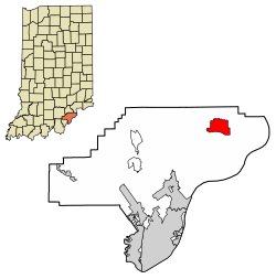
Location of New
Washington in Clark County, Indiana.
1137:
1013:
975:
902:
869:
834:
281:
271:
259:
247:
230:
213:
205:
197:
192:
184:
176:
168:
160:
155:
143:
131:
119:
109:
34:
581:
1182:Census-designated places in Clark County, Indiana
786:
687:"New Washington Elementary School – Mustangs"
549:
547:
8:
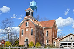
320:Photo from Small Town Indiana photo survey.
793:
779:
771:
378:
31:
1197:1815 establishments in Indiana Territory
862:Map of Indiana highlighting Clark County
479:
352:and southwest 24 miles (39 km) to
270:
246:
212:
191:
183:
154:
108:
73:
61:
49:
507:
505:
398:
521:
519:
280:
258:
229:
204:
196:
175:
167:
159:
142:
130:
118:
7:
1192:Populated places established in 1815
604:This village was laid out in 1815...
588:. Indiana University Press. p.
172:5.21 sq mi (13.49 km)
164:5.22 sq mi (13.52 km)
1187:Census-designated places in Indiana
712:"New Washington Middle High School"
180:0.01 sq mi (0.04 km)
801:Municipalities and communities of
665:"Census of Population and Housing"
388:
25:
716:New Washington Middle High School
580:Baker, Ronald L. (October 1995).
766:New Washington community website
63:
51:
334:Marble Hill Nuclear Power Plant
1:
490:. United States Census Bureau
29:CDP in Indiana, United States
209:114.25/sq mi (44.11/km)
531:United States Census Bureau
488:"2020 U.S. Gazetteer Files"
369:United States Census Bureau
309:, United States. As of the
1213:
619:. Jim Forte Postal History
313:, the population was 566.
1147:
855:
815:
419:
404:
397:
392:
387:
384:
74:
62:
50:
41:
188:715 ft (218 m)
299:census-designated place
36:New Washington, Indiana
863:
321:
861:
804:Clark County, Indiana
527:"U.S. Census website"
420:U.S. Decennial Census
380:Historical population
346:Indiana State Road 62
319:
232: • Summer (
94:38.56556°N 85.54611°W
1160:United States portal
561:on February 12, 2020
362:Louisville, Kentucky
206: • Density
381:
99:38.56556; -85.54611
90: /
864:
691:nwes.gcs.k12.in.us
379:
322:
198: • Total
177: • Water
161: • Total
18:New Washington, IN
1169:
1168:
650:978-0-16-088436-8
599:978-0-253-32866-3
456:per capita income
451:were 79.3 males.
424:
423:
367:According to the
292:
291:
169: • Land
16:(Redirected from
1204:
1161:
1154:
860:
827:
820:
810:
805:
795:
788:
781:
772:
753:
752:
750:
748:
743:on March 4, 2018
733:
727:
726:
724:
722:
708:
702:
701:
699:
697:
683:
677:
676:
674:
672:
661:
655:
654:
635:
629:
628:
626:
624:
613:
607:
606:
587:
577:
571:
570:
568:
566:
551:
542:
541:
539:
537:
523:
514:
509:
500:
499:
497:
495:
484:
437:African American
400:
395:
390:
382:
237:
105:
104:
102:
101:
100:
95:
91:
88:
87:
86:
83:
67:
55:
32:
21:
1212:
1211:
1207:
1206:
1205:
1203:
1202:
1201:
1172:
1171:
1170:
1165:
1159:
1152:
1143:
1133:
1016:
1009:
971:
898:
865:
853:
830:
825:
818:
811:
808:
803:
799:
762:
757:
756:
746:
744:
735:
734:
730:
720:
718:
710:
709:
705:
695:
693:
685:
684:
680:
670:
668:
663:
662:
658:
651:
637:
636:
632:
622:
620:
615:
614:
610:
600:
579:
578:
574:
564:
562:
553:
552:
545:
535:
533:
525:
524:
517:
510:
503:
493:
491:
486:
485:
481:
476:
468:
444:married couples
393:
377:
342:
327:
255:
231:
98:
96:
92:
89:
84:
81:
79:
77:
76:
70:
58:
46:
37:
30:
23:
22:
15:
12:
11:
5:
1210:
1208:
1200:
1199:
1194:
1189:
1184:
1174:
1173:
1167:
1166:
1164:
1163:
1156:
1153:Indiana portal
1148:
1145:
1144:
1141:
1139:
1135:
1134:
1132:
1131:
1128:
1123:
1121:Sunset Village
1118:
1113:
1108:
1103:
1098:
1093:
1088:
1083:
1078:
1072:
1067:
1062:
1057:
1052:
1047:
1042:
1037:
1032:
1027:
1025:Arctic Springs
1021:
1019:
1011:
1010:
1008:
1007:
1002:
997:
995:New Washington
992:
987:
981:
979:
973:
972:
970:
969:
964:
959:
954:
949:
944:
939:
934:
929:
927:Jeffersonville
924:
919:
914:
908:
906:
900:
899:
897:
896:
891:
886:
881:
875:
873:
867:
866:
856:
854:
852:
851:
849:Jeffersonville
846:
840:
838:
832:
831:
826:Jeffersonville
816:
813:
812:
800:
798:
797:
790:
783:
775:
769:
768:
761:
760:External links
758:
755:
754:
728:
703:
678:
656:
649:
630:
617:"Clark County"
608:
598:
572:
543:
515:
501:
478:
477:
475:
472:
467:
464:
422:
421:
417:
416:
413:
411:
408:
402:
401:
396:
391:
386:
376:
373:
354:Jeffersonville
341:
338:
326:
323:
295:New Washington
290:
289:
286:
279:
278:
275:
269:
268:
263:
257:
256:
253:
251:
245:
244:
238:
228:
227:
217:
211:
210:
207:
203:
202:
199:
195:
194:
190:
189:
186:
182:
181:
178:
174:
173:
170:
166:
165:
162:
158:
157:
153:
152:
147:
141:
140:
135:
129:
128:
123:
117:
116:
113:
107:
106:
72:
71:
68:
60:
59:
56:
48:
47:
42:
39:
38:
35:
28:
24:
14:
13:
10:
9:
6:
4:
3:
2:
1209:
1198:
1195:
1193:
1190:
1188:
1185:
1183:
1180:
1179:
1177:
1162:
1157:
1155:
1150:
1149:
1146:
1140:
1136:
1129:
1127:
1124:
1122:
1119:
1117:
1114:
1112:
1109:
1107:
1104:
1102:
1099:
1097:
1094:
1092:
1089:
1087:
1084:
1082:
1079:
1076:
1073:
1071:
1068:
1066:
1063:
1061:
1058:
1056:
1053:
1051:
1048:
1046:
1043:
1041:
1038:
1036:
1033:
1031:
1030:Bennettsville
1028:
1026:
1023:
1022:
1020:
1018:
1012:
1006:
1003:
1001:
998:
996:
993:
991:
988:
986:
983:
982:
980:
978:
974:
968:
965:
963:
960:
958:
955:
953:
950:
948:
945:
943:
940:
938:
935:
933:
930:
928:
925:
923:
920:
918:
915:
913:
910:
909:
907:
905:
901:
895:
892:
890:
887:
885:
882:
880:
877:
876:
874:
872:
868:
850:
847:
845:
842:
841:
839:
837:
833:
829:
828:
821:
814:
809:United States
806:
796:
791:
789:
784:
782:
777:
776:
773:
767:
764:
763:
759:
742:
738:
732:
729:
717:
713:
707:
704:
692:
688:
682:
679:
666:
660:
657:
652:
646:
642:
641:
634:
631:
618:
612:
609:
605:
601:
595:
591:
586:
585:
576:
573:
560:
556:
550:
548:
544:
532:
528:
522:
520:
516:
513:
508:
506:
502:
489:
483:
480:
473:
471:
465:
463:
461:
457:
452:
448:
445:
440:
438:
434:
429:
418:
414:
412:
409:
407:
403:
383:
374:
372:
370:
365:
363:
359:
355:
351:
347:
339:
337:
335:
330:
324:
318:
314:
312:
308:
304:
300:
296:
287:
284:
276:
274:
267:
264:
262:
252:
250:
242:
239:
235:
225:
224:Eastern (EST)
221:
218:
216:
208:
200:
187:
179:
171:
163:
151:
148:
146:
139:
136:
134:
127:
124:
122:
115:United States
114:
112:
103:
75:Coordinates:
66:
57:Former school
54:
45:
40:
33:
27:
19:
994:
947:Silver Creek
823:
745:. Retrieved
741:the original
731:
719:. Retrieved
715:
706:
694:. Retrieved
690:
681:
669:. Retrieved
667:. Census.gov
659:
639:
633:
621:. Retrieved
611:
603:
583:
575:
563:. Retrieved
559:the original
534:. Retrieved
492:. Retrieved
482:
469:
460:poverty line
453:
449:
441:
425:
375:Demographics
366:
343:
331:
328:
303:Clark County
294:
293:
26:
1111:Springville
1101:River Ridge
1055:Cementville
1017:communities
922:Charlestown
889:Sellersburg
884:Clarksville
844:Charlestown
819:County seat
737:"Locations"
721:November 8,
696:November 8,
536:January 31,
356:across the
311:2010 census
97: /
1176:Categories
1081:New Market
1070:Marysville
1045:Broom Hill
985:Henryville
962:Washington
623:August 30,
474:References
435:and 0.37%
426:As of the
358:Ohio River
285:feature ID
193:Population
150:Washington
85:85°32′46″W
82:38°33′56″N
1138:Footnotes
1116:Starlight
1040:Blue Lick
1035:Bethlehem
1005:Underwood
912:Bethlehem
904:Townships
565:August 4,
494:March 16,
466:Education
340:Geography
301:(CDP) in
273:FIPS code
261:Area code
215:Time zone
185:Elevation
1086:Oak Park
1065:Hibernia
747:March 4,
277:18-53820
249:ZIP code
145:Township
1096:Prather
1060:Hamburg
1050:Carwood
990:Memphis
671:June 4,
350:Madison
325:History
307:Indiana
288:2393150
126:Indiana
111:Country
1130:Wilson
1126:Watson
1000:Otisco
937:Oregon
932:Monroe
879:Borden
836:Cities
647:
596:
428:census
385:Census
133:County
1106:Speed
1015:Other
957:Utica
952:Union
894:Utica
871:Towns
433:White
360:from
297:is a
254:47162
243:(EDT)
241:UTC-4
220:UTC-5
138:Clark
121:State
1091:Otto
1075:Nabb
977:CDPs
967:Wood
942:Owen
917:Carr
749:2018
723:2019
698:2019
673:2016
645:ISBN
625:2014
594:ISBN
567:2014
538:2008
496:2022
406:2020
394:Note
389:Pop.
283:GNIS
156:Area
590:242
410:595
266:812
234:DST
201:595
44:CDP
1178::
822::
807:,
714:.
689:.
602:.
592:.
546:^
529:.
518:^
504:^
439:.
399:%±
364:.
336:.
305:,
1077:‡
794:e
787:t
780:v
751:.
725:.
700:.
675:.
653:.
627:.
569:.
540:.
498:.
415:—
236:)
226:)
222:(
20:)
Text is available under the Creative Commons Attribution-ShareAlike License. Additional terms may apply.