54:
652:
42:
375:
The township is governed by a three-member board of trustees, who are elected in
November of odd-numbered years to a four-year term beginning on the following January 1. Two are elected in the year after the presidential election and one is elected in the year before it. There is also an elected
376:
township fiscal officer, who serves a four-year term beginning on April 1 of the year after the election, which is held in
November of the year before the presidential election. Vacancies in the fiscal officership or on the board of trustees are filled by the remaining trustees.
53:
67:
585:
754:
312:
1180:
809:
804:
779:
749:
739:
774:
759:
714:
318:
306:
764:
744:
729:
324:
814:
799:
789:
769:
794:
709:
249:
578:
41:
1012:
907:
259:
1022:
422:
842:
571:
346:
200:
400:
331:
563:
360:
In 1833, Newport
Township contained a meeting house, several brick school houses, two dry goods stores, and a flour mill.
476:
448:
469:
1185:
287:
237:
121:
99:
824:
595:
364:
279:
126:
734:
724:
719:
1157:
1047:
837:
210:
1150:
1037:
867:
342:
1097:
1067:
967:
937:
877:
1132:
942:
681:
537:
1137:
1102:
1057:
1042:
927:
892:
505:
1122:
1072:
1062:
857:
691:
686:
1052:
1002:
932:
887:
701:
663:
641:
617:
275:
32:
1174:
1127:
1082:
1007:
997:
972:
957:
947:
922:
897:
852:
671:
335:
242:
1117:
1087:
1077:
1027:
1017:
992:
982:
977:
952:
917:
882:
832:
676:
636:
499:
1092:
1032:
902:
628:
610:
1112:
1107:
987:
962:
912:
847:
299:
109:
82:
69:
191:
367:
in
Newport Township is listed on the National Register of Historic Places.
225:
558:
533:
529:
525:
423:"Newport township, Washington County, Ohio - Census Bureau Profile"
651:
217:
196:
341:
No municipalities are located in
Newport Township, although the
283:
114:
567:
553:
650:
396:
444:
298:
Located in the southeastern part of the county along the
866:
823:
700:
662:
627:
258:
248:
236:
224:
207:
190:
182:
174:
169:
161:
153:
145:
137:
132:
120:
108:
98:
23:
501:The Ohio Gazetteer, or, a Topographical Dictionary
58:Location of Newport Township in Washington County
579:
338:lies across the Ohio River to the southeast.
8:
357:It is the only Newport Township statewide.
655:Map of Ohio highlighting Washington County
586:
572:
564:
349:lies on the township's eastern shoreline.
20:
25:Newport Township, Washington County, Ohio
46:The Hildreth Bridge, a township landmark
385:
247:
223:
189:
168:
160:
131:
97:
62:
50:
38:
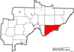
302:, it borders the following townships:
391:
389:
257:
235:
206:
181:
173:
152:
144:
136:
119:
107:
7:
1181:Townships in Washington County, Ohio
290:found 1,901 people in the township.
149:35.5 sq mi (92.0 km)
141:35.7 sq mi (92.4 km)
594:Municipalities and communities of
14:
157:0.1 sq mi (0.3 km)
52:
40:
401:United States Geological Survey
18:Township in Ohio, United States
397:"US Board on Geographic Names"
1:
504:. Scott and Wright. pp.
425:. United States Census Bureau
559:Newport, OH History Website
477:United States Census Bureau
449:United States Census Bureau
1202:
1146:
648:
608:
274:is one of the twenty-two
186:53.5/sq mi (20.7/km)
63:
51:
39:
30:
343:unincorporated community
165:994 ft (303 m)
597:Washington County, Ohio
498:Kilbourn, John (1833).
365:Hildreth Covered Bridge
656:
470:"Detailed map of Ohio"
286:, United States. The
654:
540:. Accessed 4/30/2009.
445:"U.S. Census website"
313:Independence Township
209: • Summer (
83:39.39667°N 81.27361°W
1159:United States portal
183: • Density
88:39.39667; -81.27361
79: /
657:
403:. October 25, 2007
327:- northwest corner
175: • Total
154: • Water
138: • Total
1186:Townships in Ohio
1168:
1167:
538:Ohio Revised Code
319:Marietta Township
307:Lawrence Township
280:Washington County
269:
268:
146: • Land
1193:
1160:
1153:
653:
620:
613:
603:
598:
588:
581:
574:
565:
541:
523:
517:
516:
514:
512:
495:
489:
488:
486:
484:
474:
466:
460:
459:
457:
455:
441:
435:
434:
432:
430:
419:
413:
412:
410:
408:
393:
353:Name and history
332:Pleasants County
325:Fearing Township
272:Newport Township
214:
94:
93:
91:
90:
89:
84:
80:
77:
76:
75:
72:
56:
44:
21:
1201:
1200:
1196:
1195:
1194:
1192:
1191:
1190:
1171:
1170:
1169:
1164:
1158:
1151:
1142:
869:
862:
819:
696:
658:
646:
623:
618:
611:
604:
601:
596:
592:
550:
545:
544:
524:
520:
510:
508:
497:
496:
492:
482:
480:
472:
468:
467:
463:
453:
451:
443:
442:
438:
428:
426:
421:
420:
416:
406:
404:
395:
394:
387:
382:
373:
355:
296:
232:
208:
87:
85:
81:
78:
73:
70:
68:
66:
65:
59:
47:
35:
26:
19:
12:
11:
5:
1199:
1197:
1189:
1188:
1183:
1173:
1172:
1166:
1165:
1163:
1162:
1155:
1147:
1144:
1143:
1141:
1140:
1135:
1130:
1125:
1120:
1115:
1110:
1105:
1100:
1095:
1090:
1085:
1080:
1075:
1070:
1065:
1060:
1055:
1050:
1048:Moore Junction
1045:
1040:
1035:
1030:
1025:
1020:
1015:
1010:
1005:
1000:
995:
990:
985:
980:
975:
970:
965:
960:
955:
950:
945:
940:
935:
930:
925:
920:
915:
910:
905:
900:
895:
890:
885:
880:
874:
872:
868:Unincorporated
864:
863:
861:
860:
855:
850:
845:
840:
838:Little Hocking
835:
829:
827:
821:
820:
818:
817:
812:
807:
802:
797:
792:
787:
782:
777:
772:
767:
762:
757:
752:
747:
742:
737:
732:
727:
722:
717:
712:
706:
704:
698:
697:
695:
694:
689:
684:
679:
674:
668:
666:
660:
659:
649:
647:
645:
644:
639:
633:
631:
625:
624:
609:
606:
605:
593:
591:
590:
583:
576:
568:
562:
561:
556:
554:County website
549:
548:External links
546:
543:
542:
518:
490:
461:
436:
414:
384:
383:
381:
378:
372:
369:
354:
351:
329:
328:
322:
316:
310:
295:
292:
267:
266:
263:
256:
255:
252:
246:
245:
240:
234:
233:
230:
228:
222:
221:
215:
205:
204:
194:
188:
187:
184:
180:
179:
176:
172:
171:
167:
166:
163:
159:
158:
155:
151:
150:
147:
143:
142:
139:
135:
134:
130:
129:
124:
118:
117:
112:
106:
105:
102:
96:
95:
61:
60:
57:
49:
48:
45:
37:
36:
31:
28:
27:
24:
17:
13:
10:
9:
6:
4:
3:
2:
1198:
1187:
1184:
1182:
1179:
1178:
1176:
1161:
1156:
1154:
1149:
1148:
1145:
1139:
1136:
1134:
1131:
1129:
1126:
1124:
1121:
1119:
1116:
1114:
1111:
1109:
1106:
1104:
1101:
1099:
1096:
1094:
1091:
1089:
1086:
1084:
1081:
1079:
1076:
1074:
1071:
1069:
1066:
1064:
1061:
1059:
1056:
1054:
1051:
1049:
1046:
1044:
1041:
1039:
1038:Lower Newport
1036:
1034:
1031:
1029:
1026:
1024:
1021:
1019:
1016:
1014:
1011:
1009:
1006:
1004:
1001:
999:
996:
994:
991:
989:
986:
984:
981:
979:
976:
974:
971:
969:
966:
964:
961:
959:
956:
954:
951:
949:
946:
944:
941:
939:
936:
934:
931:
929:
926:
924:
921:
919:
916:
914:
911:
909:
906:
904:
901:
899:
896:
894:
891:
889:
886:
884:
881:
879:
876:
875:
873:
871:
865:
859:
856:
854:
851:
849:
846:
844:
841:
839:
836:
834:
831:
830:
828:
826:
822:
816:
813:
811:
808:
806:
803:
801:
798:
796:
793:
791:
788:
786:
783:
781:
778:
776:
773:
771:
768:
766:
763:
761:
758:
756:
753:
751:
748:
746:
743:
741:
738:
736:
733:
731:
728:
726:
723:
721:
718:
716:
713:
711:
708:
707:
705:
703:
699:
693:
690:
688:
685:
683:
680:
678:
675:
673:
670:
669:
667:
665:
661:
643:
640:
638:
635:
634:
632:
630:
626:
622:
621:
614:
607:
602:United States
599:
589:
584:
582:
577:
575:
570:
569:
566:
560:
557:
555:
552:
551:
547:
539:
535:
531:
527:
522:
519:
507:
503:
502:
494:
491:
478:
471:
465:
462:
450:
446:
440:
437:
424:
418:
415:
402:
398:
392:
390:
386:
379:
377:
370:
368:
366:
361:
358:
352:
350:
348:
344:
339:
337:
336:West Virginia
333:
326:
323:
320:
317:
314:
311:
308:
305:
304:
303:
301:
293:
291:
289:
285:
281:
277:
273:
264:
261:
253:
251:
244:
241:
239:
229:
227:
219:
216:
212:
202:
201:Eastern (EST)
198:
195:
193:
185:
177:
164:
156:
148:
140:
128:
125:
123:
116:
113:
111:
104:United States
103:
101:
92:
64:Coordinates:
55:
43:
34:
29:
22:
16:
1098:Stanleyville
1068:Patten Mills
968:Decaturville
938:Constitution
878:Archers Fork
784:
755:Independence
616:
521:
511:December 12,
509:. Retrieved
500:
493:
483:February 16,
481:. Retrieved
464:
452:. Retrieved
439:
429:September 8,
427:. Retrieved
417:
405:. Retrieved
374:
362:
359:
356:
340:
330:
297:
271:
270:
15:
1152:Ohio portal
1133:Wingett Run
943:Cornerville
870:communities
682:Lower Salem
612:County seat
454:January 31,
407:January 31,
315:- northeast
288:2020 census
86: /
1175:Categories
1138:Yankeeburg
1103:Tick Ridge
1058:Newell Run
1043:Luke Chute
1013:Germantown
928:Churchtown
908:Bloomfield
893:Beavertown
380:References
371:Government
300:Ohio River
262:feature ID
170:Population
127:Washington
74:81°16′25″W
71:39°23′48″N
1123:Watertown
1073:Pinehurst
1063:Oak Grove
1023:Grandview
858:Waterford
810:Watertown
805:Waterford
780:Muskingum
750:Grandview
740:Fairfield
702:Townships
692:Matamoras
687:Macksburg
294:Geography
276:townships
250:FIPS code
238:Area code
192:Time zone
162:Elevation
1053:Moss Run
1003:Fillmore
933:Coal Run
888:Bartlett
775:Marietta
760:Lawrence
715:Aurelius
664:Villages
642:Marietta
619:Marietta
254:39-55356
226:ZIP code
33:Township
1128:Whipple
1083:Rainbow
1008:Fleming
998:Fifteen
973:Deucher
958:Dalzell
948:Cow Run
923:Caywood
898:Beckett
853:Vincent
843:Newport
785:Newport
765:Liberty
745:Fearing
730:Decatur
672:Beverly
536:of the
534:§507.01
530:§505.01
526:§503.24
347:Newport
309:- north
265:1087141
100:Country
1118:Warner
1088:Relief
1078:Qualey
1028:Layman
1018:Gracey
993:Equity
983:Dunham
978:Dunbar
953:Cutler
918:Briggs
883:Barlow
833:Devola
815:Wesley
800:Warren
790:Palmer
770:Ludlow
735:Dunham
725:Belpre
720:Barlow
677:Lowell
637:Belpre
629:Cities
532:, and
479:. 2000
321:- west
122:County
1093:Sitka
1033:Leith
903:Bevan
795:Salem
710:Adams
473:(PDF)
231:45768
220:(EDT)
218:UTC-4
197:UTC-5
178:1,901
110:State
1113:Wade
1108:Veto
988:Elba
963:Dart
913:Bonn
848:Reno
825:CDPs
513:2013
485:2007
456:2008
431:2023
409:2008
363:The
284:Ohio
260:GNIS
133:Area
115:Ohio
506:344
345:of
278:of
243:740
211:DST
1177::
615::
600:,
528:,
475:.
447:.
399:.
388:^
334:,
282:,
587:e
580:t
573:v
515:.
487:.
458:.
433:.
411:.
213:)
203:)
199:(
Text is available under the Creative Commons Attribution-ShareAlike License. Additional terms may apply.