79:
51:
86:
58:
207:
34:
345:
completely independent of outside control. Yoshishige's armed retainers continually expanded the borders of his estate at the expense of his weaker neighbors, and his descendants took the surname of "Nitta" after the name of the manor.
78:
420:
499:
134:
50:
341:
Fujiwara no
Tadamasa, and accepted the title of "steward". This had the effect of converting the estate into an autonomous tax-free
504:
361:, a branch of the Nitta clan continued to rule parts of the territory under the surname of "Iwamatsu" until they sided against
468:
444:
388:
366:
494:
330:
306:
298:
286:
266:
289:
obtained rights to a large territory in Kōzuke
Province which had been devastated by the eruption of
206:
333:
nominally donated this estate to the
Buddhist temple of Kongoshin-in which had been established by
326:
302:
362:
358:
274:
262:
196:
238:
33:
258:
354:
310:
250:
242:
350:
122:
396:
318:
488:
322:
314:
270:
109:
269:. In the year 2000, eleven sites connected with the Nitta-no-shō within the city of
334:
246:
234:
174:
476:
440:
290:
294:
254:
325:. Yoshikuni had already laid claim to a similar vast estate, Ashikaga-shō in
149:
136:
372:
The eleven sites covered under the
National Historic Site designation are:
229:
313:. In modern terms, this corresponds to all of the area of the cities of
205:
112:
338:
329:
in 1142. In 1157, Yoshikuni, together with this son
185:
180:
170:
165:
128:
118:
105:
220:
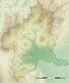
293:. This territory was on the left bank of the
8:
19:
32:
18:
297:and extended for the entirety of ancient
227:, also known as Nitta-no-shō, was a vast
257:, which played an important role in the
432:
421:List of Historic Sites of Japan (Gunma)
309:, and a portion of Hanzawa County in
7:
253:. It was the home territory of the
233:, or landed estate dating the from
85:
57:
14:
401:Sorimach Yakushi temple precincts
84:
77:
56:
49:
275:National Historic Site of Japan
273:were collectively designated a
197:National Historic Site of Japan
38:Nitta-no-shō Museum of History
1:
68:Show map of Gunma Prefecture
500:History of Gunma Prefecture
445:Agency for Cultural Affairs
385:Chōraku-ji temple precincts
265:and subsequent wars of the
521:
376:Enfuku-ji temple precincts
477:Ota Tourism official site
221:
193:
43:
31:
24:
393:Meiō-in temple precincts
382:Sōji-ji temple precincts
505:Historic Sites of Japan
379:Junisho Jinja precincts
469:Ota City official site
331:Minamoto no Yoshishige
211:
150:36.29722°N 139.33361°E
410:Yatagami water source
349:Despite the death of
287:Minamoto no Yoshikuni
209:
407:Shigeno water source
357:and the rise of the
261:which overthrew the
404:Eda residence ruins
327:Shimotsuke Province
155:36.29722; 139.33361
146: /
93:Nitta Shōen (Japan)
21:
363:Toyotomi Hideyoshi
359:Ashikaga shogunate
267:Nanboku-chō period
263:Kamakura shogunate
212:
186:Public access
259:Kemmu restoration
237:which existed in
204:
203:
96:Show map of Japan
512:
481:
473:
456:
455:
453:
451:
437:
367:Siege of Odawara
355:Muromachi period
311:Musashi Province
251:Muromachi period
245:) from the late
243:Gunma Prefecture
226:
224:
223:
161:
160:
158:
157:
156:
151:
147:
144:
143:
142:
139:
97:
88:
87:
81:
69:
60:
59:
53:
36:
22:
520:
519:
515:
514:
513:
511:
510:
509:
485:
484:
479:
471:
465:
460:
459:
449:
447:
443:(in Japanese).
439:
438:
434:
429:
417:
389:Serada Tōshō-gū
351:Nitta Yoshisada
301:, and much of
283:
239:Kōzuke Province
218:
210:Sarada Tōshō-gū
200:
199:
154:
152:
148:
145:
140:
137:
135:
133:
132:
101:
100:
99:
98:
95:
94:
91:
90:
89:
72:
71:
70:
67:
66:
63:
62:
61:
39:
27:
17:
12:
11:
5:
518:
516:
508:
507:
502:
497:
487:
486:
483:
482:
474:
464:
463:External links
461:
458:
457:
431:
430:
428:
425:
424:
423:
416:
413:
412:
411:
408:
405:
402:
399:
397:Ikushina Jinja
394:
391:
386:
383:
380:
377:
282:
279:
202:
201:
195:
194:
191:
190:
187:
183:
182:
178:
177:
172:
168:
167:
163:
162:
130:
126:
125:
120:
116:
115:
107:
103:
102:
92:
83:
82:
76:
75:
74:
73:
64:
55:
54:
48:
47:
46:
45:
44:
41:
40:
37:
29:
28:
25:
15:
13:
10:
9:
6:
4:
3:
2:
517:
506:
503:
501:
498:
496:
493:
492:
490:
480:(in Japanese)
478:
475:
472:(in Japanese)
470:
467:
466:
462:
446:
442:
436:
433:
426:
422:
419:
418:
414:
409:
406:
403:
400:
398:
395:
392:
390:
387:
384:
381:
378:
375:
374:
373:
370:
368:
364:
360:
356:
353:in the early
352:
347:
344:
340:
336:
332:
328:
324:
320:
316:
312:
308:
304:
300:
296:
292:
288:
280:
278:
276:
272:
268:
264:
260:
256:
252:
248:
244:
241:(present-day
240:
236:
232:
231:
217:
208:
198:
192:
188:
184:
179:
176:
173:
169:
164:
159:
131:
127:
124:
121:
117:
114:
111:
108:
104:
80:
52:
42:
35:
30:
23:
16:Landed estate
448:. Retrieved
435:
371:
348:
342:
335:Emperor Toba
299:Nitta County
285:In 1108 AD,
284:
247:Heian period
235:Heian period
228:
215:
213:
175:Heian period
123:Kantō region
65:Nitta-no-shō
339:court noble
337:and to the
307:Sari County
291:Mount Asama
216:Nitta shōen
153: /
141:139°20′01″E
129:Coordinates
20:Nitta shōen
495:Ōta, Gunma
489:Categories
450:August 20,
427:References
303:Sai County
295:Tone River
271:Ōta, Gunma
255:Nitta clan
181:Site notes
138:36°17′50″N
369:in 1590.
249:into the
415:See also
281:Overview
106:Location
441:"新田荘遺跡"
365:at the
319:Isesaki
171:Periods
166:History
323:Midori
119:Region
343:shōen
230:shōen
113:Japan
452:2020
321:and
222:新田荘遺
214:The
26:新田荘遺
315:Ōta
305:,
189:Yes
110:Ōta
491::
317:,
277:.
454:.
225:)
219:(
Text is available under the Creative Commons Attribution-ShareAlike License. Additional terms may apply.