428:
416:
151:
377:
158:
80:
392:
440:
222:
404:
31:
334:
The summit of the hill can be reached by a footpath starting from a car park located at the foot of the law. The round trip takes about one hour's walk. In order to reduce soil erosion it's warmly recommended to hikers not to leave the established path. The hill top, in clear weather, offers views of
325:
Since 1709 the law has been topped with a whale's jawbone. The bone was replaced three times until being removed, due to safety concerns, in 2005. On 26 June 2008, a fibreglass replica whale bone, the same size as the one that was removed in 2005, was airlifted into place to give North
Berwick Law
675:
427:
196:
439:
415:
670:
690:
680:
150:
376:
107:
403:
615:
581:
685:
391:
647:
605:
571:
665:
362:
190:
100:
558:
537:
695:
61:
71:
471:
326:
back its landmark. The funding for the replica was donated by an anonymous friend of North
Berwick.
352:
79:
357:
311:
88:
642:
611:
577:
221:
315:
209:
204:
314:, and the ruins of later military buildings that were once used by lookouts in both the
240:
which rises conspicuously from the surrounding landscape (this is the definition of the
336:
241:
178:
93:
659:
299:
283:
272:
249:
38:
383:
319:
245:
237:
170:
257:
30:
122:
109:
446:
340:
287:
276:
291:
279:
253:
174:
493:
295:
51:
263:
It is considerably steeper (1:1 gradient) on its north side.
676:
Sites of
Special Scientific Interest in Mid and East Lothian
433:
An anonymous friend of the town donated the replica jawbone
409:
The whale's jawbone as it sat on top of North
Berwick Law
445:Viewpoint indicator on North Berwick Law, with the
203:
189:
138:
99:
87:
70:
60:
50:
45:
23:
573:John Muir Way: A Scottish coast-to-coast route
522:, 4th edition, London, The Geological Society.
570:Bardwell, Sandra; Megarry, Jacquetta (2018).
8:
302:with a prominent tail extending eastwards.
78:
20:
157:
650:The Goddess in the Landscape of Scotland
220:
466:
464:
460:
372:
641:Computer-generated virtual panoramas
474:. Database of British and Irish Hills
7:
671:Hills of the Scottish Midland Valley
532:
530:
528:
290:) age. It has survived the scraping
691:Tourist attractions in East Lothian
681:Mountains and hills of East Lothian
538:"'Whale' jawbones put back on hill"
518:, page 294 in Trewin, N. H. (2002)
421:The replica of the original jawbone
496:. Dictionary of the Scots Language
382:North Berwick Law, North Berwick,
14:
76:9.77 km (6.07 mi)
576:. Rucksack Readers. p. 76.
438:
426:
414:
402:
390:
375:
310:The summit bears remnants of an
156:
149:
29:
397:Berwick Law, seen from the town
604:Sawyers, June Skinner (1999).
260:(187 m) above sea level.
244:word "law"). It overlooks the
16:Hill in East Lothian, Scotland
1:
363:List of mountains in Scotland
271:Geologically, the law is a
232:, sometimes abbreviated to
35:North Berwick Law seen from
712:
686:Volcanic plugs of Scotland
607:Maverick Guide to Scotland
514:Read, W. A. et al. (2002)
256:, and stands at 613
225:Berwick Law from the east
143:
28:
66:168 m (551 ft)
56:187 m (614 ft)
520:The Geology of Scotland
610:. Pelican Publishing.
226:
224:
666:Marilyns of Scotland
330:Access to the summit
123:56.04859°N 2.71597°W
472:"North Berwick Law"
353:Breast shaped hills
119: /
358:List of inselbergs
339:and of the nearby
312:Iron Age hill fort
227:
128:56.04859; -2.71597
46:Highest point
643:North Berwick Law
617:978-1-4556-0866-9
583:978-1-898481-83-6
449:in the background
230:North Berwick Law
219:
218:
164:North Berwick Law
24:North Berwick Law
703:
648:Stuart McHardy,
629:
628:
626:
624:
601:
595:
594:
592:
590:
567:
561:
556:
550:
549:
547:
545:
534:
523:
512:
506:
505:
503:
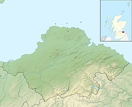
501:
490:
484:
483:
481:
479:
468:
442:
430:
418:
406:
394:
379:
199:
160:
159:
153:
134:
133:
131:
130:
129:
124:
120:
117:
116:
115:
112:
83:
82:
37:the seafront of
33:
21:
711:
710:
706:
705:
704:
702:
701:
700:
656:
655:
638:
633:
632:
622:
620:
618:
603:
602:
598:
588:
586:
584:
569:
568:
564:
557:
553:
543:
541:
536:
535:
526:
513:
509:
499:
497:
492:
491:
487:
477:
475:
470:
469:
462:
457:
450:
443:
434:
431:
422:
419:
410:
407:
398:
395:
386:
380:
371:
349:
332:
316:Napoleonic Wars
308:
269:
195:
185:
184:
183:
182:
181:
168:
167:
166:
165:
161:
127:
125:
121:
118:
113:
110:
108:
106:
105:
77:
41:
36:
17:
12:
11:
5:
709:
707:
699:
698:
693:
688:
683:
678:
673:
668:
658:
657:
654:
653:
645:
637:
636:External links
634:
631:
630:
616:
596:
582:
562:
551:
540:. 26 June 2008
524:
507:
485:
459:
458:
456:
453:
452:
451:
444:
437:
435:
432:
425:
423:
420:
413:
411:
408:
401:
399:
396:
389:
387:
381:
374:
370:
367:
366:
365:
360:
355:
348:
345:
337:Firth of Forth
331:
328:
307:
304:
268:
265:
217:
216:
207:
201:
200:
193:
187:
186:
179:United Kingdom
169:
163:
162:
155:
154:
148:
147:
146:
145:
144:
141:
140:
136:
135:
103:
97:
96:
91:
85:
84:
74:
68:
67:
64:
58:
57:
54:
48:
47:
43:
42:
34:
26:
25:
15:
13:
10:
9:
6:
4:
3:
2:
708:
697:
696:North Berwick
694:
692:
689:
687:
684:
682:
679:
677:
674:
672:
669:
667:
664:
663:
661:
652:
651:
646:
644:
640:
639:
635:
619:
613:
609:
608:
600:
597:
585:
579:
575:
574:
566:
563:
560:
555:
552:
539:
533:
531:
529:
525:
521:
517:
516:Carboniferous
511:
508:
495:
489:
486:
473:
467:
465:
461:
454:
448:
441:
436:
429:
424:
417:
412:
405:
400:
393:
388:
385:
378:
373:
368:
364:
361:
359:
356:
354:
351:
350:
346:
344:
342:
338:
329:
327:
323:
321:
317:
313:
305:
303:
301:
300:crag and tail
297:
293:
289:
285:
284:Carboniferous
281:
278:
274:
273:volcanic plug
266:
264:
261:
259:
255:
251:
250:North Berwick
247:
243:
242:Lowland Scots
239:
235:
231:
223:
214:
211:
208:
206:
202:
198:
194:
192:
188:
180:
176:
172:
152:
142:
137:
132:
104:
102:
98:
95:
92:
90:
86:
81:
75:
73:
69:
65:
63:
59:
55:
53:
49:
44:
40:
39:North Berwick
32:
27:
22:
19:
649:
621:. Retrieved
606:
599:
587:. Retrieved
572:
565:
559:Scotsman.com
554:
542:. Retrieved
519:
515:
510:
498:. Retrieved
488:
476:. Retrieved
384:East Lothian
333:
324:
320:World War II
309:
270:
262:
246:East Lothian
238:conical hill
233:
229:
228:
212:
171:East Lothian
18:
234:Berwick Law
126: /
101:Coordinates
660:Categories
455:References
298:. It is a
277:phonolitic
213:Landranger
111:56°02′55″N
62:Prominence
623:6 October
589:6 October
544:30 August
478:3 October
447:Bass Rock
341:Bass Rock
318:, and in
288:Dinantian
139:Geography
114:2°42′57″W
72:Isolation
52:Elevation
347:See also
343:island.
292:glaciers
282:rock of
280:trachyte
275:of hard
254:Scotland
248:town of
205:Topo map
197:NT555842
175:Scotland
369:Gallery
306:History
296:ice age
294:of the
267:Geology
236:, is a
191:OS grid
94:Marilyn
89:Listing
614:
580:
500:28 May
494:"Law"
625:2018
612:ISBN
591:2018
578:ISBN
546:2018
502:2015
480:2018
335:the
662::
527:^
463:^
322:.
258:ft
252:,
215:66
210:OS
177:,
173:,
627:.
593:.
548:.
504:.
482:.
286:(
Text is available under the Creative Commons Attribution-ShareAlike License. Additional terms may apply.