29:
120:
113:
318:). North of Ounastunturi and the valley containing Ounasjärvi lake the terrain rises towards the highest parts of Finland, towards the south beyond Pallastunturi, it is comparatively flat.
332:
with a mean annual temperature of -4 °C. The warmest month is July with an average temperature of 14 °C, the coldest is
February with a mean temperature of -18 °C.
237:. The Pallas-Ounastunturi National Park, established in 1938 and included in the former in 2005, was partly named after the fell. Ounastunturi is separated from the neighbouring
69:
234:
112:
321:
The region around
Ounastunturi is almost uninhabited with less than 2 people per square kilometer. The nearest larger settlement is
325:
16.6 km (10.3 mi) north of the mountain. The vegetation is sparse and consists mostly of low subarctic woodland.
483:
28:
62:
290:
255:
415:
219:
172:
488:
245:
329:
284:
249:
226:
165:
392:
430:
370:
348:
229:
region, in the north of the country, about 900 km (560 mi) north of the capital
222:
177:
184:
477:
238:
322:
145:
456:
435:
305:
292:
270:
257:
84:
71:
230:
215:
155:
52:
196:
252:
with a height of 723 m a.s.l. in the southern part of the fell (
211:
416:"Updated world map of the Köppen-Geiger climate classification"
393:"NASA Earth Observations: Land Cover Classification"
195:
183:
171:
161:
151:
141:
100:
61:
51:
43:
38:
21:
414:Peel, M C; Finlayson, B L; McMahon, T A (2007).
349:"History of Pallas-Yllästunturi National Park"
371:"NASA Earth Observations: Population Density"
8:
287:with a height of 713 m a.s.l. in the north (
248:, north of the fell. The highest summit is
241:fell in the south by the Hannukuru valley.
351:. Metsähallitus, Natural Heritage Services
18:
434:
457:"NASA Earth Observations Data Set Index"
340:
233:. It lies in the northern part of the
7:
119:
423:Hydrology and Earth System Sciences
33:Ounastunturi seen across Ounasjärvi
14:
235:Pallas-Yllästunturi National Park
191:Pallastunturi–Ounastunturi massif
118:
111:
27:
1:
505:
244:The nearest large lake is
57:725 m (2,379 ft)
436:10.5194/hess-11-1633-2007
105:
26:
218:. It is situated in the
16:Fell in Lapland, Finland
330:subarctic climate zone
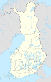
132:Location in NW Finland
484:Mountains of Finland
328:The fell is in the
306:68.3253°N 23.7711°E
302: /
271:68.2339°N 23.8278°E
267: /
81: /
39:Highest point
205:
204:
85:68.233°N 23.800°E
496:
469:
468:
466:
464:
453:
447:
446:
444:
443:
438:
420:
411:
405:
404:
402:
400:
389:
383:
382:
380:
378:
367:
361:
360:
358:
356:
345:
317:
316:
314:
313:
312:
311:68.3253; 23.7711
307:
303:
300:
299:
298:
295:
282:
281:
279:
278:
277:
276:68.2339; 23.8278
272:
268:
265:
264:
263:
260:
187:
122:
121:
115:
96:
95:
93:
92:
91:
86:
82:
79:
78:
77:
74:
31:
19:
504:
503:
499:
498:
497:
495:
494:
493:
474:
473:
472:
462:
460:
455:
454:
450:
441:
439:
418:
413:
412:
408:
398:
396:
391:
390:
386:
376:
374:
369:
368:
364:
354:
352:
347:
346:
342:
338:
310:
308:
304:
301:
296:
293:
291:
289:
288:
283:), followed by
275:
273:
269:
266:
261:
258:
256:
254:
253:
223:Tunturi Lapland
185:
178:Tunturi Lapland
137:
136:
135:
134:
133:
130:
129:
128:
127:
123:
89:
87:
83:
80:
75:
72:
70:
68:
67:
34:
17:
12:
11:
5:
502:
500:
492:
491:
486:
476:
475:
471:
470:
448:
406:
384:
362:
339:
337:
334:
203:
202:
199:
193:
192:
189:
181:
180:
175:
169:
168:
163:
159:
158:
153:
149:
148:
143:
139:
138:
131:
125:
124:
117:
116:
110:
109:
108:
107:
106:
103:
102:
98:
97:
90:68.233; 23.800
65:
59:
58:
55:
49:
48:
45:
41:
40:
36:
35:
32:
24:
23:
15:
13:
10:
9:
6:
4:
3:
2:
501:
490:
487:
485:
482:
481:
479:
458:
452:
449:
437:
432:
429:: 1633–1644.
428:
424:
417:
410:
407:
394:
388:
385:
372:
366:
363:
350:
344:
341:
335:
333:
331:
326:
324:
319:
315:
286:
280:
251:
247:
242:
240:
239:Pallastunturi
236:
232:
228:
224:
221:
217:
213:
209:
201:boreal forest
200:
198:
194:
190:
188:
182:
179:
176:
174:
170:
167:
164:
160:
157:
154:
150:
147:
144:
140:
114:
104:
99:
94:
66:
64:
60:
56:
54:
50:
46:
42:
37:
30:
25:
20:
461:. Retrieved
451:
440:. Retrieved
426:
422:
409:
397:. Retrieved
395:. NASA/MODIS
387:
375:. Retrieved
373:. NASA/SEDAC
365:
353:. Retrieved
343:
327:
320:
243:
208:Ounastunturi
207:
206:
186:Parent range
126:Ounastunturi
22:Ounastunturi
309: /
274: /
88: /
63:Coordinates
478:Categories
463:30 January
442:2016-01-30
399:30 January
377:30 January
336:References
297:23°46′16″E
294:68°19′31″N
262:23°49′40″E
259:68°14′02″N
246:Ounasjärvi
220:sub-region
173:Sub-region
489:Enontekiö
323:Enontekiö
146:Enontekiö
101:Geography
53:Elevation
355:24 March
285:Pyhäkero
250:Outtakka
231:Helsinki
166:Lappland
162:Landskap
142:Location
47:Outtakka
227:Lapland
225:of the
216:Finland
156:Finland
152:Country
76:23°48′E
73:68°14′N
459:. NASA
419:(PDF)
210:is a
197:Biome
465:2016
401:2016
379:2016
357:2017
212:fell
44:Peak
431:doi
214:in
480::
427:11
425:.
421:.
467:.
445:.
433::
403:.
381:.
359:.
Text is available under the Creative Commons Attribution-ShareAlike License. Additional terms may apply.