49:
958:
69:
102:
109:
76:
693:
In the township the population was spread out, with 20.9% under the age of 18, 6.6% from 18 to 24, 24.5% from 25 to 44, 30.6% from 45 to 64, and 17.4% who were 65 years of age or older. The median age was 44 years. For every 100 females, there were 105.8 males. For every 100 females age 18 and over,
657:
of 2000, there were 2,432 people, 1,026 households, and 738 families residing in the township. The population density was 73.1 inhabitants per square mile (28.2/km). There were 1,889 housing units at an average density of 56.8 per square mile (21.9/km). The racial makeup of the township was 98.11%
689:
living together, 5.2% had a female householder with no husband present, and 28.0% were non-families. 23.5% of all households were made up of individuals, and 10.0% had someone living alone who was 65 years of age or older. The average household size was 2.37 and the average family size was 2.77.
697:
The median income for a household in the township was $ 44,593, and the median income for a family was $ 49,712. Males had a median income of $ 36,410 versus $ 23,382 for females. The
569:, the township has a total area of 36.2 square miles (93.8 km), of which 33.2 square miles (85.9 km) is land and 3.0 square miles (7.8 km), or 8.35%, is water.
137:
891:
1199:
550:
The township is dominated geographically by lakes, primarily
Coldwater Lake, as well as the smaller Lake of the Woods and several others. All drain into the
354:
The township, which is primarily agricultural, does not have any incorporated municipalities. Five settlements exist in several unincorporated communities:
1036:
835:
1071:
1081:
293:
17:
1106:
510:
475:
438:
401:
364:
48:
884:
101:
1136:
303:
68:
877:
555:
268:
766:
551:
1204:
869:
1101:
1051:
1031:
663:
189:
1076:
1056:
1006:
731:
671:
566:
839:
1141:
1021:
1011:
1146:
1046:
1041:
1026:
1016:
633:
618:
603:
343:
1061:
751:
685:
There were 1,026 households, out of which 25.1% had children under the age of 18 living with them, 62.9% were
820:
809:
798:
787:
1169:
901:
335:
194:
54:
675:
1111:
836:"Geographic Identifiers: 2010 Demographic Profile Data (G001): Ovid township, Branch County, Michigan"
1176:
987:
679:
278:
1091:
947:
923:
667:
659:
752:
U.S. Geological Survey
Geographic Names Information System: Ovid Township, Branch County, Michigan
1131:
1121:
982:
969:
701:
for the township was $ 21,942. About 3.0% of families and 3.1% of the population were below the
942:
698:
1126:
1116:
977:
539:
998:
934:
331:
39:
821:
U.S. Geological Survey
Geographic Names Information System: Sans Souci Beach, Michigan
1193:
559:
788:
U.S. Geological Survey
Geographic Names Information System: Crystal Beach, Michigan
702:
810:
U.S. Geological Survey
Geographic Names Information System: Pearl Beach, Michigan
916:
799:
U.S. Geological Survey
Geographic Names Information System: Lockwood, Michigan
177:
525:
512:
490:
477:
453:
440:
416:
403:
379:
366:
152:
139:
259:
1160:‡This populated place also has portions in an adjacent county or counties
705:, including 3.3% of those under age 18 and 5.0% of those age 65 or over.
686:
538:
between Lake of the Woods and
Bingham Lake, about two miles northeast of
339:
182:
957:
654:
285:
264:
767:"Ovid township, Branch County, Michigan - Census Bureau Profile"
873:
956:
318:
864:
838:. U.S. Census Bureau, American Factfinder. Archived from
727:
1155:
1090:
997:
968:
933:
313:
302:
292:
275:
258:
250:
242:
237:
229:
221:
213:
205:
200:
188:
176:
168:
30:
961:Map of Michigan highlighting Branch County.svg
885:
830:
828:
761:
759:
8:
892:
878:
870:
682:of any race were 1.07% of the population.
576:
27:
25:Civil township in Michigan, United States
714:
507:There is also an unnamed settlement at
312:
291:
257:
236:
228:
199:
167:
132:
60:
45:
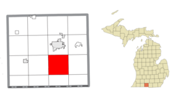
18:Ovid Township, Clinton County, Michigan
596:
722:
720:
718:
301:
274:
249:
241:
220:
212:
204:
187:
175:
108:
88:Location within the state of Michigan
75:
7:
1200:Townships in Branch County, Michigan
674:, and 0.82% from two or more races.
217:33.2 sq mi (85.9 km)
209:36.2 sq mi (93.8 km)
900:Municipalities and communities of
586:
342:. The population was 2,161 at the
14:
225:3.0 sq mi (7.8 km)
121:Location within the United States
107:
100:
74:
67:
47:
865:Ovid Township official website
1:
769:. United States Census Bureau
124:Show map of the United States
732:United States Census Bureau
567:United States Census Bureau
1221:
15:
1165:
954:
914:
647:
632:
617:
602:
595:
590:
585:
582:
133:
61:
46:
37:
694:there were 101.6 males.
233:981 ft (299 m)
903:Branch County, Michigan
32:Ovid Township, Michigan
962:
1205:Townships in Michigan
960:
728:"U.S. Census website"
578:Historical population
554:, a tributary of the
526:41.84056°N 85.05389°W
491:41.83056°N 84.97000°W
454:41.82417°N 84.98639°W
417:41.88361°N 85.04889°W
380:41.83694°N 84.97111°W
338:in the U.S. state of
277: • Summer (
254:60/sq mi (23/km)
153:41.85250°N 84.99528°W
1178:United States portal
842:on February 12, 2020
251: • Density
91:Show map of Michigan
579:
531:41.84056; -85.05389
522: /
496:41.83056; -84.97000
487: /
459:41.82417; -84.98639
450: /
422:41.88361; -85.04889
413: /
385:41.83694; -84.97111
376: /
158:41.85250; -84.99528
149: /
963:
577:
243: • Total
222: • Water
206: • Total
1187:
1186:
699:per capita income
651:
650:
565:According to the
325:
324:
214: • Land
1212:
1179:
1172:
1142:Sans Souci Beach
959:
926:
919:
909:
904:
894:
887:
880:
871:
852:
851:
849:
847:
832:
823:
818:
812:
807:
801:
796:
790:
785:
779:
778:
776:
774:
763:
754:
749:
743:
742:
740:
738:
724:
598:
593:
588:
580:
556:St. Joseph River
537:
536:
534:
533:
532:
527:
523:
520:
519:
518:
515:
502:
501:
499:
498:
497:
492:
488:
485:
484:
483:
480:
470:Sans Souci Beach
465:
464:
462:
461:
460:
455:
451:
448:
447:
446:
443:
428:
427:
425:
424:
423:
418:
414:
411:
410:
409:
406:
391:
390:
388:
387:
386:
381:
377:
374:
373:
372:
369:
321:
319:Official website
282:
164:
163:
161:
160:
159:
154:
150:
147:
146:
145:
142:
125:
111:
110:
104:
92:
78:
77:
71:
53:Location within
51:
28:
1220:
1219:
1215:
1214:
1213:
1211:
1210:
1209:
1190:
1189:
1188:
1183:
1177:
1171:Michigan portal
1170:
1161:
1151:
1093:
1086:
993:
964:
952:
929:
924:
917:
910:
907:
902:
898:
861:
856:
855:
845:
843:
834:
833:
826:
819:
815:
808:
804:
797:
793:
786:
782:
772:
770:
765:
764:
757:
750:
746:
736:
734:
726:
725:
716:
711:
687:married couples
664:Native American
591:
575:
552:Coldwater River
548:
530:
528:
524:
521:
516:
513:
511:
509:
508:
495:
493:
489:
486:
481:
478:
476:
474:
473:
458:
456:
452:
449:
444:
441:
439:
437:
436:
421:
419:
415:
412:
407:
404:
402:
400:
399:
384:
382:
378:
375:
370:
367:
365:
363:
362:
352:
317:
276:
157:
155:
151:
148:
143:
140:
138:
136:
135:
129:
128:
127:
126:
123:
122:
119:
118:
117:
116:
112:
95:
94:
93:
90:
89:
86:
85:
84:
83:
79:
57:
42:
33:
26:
21:
12:
11:
5:
1218:
1216:
1208:
1207:
1202:
1192:
1191:
1185:
1184:
1182:
1181:
1174:
1166:
1163:
1162:
1159:
1157:
1153:
1152:
1150:
1149:
1144:
1139:
1134:
1129:
1124:
1119:
1114:
1109:
1104:
1098:
1096:
1092:Unincorporated
1088:
1087:
1085:
1084:
1079:
1074:
1069:
1064:
1059:
1054:
1049:
1044:
1039:
1034:
1029:
1024:
1019:
1014:
1009:
1003:
1001:
995:
994:
992:
991:
985:
980:
974:
972:
966:
965:
955:
953:
951:
950:
945:
939:
937:
931:
930:
915:
912:
911:
899:
897:
896:
889:
882:
874:
868:
867:
860:
859:External links
857:
854:
853:
824:
813:
802:
791:
780:
755:
744:
713:
712:
710:
707:
649:
648:
645:
644:
641:
639:
636:
630:
629:
626:
624:
621:
615:
614:
611:
609:
606:
600:
599:
594:
589:
584:
574:
571:
547:
544:
505:
504:
467:
430:
393:
351:
348:
332:civil township
323:
322:
315:
311:
310:
307:
300:
299:
296:
290:
289:
283:
273:
272:
262:
256:
255:
252:
248:
247:
244:
240:
239:
235:
234:
231:
227:
226:
223:
219:
218:
215:
211:
210:
207:
203:
202:
198:
197:
192:
186:
185:
180:
174:
173:
170:
166:
165:
131:
130:
120:
114:
113:
106:
105:
99:
98:
97:
96:
87:
81:
80:
73:
72:
66:
65:
64:
63:
62:
59:
58:
52:
44:
43:
40:Civil township
38:
35:
34:
31:
24:
16:There is also
13:
10:
9:
6:
4:
3:
2:
1217:
1206:
1203:
1201:
1198:
1197:
1195:
1180:
1175:
1173:
1168:
1167:
1164:
1158:
1154:
1148:
1145:
1143:
1140:
1138:
1135:
1133:
1130:
1128:
1125:
1123:
1120:
1118:
1115:
1113:
1110:
1108:
1107:Crystal Beach
1105:
1103:
1102:Canada Shores
1100:
1099:
1097:
1095:
1089:
1083:
1080:
1078:
1075:
1073:
1070:
1068:
1065:
1063:
1060:
1058:
1055:
1053:
1050:
1048:
1045:
1043:
1040:
1038:
1035:
1033:
1030:
1028:
1025:
1023:
1020:
1018:
1015:
1013:
1010:
1008:
1005:
1004:
1002:
1000:
996:
989:
986:
984:
981:
979:
976:
975:
973:
971:
967:
949:
946:
944:
941:
940:
938:
936:
932:
928:
927:
920:
913:
908:United States
905:
895:
890:
888:
883:
881:
876:
875:
872:
866:
863:
862:
858:
841:
837:
831:
829:
825:
822:
817:
814:
811:
806:
803:
800:
795:
792:
789:
784:
781:
768:
762:
760:
756:
753:
748:
745:
733:
729:
723:
721:
719:
715:
708:
706:
704:
700:
695:
691:
688:
683:
681:
677:
673:
670:, 0.53% from
669:
665:
661:
656:
646:
642:
640:
637:
635:
631:
627:
625:
622:
620:
616:
612:
610:
607:
605:
601:
581:
572:
570:
568:
563:
561:
560:Lake Michigan
557:
553:
545:
543:
541:
535:
500:
471:
468:
463:
434:
431:
426:
397:
394:
389:
360:
359:Crystal Beach
357:
356:
355:
349:
347:
345:
341:
337:
336:Branch County
333:
329:
328:Ovid Township
320:
316:
308:
305:
297:
295:
287:
284:
280:
270:
269:Eastern (EST)
266:
263:
261:
253:
245:
232:
224:
216:
208:
196:
193:
191:
184:
181:
179:
172:United States
171:
162:
134:Coordinates:
115:Ovid Township
103:
82:Ovid Township
70:
56:
55:Branch County
50:
41:
36:
29:
23:
19:
1066:
922:
844:. Retrieved
840:the original
816:
805:
794:
783:
771:. Retrieved
747:
735:. Retrieved
703:poverty line
696:
692:
684:
652:
573:Demographics
564:
549:
506:
469:
432:
395:
358:
353:
327:
326:
22:
1137:Pearl Beach
1112:East Gilead
1094:communities
918:County seat
846:January 15,
737:January 31,
672:other races
558:flowing to
529: /
494: /
457: /
433:Pearl Beach
420: /
383: /
350:Communities
344:2020 census
156: /
1194:Categories
1052:Kinderhook
1032:California
988:Union City
709:References
653:As of the
517:85°03′14″W
514:41°50′26″N
482:84°58′12″W
479:41°49′50″N
445:84°59′11″W
442:41°49′27″N
408:85°02′56″W
405:41°53′01″N
371:84°58′16″W
368:41°50′13″N
306:feature ID
238:Population
144:84°59′43″W
141:41°51′09″N
1156:Footnotes
1037:Coldwater
999:Townships
948:Coldwater
925:Coldwater
773:March 21,
546:Geography
294:FIPS code
260:Time zone
230:Elevation
1132:Lockwood
1122:Hatmaker
1077:Sherwood
1057:Matteson
1007:Algansee
983:Sherwood
970:Villages
676:Hispanic
666:, 0.33%
662:, 0.21%
396:Lockwood
340:Michigan
298:26-61840
183:Michigan
1022:Bronson
1012:Batavia
943:Bronson
314:Website
309:1626873
169:Country
1127:Hodunk
1117:Girard
1072:Quincy
1047:Girard
1042:Gilead
1027:Butler
1017:Bethel
978:Quincy
935:Cities
680:Latino
655:census
583:Census
540:Bethel
472:is at
435:is at
398:is at
361:is at
195:Branch
190:County
1082:Union
1062:Noble
668:Asian
660:White
643:−7.1%
638:2,161
628:−4.4%
623:2,326
608:2,432
330:is a
288:(EDT)
286:UTC-4
265:UTC-5
246:2,161
178:State
1067:Ovid
848:2014
775:2024
739:2008
634:2020
619:2010
604:2000
592:Note
587:Pop.
304:GNIS
201:Area
1147:Ray
678:or
334:of
279:DST
1196::
921::
906:,
827:^
758:^
730:.
717:^
597:%±
562:.
542:.
346:.
990:‡
893:e
886:t
879:v
850:.
777:.
741:.
613:—
503:.
466:.
429:.
392:.
281:)
271:)
267:(
20:.
Text is available under the Creative Commons Attribution-ShareAlike License. Additional terms may apply.