244:
632:
602:
40:
572:
488:
424:
395:
26:
578:
534:
494:
457:
227:
212:
638:
608:
529:
430:
401:
105:
86:
340:
SR 139 was first designated in 1923 along the New Boston–Jackson route it has always followed. SR 139 fully replaced SR 402 which had been in existence since the creation of the state highway system in 1912. No major changes have occurred to SR 139's routing since it was first designated.
845:
840:
703:
474:
802:
775:
748:
516:
444:
180:
723:
53:
835:
727:
506:
190:
185:
434:
405:
289:
278:
89:
783:(Map). Cartography by James R. Marker, State Highway Commissioner. Ohio State Highway Department. 1912
582:
541:
498:
469:
460:
325:
317:
313:
305:
248:
230:
215:
155:
642:
612:
537:
376:
329:
309:
282:
151:
108:
332:
in downtown
Jackson, terminating 0.15 miles (0.24 km) north where State Route 93 turns east.
663:
292:
in New Boston. The route goes north through a couple of traffic lights before passing through
694:
277:
at its northern terminus. This route offers a quick, yet narrow and sharp route to
Jackson.
195:
381:
293:
266:
93:
297:
502:
321:
829:
558:
301:
270:
252:
131:
112:
545:
243:
549:
756:(Map). Cartography by L.A. Boulay, Director. Ohio Division of Highways. 1923
285:
offer a more straight route with a higher speed limit, though less direct.
39:
328:
within less than mile of downtown. The route then briefly overlaps
628:
598:
25:
702:
274:
141:
308:
and then begins to turn north once again. After reaching the
653:
1.000 mi = 1.609 km; 1.000 km = 0.621 mi
804:
Map of Ohio State
Highways Showing All Improved Roadways
690:
685:
647:
617:
165:
147:
137:
127:
122:
99:
80:
75:
67:
59:
46:
21:
265:) is a north–south road that stretches from
324:. SR 139 crosses SR 32 just outside Jackson and
251:intersection while traveling north on SR 335 in
615:south (East Main Street) / Broadway Street
320:splits off of State Route 139 and heads toward
810:(Map). Cartography by E.C. Blosser. ODOH. 1922
544:(James A. Rhodes Appalachian Highway) –
8:
728:"Technical Services Straight Line Diagrams"
704:Template:Attached KML/Ohio State Route 139
348:
204:
777:Map of Ohio Showing Inter-County Highways
707:
296:, Eden Park, Twin Valley, Rubyville, and
645:north (Bridge Street) / Main Street
242:
712:
846:Transportation in Jackson County, Ohio
288:SR 139 begins at an intersection with
18:
841:Transportation in Scioto County, Ohio
718:
716:
622:
592:
568:
562:
526:
520:
484:
478:
454:
448:
420:
414:
391:
385:
7:
300:before it continues due east toward
363:
63:33.99 mi (54.70 km)
14:
724:Ohio Department of Transportation
648:Northern end of SR 93 concurrency
618:Southern end of SR 93 concurrency
750:Map of Ohio Showing State Routes
636:
630:
606:
600:
576:
570:
532:
527:
492:
486:
455:
428:
422:
399:
393:
225:
210:
103:
84:
38:
24:
1:
358:
269:at its southern terminus to
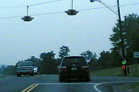
247:A view of the SR 139 &
862:
588:Eastern terminus of SR 776
511:Western terminus of SR 279
652:
625:
595:
587:
565:
557:
553:
523:
515:
510:
481:
473:
468:
464:
451:
443:
439:
417:
410:
388:
380:
375:
370:
367:
362:
357:
354:
351:
304:. From there it crosses
203:
174:Ohio State Highway System
170:
161:
118:
51:
37:
16:State highway in Ohio, US
659:
507:Jackson Lake State Park
836:State highways in Ohio
255:
246:
708:KML is from Wikidata
437:west (Gallia Street)
408:east (Rhodes Avenue)
585:west (South Street)
345:Major intersections
256:
674:
673:
475:Hamilton Township
241:
240:
237:
236:
47:Route information
853:
820:
819:
817:
815:
809:
799:
793:
792:
790:
788:
782:
772:
766:
765:
763:
761:
755:
745:
739:
738:
736:
734:
720:
698:
667:
660:
641:
640:
639:
634:
633:
611:
610:
609:
604:
603:
581:
580:
579:
574:
573:
536:
535:
531:
530:
517:Madison Township
497:
496:
495:
490:
489:
459:
458:
445:Madison Township
433:
432:
431:
426:
425:
404:
403:
402:
397:
396:
365:
360:
349:
233:
229:
228:
218:
214:
213:
205:
107:
106:
88:
87:
42:
28:
19:
861:
860:
856:
855:
854:
852:
851:
850:
826:
825:
824:
823:
813:
811:
807:
801:
800:
796:
786:
784:
780:
774:
773:
769:
759:
757:
753:
747:
746:
742:
732:
730:
722:
721:
714:
709:
706:
701:
700:
699:
683:
679:
670:
662:
658:
654:
637:
635:
631:
629:
607:
605:
601:
599:
577:
575:
571:
569:
533:
528:
493:
491:
487:
485:
456:
429:
427:
423:
421:
400:
398:
394:
392:
347:
338:
259:State Route 139
226:
224:
211:
209:
104:
85:
76:Major junctions
33:
32:
31:State Route 139
29:
17:
12:
11:
5:
859:
857:
849:
848:
843:
838:
828:
827:
822:
821:
794:
767:
740:
711:
710:
682:
681:
680:
678:
675:
672:
671:
669:
668:
655:
650:
649:
646:
627:
624:
620:
619:
616:
597:
594:
590:
589:
586:
567:
564:
561:
555:
554:
552:
525:
522:
519:
513:
512:
509:
483:
480:
477:
472:
466:
465:
463:
453:
450:
447:
441:
440:
438:
419:
416:
412:
411:
409:
390:
387:
384:
379:
373:
372:
369:
366:
361:
356:
353:
346:
343:
337:
334:
314:Jackson County
239:
238:
235:
234:
221:
219:
201:
200:
199:
198:
193:
188:
183:
177:
176:
168:
167:
166:Highway system
163:
162:
159:
158:
149:
145:
144:
139:
135:
134:
129:
125:
124:
120:
119:
116:
115:
101:
100:North end
97:
96:
82:
81:South end
78:
77:
73:
72:
69:
65:
64:
61:
57:
56:
52:Maintained by
49:
48:
44:
43:
35:
34:
30:
23:
22:
15:
13:
10:
9:
6:
4:
3:
2:
858:
847:
844:
842:
839:
837:
834:
833:
831:
806:
805:
798:
795:
779:
778:
771:
768:
752:
751:
744:
741:
729:
725:
719:
717:
713:
705:
696:
692:
688:
687:
676:
665:
657:
656:
651:
644:
621:
614:
591:
584:
560:
556:
551:
547:
543:
539:
518:
514:
508:
504:
500:
476:
471:
467:
462:
446:
442:
436:
413:
407:
383:
378:
374:
350:
344:
342:
335:
333:
331:
327:
323:
319:
315:
311:
310:Scioto County
307:
303:
299:
295:
291:
286:
284:
280:
276:
272:
268:
264:
260:
254:
250:
245:
232:
222:
220:
217:
207:
206:
202:
197:
194:
192:
189:
187:
184:
182:
179:
178:
175:
172:
171:
169:
164:
160:
157:
153:
150:
146:
143:
140:
136:
133:
132:United States
130:
126:
121:
117:
114:
110:
102:
98:
95:
91:
83:
79:
74:
70:
66:
62:
58:
55:
50:
45:
41:
36:
27:
20:
812:. Retrieved
803:
797:
785:. Retrieved
776:
770:
758:. Retrieved
749:
743:
731:. Retrieved
684:
661:
501:east –
368:Destinations
339:
287:
262:
258:
257:
173:
71:1924–present
664:Concurrency
583:SR 776
542:SR 124
499:SR 279
461:SR 335
231:SR 140
216:SR 138
830:Categories
814:August 18,
787:August 18,
760:August 18,
677:References
643:SR 93
613:SR 93
550:Cincinnati
538:SR 32
435:US 52
406:US 52
382:New Boston
294:Portsmouth
267:New Boston
181:Interstate
109:SR 93
94:New Boston
90:US 52
733:April 30,
298:Clarktown
686:KML file
666:terminus
540: /
503:Oak Hill
355:Location
322:Oak Hill
148:Counties
123:Location
808:(MrSID)
781:(MrSID)
754:(MrSID)
559:Jackson
470:Jackson
336:History
302:Minford
271:Jackson
253:Minford
156:Jackson
128:Country
113:Jackson
68:Existed
546:Athens
377:Scioto
352:County
326:SR 776
318:SR 279
316:line,
306:SR 335
263:SR 139
249:SR 335
196:Scenic
152:Scioto
60:Length
626:54.70
623:33.99
596:54.30
593:33.74
566:53.67
563:33.35
524:49.33
521:30.65
482:30.45
479:18.92
452:17.56
449:10.91
371:Notes
330:SR 93
290:US 52
283:SR 32
279:US 23
191:State
138:State
816:2013
789:2013
762:2013
735:2010
695:help
691:edit
418:0.18
415:0.11
389:0.00
386:0.00
312:and
281:and
275:Ohio
142:Ohio
54:ODOT
111:in
92:in
832::
726:.
715:^
693:•
548:,
505:,
364:km
359:mi
273:,
223:→
208:←
186:US
154:,
818:.
791:.
764:.
737:.
697:)
689:(
261:(
Text is available under the Creative Commons Attribution-ShareAlike License. Additional terms may apply.