48:
474:
359:
55:
315:
at an elevation of 1,160 metres (3,810 ft). It flows SSE for about 70 km (43 mi) then it bends and flows SSW across the Ola
Lowland, bending again and flowing roughly southwards. Its last stretch is among
207:
535:
130:
511:
47:
530:
504:
540:
497:
379:
308:
325:
304:
292:
116:
348:
281:
473:
481:
333:
285:
277:
181:
83:
63:
524:
420:
341:
312:
432:
462:
337:
176:
398:
409:
222:
209:
145:
132:
358:
329:
317:
193:
17:
362:
321:
365:
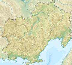
area map with the last stretch of river Ola in the upper right corner.
87:
295:
crosses the Ola about 40 km (25 mi) north of its mouth.
433:"Топографска карта P-55_56 - Topographic USSR Chart (in Russian)"
485:
456:
288:
of 8,570 square kilometres (3,310 sq mi).
284:. It is 166 kilometres (103 mi) long, with a
256:
248:
238:
199:
187:
175:
161:
122:
110:
102:
93:
79:
74:
32:
351:that joins it in its lower course from the left.
480:This article related to a river in Russia is a
410:Floating Tours Down The Rivers of Magadan Region
505:
271:
8:
463:Kolyma - Modern Guidebook to Magadan Oblast
512:
498:
399:Russian State Water Register - Ola River
357:
391:
344:is located at the mouth of the river.
311:, 30 km (19 mi) southwest of
29:
536:Drainage basins of the Sea of Okhotsk
347:The main tributary of the Ola is the
260:8,570 km (3,310 sq mi)
7:
470:
468:
54:
25:
472:
303:The river has its source in the
53:
46:
340:, the administrative center of
27:River in Magadan Oblast, Russia
201: • coordinates
124: • coordinates
1:
94:Physical characteristics
484:. You can help Knowledge by
307:, at the eastern end of the
240: • elevation
167:1,160 m (3,810 ft)
163: • elevation
189: • location
112: • location
557:
467:
355:
328:. Finally it flows in the
272:
252:166 km (103 mi)
171:
98:
41:
531:Rivers of Magadan Oblast
380:List of rivers of Russia
366:
309:Upper Kolyma Highlands
223:59.56139°N 151.26694°E
146:60.67000°N 151.28389°E
361:
244:0 m (0 ft)
293:R504 Kolyma Highway
228:59.56139; 151.26694
219: /
151:60.67000; 151.28389
142: /
541:Russia river stubs
367:
62:Mouth location in
493:
492:
371:
370:
264:
263:
16:(Redirected from
548:
514:
507:
500:
476:
469:
444:
443:
441:
439:
429:
423:
418:
412:
407:
401:
396:
354:
353:
282:Russian Far East
276:) is a river in
275:
274:
234:
233:
231:
230:
229:
224:
220:
217:
216:
215:
212:
164:
157:
156:
154:
153:
152:
147:
143:
140:
139:
138:
135:
125:
113:
57:
56:
50:
30:
21:
556:
555:
551:
550:
549:
547:
546:
545:
521:
520:
519:
518:
453:
448:
447:
437:
435:
431:
430:
426:
419:
415:
408:
404:
397:
393:
388:
376:
301:
241:
227:
225:
221:
218:
213:
210:
208:
206:
205:
202:
190:
162:
150:
148:
144:
141:
136:
133:
131:
129:
128:
123:
111:
70:
69:
68:
67:
60:
59:
58:
37:
34:
28:
23:
22:
15:
12:
11:
5:
554:
552:
544:
543:
538:
533:
523:
522:
517:
516:
509:
502:
494:
491:
490:
477:
466:
465:
460:
452:
451:External links
449:
446:
445:
424:
413:
402:
390:
389:
387:
384:
383:
382:
375:
372:
369:
368:
334:Sea of Okhotsk
300:
297:
286:drainage basin
278:Magadan Oblast
270:(Russian:
262:
261:
258:
254:
253:
250:
246:
245:
242:
239:
236:
235:
203:
200:
197:
196:
191:
188:
185:
184:
182:Sea of Okhotsk
179:
173:
172:
169:
168:
165:
159:
158:
126:
120:
119:
114:
108:
107:
104:
100:
99:
96:
95:
91:
90:
84:Magadan Oblast
81:
77:
76:
72:
71:
64:Magadan Oblast
61:
52:
51:
45:
44:
43:
42:
39:
38:
35:
26:
24:
14:
13:
10:
9:
6:
4:
3:
2:
553:
542:
539:
537:
534:
532:
529:
528:
526:
515:
510:
508:
503:
501:
496:
495:
489:
487:
483:
478:
475:
471:
464:
461:
458:
455:
454:
450:
434:
428:
425:
422:
417:
414:
411:
406:
403:
400:
395:
392:
385:
381:
378:
377:
373:
364:
360:
356:
352:
350:
345:
343:
339:
335:
331:
327:
326:Lake Chistoye
323:
319:
314:
310:
306:
305:Olsky Plateau
298:
296:
294:
289:
287:
283:
279:
269:
259:
255:
251:
247:
243:
237:
232:
204:
198:
195:
192:
186:
183:
180:
178:
174:
170:
166:
160:
155:
127:
121:
118:
117:Olsky Plateau
115:
109:
105:
101:
97:
92:
89:
85:
82:
78:
73:
65:
49:
40:
31:
19:
486:expanding it
479:
459:(in Russian)
436:. Retrieved
427:
421:Google Earth
416:
405:
394:
346:
342:Ola District
302:
290:
267:
265:
226: /
149: /
525:Categories
386:References
257:Basin size
214:151°16′1″E
211:59°33′41″N
137:151°17′2″E
134:60°40′12″N
349:Lankovaya
18:Ola River
438:13 March
374:See also
330:Taui Bay
320:between
318:wetlands
194:Taui Bay
75:Location
66:, Russia
363:Magadan
332:of the
322:Magadan
80:Country
299:Course
249:Length
106:
103:Source
88:Russia
457:Water
177:Mouth
482:stub
440:2022
324:and
313:Atka
291:The
266:The
338:Ola
273:Ола
268:Ola
36:Ола
33:Ola
527::
336:.
280:,
86:,
513:e
506:t
499:v
488:.
442:.
20:)
Text is available under the Creative Commons Attribution-ShareAlike License. Additional terms may apply.

