60:
72:
781:
46:
213:
485:
In the township the population was spread out, with 26.0% under the age of 18, 8.8% from 18 to 24, 28.3% from 25 to 44, 25.6% from 45 to 64, and 11.2% who were 65 years of age or older. The median age was 36 years. For every 100 females, there were 95.0 males. For every 100 females age 18 and over,
445:
of 2000, there were 2,061 people, 811 households, and 603 families residing in the township. The population density was 249.1 inhabitants per square mile (96.2/km). There were 858 housing units at an average density of 103.7 per square mile (40.0/km). The racial makeup of the township was 97.96%
481:
living together, 13.6% had a female householder with no husband present, and 25.6% were non-families. 21.2% of all households were made up of individuals, and 10.0% had someone living alone who was 65 years of age or older. The average household size was 2.54 and the average family size was 2.92.
59:
1047:
1003:
358:, the township has a total area of 8.6 square miles (22.1 km), of which 8.3 square miles (21.4 km) is land and 0.3 square mile (0.7 km) (3.16%) is water.
489:
The median income for a household in the township was $ 39,063, and the median income for a family was $ 44,375. Males had a median income of $ 32,311 versus $ 28,542 for females. The
679:
339:
1052:
884:
834:
814:
1042:
71:
1062:
879:
829:
824:
804:
799:
889:
874:
839:
809:
894:
854:
819:
869:
844:
672:
282:
595:
343:
665:
1057:
899:
514:
245:
104:
544:
657:
864:
451:
455:
962:
760:
980:
967:
640:
463:
355:
166:
156:
859:
689:
311:
109:
45:
765:
755:
407:
392:
331:
319:
952:
750:
740:
711:
270:
82:
947:
922:
917:
909:
791:
745:
735:
477:
There were 811 households, out of which 34.6% had children under the age of 18 living with them, 54.6% were
335:
307:
50:
36:
722:
467:
770:
600:
987:
957:
471:
255:
932:
730:
493:
for the township was $ 18,295. About 10.4% of families and 12.4% of the population were below the
459:
447:
942:
614:
564:
490:
576:
1036:
275:
494:
315:
97:
704:
92:
1018:
1005:
236:
497:, including 19.3% of those under age 18 and 12.3% of those age 65 or over.
478:
295:
442:
262:
241:
590:
661:
64:
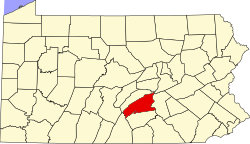
Map of Perry County, Pennsylvania highlighting Oliver
Township
779:
636:
538:
536:
534:
532:
931:
908:
790:
721:
291:
281:
269:
252:
235:
227:
219:
206:
201:
193:
185:
177:
172:
162:
152:
144:
136:
131:
123:
115:
103:
91:
81:
23:
318:, United States. The population was 2,046 at the
1048:Harrisburg–Carlisle metropolitan statistical area
673:
8:
545:"City and Town Population Totals: 2020-2021"
680:
666:
658:
474:of any race were 0.63% of the population.
365:
20:
1053:Townships in Perry County, Pennsylvania
506:
290:
280:
268:
234:
200:
171:
130:
114:
80:
56:
42:
18:Township in Pennsylvania, United States
591:"National Register Information System"
572:
562:
385:
251:
226:
218:
205:
192:
184:
176:
161:
151:
143:
135:
122:
102:
90:
68:
7:
1043:Populated places established in 1788
596:National Register of Historic Places
466:, and 0.44% from two or more races.
344:National Register of Historic Places
189:8.23 sq mi (21.33 km)
181:8.54 sq mi (22.10 km)
1063:1788 establishments in Pennsylvania
197:0.30 sq mi (0.78 km)
688:Municipalities and communities of
615:"Census of Population and Housing"
375:
14:
76:Map of Perry County, Pennsylvania
212:
211:
70:
58:
44:
1:
517:. United States Census Bureau
231:235.00/sq mi (90.73/km)
641:United States Census Bureau
515:"2016 U.S. Gazetteer Files"
356:United States Census Bureau
220: • Estimate
1079:
691:Perry County, Pennsylvania
153: • Vice-chairman
1058:Townships in Pennsylvania
976:
777:
702:
434:
421:
406:
391:
384:
379:
374:
371:
340:Newport Historic District
332:Bridge in Newport Borough
69:
57:
43:
34:
486:there were 91.6 males.
336:Fleisher Covered Bridge
163: • Supervisor
51:Fleisher Covered Bridge
784:
1019:40.46667°N 77.11639°W
783:
637:"U.S. Census website"
601:National Park Service
435:U.S. Decennial Census
367:Historical population
254: • Summer (
145: • Chairman
989:United States portal
228: • Density
140:Board of Supervisors
1024:40.46667; -77.11639
1015: /
982:Pennsylvania portal
543:Bureau, US Census.
368:
785:
575:has generic name (
551:. US Census Bureau
366:
342:are listed on the
207: • Total
194: • Water
178: • Total
998:
997:
870:Southwest Madison
845:Northeast Madison
491:per capita income
439:
438:
354:According to the
301:
300:
186: • Land
137: • Type
1070:
1030:
1029:
1027:
1026:
1025:
1020:
1016:
1013:
1012:
1011:
1008:
990:
983:
782:
714:
707:
697:
692:
682:
675:
668:
659:
652:
651:
649:
647:
633:
627:
626:
624:
622:
611:
605:
604:
587:
581:
580:
574:
570:
568:
560:
558:
556:
540:
527:
526:
524:
522:
511:
452:African American
387:
382:
377:
369:
259:
215:
214:
74:
62:
48:
25:Oliver Township,
21:
1078:
1077:
1073:
1072:
1071:
1069:
1068:
1067:
1033:
1032:
1023:
1021:
1017:
1014:
1009:
1006:
1004:
1002:
1001:
999:
994:
988:
981:
972:
934:
927:
904:
786:
780:
775:
717:
712:
705:
698:
695:
690:
686:
656:
655:
645:
643:
635:
634:
630:
620:
618:
613:
612:
608:
603:. July 9, 2010.
589:
588:
584:
571:
561:
554:
552:
542:
541:
530:
520:
518:
513:
512:
508:
503:
479:married couples
456:Native American
380:
364:
352:
328:
304:Oliver Township
296:Oliver Township
253:
77:
65:
53:
39:
30:
28:
26:
19:
12:
11:
5:
1076:
1074:
1066:
1065:
1060:
1055:
1050:
1045:
1035:
1034:
996:
995:
993:
992:
985:
977:
974:
973:
971:
970:
965:
963:New Germantown
960:
955:
950:
945:
939:
937:
933:Unincorporated
929:
928:
926:
925:
920:
914:
912:
906:
905:
903:
902:
897:
892:
887:
882:
877:
872:
867:
862:
857:
852:
847:
842:
837:
832:
827:
822:
817:
812:
807:
802:
796:
794:
788:
787:
778:
776:
774:
773:
768:
763:
758:
753:
748:
743:
738:
733:
727:
725:
719:
718:
703:
700:
699:
687:
685:
684:
677:
670:
662:
654:
653:
628:
606:
582:
528:
505:
504:
502:
499:
437:
436:
432:
431:
428:
426:
423:
419:
418:
415:
413:
410:
404:
403:
400:
398:
395:
389:
388:
383:
378:
373:
363:
360:
351:
348:
327:
324:
299:
298:
293:
289:
288:
285:
279:
278:
273:
267:
266:
260:
250:
249:
239:
233:
232:
229:
225:
224:
221:
217:
216:
208:
204:
203:
199:
198:
195:
191:
190:
187:
183:
182:
179:
175:
174:
170:
169:
164:
160:
159:
154:
150:
149:
146:
142:
141:
138:
134:
133:
129:
128:
125:
121:
120:
117:
113:
112:
107:
101:
100:
95:
89:
88:
85:
79:
78:
75:
67:
66:
63:
55:
54:
49:
41:
40:
35:
32:
31:
24:
17:
13:
10:
9:
6:
4:
3:
2:
1075:
1064:
1061:
1059:
1056:
1054:
1051:
1049:
1046:
1044:
1041:
1040:
1038:
1031:
1028:
991:
986:
984:
979:
978:
975:
969:
968:Shermans Dale
966:
964:
961:
959:
956:
954:
951:
949:
946:
944:
941:
940:
938:
936:
930:
924:
921:
919:
916:
915:
913:
911:
907:
901:
898:
896:
893:
891:
888:
886:
883:
881:
878:
876:
873:
871:
868:
866:
863:
861:
858:
856:
853:
851:
848:
846:
843:
841:
838:
836:
833:
831:
828:
826:
823:
821:
818:
816:
813:
811:
808:
806:
803:
801:
798:
797:
795:
793:
789:
772:
769:
767:
764:
762:
759:
757:
754:
752:
749:
747:
744:
742:
739:
737:
734:
732:
729:
728:
726:
724:
720:
716:
715:
708:
701:
696:United States
693:
683:
678:
676:
671:
669:
664:
663:
660:
642:
638:
632:
629:
616:
610:
607:
602:
598:
597:
592:
586:
583:
578:
566:
550:
546:
539:
537:
535:
533:
529:
516:
510:
507:
500:
498:
496:
492:
487:
483:
480:
475:
473:
469:
465:
462:, 0.24% from
461:
457:
453:
449:
444:
433:
429:
427:
424:
420:
416:
414:
411:
409:
405:
401:
399:
396:
394:
390:
370:
361:
359:
357:
349:
347:
345:
341:
337:
333:
325:
323:
321:
317:
313:
309:
305:
297:
294:
286:
284:
277:
274:
272:
264:
261:
257:
247:
246:Eastern (EST)
243:
240:
238:
230:
222:
209:
196:
188:
180:
168:
165:
158:
155:
147:
139:
126:
118:
111:
108:
106:
99:
96:
94:
87:United States
86:
84:
73:
61:
52:
47:
38:
33:
27:Perry County,
22:
16:
1000:
849:
710:
644:. Retrieved
631:
619:. Retrieved
617:. Census.gov
609:
594:
585:
573:|last1=
553:. Retrieved
548:
519:. Retrieved
509:
495:poverty line
488:
484:
476:
440:
362:Demographics
353:
329:
316:Pennsylvania
312:Perry County
303:
302:
287:42-099-56728
167:Joseph Baker
157:Lee Morrison
148:James Spotts
124:Incorporated
98:Pennsylvania
29:Pennsylvania
15:
1022: /
935:communities
766:New Buffalo
756:Millerstown
706:County seat
646:January 31,
464:other races
422:2021 (est.)
320:2020 census
1037:Categories
1010:77°06′59″W
1007:40°28′00″N
953:Green Park
900:Wheatfield
761:Bloomfield
751:Marysville
741:Landisburg
713:Bloomfield
549:Census.gov
521:August 14,
501:References
441:As of the
202:Population
132:Government
948:Dellville
923:Loysville
918:Ickesburg
885:Tuscarora
835:Liverpool
815:Greenwood
792:Townships
746:Liverpool
736:Duncannon
350:Geography
283:FIPS code
271:Area code
237:Time zone
723:Boroughs
565:cite web
555:July 12,
468:Hispanic
458:, 0.53%
454:, 0.15%
450:, 0.68%
308:township
37:Township
880:Toboyne
865:Saville
830:Juniata
825:Jackson
805:Carroll
800:Buffalo
771:Newport
621:June 4,
326:History
292:Website
116:Settled
83:Country
958:Perdix
890:Tyrone
875:Spring
850:Oliver
840:Miller
810:Centre
472:Latino
443:census
372:Census
338:, and
210:2,046
105:County
895:Watts
731:Blain
460:Asian
448:White
430:−5.4%
425:1,935
412:2,046
397:1,931
306:is a
265:(EDT)
263:UTC-4
242:UTC-5
223:2,051
110:Perry
93:State
943:Cove
910:CDPs
855:Penn
820:Howe
648:2008
623:2016
577:help
557:2022
523:2017
417:6.0%
408:2020
393:2010
381:Note
376:Pop.
330:The
173:Area
127:1837
119:1788
860:Rye
470:or
310:in
276:717
256:DST
1039::
709::
694:,
639:.
599:.
593:.
569::
567:}}
563:{{
547:.
531:^
386:%±
346:.
334:,
322:.
314:,
681:e
674:t
667:v
650:.
625:.
579:)
559:.
525:.
402:—
258:)
248:)
244:(
Text is available under the Creative Commons Attribution-ShareAlike License. Additional terms may apply.