2067:. A high rock ridge between Sanford Valley and Thomas Valley in the east part of Olympus Range. Named by US-ACAN (1997) after Elias E. McClelland, topographic engineer, leader of the 1971-72 United States Geological Survey (USGS) field party that established a network of horizontal and vertical control over a 6,000 square kilometer area of McMurdo Dry Valleys to support compilation of eight topographic maps at 1:50,000 scale. These maps, bounded by 160| and 164|E and 77|15' and 77|45|S|were published by United States Geological Survey (USGS) in 1977.
669:
1597:
1144:. A 1,400 metres (4,600 ft) high hanging valley, largely ice free, between Mount Circe and Mount Dido on the west and Mount Boreas on the east. Named by US-ACAN in 1997 after Minze Stuiver, geochemist, Quaternary Research Center, University of Washington, Quaternary specialist in dating Antarctic samples with United States Antarctic Research Program (USARP) from 1969 to the time of naming; authority on the glacial history of the McMurdo Sound region and McMurdo Dry Valleys, the location of this valley (not completed).
52:
45:
1229:
1991:. A ridge to the north of Mount Peleus that separates Baumann Valley and Sanford Valley in the east part of Olympus Range. Named by US-ACAN (1997) after George W. (Billy) Nottage, topographic engineer, a member of the 1971-72 United States Geological Survey (USGS) field party that established a network of horizontal and vertical control in support of compilation of topographic maps at the scale of 1:50,000 of areas of McMurdo Dry Valleys bounded by 160| and 164|E and 77|15' and 77|45'S.
282:
1588:. A prominent rock spur 2.5 nautical miles (4.6 km; 2.9 mi) long that extends east-southeast from 1,700 metres (5,600 ft) Goldich Crest. The spur descends to 500 metres (1,600 ft) high at the east extremity where it overhangs Wright Valley and forms the west side of the south entrance to higher Bull Pass. Named by US-ACAN (2004) after Angel Gonzalez, Manager, United States Antarctic Resource Center, United States Geological Survey, 1996-2004.
760:. A nearly rectangular plateau of about 9 square nautical miles (31 km; 12 sq mi) at the north side of Wright Upper Glacier and west of Apollo Peak. The upper surface about 1,850 metres (6,070 ft) high is ice covered except for scoured outcrops. Named by US-ACAN (2004) after Michael L. Prentice, Department of Earth Sciences, University of New Hampshire, Durham, NH; in USAP for 15 years from about 1983 including work in McMurdo Dry Valleys.
290:
1953:. A valley at the west side of Nottage Ridge in the east part of Olympus Range. Named by US-ACAN (1997) after Clinton L. Baumann, electronic technician, Applied Physics Laboratory, Johns Hopkins University, who was a member of the 1971-72 United States Geological Survey (USGS) field party that established a network of horizontal and vertical control in support of compilation of topographic maps at 1:50,000 scale, of areas of McMurdo Dry Valleys.
2143:. A valley at the east side of McClelland Ridge in the east part of Olympus Range. Named by US-ACAN (1997) after Jean-Claude Thomas, Associate Professor of Geography-Cartography, Catholic University of America, 1967-76, George Mason University, 1976-85; United States Geological Survey (USGS) Cartographer from 1985, specializing in satellite image mapping at various scales, including the 1:25,000-scale color maps of McMurdo Dry Valleys, 1997.
2295:. A broad rock ridge, 4.5 nautical miles (8.3 km; 5.2 mi) long, that extends in an east-northeast direction from Mount Helios, Olympus Range, to the vicinity of Lake Brownworth in Wright Valley. The ridge rises between the east snout of Clark Glacier and Wright Valley, causing meltwater streams to flow east around it to reach Onyx River. Named by US-ACAN (1997) in association with Mount Helios.
2029:. A valley that trends north–south between Nottage Ridge and McClelland Ridge in the east part of Olympus Range. Named by US-ACAN (1997) after Leroy L. Sanford, topographic engineer, a member of the 1971-72 United States Geological Survey (USGS) field party that established a network of horizontal and vertical control for compilation of eight 1:50,000 scale maps of an area of McMurdo Dry Valleys.
1839:. A prominent ice free terrace south of Mount Peleus, at the south end of the east segment of Olympus Range. The terrace rises 800 metres (2,600 ft) high from the floor of central Wright Valley to a summit of over 1,000 metres (3,300 ft). Named by US-ACAN (1997) after Lois M. Jones, geologist, University of Georgia, leader of a 1969-1970 research party in McMurdo Dry Valleys.
617:. A glacier 0.7 nautical miles (1.3 km; 0.81 mi) long on the south side of Mount Theseus. A hanging glacier, it terminates on the north wall of Wright Valley. Named by NZGB (1998) after Trevor J. H. Chinn of the Institute of Geological and Nuclear Sciences Limited, Christchurch, New Zealand, a glaciologist in McMurdo Dry Valleys for several seasons in the period 1974-93.
1550:. A peak, 1,700 metres (5,600 ft) high, between Mount Jason and Bull Pass. Gonzalez Spur extends east-southeast from the peak. Named by US-ACAN (2004) after S.S. (Sam) Goldich, Department of Geology, Northern Illinois University, DeKalb, IL (later United States Geological Survey, Denver, CO); a participant in the McMurdo Dry Valleys Drilling Project, 1973-76.
1316:. A hanging valley that is for the most part free of ice, lying east of Mount Aeolus. Named by US-ACAN (1997) after Keros Cartwright, Illinois State Geological Survey, who made hydrogeological studies with Henry Harris (Harris Ledge) in Victoria Valley, Wright Valley, and Taylor Valley during the Dry Valley Drilling Project; 1973-74, 1974-75, and 1975-76 seasons.
798:. A mountain 1,917 metres (6,289 ft) high which forms a salient angle in the northeast part of Prentice Plateau. Rude Spur descends from the east side of the mountain. Named by US-ACAN (2004) after Dennis S. Cassidy, Curator of the Antarctic Marine Geology Research Facility and Core Library, Florida State University, Tallahassee, from 1962-1991.
722:. A cirque about 0.5 nautical miles (0.93 km; 0.58 mi) wide, in part occupied by a glacier, near the center of the south cliffs of Prentice Plateau, Olympus Range. The cirque opens south to Wright Upper Glacier. Named by US-ACAN (2004) after Jack D. Hawkins, lead PHI helicopter pilot with USAP in eight consecutive field seasons from 1996-97.
3847:
3084:
1392:. A flat, ice-free ridge to the north of Mount Hercules. Named by US-ACAN (1997) after Henry Harris, Illinois State Geological Survey, who made hydrogeological studies with Keros Cartwright (Cartwright Valley) in Victoria Valley, Wright Valley, and Taylor Valley during the Dry Valley Drilling Project; 1973-74, 1974-75, and 1975-76 seasons.
339:. A snowfield at about 1,600 metres (5,200 ft) elevation that occupies the col between Mount Hercules and Mount Jason. Named by US-ACAN (2004) after Nobuyuki Nakai, Department of Earth Sciences, Nagoya University, Nagoya, Japan; a participant in the McMurdo Dry Valleys Drilling Project, 1973-76.
1354:. An upland valley to the north of the Mount Hercules summit area and west of Harris Ledge. Named by US-ACAN (2004) after Christian H. Fritsen, microbiologist, Division of Earth and Ecosystem Sciences, Desert Research Institute, Reno, NV; USAP investigator of pack ice and lake ice from about 1992.
1604:
Eastern features, to the east of Bull Pass, include (from west to east), Mount Booth, Mount
Cerebus, Orestes Valley, Mount Orestes, Wrenn Peak, Jones Terrace, Mount Peleus, Eurus Ridge, Baumann Valley, Nottage Ridge, Sanford Valley, McClelland Ridge, Poseidon Pond, Thomas Valley, Artemis Ridge,
1649:. A peak 1,575 metres (5,167 ft) high surmounting the junction of mountain ridges at the southwest end of Murphy Valley. Named by US-ACAN (2004) after John F. (Johan) Booth, science technician who wintered eight times at the USAP Palmer Station and South Pole Station between 1994 and 2004.
1801:. A peak rising to 1,750 metres (5,740 ft) high on the ridge at the head of Sandy Glacier and Enyo Glacier. Named by US-ACAN (2004) after John H. Wrenn, Department of Geology, Northern Illinois University, DeKalb, IL, a participant in the McMurdo Dry Valleys Drilling Project, 1973-74.
684:, extending east to Mount Boreas and Mount Thrace, include (from west to east) Hawkins Cirque, Prentice Plateau, Mount Cassidy, Pentecost Cirque, Dean Cirque, Apollo Peak, Dipboye Cirque, Mount Electra, Leibert Cirque, Mount Dido, Mount Circe, Stuiver Valley, Mount Boreas and Mount Thrace.
874:. A cirque between the southeast part of Prentice Plateau and Apollo Peak. The cirque opens south to the Labyrinth. Named by US-ACAN (2004) after Christopher T. Dean, PHI helicopter pilot with United States Antarctic Project (USAP) in eight consecutive field seasons from 1996-97.
1474:. A flat-topped ridge 1,642 metres (5,387 ft) high on the east side of Bratina Valley. Named by US-ACAN (2004) after Thomas R. Parish, Department of Atmospheric Science, University of Wyoming, Laramie, WY, long-term USAP investigator of Antarctic katabatic winds, 1981-97.
912:. A dolerite capped peak rising to 1,900 metres (6,200 ft) high west of Mount Electra. The peak was named by the NZ-APC in 1984 after work carried out by the NZARP. Named after the god Apollo, in association with other names from Greek mythology in this range.
836:. A cirque between Hawkins Cirque and Dean Cirque on the south side of Olympus Range. The cirque opens south to Wright Upper Glacier. Named by US-ACAN (2004) after John S. Pentecost, PHI helicopter pilot with USAP in seven consecutive field seasons from 1997-98.
950:. A cirque on the south side of Olympus Range between Apollo Peak and Mount Electra. The cirque opens south to the Labyrinth. Named by US-ACAN (2004) after Richard L. Dipboye, PHI helicopter pilot with USAP in eight consecutive field seasons from 1996-97.
2371:. A summit surmounting the east part of the rocky ridge between Greenwood Valley and Wright Lower Glacier. Discovered by the BrNAE, 1901-04, under Scott, and named after Lieutenant Gerald S. Doorly, RN, of the Morning, relief ship to the expedition.
457:. A very small glacier 600 metres (2,000 ft) high long and 75 metres (246 ft) high wide) located 0.6 nautical miles (1.1 km; 0.69 mi) east of Mount Orestes. The glacier was studied and named by Wakefield Dort,
3851:
3088:
1220:. A peak rising to 1,800 metres (5,900 ft) high at the southeast side of Mount Boreas. The peak is connected by a ridge to the Mount Boreas massif. Named by US-ACAN (2004) after Thrace, legendary home of Boreas.
579:. A south-flowing glacier, 0.6 nautical miles (1.1 km; 0.69 mi) long, between Mount Peleus and Mount Theseus in the east part of Olympus Range. Named by NZGB (1998) after the mythological goddess of the dawn.
2257:. A peak 0.8 nautical miles (1.5 km; 0.92 mi) northeast of Mount Theseus, rising to 1,650 metres (5,410 ft) high in the east part of Olympus Range. Named by US-ACAN (1997) after Helios, the sun god.
2105:. A pond 0.2 nautical miles (0.37 km; 0.23 mi) long lying in Thomas Valley in eastern Olympus Range. Named by NZGB (1998) after Poseidon, god of the sea, whose mythological home was Mount Olympus.
419:. A glacier, 1 nautical mile (1.9 km; 1.2 mi) long, fringing the south and east lower slopes of otherwise ice-free Mount Cerberus. Named by US-ACAN in 1997 in association with Mount Cerberus.
1687:. Prominent peak over 1,600 metres (5,200 ft) high, with many side peaks, between Lake Vida and Mount Orestes. Named by the VUWAE (1958-59) after Cerberus, a three-headed dog of Greek mythology.
2333:. Peak, 1,400 metres (4,600 ft) high, standing between Clark Glacier and the head of Greenwood Valley. Charted by the VUWAE, 1959-60, and named for A.D. Allen, one of the party's geologists.
1877:. Small peak, 1,790 metres (5,870 ft) high, about 3 nautical miles (5.6 km; 3.5 mi) west of Mount Theseus. Named by the VUWAE (1958-59) for a figure in Greek mythology.
222:
297:
Glaciers and snowfields include, from west to east, Nakai
Snowfield, Orestes Glacier, Cerberus Glacier, Sandy Glacier, Enyo Glacier, Clio Glacier, Eos Glacier, Chinn Glacier and
2181:. A ridge, 1 mile long, rising to 1700 meters. between Thomas Valley and the southwest part of Clark Glacier. Named by NZGB (1998) after a goddess associated with the moon.
1240:, include (from west to east), Mount Aeolus, Cartwright Valley, Fritsen Valley, Harris Ledge, Mount Hercules, Parish Ledge, Mount Jason, Goldich Crest and Gonzales Spur.
541:. A northeast-flowing glacier, 1 nautical mile (1.9 km; 1.2 mi) long, on the east side of Eurus Ridge. Named by NZGB (1998) after the Greek muse of history.
1106:. Prominent peak over 2,000 metres (6,600 ft) high, standing just north of Mount Dido. Named by the VUWAE (1958-59) after a figure in Greek mythology.
1725:. A small ice-free valley at the north side of Mount Orestes. Named in 1964 for its association with Mount Orestes by American geologist Parker E. Calkin.
1278:. Prominent peak, over 2,000 metres (6,600 ft) high, between Mounts Boreas and Hercules. Named by the VUWAE (1958-59) for the Greek god of the winds.
988:. Prominent peak, over 2,000 metres (6,600 ft) high, immediately west of Mount Dido. Named by the VUWAE (1958-59) for a figure in Greek mythology.
499:. A south-flowing glacier 0.6 nautical miles (1.1 km; 0.69 mi) long situated east of Sandy Glacier in the east part of Olympus Range. Named by
1068:. Prominent peak, 2,070 metres (6,790 ft) high, between Mounts Electra and Boreas. Named by the VUWAE (1958-59) for a figure in Greek mythology.
103:
3870:
461:(USARP) geologist with the University of Kansas Expedition (1965-66), who reported that it is composed throughout of interbedded ice and sand layers.
1182:. Prominent peak, 2,180 metres (7,150 ft) high, between Mounts Aeolus and Dido. Named by the VUWAE (1958-59) for a figure in Greek mythology.
3827:
3806:
3785:
3764:
3733:
3712:
3691:
3670:
3649:
3628:
3607:
3586:
3565:
3544:
3523:
3502:
3481:
3460:
3439:
3418:
3397:
3376:
3355:
3334:
3313:
3292:
3271:
3250:
3229:
3208:
3187:
3166:
3145:
2219:. Prominent peak, 1,830 metres (6,000 ft) high, just south of Clark Glacier. Named by the VUWAE (1958-59) after a figure of Greek mythology.
458:
3092:
1763:. Prominent peak, over 1,600 metres (5,200 ft) high, just east of Bull Pass. Named by the VUWAE (1958-59) for a figure in Greek mythology.
44:
378:
152:
3818:
3797:
3776:
3755:
3724:
3703:
3682:
3661:
3640:
3619:
3598:
3577:
3556:
3535:
3514:
3493:
3472:
3451:
3430:
3409:
3388:
3367:
3346:
3325:
3304:
3283:
3262:
3241:
3220:
3199:
3178:
3157:
3136:
1436:. Large, flat-topped, elevated feature between Mounts Aeolus and Jason. Named by the VUWAE (1958-59) for a figure in Greek mythology.
3813:
3792:
3771:
3750:
3719:
3698:
3677:
3656:
3635:
3614:
3593:
3572:
3551:
3530:
3509:
3488:
3467:
3446:
3425:
3404:
3383:
3362:
3341:
3320:
3299:
3278:
3257:
3236:
3215:
3194:
3173:
3152:
3131:
3855:
3823:
3802:
3781:
3760:
3729:
3708:
3687:
3666:
3645:
3624:
3603:
3582:
3561:
3540:
3519:
3498:
3477:
3456:
3435:
3414:
3393:
3372:
3351:
3330:
3309:
3288:
3267:
3246:
3225:
3204:
3183:
3162:
3141:
2388:
1030:. Named by US-ACAN (2004) after Gregg Leibert, PHI helicopter pilot with USAP in seven consecutive field seasons from 1996-97.
1621:
377:. A narrow glacier within Orestes Valley, aligned along the valley's north wall. Named after the valley by United States
2267:
2153:
2115:
2077:
2039:
2001:
1925:
1887:
1811:
1773:
1560:
1522:
1446:
1364:
1326:
1288:
1116:
922:
846:
808:
770:
694:
589:
551:
513:
311:
3875:
2229:
1963:
1192:
732:
500:
471:
96:
1915:. A ridge between Cerberus Valley and Clio Glacier. Named by NZGB (1998) after the mythological god of the east wind.
1228:
998:
668:
298:
2343:
2305:
2191:
1849:
1735:
1697:
1659:
1484:
1408:
1250:
1154:
1078:
1040:
960:
884:
672:
West part of the
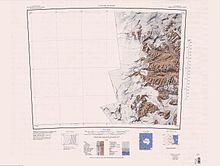
Olympus Range. 1962 USGS map showing the larger peaks. More features have been named since then.
429:
391:
349:
1596:
1026:. A cirque between Mount Electra and Mount Dido on the south side of Olympus Range. The cirque opens south to
630:
250:
2392:
681:
1600:
Eastern
Olympus Range. 1962 USGS map showing the larger peaks. More features have been named since then.
2396:
677:
657:
281:
3834:
3740:
652:
289:
1512:. Peak just west of Bull Pass. Named by the VUWAE (1958-59) for a figure in Greek mythology.
647:
246:
3115:
266:
262:
234:
198:
194:
3099:
1401:
3864:
1027:
270:
258:
226:
202:
190:
89:
3066:
210:
1614:
206:
230:
79:
17:
2358:
2345:
2320:
2307:
2282:
2269:
2244:
2231:
2206:
2193:
2168:
2155:
2130:
2117:
2092:
2079:
2054:
2041:
2016:
2003:
1978:
1965:
1940:
1927:
1902:
1889:
1864:
1851:
1826:
1813:
1788:
1775:
1750:
1737:
1712:
1699:
1674:
1661:
1636:
1623:
1575:
1562:
1537:
1524:
1499:
1486:
1461:
1448:
1423:
1410:
1379:
1366:
1341:
1328:
1303:
1290:
1265:
1252:
1207:
1194:
1169:
1156:
1131:
1118:
1093:
1080:
1055:
1042:
1013:
1000:
975:
962:
937:
924:
899:
886:
861:
848:
823:
810:
785:
772:
747:
734:
709:
696:
642:
604:
591:
566:
553:
528:
515:
486:
473:
444:
431:
406:
393:
364:
351:
326:
313:
168:
154:
119:
105:
1237:
1605:
Mount
Theseus, Mount Helios, Helios Ridge, Mount Allen and Mount Doorly.
254:
193:, Antarctica, with peaks over 2,000 metres (6,600 ft) high, between
2391:(USGS) entry for Prentice Plateau says it is at the north side of
1595:
1227:
667:
288:
280:
1236:
Central features, extending from Mount Aeolus east to the
2852:
2850:
2417:
2415:
223:
Victoria
University of Wellington Antarctic Expedition
3074:(2 ed.), United States Board on Geographic Names
95:
85:
75:
70:
32:
2733:
2952:
2589:
2565:
2481:
2469:
2457:
2940:
2916:
2745:
2685:
2649:
2625:
2553:
2433:
233:. Peaks in the range are named for figures in
2988:
2976:
2964:
2928:
2880:
2817:
2805:
2577:
2541:
285:Olympus Range north of center of mapped region
3024:
3012:
2781:
2757:
2709:
2517:
2505:
8:
2904:
2829:
2601:
2529:
2445:
503:(NZGB) (1998) after Enyo, a goddess of war.
189:) is a primarily ice-free mountain range of
2868:
29:
293:East end of Olympus Range north of center
3839:, AADC: Australian Antarctic Data Centre
3828:United States Department of the Interior
3807:United States Department of the Interior
3786:United States Department of the Interior
3765:United States Department of the Interior
3745:, AADC: Australian Antarctic Data Centre
3734:United States Department of the Interior
3713:United States Department of the Interior
3692:United States Department of the Interior
3671:United States Department of the Interior
3650:United States Department of the Interior
3629:United States Department of the Interior
3608:United States Department of the Interior
3587:United States Department of the Interior
3566:United States Department of the Interior
3545:United States Department of the Interior
3524:United States Department of the Interior
3503:United States Department of the Interior
3482:United States Department of the Interior
3461:United States Department of the Interior
3440:United States Department of the Interior
3419:United States Department of the Interior
3398:United States Department of the Interior
3377:United States Department of the Interior
3356:United States Department of the Interior
3335:United States Department of the Interior
3314:United States Department of the Interior
3293:United States Department of the Interior
3272:United States Department of the Interior
3251:United States Department of the Interior
3230:United States Department of the Interior
3209:United States Department of the Interior
3188:United States Department of the Interior
3167:United States Department of the Interior
3146:United States Department of the Interior
459:United States Antarctic Research Program
3120:, USGS: United States Geological Survey
3104:, USGS: United States Geological Survey
3093:United States Board on Geographic Names
3048:
3036:
3000:
2892:
2856:
2841:
2793:
2769:
2721:
2697:
2673:
2661:
2637:
2613:
2493:
2421:
2411:
2380:
2395:, some distance away. It should read
379:Advisory Committee on Antarctic Names
51:
7:
221:The Olympus Range was mapped by the
3819:Geographic Names Information System
3798:Geographic Names Information System
3777:Geographic Names Information System
3756:Geographic Names Information System
3725:Geographic Names Information System
3704:Geographic Names Information System
3683:Geographic Names Information System
3662:Geographic Names Information System
3641:Geographic Names Information System
3620:Geographic Names Information System
3599:Geographic Names Information System
3578:Geographic Names Information System
3557:Geographic Names Information System
3536:Geographic Names Information System
3515:Geographic Names Information System
3494:Geographic Names Information System
3473:Geographic Names Information System
3452:Geographic Names Information System
3431:Geographic Names Information System
3410:Geographic Names Information System
3389:Geographic Names Information System
3368:Geographic Names Information System
3347:Geographic Names Information System
3326:Geographic Names Information System
3305:Geographic Names Information System
3284:Geographic Names Information System
3263:Geographic Names Information System
3242:Geographic Names Information System
3221:Geographic Names Information System
3200:Geographic Names Information System
3179:Geographic Names Information System
3158:Geographic Names Information System
3137:Geographic Names Information System
245:The Olympus Range extends from the
3854:from websites or documents of the
3091:from websites or documents of the
25:
3068:Geographic Names of the Antarctic
1232:Central part of the Olympus Range
205:on the south. It is south of the
3871:Mountain ranges of Victoria Land
3850: This article incorporates
3845:
3087: This article incorporates
3082:
50:
43:
3856:United States Geological Survey
3824:United States Geological Survey
3803:United States Geological Survey
3782:United States Geological Survey
3761:United States Geological Survey
3730:United States Geological Survey
3709:United States Geological Survey
3688:United States Geological Survey
3667:United States Geological Survey
3646:United States Geological Survey
3625:United States Geological Survey
3604:United States Geological Survey
3583:United States Geological Survey
3562:United States Geological Survey
3541:United States Geological Survey
3520:United States Geological Survey
3499:United States Geological Survey
3478:United States Geological Survey
3457:United States Geological Survey
3436:United States Geological Survey
3415:United States Geological Survey
3394:United States Geological Survey
3373:United States Geological Survey
3352:United States Geological Survey
3331:United States Geological Survey
3310:United States Geological Survey
3289:United States Geological Survey
3268:United States Geological Survey
3247:United States Geological Survey
3226:United States Geological Survey
3205:United States Geological Survey
3184:United States Geological Survey
3163:United States Geological Survey
3142:United States Geological Survey
2389:United States Geological Survey
3065:Alberts, Fred G., ed. (1995),
257:. The range is bounded by the
1:
225:, 1958–59, and named for the
1637:77.431432°S 161.7632221575°E
501:New Zealand Geographic Board
27:Mountain range in Antarctica
658:GPX (secondary coordinates)
229:, mythological home of the
3892:
1642:-77.431432; 161.7632221575
1612:
1399:
676:Features to the north of
653:GPX (primary coordinates)
628:Map all coordinates using
253:on the west coast of the
37:
2283:77.439896°S 162.469388°E
2169:77.448894°S 162.242433°E
2131:77.451631°S 162.198339°E
2093:77.455289°S 162.194613°E
2055:77.452688°S 162.161797°E
2017:77.449302°S 162.140369°E
1941:77.449427°S 162.074596°E
1903:77.438451°S 161.986636°E
1827:77.497584°S 162.073715°E
1789:77.470568°S 161.994089°E
1576:77.503193°S 161.797871°E
1538:77.491252°S 161.674007°E
1462:77.474757°S 161.535191°E
1380:77.474587°S 161.439794°E
1342:77.472076°S 161.410361°E
1304:77.478076°S 161.346905°E
1132:77.481946°S 161.028341°E
938:77.503618°S 160.833629°E
862:77.505551°S 160.753169°E
824:77.506463°S 160.687231°E
786:77.455773°S 160.795539°E
710:77.508923°S 160.586736°E
636:Download coordinates as:
605:77.464743°S 162.247538°E
567:77.474534°S 162.183488°E
529:77.437069°S 162.038845°E
327:77.488399°S 161.526265°E
2245:77.447819°S 162.32695°E
1979:77.458822°S 162.09705°E
1208:77.499868°S 161.12272°E
748:77.47747°S 160.630372°E
487:77.47968°S 162.009964°E
251:Wilson Piedmont Glacier
3852:public domain material
3089:public domain material
2734:Cartwright Valley USGS
2393:Victoria Upper Glacier
2288:-77.439896; 162.469388
2174:-77.448894; 162.242433
2136:-77.451631; 162.198339
2098:-77.455289; 162.194613
2060:-77.452688; 162.161797
2022:-77.449302; 162.140369
1946:-77.449427; 162.074596
1908:-77.438451; 161.986636
1832:-77.497584; 162.073715
1794:-77.470568; 161.994089
1601:
1581:-77.503193; 161.797871
1543:-77.491252; 161.674007
1467:-77.474757; 161.535191
1385:-77.474587; 161.439794
1347:-77.472076; 161.410361
1309:-77.478076; 161.346905
1233:
1137:-77.481946; 161.028341
943:-77.503618; 160.833629
867:-77.505551; 160.753169
829:-77.506463; 160.687231
791:-77.455773; 160.795539
715:-77.508923; 160.586736
673:
610:-77.464743; 162.247538
572:-77.474534; 162.183488
534:-77.437069; 162.038845
332:-77.488399; 161.526265
294:
286:
269:to the north, and the
217:Exploration and naming
2953:McClelland Ridge USGS
2590:Pentecost Cirque USGS
2566:Prentice Plateau USGS
2482:Cerberus Glacier AADC
2250:-77.447819; 162.32695
1984:-77.458822; 162.09705
1599:
1231:
1213:-77.499868; 161.12272
753:-77.47747; 160.630372
671:
648:GPX (all coordinates)
492:-77.47968; 162.009964
292:
284:
2470:Orestes Glacier AADC
2458:Nakai Snowfield USGS
2397:Wright Upper Glacier
678:Wright Upper Glacier
3876:McMurdo Dry Valleys
3174:"Cartwright Valley"
2941:Sanford Valley USGS
2917:Baumann Valley USGS
2746:Fritsen Valley USGS
2686:Stuiver Valley USGS
2650:Leibert Cirque USGS
2626:Dipboye Cirque USGS
2554:Hawkins Cirque USGS
2434:Taylor Glacier USGS
2355: /
2317: /
2279: /
2241: /
2203: /
2165: /
2127: /
2089: /
2051: /
2013: /
1975: /
1937: /
1899: /
1861: /
1823: /
1785: /
1747: /
1709: /
1671: /
1633: /
1572: /
1534: /
1496: /
1458: /
1420: /
1376: /
1338: /
1300: /
1262: /
1204: /
1166: /
1128: /
1090: /
1052: /
1014:77.5°S 160.916667°E
1010: /
972: /
934: /
896: /
858: /
820: /
782: /
744: /
706: /
601: /
563: /
525: /
483: /
441: /
403: /
381:(US-ACAN) in 1997.
361: /
323: /
164: /
115: /
3636:"Prentice Plateau"
3594:"Pentecost Cirque"
3426:"McClelland Ridge"
2989:Artemis Ridge USGS
2977:Thomas Valley USGS
2965:Poseidon Pond USGS
2929:Nottage Ridge USGS
2881:Jones Terrace USGS
2818:Gonzalez Spur USGS
2806:Goldich Crest USGS
2578:Mount Cassidy USGS
2542:Chinn Glacier USGS
2359:77.383°S 162.900°E
2321:77.400°S 162.533°E
2207:77.450°S 162.267°E
1865:77.483°S 162.083°E
1751:77.467°S 161.917°E
1713:77.467°S 161.917°E
1675:77.433°S 161.883°E
1602:
1500:77.483°S 161.617°E
1424:77.483°S 161.450°E
1266:77.483°S 161.267°E
1234:
1170:77.483°S 161.100°E
1094:77.467°S 160.967°E
1056:77.483°S 160.950°E
976:77.500°S 160.867°E
900:77.500°S 160.800°E
674:
445:77.483°S 161.950°E
407:77.450°S 161.900°E
365:77.450°S 161.883°E
295:
287:
169:77.483°S 161.500°E
120:77.483°S 161.500°E
3531:"Nakai Snowfield"
3025:Helios Ridge USGS
3013:Mount Helios USGS
2782:Parish Ledge USGS
2758:Harris Ledge USGS
2710:Mount Thrace USGS
2518:Clio Glacier USGS
2506:Enyo Glacier USGS
1282:Cartwright Valley
1019:-77.5; 160.916667
247:Antarctic Plateau
209:and north of the
201:on the north and
143:
142:
97:Range coordinates
16:(Redirected from
3883:
3849:
3848:
3840:
3830:
3809:
3788:
3767:
3746:
3742:Cerberus Glacier
3736:
3715:
3694:
3678:"Stuiver Valley"
3673:
3657:"Sanford Valley"
3652:
3631:
3610:
3589:
3568:
3547:
3526:
3505:
3484:
3463:
3442:
3421:
3405:"Leibert Cirque"
3400:
3379:
3358:
3342:"Hawkins Cirque"
3337:
3316:
3295:
3274:
3258:"Fritsen Valley"
3253:
3232:
3216:"Dipboye Cirque"
3211:
3190:
3169:
3153:"Baumann Valley"
3148:
3127:
3126:
3125:
3111:
3110:
3109:
3086:
3085:
3081:
3080:
3079:
3073:
3052:
3046:
3040:
3034:
3028:
3022:
3016:
3010:
3004:
2998:
2992:
2986:
2980:
2974:
2968:
2962:
2956:
2950:
2944:
2938:
2932:
2926:
2920:
2914:
2908:
2905:Eurus Ridge USGS
2902:
2896:
2890:
2884:
2878:
2872:
2866:
2860:
2854:
2845:
2839:
2833:
2830:Mount Booth USGS
2827:
2821:
2815:
2809:
2803:
2797:
2791:
2785:
2779:
2773:
2767:
2761:
2755:
2749:
2743:
2737:
2731:
2725:
2719:
2713:
2707:
2701:
2695:
2689:
2683:
2677:
2671:
2665:
2659:
2653:
2647:
2641:
2635:
2629:
2623:
2617:
2611:
2605:
2602:Dean Cirque USGS
2599:
2593:
2587:
2581:
2575:
2569:
2563:
2557:
2551:
2545:
2539:
2533:
2530:Eos Glacier USGS
2527:
2521:
2515:
2509:
2503:
2497:
2491:
2485:
2479:
2473:
2467:
2461:
2455:
2449:
2446:Ross Island USGS
2443:
2437:
2431:
2425:
2419:
2400:
2385:
2370:
2369:
2367:
2366:
2365:
2364:-77.383; 162.900
2360:
2356:
2353:
2352:
2351:
2348:
2332:
2331:
2329:
2328:
2327:
2326:-77.400; 162.533
2322:
2318:
2315:
2314:
2313:
2310:
2294:
2293:
2291:
2290:
2289:
2284:
2280:
2277:
2276:
2275:
2272:
2256:
2255:
2253:
2252:
2251:
2246:
2242:
2239:
2238:
2237:
2234:
2218:
2217:
2215:
2214:
2213:
2212:-77.450; 162.267
2208:
2204:
2201:
2200:
2199:
2196:
2180:
2179:
2177:
2176:
2175:
2170:
2166:
2163:
2162:
2161:
2158:
2142:
2141:
2139:
2138:
2137:
2132:
2128:
2125:
2124:
2123:
2120:
2104:
2103:
2101:
2100:
2099:
2094:
2090:
2087:
2086:
2085:
2082:
2066:
2065:
2063:
2062:
2061:
2056:
2052:
2049:
2048:
2047:
2044:
2033:McClelland Ridge
2028:
2027:
2025:
2024:
2023:
2018:
2014:
2011:
2010:
2009:
2006:
1990:
1989:
1987:
1986:
1985:
1980:
1976:
1973:
1972:
1971:
1968:
1952:
1951:
1949:
1948:
1947:
1942:
1938:
1935:
1934:
1933:
1930:
1914:
1913:
1911:
1910:
1909:
1904:
1900:
1897:
1896:
1895:
1892:
1876:
1875:
1873:
1872:
1871:
1870:-77.483; 162.083
1866:
1862:
1859:
1858:
1857:
1854:
1838:
1837:
1835:
1834:
1833:
1828:
1824:
1821:
1820:
1819:
1816:
1800:
1799:
1797:
1796:
1795:
1790:
1786:
1783:
1782:
1781:
1778:
1762:
1761:
1759:
1758:
1757:
1756:-77.467; 161.917
1752:
1748:
1745:
1744:
1743:
1740:
1724:
1723:
1721:
1720:
1719:
1718:-77.467; 161.917
1714:
1710:
1707:
1706:
1705:
1702:
1686:
1685:
1683:
1682:
1681:
1680:-77.433; 161.883
1676:
1672:
1669:
1668:
1667:
1664:
1648:
1647:
1645:
1644:
1643:
1638:
1634:
1631:
1630:
1629:
1626:
1592:Eastern features
1587:
1586:
1584:
1583:
1582:
1577:
1573:
1570:
1569:
1568:
1565:
1549:
1548:
1546:
1545:
1544:
1539:
1535:
1532:
1531:
1530:
1527:
1511:
1510:
1508:
1507:
1506:
1505:-77.483; 161.617
1501:
1497:
1494:
1493:
1492:
1489:
1473:
1472:
1470:
1469:
1468:
1463:
1459:
1456:
1455:
1454:
1451:
1435:
1434:
1432:
1431:
1430:
1429:-77.483; 161.450
1425:
1421:
1418:
1417:
1416:
1413:
1391:
1390:
1388:
1387:
1386:
1381:
1377:
1374:
1373:
1372:
1369:
1353:
1352:
1350:
1349:
1348:
1343:
1339:
1336:
1335:
1334:
1331:
1315:
1314:
1312:
1311:
1310:
1305:
1301:
1298:
1297:
1296:
1293:
1277:
1276:
1274:
1273:
1272:
1271:-77.483; 161.267
1267:
1263:
1260:
1259:
1258:
1255:
1224:Central features
1219:
1218:
1216:
1215:
1214:
1209:
1205:
1202:
1201:
1200:
1197:
1181:
1180:
1178:
1177:
1176:
1175:-77.483; 161.100
1171:
1167:
1164:
1163:
1162:
1159:
1143:
1142:
1140:
1139:
1138:
1133:
1129:
1126:
1125:
1124:
1121:
1105:
1104:
1102:
1101:
1100:
1099:-77.467; 160.967
1095:
1091:
1088:
1087:
1086:
1083:
1067:
1066:
1064:
1063:
1062:
1061:-77.483; 160.950
1057:
1053:
1050:
1049:
1048:
1045:
1025:
1024:
1022:
1021:
1020:
1015:
1011:
1008:
1007:
1006:
1003:
987:
986:
984:
983:
982:
981:-77.500; 160.867
977:
973:
970:
969:
968:
965:
949:
948:
946:
945:
944:
939:
935:
932:
931:
930:
927:
911:
910:
908:
907:
906:
905:-77.500; 160.800
901:
897:
894:
893:
892:
889:
873:
872:
870:
869:
868:
863:
859:
856:
855:
854:
851:
835:
834:
832:
831:
830:
825:
821:
818:
817:
816:
813:
802:Pentecost Cirque
797:
796:
794:
793:
792:
787:
783:
780:
779:
778:
775:
759:
758:
756:
755:
754:
749:
745:
742:
741:
740:
737:
726:Prentice Plateau
721:
720:
718:
717:
716:
711:
707:
704:
703:
702:
699:
621:Western features
616:
615:
613:
612:
611:
606:
602:
599:
598:
597:
594:
578:
577:
575:
574:
573:
568:
564:
561:
560:
559:
556:
540:
539:
537:
536:
535:
530:
526:
523:
522:
521:
518:
498:
497:
495:
494:
493:
488:
484:
481:
480:
479:
476:
456:
455:
453:
452:
451:
450:-77.483; 161.950
446:
442:
439:
438:
437:
434:
418:
417:
415:
414:
413:
412:-77.450; 161.900
408:
404:
401:
400:
399:
396:
385:Cerberus Glacier
376:
375:
373:
372:
371:
370:-77.450; 161.883
366:
362:
359:
358:
357:
354:
338:
337:
335:
334:
333:
328:
324:
321:
320:
319:
316:
188:
187:
185:
184:
183:
181:
176:
175:
174:-77.483; 161.500
170:
165:
162:
161:
160:
157:
139:
138:
136:
135:
134:
132:
127:
126:
125:-77.483; 161.500
121:
116:
113:
112:
111:
108:
54:
53:
47:
30:
21:
3891:
3890:
3886:
3885:
3884:
3882:
3881:
3880:
3861:
3860:
3846:
3843:
3836:Orestes Glacier
3833:
3812:
3791:
3770:
3751:"Chinn Glacier"
3749:
3739:
3718:
3699:"Thomas Valley"
3697:
3676:
3655:
3634:
3615:"Poseidon Pond"
3613:
3592:
3571:
3552:"Nottage Ridge"
3550:
3529:
3508:
3487:
3468:"Mount Cassidy"
3466:
3445:
3424:
3403:
3384:"Jones Terrace"
3382:
3361:
3340:
3319:
3300:"Gonzalez Spur"
3298:
3279:"Goldich Crest"
3277:
3256:
3235:
3214:
3193:
3172:
3151:
3132:"Artemis Ridge"
3130:
3123:
3121:
3114:
3107:
3105:
3098:
3083:
3077:
3075:
3071:
3064:
3060:
3055:
3047:
3043:
3035:
3031:
3023:
3019:
3011:
3007:
2999:
2995:
2987:
2983:
2975:
2971:
2963:
2959:
2951:
2947:
2939:
2935:
2927:
2923:
2915:
2911:
2903:
2899:
2891:
2887:
2879:
2875:
2869:Wrenn Peak USGS
2867:
2863:
2855:
2848:
2840:
2836:
2828:
2824:
2816:
2812:
2804:
2800:
2792:
2788:
2780:
2776:
2768:
2764:
2756:
2752:
2744:
2740:
2732:
2728:
2720:
2716:
2708:
2704:
2696:
2692:
2684:
2680:
2672:
2668:
2660:
2656:
2648:
2644:
2636:
2632:
2624:
2620:
2612:
2608:
2600:
2596:
2588:
2584:
2576:
2572:
2564:
2560:
2552:
2548:
2540:
2536:
2528:
2524:
2516:
2512:
2504:
2500:
2492:
2488:
2480:
2476:
2468:
2464:
2456:
2452:
2444:
2440:
2432:
2428:
2420:
2413:
2409:
2404:
2403:
2386:
2382:
2377:
2363:
2361:
2357:
2354:
2349:
2346:
2344:
2342:
2341:
2339:
2325:
2323:
2319:
2316:
2311:
2308:
2306:
2304:
2303:
2301:
2287:
2285:
2281:
2278:
2273:
2270:
2268:
2266:
2265:
2263:
2249:
2247:
2243:
2240:
2235:
2232:
2230:
2228:
2227:
2225:
2211:
2209:
2205:
2202:
2197:
2194:
2192:
2190:
2189:
2187:
2173:
2171:
2167:
2164:
2159:
2156:
2154:
2152:
2151:
2149:
2135:
2133:
2129:
2126:
2121:
2118:
2116:
2114:
2113:
2111:
2097:
2095:
2091:
2088:
2083:
2080:
2078:
2076:
2075:
2073:
2059:
2057:
2053:
2050:
2045:
2042:
2040:
2038:
2037:
2035:
2021:
2019:
2015:
2012:
2007:
2004:
2002:
2000:
1999:
1997:
1983:
1981:
1977:
1974:
1969:
1966:
1964:
1962:
1961:
1959:
1945:
1943:
1939:
1936:
1931:
1928:
1926:
1924:
1923:
1921:
1907:
1905:
1901:
1898:
1893:
1890:
1888:
1886:
1885:
1883:
1869:
1867:
1863:
1860:
1855:
1852:
1850:
1848:
1847:
1845:
1831:
1829:
1825:
1822:
1817:
1814:
1812:
1810:
1809:
1807:
1793:
1791:
1787:
1784:
1779:
1776:
1774:
1772:
1771:
1769:
1755:
1753:
1749:
1746:
1741:
1738:
1736:
1734:
1733:
1731:
1717:
1715:
1711:
1708:
1703:
1700:
1698:
1696:
1695:
1693:
1679:
1677:
1673:
1670:
1665:
1662:
1660:
1658:
1657:
1655:
1641:
1639:
1635:
1632:
1627:
1624:
1622:
1620:
1619:
1617:
1611:
1594:
1580:
1578:
1574:
1571:
1566:
1563:
1561:
1559:
1558:
1556:
1542:
1540:
1536:
1533:
1528:
1525:
1523:
1521:
1520:
1518:
1504:
1502:
1498:
1495:
1490:
1487:
1485:
1483:
1482:
1480:
1466:
1464:
1460:
1457:
1452:
1449:
1447:
1445:
1444:
1442:
1428:
1426:
1422:
1419:
1414:
1411:
1409:
1407:
1406:
1404:
1398:
1384:
1382:
1378:
1375:
1370:
1367:
1365:
1363:
1362:
1360:
1346:
1344:
1340:
1337:
1332:
1329:
1327:
1325:
1324:
1322:
1308:
1306:
1302:
1299:
1294:
1291:
1289:
1287:
1286:
1284:
1270:
1268:
1264:
1261:
1256:
1253:
1251:
1249:
1248:
1246:
1226:
1212:
1210:
1206:
1203:
1198:
1195:
1193:
1191:
1190:
1188:
1174:
1172:
1168:
1165:
1160:
1157:
1155:
1153:
1152:
1150:
1136:
1134:
1130:
1127:
1122:
1119:
1117:
1115:
1114:
1112:
1098:
1096:
1092:
1089:
1084:
1081:
1079:
1077:
1076:
1074:
1060:
1058:
1054:
1051:
1046:
1043:
1041:
1039:
1038:
1036:
1018:
1016:
1012:
1009:
1004:
1001:
999:
997:
996:
994:
980:
978:
974:
971:
966:
963:
961:
959:
958:
956:
942:
940:
936:
933:
928:
925:
923:
921:
920:
918:
904:
902:
898:
895:
890:
887:
885:
883:
882:
880:
866:
864:
860:
857:
852:
849:
847:
845:
844:
842:
828:
826:
822:
819:
814:
811:
809:
807:
806:
804:
790:
788:
784:
781:
776:
773:
771:
769:
768:
766:
752:
750:
746:
743:
738:
735:
733:
731:
730:
728:
714:
712:
708:
705:
700:
697:
695:
693:
692:
690:
666:
665:
664:
663:
662:
623:
609:
607:
603:
600:
595:
592:
590:
588:
587:
585:
571:
569:
565:
562:
557:
554:
552:
550:
549:
547:
533:
531:
527:
524:
519:
516:
514:
512:
511:
509:
491:
489:
485:
482:
477:
474:
472:
470:
469:
467:
449:
447:
443:
440:
435:
432:
430:
428:
427:
425:
411:
409:
405:
402:
397:
394:
392:
390:
389:
387:
369:
367:
363:
360:
355:
352:
350:
348:
347:
345:
343:Orestes Glacier
331:
329:
325:
322:
317:
314:
312:
310:
309:
307:
305:Nakai Snowfield
279:
267:Victoria Valley
263:McKelvey Valley
243:
235:Greek mythology
219:
199:McKelvey Valley
195:Victoria Valley
179:
177:
173:
171:
167:
166:
163:
158:
155:
153:
151:
150:
130:
128:
124:
122:
118:
117:
114:
109:
106:
104:
102:
101:
66:
65:
64:
63:
62:
61:
60:
59:
55:
28:
23:
22:
15:
12:
11:
5:
3889:
3887:
3879:
3878:
3873:
3863:
3862:
3842:
3841:
3831:
3810:
3793:"Enyo Glacier"
3789:
3772:"Clio Glacier"
3768:
3747:
3737:
3716:
3695:
3674:
3653:
3632:
3611:
3590:
3573:"Parish Ledge"
3569:
3548:
3527:
3510:"Mount Thrace"
3506:
3489:"Mount Helios"
3485:
3464:
3443:
3422:
3401:
3380:
3363:"Helios Ridge"
3359:
3338:
3321:"Harris Ledge"
3317:
3296:
3275:
3254:
3233:
3212:
3191:
3170:
3149:
3128:
3117:Taylor Glacier
3112:
3096:
3061:
3059:
3056:
3054:
3053:
3051:, p. 195.
3041:
3029:
3017:
3005:
3003:, p. 741.
2993:
2981:
2969:
2957:
2945:
2933:
2921:
2909:
2897:
2895:, p. 565.
2885:
2873:
2861:
2859:, p. 546.
2846:
2844:, p. 126.
2834:
2822:
2810:
2798:
2796:, p. 369.
2786:
2774:
2772:, p. 329.
2762:
2750:
2738:
2726:
2714:
2702:
2690:
2678:
2676:, p. 136.
2666:
2664:, p. 188.
2654:
2642:
2640:, p. 216.
2630:
2618:
2606:
2594:
2582:
2570:
2558:
2546:
2534:
2522:
2510:
2498:
2496:, p. 648.
2486:
2474:
2462:
2450:
2438:
2426:
2424:, p. 543.
2410:
2408:
2405:
2402:
2401:
2379:
2378:
2376:
2373:
2338:
2335:
2300:
2297:
2262:
2259:
2224:
2221:
2186:
2183:
2148:
2145:
2110:
2107:
2072:
2069:
2034:
2031:
1996:
1995:Sanford Valley
1993:
1958:
1955:
1920:
1919:Baumann Valley
1917:
1882:
1879:
1844:
1841:
1806:
1803:
1768:
1765:
1730:
1727:
1692:
1691:Orestes Valley
1689:
1654:
1653:Mount Cerberus
1651:
1613:Main article:
1610:
1607:
1593:
1590:
1555:
1552:
1517:
1514:
1479:
1476:
1441:
1438:
1402:Mount Hercules
1400:Main article:
1397:
1396:Mount Hercules
1394:
1359:
1356:
1321:
1320:Fritsen Valley
1318:
1283:
1280:
1245:
1242:
1225:
1222:
1187:
1184:
1149:
1146:
1111:
1110:Stuiver Valley
1108:
1073:
1070:
1035:
1032:
993:
992:Leibert Cirque
990:
955:
952:
917:
916:Dipboye Cirque
914:
879:
876:
841:
838:
803:
800:
765:
762:
727:
724:
689:
688:Hawkins Cirque
686:
661:
660:
655:
650:
645:
639:
633:
626:
625:
624:
622:
619:
584:
581:
546:
543:
508:
505:
466:
463:
424:
421:
386:
383:
344:
341:
306:
303:
278:
275:
273:to the south.
242:
239:
218:
215:
141:
140:
99:
93:
92:
87:
83:
82:
77:
73:
72:
68:
67:
57:
56:
49:
48:
42:
41:
40:
39:
38:
35:
34:
26:
24:
18:Orestes Valley
14:
13:
10:
9:
6:
4:
3:
2:
3888:
3877:
3874:
3872:
3869:
3868:
3866:
3859:
3857:
3853:
3838:
3837:
3832:
3829:
3825:
3821:
3820:
3815:
3814:"Eos Glacier"
3811:
3808:
3804:
3800:
3799:
3794:
3790:
3787:
3783:
3779:
3778:
3773:
3769:
3766:
3762:
3758:
3757:
3752:
3748:
3744:
3743:
3738:
3735:
3731:
3727:
3726:
3721:
3717:
3714:
3710:
3706:
3705:
3700:
3696:
3693:
3689:
3685:
3684:
3679:
3675:
3672:
3668:
3664:
3663:
3658:
3654:
3651:
3647:
3643:
3642:
3637:
3633:
3630:
3626:
3622:
3621:
3616:
3612:
3609:
3605:
3601:
3600:
3595:
3591:
3588:
3584:
3580:
3579:
3574:
3570:
3567:
3563:
3559:
3558:
3553:
3549:
3546:
3542:
3538:
3537:
3532:
3528:
3525:
3521:
3517:
3516:
3511:
3507:
3504:
3500:
3496:
3495:
3490:
3486:
3483:
3479:
3475:
3474:
3469:
3465:
3462:
3458:
3454:
3453:
3448:
3447:"Mount Booth"
3444:
3441:
3437:
3433:
3432:
3427:
3423:
3420:
3416:
3412:
3411:
3406:
3402:
3399:
3395:
3391:
3390:
3385:
3381:
3378:
3374:
3370:
3369:
3364:
3360:
3357:
3353:
3349:
3348:
3343:
3339:
3336:
3332:
3328:
3327:
3322:
3318:
3315:
3311:
3307:
3306:
3301:
3297:
3294:
3290:
3286:
3285:
3280:
3276:
3273:
3269:
3265:
3264:
3259:
3255:
3252:
3248:
3244:
3243:
3238:
3237:"Eurus Ridge"
3234:
3231:
3227:
3223:
3222:
3217:
3213:
3210:
3206:
3202:
3201:
3196:
3195:"Dean Cirque"
3192:
3189:
3185:
3181:
3180:
3175:
3171:
3168:
3164:
3160:
3159:
3154:
3150:
3147:
3143:
3139:
3138:
3133:
3129:
3119:
3118:
3113:
3103:
3102:
3097:
3094:
3090:
3070:
3069:
3063:
3062:
3057:
3050:
3045:
3042:
3039:, p. 13.
3038:
3033:
3030:
3026:
3021:
3018:
3014:
3009:
3006:
3002:
2997:
2994:
2990:
2985:
2982:
2978:
2973:
2970:
2966:
2961:
2958:
2954:
2949:
2946:
2942:
2937:
2934:
2930:
2925:
2922:
2918:
2913:
2910:
2906:
2901:
2898:
2894:
2889:
2886:
2882:
2877:
2874:
2870:
2865:
2862:
2858:
2853:
2851:
2847:
2843:
2838:
2835:
2831:
2826:
2823:
2819:
2814:
2811:
2807:
2802:
2799:
2795:
2790:
2787:
2783:
2778:
2775:
2771:
2766:
2763:
2759:
2754:
2751:
2747:
2742:
2739:
2735:
2730:
2727:
2723:
2718:
2715:
2711:
2706:
2703:
2700:, p. 81.
2699:
2694:
2691:
2687:
2682:
2679:
2675:
2670:
2667:
2663:
2658:
2655:
2651:
2646:
2643:
2639:
2634:
2631:
2627:
2622:
2619:
2616:, p. 24.
2615:
2610:
2607:
2603:
2598:
2595:
2591:
2586:
2583:
2579:
2574:
2571:
2567:
2562:
2559:
2555:
2550:
2547:
2543:
2538:
2535:
2531:
2526:
2523:
2519:
2514:
2511:
2507:
2502:
2499:
2495:
2490:
2487:
2483:
2478:
2475:
2471:
2466:
2463:
2459:
2454:
2451:
2447:
2442:
2439:
2435:
2430:
2427:
2423:
2418:
2416:
2412:
2406:
2398:
2394:
2390:
2384:
2381:
2374:
2372:
2368:
2336:
2334:
2330:
2298:
2296:
2292:
2260:
2258:
2254:
2222:
2220:
2216:
2185:Mount Theseus
2184:
2182:
2178:
2147:Artemis Ridge
2146:
2144:
2140:
2109:Thomas Valley
2108:
2106:
2102:
2071:Poseidon Pond
2070:
2068:
2064:
2032:
2030:
2026:
1994:
1992:
1988:
1957:Nottage Ridge
1956:
1954:
1950:
1918:
1916:
1912:
1880:
1878:
1874:
1842:
1840:
1836:
1805:Jones Terrace
1804:
1802:
1798:
1766:
1764:
1760:
1729:Mount Orestes
1728:
1726:
1722:
1690:
1688:
1684:
1652:
1650:
1646:
1616:
1608:
1606:
1598:
1591:
1589:
1585:
1554:Gonzalez Spur
1553:
1551:
1547:
1516:Goldich Crest
1515:
1513:
1509:
1477:
1475:
1471:
1439:
1437:
1433:
1403:
1395:
1393:
1389:
1357:
1355:
1351:
1319:
1317:
1313:
1281:
1279:
1275:
1243:
1241:
1239:
1230:
1223:
1221:
1217:
1185:
1183:
1179:
1147:
1145:
1141:
1109:
1107:
1103:
1071:
1069:
1065:
1033:
1031:
1029:
1028:The Labyrinth
1023:
991:
989:
985:
954:Mount Electra
953:
951:
947:
915:
913:
909:
877:
875:
871:
839:
837:
833:
801:
799:
795:
764:Mount Cassidy
763:
761:
757:
725:
723:
719:
687:
685:
683:
679:
670:
659:
656:
654:
651:
649:
646:
644:
641:
640:
638:
637:
632:
631:OpenStreetMap
629:
620:
618:
614:
583:Chinn Glacier
582:
580:
576:
544:
542:
538:
506:
504:
502:
496:
464:
462:
460:
454:
423:Sandy Glacier
422:
420:
416:
384:
382:
380:
374:
342:
340:
336:
304:
302:
300:
299:Clark Glacier
291:
283:
276:
274:
272:
271:Wright Valley
268:
264:
260:
259:Balham Valley
256:
252:
248:
240:
238:
236:
232:
228:
227:Mount Olympus
224:
216:
214:
212:
208:
204:
203:Wright Valley
200:
196:
192:
191:Victoria Land
186:
180:Olympus Range
148:
147:Olympus Range
137:
131:Olympus Range
100:
98:
94:
91:
90:Victoria Land
88:
84:
81:
78:
74:
69:
58:Olympus Range
46:
36:
33:Olympus Range
31:
19:
3844:
3835:
3817:
3796:
3775:
3754:
3741:
3723:
3720:"Wrenn Peak"
3702:
3681:
3660:
3639:
3618:
3597:
3576:
3555:
3534:
3513:
3492:
3471:
3450:
3429:
3408:
3387:
3366:
3345:
3324:
3303:
3282:
3261:
3240:
3219:
3198:
3177:
3156:
3135:
3122:, retrieved
3116:
3106:, retrieved
3100:
3076:, retrieved
3067:
3049:Alberts 1995
3044:
3037:Alberts 1995
3032:
3020:
3008:
3001:Alberts 1995
2996:
2984:
2972:
2960:
2948:
2936:
2924:
2912:
2900:
2893:Alberts 1995
2888:
2876:
2864:
2857:Alberts 1995
2842:Alberts 1995
2837:
2825:
2813:
2801:
2794:Alberts 1995
2789:
2777:
2770:Alberts 1995
2765:
2753:
2741:
2729:
2724:, p. 6.
2722:Alberts 1995
2717:
2705:
2698:Alberts 1995
2693:
2681:
2674:Alberts 1995
2669:
2662:Alberts 1995
2657:
2645:
2638:Alberts 1995
2633:
2621:
2614:Alberts 1995
2609:
2597:
2585:
2573:
2561:
2549:
2537:
2525:
2513:
2501:
2494:Alberts 1995
2489:
2477:
2465:
2453:
2441:
2429:
2422:Alberts 1995
2383:
2340:
2337:Mount Doorly
2302:
2264:
2261:Helios Ridge
2226:
2223:Mount Helios
2188:
2150:
2112:
2074:
2036:
1998:
1960:
1922:
1884:
1846:
1843:Mount Peleus
1808:
1770:
1732:
1694:
1656:
1618:
1603:
1557:
1519:
1481:
1443:
1440:Parish Ledge
1405:
1361:
1358:Harris Ledge
1323:
1285:
1247:
1244:Mount Aeolus
1235:
1189:
1186:Mount Thrace
1151:
1148:Mount Boreas
1113:
1075:
1037:
995:
957:
919:
881:
843:
805:
767:
729:
691:
675:
635:
634:
627:
586:
548:
510:
507:Clio Glacier
468:
465:Enyo Glacier
426:
388:
346:
308:
296:
244:
220:
211:Asgard Range
146:
144:
3101:Ross Island
2362: /
2324: /
2299:Mount Allen
2286: /
2274:162°28′10″E
2248: /
2236:162°19′37″E
2210: /
2172: /
2160:162°14′33″E
2134: /
2122:162°11′54″E
2096: /
2084:162°11′41″E
2058: /
2046:162°09′42″E
2020: /
2008:162°08′25″E
1982: /
1970:162°05′49″E
1944: /
1932:162°04′29″E
1906: /
1894:161°59′12″E
1881:Eurus Ridge
1868: /
1830: /
1818:162°04′25″E
1792: /
1780:161°59′39″E
1754: /
1716: /
1678: /
1640: /
1628:161°45′48″E
1615:Mount Booth
1609:Mount Booth
1579: /
1567:161°47′52″E
1541: /
1529:161°40′26″E
1503: /
1478:Mount Jason
1465: /
1453:161°32′07″E
1427: /
1383: /
1371:161°26′23″E
1345: /
1333:161°24′37″E
1307: /
1295:161°20′49″E
1269: /
1211: /
1199:161°07′22″E
1173: /
1135: /
1123:161°01′42″E
1097: /
1072:Mount Circe
1059: /
1017: /
1005:160°55′00″E
979: /
941: /
929:160°50′01″E
903: /
878:Apollo Peak
865: /
853:160°45′11″E
840:Dean Cirque
827: /
815:160°41′14″E
789: /
777:160°47′44″E
751: /
739:160°37′49″E
713: /
701:160°35′12″E
608: /
596:162°14′51″E
570: /
558:162°11′01″E
545:Eos Glacier
532: /
520:162°02′20″E
490: /
478:162°00′36″E
448: /
410: /
368: /
330: /
318:161°31′35″E
207:Clare Range
172: /
123: /
3865:Categories
3124:2024-02-13
3108:2024-02-13
3078:2024-01-30
2407:References
2271:77°26′24″S
2233:77°26′52″S
2157:77°26′56″S
2119:77°27′06″S
2081:77°27′19″S
2043:77°27′10″S
2005:77°26′57″S
1967:77°27′32″S
1929:77°26′58″S
1891:77°26′18″S
1815:77°29′51″S
1777:77°28′14″S
1767:Wrenn Peak
1625:77°25′53″S
1564:77°30′11″S
1526:77°29′29″S
1450:77°28′29″S
1368:77°28′29″S
1330:77°28′19″S
1292:77°28′41″S
1196:77°30′00″S
1120:77°28′55″S
1034:Mount Dido
1002:77°30′00″S
926:77°30′13″S
850:77°30′20″S
812:77°30′23″S
774:77°27′21″S
736:77°28′39″S
698:77°30′32″S
593:77°27′53″S
555:77°28′28″S
517:77°26′13″S
475:77°28′47″S
315:77°29′18″S
231:Greek gods
178: (
129: (
80:Antarctica
1238:Bull Pass
682:Labyrinth
76:Continent
71:Geography
2350:162°54′E
2312:162°32′E
2198:162°16′E
1856:162°05′E
1742:161°55′E
1704:161°55′E
1666:161°53′E
1491:161°37′E
1415:161°27′E
1257:161°16′E
1161:161°06′E
1085:160°58′E
1047:160°57′E
967:160°52′E
891:160°48′E
680:and the
436:161°57′E
398:161°54′E
356:161°53′E
277:Glaciers
255:Ross Sea
241:Location
159:161°30′E
110:161°30′E
3058:Sources
2347:77°23′S
2309:77°24′S
2195:77°27′S
1853:77°29′S
1739:77°28′S
1701:77°28′S
1663:77°26′S
1488:77°29′S
1412:77°29′S
1254:77°29′S
1158:77°29′S
1082:77°28′S
1044:77°29′S
964:77°30′S
888:77°30′S
433:77°29′S
395:77°27′S
353:77°27′S
249:to the
156:77°29′S
107:77°29′S
86:Region
3072:(PDF)
2375:Notes
2387:The
265:and
197:and
145:The
643:KML
3867::
3858:.
3826:,
3822:,
3816:,
3805:,
3801:,
3795:,
3784:,
3780:,
3774:,
3763:,
3759:,
3753:,
3732:,
3728:,
3722:,
3711:,
3707:,
3701:,
3690:,
3686:,
3680:,
3669:,
3665:,
3659:,
3648:,
3644:,
3638:,
3627:,
3623:,
3617:,
3606:,
3602:,
3596:,
3585:,
3581:,
3575:,
3564:,
3560:,
3554:,
3543:,
3539:,
3533:,
3522:,
3518:,
3512:,
3501:,
3497:,
3491:,
3480:,
3476:,
3470:,
3459:,
3455:,
3449:,
3438:,
3434:,
3428:,
3417:,
3413:,
3407:,
3396:,
3392:,
3386:,
3375:,
3371:,
3365:,
3354:,
3350:,
3344:,
3333:,
3329:,
3323:,
3312:,
3308:,
3302:,
3291:,
3287:,
3281:,
3270:,
3266:,
3260:,
3249:,
3245:,
3239:,
3228:,
3224:,
3218:,
3207:,
3203:,
3197:,
3186:,
3182:,
3176:,
3165:,
3161:,
3155:,
3144:,
3140:,
3134:,
2849:^
2414:^
301:.
261:,
237:.
213:.
3095:.
3027:.
3015:.
2991:.
2979:.
2967:.
2955:.
2943:.
2931:.
2919:.
2907:.
2883:.
2871:.
2832:.
2820:.
2808:.
2784:.
2760:.
2748:.
2736:.
2712:.
2688:.
2652:.
2628:.
2604:.
2592:.
2580:.
2568:.
2556:.
2544:.
2532:.
2520:.
2508:.
2484:.
2472:.
2460:.
2448:.
2436:.
2399:.
182:)
149:(
133:)
20:)
Text is available under the Creative Commons Attribution-ShareAlike License. Additional terms may apply.