40:
390:
301:
from the right, turns west and passes
Roslavl. There, the Ostyor turns northwest. At the border of the district, it turns west, a stretch of the Ostyor makes the border between Roslavlsky and Pochinskovsky Districts. Downstream, it turns south and makes the border between Roslavlsky and Shumyachsky
374:
314:
from the right. It crosses
Shumyachsky District, and at the state border between Russia and Belarus turns west and follows the border. The mouth of the Ostyor is close to the village of
325:
of the Ostyor includes the southern part of
Pochinkovsky District, the western part of Roslavlsky District, the central part of Shumyachsky District, minor areas in the east of
116:
243:
409:
414:
419:
315:
286:. The Ostyor is 274 kilometres (170 mi) long, and has a 3,490 square kilometres (1,350 sq mi) basin. The town of
290:
is located on the left bank of the Ostyor. The lower course of the Ostyor marks the state border between Russia and
Belarus.
394:
424:
303:
206:
326:
39:
45:
251:
353:
298:
263:
247:
235:
267:
223:
64:
311:
294:
255:
322:
271:
21:
403:
17:
306:
it departs from the border, turns west, flows north of the urban-type settlement of
97:
131:
118:
307:
279:
210:
389:
293:
The source of the Ostyor is in the east of
Pochinkovsky District, in the
287:
275:
202:
85:
259:
81:
283:
198:
102:
329:, as well as parts of Klimavichy and Krychaw Districts.
194:
189:
175:
167:
155:
147:
108:
96:
91:
77:
72:
52:
32:
16:For the tributary of the Desna in Ukraine, see
354:"Научно-популярная энциклопедия "Вода России""
56:
8:
20:. For the rural locality in Russia, see
338:
29:
348:
346:
344:
342:
297:. The river flows south, accepts the
181:20.8 m/s (730 cu ft/s)
159:3,490 km (1,350 sq mi)
7:
302:Districts. Close to the village of
310:, turns southwest and accepts the
14:
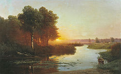
44:Ostyor River (1885), painting by
388:
38:
110: • coordinates
1:
92:Physical characteristics
441:
410:Tributaries of the Dnieper
177: • average
15:
415:Rivers of Smolensk Oblast
239:
227:
185:
163:
151:274 km (170 mi)
57:
37:
420:Rivers of Mogilev Region
375:official transliteration
27:River in Russia, Belarus
327:Khislavichsky District
397:at Wikimedia Commons
252:Shumyachsky Districts
132:53.79694°N 31.76056°E
395:Ostyor River (Sozh)
207:Dnieper–Bug estuary
190:Basin features
128: /
137:53.79694; 31.76056
425:Rivers of Belarus
393:Media related to
268:Krychaw Districts
216:
215:
46:Nikolay Atryganev
432:
392:
377:
372:
366:
365:
363:
361:
350:
242:) is a river in
241:
229:
178:
143:
142:
140:
139:
138:
133:
129:
126:
125:
124:
121:
68:
60:
59:
42:
30:
440:
439:
435:
434:
433:
431:
430:
429:
400:
399:
386:
381:
380:
373:
369:
359:
357:
352:
351:
340:
335:
295:Smolensk Upland
278:. It is a left
256:Smolensk Oblast
176:
136:
134:
130:
127:
122:
119:
117:
115:
114:
111:
62:
48:
28:
25:
12:
11:
5:
438:
436:
428:
427:
422:
417:
412:
402:
401:
385:
384:External links
382:
379:
378:
367:
337:
336:
334:
331:
323:drainage basin
272:Mogilev Region
214:
213:
196:
192:
191:
187:
186:
183:
182:
179:
173:
172:
169:
165:
164:
161:
160:
157:
153:
152:
149:
145:
144:
112:
109:
106:
105:
100:
94:
93:
89:
88:
79:
75:
74:
70:
69:
54:
50:
49:
43:
35:
34:
26:
22:Ostyor, Russia
13:
10:
9:
6:
4:
3:
2:
437:
426:
423:
421:
418:
416:
413:
411:
408:
407:
405:
398:
396:
391:
383:
376:
371:
368:
355:
349:
347:
345:
343:
339:
332:
330:
328:
324:
319:
317:
313:
309:
305:
300:
296:
291:
289:
285:
281:
277:
273:
269:
265:
261:
257:
253:
249:
245:
237:
233:
225:
221:
212:
208:
204:
200:
197:
193:
188:
184:
180:
174:
170:
166:
162:
158:
154:
150:
146:
141:
113:
107:
104:
101:
99:
95:
90:
87:
83:
80:
76:
71:
66:
55:
51:
47:
41:
36:
31:
23:
19:
18:Oster (river)
387:
370:
358:. Retrieved
356:(in Russian)
320:
292:
244:Pochinkovsky
231:
219:
217:
360:26 December
304:Samolyubovo
195:Progression
135: /
53:Native name
404:Categories
333:References
264:Klimavichy
248:Roslavlsky
236:Belarusian
156:Basin size
123:31°45′38″E
120:53°47′49″N
308:Shumyachi
280:tributary
211:Black Sea
168:Discharge
73:Location
288:Roslavl
282:of the
276:Belarus
262:and in
224:Russian
203:Dnieper
86:Belarus
78:Country
65:Russian
316:Kholmy
299:Ostrik
260:Russia
250:, and
232:Ascior
230:), or
220:Ostyor
171:
148:Length
82:Russia
61:
33:Ostyor
312:Nemka
240:Асцёр
228:Остёр
98:Mouth
58:Остёр
362:2017
321:The
284:Sozh
266:and
218:The
199:Sozh
103:Sozh
274:of
270:of
258:in
254:of
406::
341:^
318:.
246:,
238::
226::
209:→
205:→
201:→
84:,
364:.
234:(
222:(
67:)
63:(
24:.
Text is available under the Creative Commons Attribution-ShareAlike License. Additional terms may apply.