31:
53:
40:
937:
895:
683:
587:
127:
60:
227:. This city, located 200 km south of the capital Algiers, is crossed by the Trans-Saharan Highway main road number 1. The road that runs through the whole of Algeria from north to south over 2000 km, connects Algiers on its southern border with Mali near Tamanrasset. Ain Oussera, has experienced, since 1990, rapid
30:
997:
978:
575:
87:
916:
1007:
261:
52:
971:
568:
553:
1002:
964:
561:
232:
652:
622:
617:
257:
119:
662:
672:
647:
637:
609:
236:
224:
151:
139:
691:
667:
657:
268:
240:
869:
228:
948:
223:, with an estimated (2005) population of 134,174. It is the district seat of the Aïn Oussera
191:
39:
944:
759:
642:
632:
627:
591:
216:
208:
144:
699:
936:
900:
789:
729:
704:
991:
814:
744:
714:
473:
819:
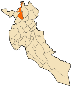
809:
859:
854:
839:
834:
779:
769:
754:
734:
709:
890:
824:
804:
102:
89:
844:
784:
774:
182:
682:
799:
794:
849:
829:
724:
220:
132:
73:
874:
864:
764:
749:
739:
601:
187:
557:
917:"Weatherbase: Historical Weather for Ain Oussera, Algeria"
952:
690:
608:
181:
173:
168:
160:
150:
138:
118:
21:
239:) and N40B highways. The nearest airport is the
235:. Aïn Oussera is on the crossroads of the N1 (
972:
569:
8:
979:
965:
576:
562:
554:
279:
18:
908:
180:
167:
159:
117:
82:
45:
36:
27:
172:
149:
137:
7:
933:
931:
998:Populated places in Djelfa Province
212:
59:
951:. You can help Knowledge (XXG) by
231:due to its proximity to the 15 MW
14:
943:This article about a location in
935:
893:
681:
585:
243:'s Aïn Oussera airfield (DAAQ).
125:
58:
51:
38:
29:
921:Retrieved on November 24, 2011.
72:Location of Aïn Oussera within
1:
283:Climate data for Ain Oussera
262:Köppen climate classification
267:), while it closely borders
402:Mean daily minimum °C (°F)
332:Mean daily maximum °C (°F)
1024:
930:
545:
282:
164:687 m (2,254 ft)
679:
598:
471:
401:
331:
326:
323:
320:
317:
314:
311:
308:
305:
302:
299:
296:
293:
290:
287:
83:
46:
37:
28:
233:Es Salam nuclear reactor
16:Place in Djelfa, Algeria
1008:Algeria geography stubs
258:cold semi-arid climate
546:Source: Weatherbase
919:. Weatherbase. 2011.
103:35.44889°N 2.90444°E
269:cold desert climate
99: /
256:Aïn Oussera has a
241:Algerian Air Force
174: • Total
1003:Cities in Algeria
960:
959:
883:
882:
550:
549:
229:population growth
198:
197:
108:35.44889; 2.90444
1015:
981:
974:
967:
939:
932:
922:
920:
913:
903:
898:
897:
896:
685:
590:
589:
588:
578:
571:
564:
555:
280:
214:
192:West Africa Time
131:
129:
128:
114:
113:
111:
110:
109:
104:
100:
97:
96:
95:
92:
62:
61:
55:
42:
33:
19:
1023:
1022:
1018:
1017:
1016:
1014:
1013:
1012:
988:
987:
986:
985:
945:Djelfa Province
928:
926:
925:
915:
914:
910:
899:
894:
892:
889:
884:
879:
686:
677:
604:
594:
592:Djelfa Province
586:
584:
582:
552:
551:
540:
535:
530:
525:
520:
515:
510:
505:
500:
495:
490:
485:
480:
466:
461:
456:
451:
446:
441:
436:
431:
426:
421:
416:
411:
406:
396:
391:
386:
381:
376:
371:
366:
361:
356:
351:
346:
341:
336:
254:
249:
217:Djelfa Province
215:) is a city in
126:
124:
107:
105:
101:
98:
93:
90:
88:
86:
85:
79:
78:
77:
76:
70:
69:
68:
67:
63:
24:
17:
12:
11:
5:
1021:
1019:
1011:
1010:
1005:
1000:
990:
989:
984:
983:
976:
969:
961:
958:
957:
940:
924:
923:
907:
906:
905:
904:
901:Algeria portal
888:
885:
881:
880:
878:
877:
872:
867:
862:
857:
852:
847:
842:
837:
832:
827:
822:
817:
812:
807:
802:
797:
792:
790:Faidh El Botma
787:
782:
777:
772:
767:
762:
757:
752:
747:
742:
737:
732:
727:
722:
717:
712:
707:
702:
696:
694:
688:
687:
680:
678:
676:
675:
670:
665:
660:
655:
653:Faidh El Botma
650:
645:
640:
635:
630:
625:
620:
614:
612:
606:
605:
599:
596:
595:
583:
581:
580:
573:
566:
558:
548:
547:
543:
542:
537:
532:
527:
522:
517:
512:
507:
502:
497:
492:
487:
482:
477:
469:
468:
463:
458:
453:
448:
443:
438:
433:
428:
423:
418:
413:
408:
403:
399:
398:
393:
388:
383:
378:
373:
368:
363:
358:
353:
348:
343:
338:
333:
329:
328:
325:
322:
319:
316:
313:
310:
307:
304:
301:
298:
295:
292:
289:
285:
284:
278:
277:
253:
250:
248:
245:
196:
195:
185:
179:
178:
175:
171:
170:
166:
165:
162:
158:
157:
154:
148:
147:
142:
136:
135:
122:
116:
115:
81:
80:
71:
65:
64:
57:
56:
50:
49:
48:
47:
44:
43:
35:
34:
26:
25:
22:
15:
13:
10:
9:
6:
4:
3:
2:
1020:
1009:
1006:
1004:
1001:
999:
996:
995:
993:
982:
977:
975:
970:
968:
963:
962:
956:
954:
950:
946:
941:
938:
934:
929:
918:
912:
909:
902:
891:
886:
876:
873:
871:
868:
866:
863:
861:
858:
856:
853:
851:
848:
846:
843:
841:
838:
836:
833:
831:
828:
826:
823:
821:
818:
816:
815:Hassi El Euch
813:
811:
808:
806:
803:
801:
798:
796:
793:
791:
788:
786:
783:
781:
778:
776:
773:
771:
768:
766:
763:
761:
758:
756:
753:
751:
748:
746:
745:Bouira Lahdab
743:
741:
738:
736:
733:
731:
728:
726:
723:
721:
718:
716:
713:
711:
708:
706:
703:
701:
698:
697:
695:
693:
689:
684:
674:
671:
669:
666:
664:
661:
659:
656:
654:
651:
649:
646:
644:
641:
639:
636:
634:
631:
629:
626:
624:
621:
619:
616:
615:
613:
611:
607:
603:
597:
593:
579:
574:
572:
567:
565:
560:
559:
556:
544:
538:
533:
528:
523:
518:
513:
508:
503:
498:
493:
488:
483:
478:
475:
474:precipitation
470:
464:
459:
454:
449:
444:
439:
434:
429:
424:
419:
414:
409:
404:
400:
394:
389:
384:
379:
374:
369:
364:
359:
354:
349:
344:
339:
334:
330:
286:
281:
276:
274:
270:
266:
263:
259:
251:
246:
244:
242:
238:
237:Trans-Saharan
234:
230:
226:
222:
218:
210:
206:
202:
193:
189:
186:
184:
176:
163:
155:
153:
146:
143:
141:
134:
123:
121:
112:
84:Coordinates:
75:
54:
41:
32:
20:
953:expanding it
942:
927:
911:
820:Hassi Fedoul
810:Hassi Bahbah
719:
700:Aïn Chouhada
663:Hassi Bahbah
476:mm (inches)
272:
264:
255:
204:
200:
199:
860:Sidi Ladjel
855:Sidi Baizid
840:Oum Laadham
835:Mouadjebara
780:El Idrissia
755:Dar Chioukh
735:Beni Yagoub
720:Aïn Oussera
705:Aïn El Ibel
673:Sidi Ladjel
648:El Idrissia
638:Dar Chioukh
623:Aïn Oussera
618:Aïn El Ibil
205:Aïn Oussara
201:Aïn Oussera
156:Aïn Oussera
106: /
66:Aïn Oussera
23:Aïn Oussera
992:Categories
887:References
805:Had-Sahary
715:Aïn Maabed
658:Had Sahary
169:Population
91:35°26′56″N
845:Sed Rahal
785:El Khemis
775:El Guedid
610:Districts
600:Capital:
247:Geography
213:عين وسارة
183:Time zone
161:Elevation
94:2°54′16″E
870:Zaafrane
800:Guettara
795:Guernini
710:Aïn Feka
692:Communes
472:Average
225:District
152:District
140:Province
850:Selmana
830:Mouilha
760:Deldoul
725:Amourah
668:Messaâd
252:Climate
221:Algeria
177:134,174
133:Algeria
120:Country
74:Algeria
875:Zaccar
865:Tadmit
825:Messad
765:Djelfa
750:Charef
740:Birine
730:Benhar
643:Djelfa
633:Charef
628:Birine
602:Djelfa
541:(9.5)
536:(0.8)
531:(0.6)
526:(0.8)
521:(1.4)
516:(0.2)
506:(1.2)
501:(0.6)
491:(1.3)
481:(0.6)
288:Month
209:Arabic
145:Djelfa
130:
947:is a
770:Douis
467:(50)
462:(38)
457:(43)
452:(51)
447:(60)
442:(67)
437:(66)
432:(62)
427:(52)
422:(44)
417:(43)
412:(37)
407:(34)
397:(74)
392:(54)
387:(63)
382:(73)
377:(88)
372:(99)
367:(98)
362:(90)
357:(79)
352:(69)
347:(65)
342:(60)
337:(55)
327:Year
188:UTC+1
949:stub
511:(0)
496:(1)
486:(1)
324:Dec
321:Nov
318:Oct
315:Sep
312:Aug
309:Jul
306:Jun
303:May
300:Apr
297:Mar
294:Feb
291:Jan
539:240
514:5.1
275:).
273:BWk
265:BSk
203:or
994::
534:20
529:15
524:20
519:36
504:30
499:15
494:25
489:33
484:25
479:15
465:10
450:11
445:16
440:19
435:19
430:17
425:11
395:23
390:12
385:17
380:23
375:31
370:37
365:37
360:32
355:26
350:21
345:18
340:16
335:13
219:,
211::
980:e
973:t
966:v
955:.
577:e
570:t
563:v
509:0
460:3
455:6
420:7
415:6
410:3
405:1
271:(
260:(
207:(
194:)
190:(
Text is available under the Creative Commons Attribution-ShareAlike License. Additional terms may apply.
↑