68:
1214:
56:
718:
living together, 10.3% had a female householder with no husband present, 4.7% had a male householder with no wife present, and 33.3% were non-families. 29.1% of all households were made up of individuals, and 13.7% had someone living alone who was 65 years of age or older. The average household size
779:
In the city, the population was spread out, with 23.3% under the age of 18, 9.2% from 18 to 24, 25.1% from 25 to 44, 24.1% from 45 to 64, and 18.4% who were 65 years of age or older. The median age was 41 years. For every 100 females, there were 91.0 males. For every 100 females age 18 and over,
775:
living together, 8.2% had a female householder with no husband present, and 35.6% were non-families. 32.3% of all households were made up of individuals, and 20.0% had someone living alone who was 65 years of age or older. The average household size was 2.31 and the average family size was 2.89.
735:
of 2000, there were 1,079 people, 461 households, and 296 families living in the city. The population density was 1,053.3 inhabitants per square mile (406.7/km). There were 475 housing units at an average density of 463.7 per square mile (179.0/km). The racial makeup of the city was 97.96%
722:
The median age in the city was 37.7 years. 25.1% of residents were under the age of 18; 8.2% were between the ages of 18 and 24; 23.4% were from 25 to 44; 28.8% were from 45 to 64; and 14.7% were 65 years of age or older. The gender makeup of the city was 49.2% male and 50.8% female.
382:. School colors are teal, black and silver. Currently, students in grades 5-12 attend classes in the neighboring town of Grove City. Younger students from Atwater attend ACGC North Elementary located approximately one-quarter mile from the downtown.
67:
362:
Atwater was laid out in 1869, and incorporated on
February 17, 1876. The city was named for E. D. Atwater, a railroad official. A post office has been in operation at Atwater since 1870.
1253:
783:
The median income for a household in the city was $ 39,265, and the median income for a family was $ 48,289. Males had a median income of $ 30,365 versus $ 22,625 for females. The
683:
was 1,100.0 inhabitants per square mile (424.7/km). There were 494 housing units at an average density of 479.6 per square mile (185.2/km). The racial makeup of the city was 97.2%
1097:
1303:
1308:
1323:
1298:
1343:
1318:
1273:
1338:
1333:
1293:
1268:
1233:
1436:
1328:
1278:
348:, the city has a total area of 1.08 square miles (2.80 km), of which 1.03 square miles (2.67 km) is land and 0.05 square miles (0.13 km) is water.
1348:
1283:
1258:
1238:
1288:
1263:
1243:
1313:
1248:
81:
1090:
937:
287:
1083:
297:
821:
1075:
890:
55:
1070:
1015:
991:
753:
741:
688:
1065:
745:
692:
133:
1431:
1107:
1032:
941:
916:
866:
757:
345:
325:
138:
351:
634:
619:
604:
589:
574:
559:
544:
529:
514:
499:
484:
469:
454:
439:
424:
333:
1401:
275:
845:
862:
1163:
771:
There were 461 households, out of which 27.5% had children under the age of 18 living with them, 53.4% were
1373:
761:
704:
945:
1168:
714:
There were 468 households, of which 32.9% had children under the age of 18 living with them, 51.7% were
375:
153:
1408:
1178:
1158:
765:
708:
248:
1383:
1358:
1153:
749:
737:
696:
684:
977:
1203:
1198:
1183:
1173:
1129:
700:
680:
1036:
1368:
1193:
784:
371:
238:
787:
for the city was $ 21,112. About 4.1% of families and 5.5% of the population were below the
1378:
1188:
679:
of 2010, there were 1,133 people, 468 households, and 312 families living in the city. The
1388:
1019:
971:
1225:
1012:
1425:
280:
800:
788:
1122:
846:
U.S. Geological Survey
Geographic Names Information System: Atwater, Minnesota
121:
96:
83:
329:
229:
126:
17:
791:, including 7.1% of those under age 18 and 4.0% of those age 65 or over.
772:
715:
263:
1213:
378:, which comprise the "ACGC" school district. Their mascot name is the
732:
676:
370:
Atwater is part of a consolidated school district with the cities of
973:
Minnesota
Geographic Names: Their Origin and Historic Significance
255:
234:
1140:
46:
1079:
978:
https://archive.org/details/minnesotageogra00uphagoog/page/n288
1212:
1060:
912:
312:
1013:
http://www.atwaterchamber.com/city%20government.html
857:
855:
853:
1357:
1224:
1139:
307:
296:
286:
274:
262:
245:
228:
220:
212:
204:
199:
191:
183:
175:
167:
162:
152:
144:
132:
120:
112:
37:
885:
883:
332:, United States. The population was 1,124 at the
719:was 2.37 and the average family size was 2.91.
390:The town has a three-person police department.
1217:Map of Minnesota highlighting Kandiyohi County
1091:
8:
891:"City and Town Population Totals: 2020-2021"
965:
963:
60:Atwater City Hall, built as a hotel in 1904
1098:
1084:
1076:
893:. United States Census Bureau. May 2, 2022
768:of any race were 1.30% of the population.
397:
34:
1071:Atwater-Cosmos-Grove City School District
711:of any race were 4.0% of the population.
976:. Minnesota Historical Society. p.
813:
306:
285:
261:
227:
198:
190:
161:
143:
111:
76:
64:
52:
841:
839:
417:
1437:Cities in Kandiyohi County, Minnesota
295:
273:
244:
219:
211:
203:
182:
174:
166:
151:
131:
119:
7:
760:, and 0.83% from two or more races.
354:serves as a main route in the city.
703:, and 0.4% from two or more races.
187:0.05 sq mi (0.13 km)
179:1.03 sq mi (2.67 km)
171:1.08 sq mi (2.80 km)
1106:Municipalities and communities of
1037:"Census of Population and Housing"
407:
25:
66:
54:
32:City in Minnesota, United States
29:City in Minnesota, United States
224:1,091.26/sq mi (421.15/km)
803:, Professional baseball player
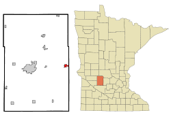
72:Location of Atwater, Minnesota
1:
824:. United States Census Bureau
1061:Atwater, MN -- Official site
1022:; accessed September 5, 2014
1109:Kandiyohi County, Minnesota
1066:Atwater Chamber of Commerce
1033:United States Census Bureau
942:United States Census Bureau
917:United States Census Bureau
867:United States Census Bureau
822:"2020 U.S. Gazetteer Files"
346:United States Census Bureau
213: • Estimate
1453:
994:. Jim Forte Postal History
195:1,214 ft (370 m)
1397:
1210:
1120:
938:"US Gazetteer files 2010"
661:
648:
633:
618:
603:
588:
573:
558:
543:
528:
513:
498:
483:
468:
453:
438:
423:
416:
411:
406:
403:
77:
65:
53:
44:
780:there were 89.0 males.
1218:
1018:July 22, 2014, at the
970:Upham, Warren (1920).
1216:
913:"U.S. Census website"
863:"Explore Census Data"
662:U.S. Decennial Census
399:Historical population
247: • Summer (
97:45.13556°N 94.77694°W
1410:United States portal
221: • Density
1432:Cities in Minnesota
948:on January 12, 2012
400:
102:45.13556; -94.77694
93: /
1219:
992:"Kandiyohi County"
681:population density
398:
205: • Total
184: • Water
168: • Total
1419:
1418:
1254:East Lake Lillian
785:per capita income
668:
667:
344:According to the
319:
318:
176: • Land
158:February 17, 1876
16:(Redirected from
1444:
1411:
1404:
1403:Minnesota portal
1215:
1132:
1125:
1115:
1110:
1100:
1093:
1086:
1077:
1048:
1047:
1045:
1043:
1029:
1023:
1010:
1004:
1003:
1001:
999:
988:
982:
981:
967:
958:
957:
955:
953:
944:. Archived from
934:
928:
927:
925:
923:
909:
903:
902:
900:
898:
887:
878:
877:
875:
873:
859:
848:
843:
834:
833:
831:
829:
818:
754:Pacific Islander
742:African American
689:African American
419:
414:
409:
401:
326:Kandiyohi County
315:
252:
108:
107:
105:
104:
103:
98:
94:
91:
90:
89:
86:
70:
58:
35:
21:
1452:
1451:
1447:
1446:
1445:
1443:
1442:
1441:
1422:
1421:
1420:
1415:
1409:
1402:
1393:
1360:
1353:
1220:
1208:
1135:
1130:
1123:
1116:
1113:
1108:
1104:
1057:
1052:
1051:
1041:
1039:
1031:
1030:
1026:
1020:Wayback Machine
1011:
1007:
997:
995:
990:
989:
985:
969:
968:
961:
951:
949:
936:
935:
931:
921:
919:
911:
910:
906:
896:
894:
889:
888:
881:
871:
869:
861:
860:
851:
844:
837:
827:
825:
820:
819:
815:
810:
797:
773:married couples
746:Native American
729:
716:married couples
693:Native American
673:
663:
412:
396:
388:
368:
360:
342:
311:
270:
246:
101:
99:
95:
92:
87:
84:
82:
80:
79:
73:
61:
49:
40:
33:
30:
23:
22:
15:
12:
11:
5:
1450:
1448:
1440:
1439:
1434:
1424:
1423:
1417:
1416:
1414:
1413:
1406:
1398:
1395:
1394:
1392:
1391:
1386:
1381:
1376:
1371:
1365:
1363:
1359:Unincorporated
1355:
1354:
1352:
1351:
1346:
1341:
1336:
1331:
1326:
1321:
1316:
1311:
1306:
1304:Lake Elizabeth
1301:
1296:
1291:
1286:
1281:
1276:
1271:
1266:
1261:
1256:
1251:
1246:
1241:
1236:
1230:
1228:
1222:
1221:
1211:
1209:
1207:
1206:
1201:
1196:
1191:
1186:
1181:
1176:
1171:
1166:
1161:
1156:
1151:
1145:
1143:
1137:
1136:
1121:
1118:
1117:
1105:
1103:
1102:
1095:
1088:
1080:
1074:
1073:
1068:
1063:
1056:
1055:External links
1053:
1050:
1049:
1024:
1005:
983:
959:
929:
904:
879:
849:
835:
812:
811:
809:
806:
805:
804:
796:
795:Notable people
793:
728:
725:
672:
669:
666:
665:
659:
658:
655:
653:
650:
646:
645:
642:
640:
637:
631:
630:
627:
625:
622:
616:
615:
612:
610:
607:
601:
600:
597:
595:
592:
586:
585:
582:
580:
577:
571:
570:
567:
565:
562:
556:
555:
552:
550:
547:
541:
540:
537:
535:
532:
526:
525:
522:
520:
517:
511:
510:
507:
505:
502:
496:
495:
492:
490:
487:
481:
480:
477:
475:
472:
466:
465:
462:
460:
457:
451:
450:
447:
445:
442:
436:
435:
432:
430:
427:
421:
420:
415:
410:
405:
395:
392:
387:
384:
367:
364:
359:
356:
341:
338:
317:
316:
309:
305:
304:
301:
294:
293:
290:
284:
283:
278:
272:
271:
268:
266:
260:
259:
253:
243:
242:
232:
226:
225:
222:
218:
217:
214:
210:
209:
206:
202:
201:
197:
196:
193:
189:
188:
185:
181:
180:
177:
173:
172:
169:
165:
164:
160:
159:
156:
150:
149:
146:
142:
141:
136:
130:
129:
124:
118:
117:
114:
110:
109:
75:
74:
71:
63:
62:
59:
51:
50:
45:
42:
41:
38:
31:
28:
24:
14:
13:
10:
9:
6:
4:
3:
2:
1449:
1438:
1435:
1433:
1430:
1429:
1427:
1412:
1407:
1405:
1400:
1399:
1396:
1390:
1387:
1385:
1382:
1380:
1377:
1375:
1372:
1370:
1367:
1366:
1364:
1362:
1356:
1350:
1347:
1345:
1342:
1340:
1337:
1335:
1332:
1330:
1327:
1325:
1322:
1320:
1317:
1315:
1312:
1310:
1307:
1305:
1302:
1300:
1297:
1295:
1292:
1290:
1287:
1285:
1282:
1280:
1277:
1275:
1272:
1270:
1267:
1265:
1262:
1260:
1257:
1255:
1252:
1250:
1247:
1245:
1242:
1240:
1237:
1235:
1232:
1231:
1229:
1227:
1223:
1205:
1202:
1200:
1197:
1195:
1192:
1190:
1187:
1185:
1182:
1180:
1177:
1175:
1172:
1170:
1167:
1165:
1162:
1160:
1157:
1155:
1152:
1150:
1147:
1146:
1144:
1142:
1138:
1134:
1133:
1126:
1119:
1114:United States
1111:
1101:
1096:
1094:
1089:
1087:
1082:
1081:
1078:
1072:
1069:
1067:
1064:
1062:
1059:
1058:
1054:
1042:September 11,
1038:
1034:
1028:
1025:
1021:
1017:
1014:
1009:
1006:
993:
987:
984:
979:
975:
974:
966:
964:
960:
947:
943:
939:
933:
930:
918:
914:
908:
905:
892:
886:
884:
880:
868:
864:
858:
856:
854:
850:
847:
842:
840:
836:
823:
817:
814:
807:
802:
799:
798:
794:
792:
790:
786:
781:
777:
774:
769:
767:
763:
759:
756:, 0.74% from
755:
751:
747:
743:
739:
734:
726:
724:
720:
717:
712:
710:
706:
702:
698:
694:
690:
686:
682:
678:
670:
660:
656:
654:
651:
647:
643:
641:
638:
636:
632:
628:
626:
623:
621:
617:
613:
611:
608:
606:
602:
598:
596:
593:
591:
587:
583:
581:
578:
576:
572:
568:
566:
563:
561:
557:
553:
551:
548:
546:
542:
538:
536:
533:
531:
527:
523:
521:
518:
516:
512:
508:
506:
503:
501:
497:
493:
491:
488:
486:
482:
478:
476:
473:
471:
467:
463:
461:
458:
456:
452:
448:
446:
443:
441:
437:
433:
431:
428:
426:
422:
402:
393:
391:
385:
383:
381:
377:
373:
365:
363:
357:
355:
353:
352:U.S. Route 12
349:
347:
339:
337:
335:
331:
327:
324:is a city in
323:
314:
313:atwatermn.gov
310:
302:
299:
291:
289:
282:
279:
277:
267:
265:
257:
254:
250:
240:
236:
233:
231:
223:
215:
207:
194:
186:
178:
170:
157:
155:
147:
140:
137:
135:
128:
125:
123:
116:United States
115:
106:
78:Coordinates:
69:
57:
48:
43:
36:
27:
19:
1309:Lake Lillian
1164:Lake Lillian
1148:
1128:
1040:. Retrieved
1027:
1008:
996:. Retrieved
986:
972:
952:November 13,
950:. Retrieved
946:the original
932:
920:. Retrieved
907:
895:. Retrieved
870:. Retrieved
826:. Retrieved
816:
801:Mike Kingery
789:poverty line
782:
778:
770:
730:
721:
713:
699:, 2.0% from
674:
394:Demographics
389:
379:
369:
361:
350:
343:
321:
320:
154:Incorporated
26:
1374:Norway Lake
1361:communities
1324:Norway Lake
1299:Lake Andrew
1124:County seat
922:January 31,
758:other races
727:2000 census
701:other races
671:2010 census
664:2020 Census
649:2021 (est.)
334:2020 census
100: /
18:Atwater, MN
1426:Categories
1344:Whitefield
1319:New London
1274:Green Lake
1169:New London
808:References
731:As of the
675:As of the
386:Government
376:Grove City
300:feature ID
200:Population
88:94°46′37″W
85:45°08′08″N
1339:St. Johns
1334:Roseville
1294:Kandiyohi
1269:Gennessee
1234:Arctander
1226:Townships
1179:Prinsburg
1159:Kandiyohi
366:Education
340:Geography
330:Minnesota
288:FIPS code
276:Area code
230:Time zone
192:Elevation
139:Kandiyohi
127:Minnesota
1384:Roseland
1329:Roseland
1279:Harrison
1154:Blomkest
1016:Archived
998:July 15,
828:July 24,
762:Hispanic
752:, 0.09%
748:, 0.19%
744:, 0.09%
740:, 0.09%
705:Hispanic
292:27-02692
264:ZIP code
1349:Willmar
1284:Holland
1259:Edwards
1239:Burbank
1204:Willmar
1199:Sunburg
1184:Raymond
1174:Pennock
1149:Atwater
1131:Willmar
695:, 0.3%
691:, 0.1%
687:, 0.1%
380:Falcons
358:History
322:Atwater
308:Website
303:2394020
239:Central
145:Founded
113:Country
39:Atwater
1369:Hawick
1289:Irving
1264:Fahlun
1244:Colfax
1194:Spicer
1141:Cities
897:May 2,
872:May 2,
766:Latino
733:census
709:Latino
677:census
404:Census
372:Cosmos
134:County
1379:Priam
1314:Mamre
1249:Dovre
1189:Regal
980:269].
750:Asian
738:White
697:Asian
685:White
657:−0.9%
652:1,114
644:−0.8%
639:1,124
624:1,133
609:1,079
599:−6.6%
594:1,053
584:18.0%
579:1,128
524:17.4%
509:−5.6%
494:22.5%
464:37.1%
449:42.1%
269:56209
258:(CDT)
256:UTC-5
235:UTC-6
216:1,114
208:1,124
122:State
1389:Svea
1044:2013
1000:2015
954:2012
924:2008
899:2022
874:2023
830:2022
635:2020
629:5.0%
620:2010
614:2.5%
605:2000
590:1990
575:1980
569:6.3%
560:1970
554:2.2%
545:1960
539:8.0%
530:1950
515:1940
500:1930
485:1920
479:2.0%
470:1910
455:1900
440:1890
425:1880
413:Note
408:Pop.
374:and
298:GNIS
163:Area
148:1869
47:City
764:or
707:or
564:956
549:899
534:880
519:815
504:694
489:735
474:600
459:588
444:429
429:302
281:320
249:DST
1428::
1127::
1112:,
1035:.
962:^
940:.
915:.
882:^
865:.
852:^
838:^
418:%±
336:.
328:,
1099:e
1092:t
1085:v
1046:.
1002:.
956:.
926:.
901:.
876:.
832:.
434:—
251:)
241:)
237:(
20:)
Text is available under the Creative Commons Attribution-ShareAlike License. Additional terms may apply.