316:, sixteen miles southeast of Clarksville in eastern Red River County. When the Texas and Pacific railroad was being constructed through the county in the 1870s, the managers of the railroad planned a station at the site and named it Douglass. Settlement in the community was slow because the surrounding area was so sparsely populated. When a correspondent of the Clarksville Standard newspaper visited Douglass in early 1881, he found a collection of families living in tents. Later that year, when Isaac Bradford and his partner opened their general store, a post office was established there, and the name of the town was changed to Isaca. In 1902 the name was changed to Avery, in honor of Ed Avery, the first railway station agent. In 1884, the population was estimated at thirty, and by 1896 it had increased to forty-eight. By 1900 Avery had three churches, a school, and a population of 176. During the first decade of the twentieth century, cotton ginning was an important local industry. By 1914, the town had two banks; a weekly newspaper, the Avery News, published by H. H. Morgan; and a population estimated at 500. The population reached its highest point in the late 1920s with a reported 800 residents, before declining sharply to a low of 300 in the early 1930s. Avery was incorporated before the 1940 census, when it reported 477 residents. The population subsequently remained relatively stable. The 1980 census recorded 520 residents, and in 1986 nine businesses were reported. In 1990 the population was 430. By 2000, the population increased to 462.
815:
42:
535:
living together, 13.8% had a female householder with no husband present, and 34.8% were non-families. 34.8% of all households were made up of individuals, and 21.4% had someone living alone who was 65 years of age or older. The average household size was 2.20 and the average family size was 2.75.
539:
In the town, the population was spread out, with 22.7% under the age of 18, 8.9% from 18 to 24, 22.7% from 25 to 44, 25.1% from 45 to 64, and 20.6% who were 65 years of age or older. The median age was 43 years. For every 100 females, there were 88.6 males. For every 100 females age 18 and over,
507:
of 2000, there were 462 people, 210 households, and 136 families residing in the town. The population density was 487.9 inhabitants per square mile (188.4/km). There were 241 housing units at an average density of 254.5 per square mile (98.3/km). The racial makeup of the town was 96.54%
543:
The median income for a household in the town was $ 21,146, and the median income for a family was $ 27,917. Males had a median income of $ 23,333 versus $ 16,346 for females. The
742:
328:, the town has a total area of 1.0 square mile (2.6 km), of which 0.9 square miles (2.3 km) is land and 0.04 square miles (0.10 km) (3.06%) is water.
970:
263:
735:
273:
81:
688:
304:. From the 1920s through the early 1960s Avery was one of the largest tomato producing and shipping cities in northeastern Texas.
884:
728:
585:
214:
889:
513:
720:
517:
628:
325:
482:
467:
452:
437:
422:
407:
392:
377:
362:
301:
135:
251:
113:
609:
975:
752:
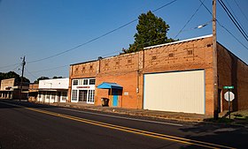
531:
There were 210 households, out of which 26.7% had children under the age of 18 living with them, 43.8% were
289:
140:
521:
313:
256:
41:
649:
947:
940:
525:
224:
854:
509:
917:
864:
798:
774:
702:
683:
547:
for the town was $ 13,180. About 14.3% of families and 21.5% of the population were below the
544:
678:
879:
874:
844:
964:
894:
869:
834:
803:
793:
565:
560:
548:
912:
767:
904:
293:
123:
96:
83:
205:
551:, including 22.3% of those under age 18 and 30.5% of those age 65 or over.
931:‡This populated place also has portions in an adjacent county or counties
532:
239:
610:
U.S. Geological Survey
Geographic Names Information System: Avery, Texas
504:
297:
231:
210:
128:
826:
785:
32:
724:
813:
312:
The town was established in the 1870s. Avery is located on
624:
926:
903:
853:
825:
784:
272:
262:
250:
238:
221:
204:
196:
188:
183:
175:
167:
159:
151:
146:
134:
122:
112:
23:
736:
8:
814:
743:
729:
721:
528:of any race were 0.43% of the population.
335:
20:
577:
261:
237:
203:
182:
174:
145:
111:
76:
50:
38:
672:
670:
605:
603:
355:
619:
617:
271:
249:
220:
195:
187:
166:
158:
150:
133:
121:
7:
520:, and 1.95% from two or more races.
171:0.03 sq mi (0.06 km)
163:0.95 sq mi (2.46 km)
155:0.97 sq mi (2.52 km)
751:Municipalities and communities of
703:"Census of Population and Housing"
689:Texas State Historical Association
345:
14:
677:Harper, Cecil Jr (June 9, 2010).
971:Towns in Red River County, Texas
300:. The population was 421 at the
40:
1:
588:. United States Census Bureau
18:Town in Texas, United States
629:United States Census Bureau
586:"2019 U.S. Gazetteer Files"
326:United States Census Bureau
992:
936:
811:
765:
496:
481:
466:
451:
436:
421:
406:
391:
376:
361:
354:
349:
344:
341:
77:
51:
39:
30:
179:466 ft (142 m)
754:Red River County, Texas
540:there were 76.7 males.
200:430/sq mi (170/km)
819:
70:Show the United States
817:
650:"Explore Census Data"
625:"U.S. Census website"
497:U.S. Decennial Census
337:Historical population
223: • Summer (
97:33.55222°N 94.78028°W
60:Show Red River County
949:United States portal
818:Red River County map
197: • Density
687:(online ed.).
338:
102:33.55222; -94.78028
93: /
820:
336:
189: • Total
168: • Water
152: • Total
958:
957:
684:Handbook of Texas
545:per capita income
501:
500:
324:According to the
283:
282:
160: • Land
983:
950:
943:
816:
777:
770:
760:
755:
745:
738:
731:
722:
715:
714:
712:
710:
699:
693:
692:
674:
665:
664:
662:
660:
646:
640:
639:
637:
635:
621:
612:
607:
598:
597:
595:
593:
582:
514:African American
357:
352:
347:
339:
290:Red River County
228:
108:
107:
105:
104:
103:
98:
94:
91:
90:
89:
86:
71:
66:
61:
56:
44:
21:
991:
990:
986:
985:
984:
982:
981:
980:
961:
960:
959:
954:
948:
941:
932:
922:
899:
856:
849:
821:
809:
780:
775:
768:
761:
758:
753:
749:
719:
718:
708:
706:
701:
700:
696:
676:
675:
668:
658:
656:
654:data.census.gov
648:
647:
643:
633:
631:
623:
622:
615:
608:
601:
591:
589:
584:
583:
579:
574:
557:
533:married couples
518:Native American
350:
334:
322:
314:U.S. Highway 82
310:
246:
222:
101:
99:
95:
92:
87:
84:
82:
80:
79:
73:
72:
69:
67:
64:
62:
59:
57:
54:
47:
35:
26:
19:
12:
11:
5:
989:
987:
979:
978:
976:Towns in Texas
973:
963:
962:
956:
955:
953:
952:
945:
937:
934:
933:
930:
928:
924:
923:
921:
920:
915:
909:
907:
901:
900:
898:
897:
892:
887:
882:
877:
872:
867:
861:
859:
855:Unincorporated
851:
850:
848:
847:
842:
837:
831:
829:
823:
822:
812:
810:
808:
807:
801:
796:
790:
788:
782:
781:
766:
763:
762:
750:
748:
747:
740:
733:
725:
717:
716:
694:
679:"Avery, Texas"
666:
641:
613:
599:
576:
575:
573:
570:
569:
568:
563:
556:
553:
499:
498:
494:
493:
490:
488:
485:
479:
478:
475:
473:
470:
464:
463:
460:
458:
455:
449:
448:
445:
443:
440:
434:
433:
430:
428:
425:
419:
418:
415:
413:
410:
404:
403:
400:
398:
395:
389:
388:
385:
383:
380:
374:
373:
370:
368:
365:
359:
358:
353:
348:
343:
333:
330:
321:
318:
309:
306:
281:
280:
277:
270:
269:
266:
260:
259:
254:
248:
247:
244:
242:
236:
235:
229:
219:
218:
208:
202:
201:
198:
194:
193:
190:
186:
185:
181:
180:
177:
173:
172:
169:
165:
164:
161:
157:
156:
153:
149:
148:
144:
143:
138:
132:
131:
126:
120:
119:
116:
110:
109:
75:
74:
68:
63:
58:
53:
52:
49:
48:
46:Downtown Avery
45:
37:
36:
31:
28:
27:
24:
17:
13:
10:
9:
6:
4:
3:
2:
988:
977:
974:
972:
969:
968:
966:
951:
946:
944:
939:
938:
935:
929:
925:
919:
916:
914:
911:
910:
908:
906:
902:
896:
893:
891:
888:
886:
883:
881:
878:
876:
873:
871:
868:
866:
863:
862:
860:
858:
852:
846:
843:
841:
838:
836:
833:
832:
830:
828:
824:
805:
802:
800:
797:
795:
792:
791:
789:
787:
783:
779:
778:
771:
764:
759:United States
756:
746:
741:
739:
734:
732:
727:
726:
723:
704:
698:
695:
690:
686:
685:
680:
673:
671:
667:
655:
651:
645:
642:
630:
626:
620:
618:
614:
611:
606:
604:
600:
587:
581:
578:
571:
567:
566:Sulphur River
564:
562:
561:Brevelle Lake
559:
558:
554:
552:
550:
546:
541:
537:
534:
529:
527:
523:
519:
515:
511:
506:
495:
491:
489:
486:
484:
480:
476:
474:
471:
469:
465:
461:
459:
456:
454:
450:
446:
444:
441:
439:
435:
431:
429:
426:
424:
420:
416:
414:
411:
409:
405:
401:
399:
396:
394:
390:
386:
384:
381:
379:
375:
371:
369:
366:
364:
360:
340:
331:
329:
327:
319:
317:
315:
307:
305:
303:
299:
295:
291:
288:is a town in
287:
278:
275:
267:
265:
258:
255:
253:
243:
241:
233:
230:
226:
216:
215:Central (CST)
212:
209:
207:
199:
191:
178:
170:
162:
154:
142:
139:
137:
130:
127:
125:
118:United States
117:
115:
106:
78:Coordinates:
43:
34:
29:
22:
16:
942:Texas portal
839:
773:
707:. Retrieved
705:. Census.gov
697:
682:
657:. Retrieved
653:
644:
632:. Retrieved
590:. Retrieved
580:
549:poverty line
542:
538:
530:
502:
332:Demographics
323:
311:
285:
284:
252:Area code(s)
25:Avery, Texas
15:
918:Pecan Point
865:Aikin Grove
857:communities
799:Clarksville
776:Clarksville
769:County seat
634:January 31,
302:2020 census
100: /
965:Categories
905:Ghost town
572:References
503:As of the
294:U.S. state
276:feature ID
184:Population
88:94°46′49″W
85:33°33′08″N
65:Show Texas
55:Show Avery
927:Footnotes
592:August 7,
320:Geography
292:, in the
264:FIPS code
206:Time zone
176:Elevation
141:Red River
555:See also
522:Hispanic
516:, 0.22%
512:, 1.30%
268:48-05072
257:903, 430
240:ZIP code
885:English
880:Cuthand
875:Bagwell
845:Detroit
709:June 4,
308:History
279:2411656
114:Country
895:Negley
870:Albion
835:Annona
804:Deport
794:Bogata
786:Cities
659:May 2,
526:Latino
505:census
492:−12.7%
447:−17.3%
402:−22.4%
342:Census
136:County
890:Maple
840:Avery
827:Towns
510:White
417:43.1%
387:−7.3%
298:Texas
286:Avery
245:75554
234:(CDT)
232:UTC-5
211:UTC-6
129:Texas
124:State
913:Opah
711:2015
661:2024
636:2008
594:2020
483:2020
477:4.3%
468:2010
462:7.4%
453:2000
438:1990
432:5.9%
423:1980
408:1970
393:1960
378:1950
363:1940
351:Note
346:Pop.
274:GNIS
147:Area
33:Town
524:or
487:421
472:482
457:462
442:430
427:520
412:491
397:343
382:442
367:477
296:of
225:DST
192:421
967::
772::
757:,
681:.
669:^
652:.
627:.
616:^
602:^
356:%±
806:‡
744:e
737:t
730:v
713:.
691:.
663:.
638:.
596:.
372:—
227:)
217:)
213:(
Text is available under the Creative Commons Attribution-ShareAlike License. Additional terms may apply.