67:
39:
74:
46:
294:, wells, and roads, with the houses arranged around a central square. Each house had a width of 4 to 6 meters, and a length of 8 to 14 meters, and the presence of multiple hearths seem to indicate that these were used by multiple family groups. A cemetery pit in the south end of the settlement yielded 50 earrings made of stone and bone, thought to have been produced from the
338:
324:
66:
301:
The site was backfilled after excavation and is now an empty field with an explanatory placard. The site is located approximately 50 minutes on foot from
283:
in the Tōno Basin, at an altitude of approximately 270 meters and were discovered when the site was surveyed in preparation for development into an
351:
428:
123:
38:
423:
392:
433:
287:. The Tōno City Board of Education conducted exploratory surveys in 1997, and the site came under city protection in 2000.
375:
418:
264:
240:
209:
256:
252:
111:
284:
276:
244:
187:
329:
302:
280:
248:
97:
412:
309:
343:
295:
371:
400:
319:
138:
125:
291:
306:
260:
101:
263:. It has been designated by the central government as a
198:
193:
183:
175:
170:
162:
154:
117:
107:
93:
16:Ruins of a Jōmon period settlement in Tōno, Japan
230:
224:
8:
19:
73:
45:
18:
275:The Ayaorishinden ruins are located on a
243:containing the remains of a large early
363:
352:List of Historic Sites of Japan (Iwate)
290:The settlement consisted of 17 large
7:
247:settlement located in the city of
14:
336:
322:
72:
65:
44:
37:
210:National Historic Site of Japan
1:
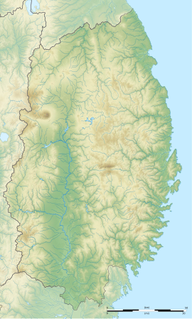
56:Show map of Iwate Prefecture
429:History of Iwate Prefecture
376:Agency for Cultural Affairs
231:
450:
81:Ayaorishinden Site (Japan)
225:
206:
31:
24:
401:Cultural Heritage Online
158:270 m (886 ft)
424:Historic Sites of Japan
279:of on a branch of the
265:National Historic Site
139:39.31694°N 141.29889°E
255:in the far northern
393:Tono city home page
241:archaeological site
232:Ayaorishinden iseki
220:Ayaorishinden ruins
144:39.31694; 141.29889
135: /
21:
434:Jōmon-period ruins
298:region of Japan.
199:Public access
53:Ayaorishinden Site
20:Ayaorishinden Site
217:
216:
84:Show map of Japan
441:
405:
397:
380:
379:
368:
346:
341:
340:
339:
332:
327:
326:
325:
253:Iwate Prefecture
238:
237:
234:
228:
227:
150:
149:
147:
146:
145:
140:
136:
133:
132:
131:
128:
85:
76:
75:
69:
57:
48:
47:
41:
22:
449:
448:
444:
443:
442:
440:
439:
438:
409:
408:
403:
395:
389:
384:
383:
374:(in Japanese).
370:
369:
365:
360:
342:
337:
335:
328:
323:
321:
318:
285:industrial park
273:
235:
222:
213:
212:
143:
141:
137:
134:
129:
126:
124:
122:
121:
89:
88:
87:
86:
83:
82:
79:
78:
77:
60:
59:
58:
55:
54:
51:
50:
49:
27:
17:
12:
11:
5:
447:
445:
437:
436:
431:
426:
421:
411:
410:
407:
406:
398:
388:
387:External links
385:
382:
381:
362:
361:
359:
356:
355:
354:
348:
347:
333:
330:History portal
317:
314:
303:Ayaori Station
281:Kitakami River
272:
269:
215:
214:
208:
207:
204:
203:
200:
196:
195:
191:
190:
185:
181:
180:
177:
173:
172:
168:
167:
164:
160:
159:
156:
152:
151:
119:
115:
114:
109:
105:
104:
95:
91:
90:
80:
71:
70:
64:
63:
62:
61:
52:
43:
42:
36:
35:
34:
33:
32:
29:
28:
25:
15:
13:
10:
9:
6:
4:
3:
2:
446:
435:
432:
430:
427:
425:
422:
420:
417:
416:
414:
404:(in Japanese)
402:
399:
396:(in Japanese)
394:
391:
390:
386:
377:
373:
367:
364:
357:
353:
350:
349:
345:
334:
331:
320:
315:
313:
311:
310:Kamaishi Line
308:
304:
299:
297:
293:
288:
286:
282:
278:
277:river terrace
270:
268:
267:since 2002.
266:
262:
258:
257:Tōhoku region
254:
250:
246:
242:
233:
221:
211:
205:
201:
197:
192:
189:
186:
182:
178:
174:
169:
165:
161:
157:
153:
148:
120:
116:
113:
112:Tōhoku region
110:
106:
103:
99:
96:
92:
68:
40:
30:
23:
366:
344:Japan portal
300:
296:Sea of Japan
289:
274:
245:Jōmon period
219:
218:
188:Jōmon period
419:Tōno, Iwate
142: /
130:141°17′56″E
118:Coordinates
98:Tōno, Iwate
413:Categories
358:References
292:pit houses
194:Site notes
166:settlement
127:39°19′01″N
372:"綾織新田遺跡"
316:See also
271:Overview
155:Altitude
94:Location
307:JR East
305:on the
184:Periods
179:4000 BC
176:Founded
171:History
251:, in
239:is an
226:綾織新田遺跡
108:Region
26:綾織新田遺跡
261:Japan
102:Japan
249:Tōno
163:Type
312:.
259:of
202:Yes
415::
229:,
100:,
378:.
236:)
223:(
Text is available under the Creative Commons Attribution-ShareAlike License. Additional terms may apply.