55:
401:
389:
88:
38:
377:
504:
365:
95:
62:
314:
Aalst experienced rapid growth during the 1970s and 1980s as housing estates were built in the
Ekenrooi area, which served as an overflow area for Eindhoven. Despite this development, the area remains very green and pleasant with large stretches of managed forest and heathland. Notable places include
569:
545:
54:
564:
123:
269:
579:
281:
349:, which makes metals and plastics household products sold worldwide, was founded in Aalst. Today, Brabantia's head office is located in
538:
376:
177:
87:
345:
In recent decades, Aalst has developed from an agricultural community into a village of
Eindhoven. In 1919, industrial company
531:
487:
261:
165:
37:
400:
388:
319:
323:
315:'De hut van Mie Pils', a cafe and restaurant located in the wooded area in the east of the municipality.
240:
250:
364:
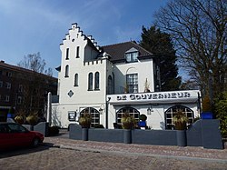
483:
515:
574:
330:
429:
307:. It was an independent municipality until 1923, when it merged with the municipality of
334:
558:
511:
170:
350:
304:
503:
158:
300:
138:
125:
346:
296:
231:
308:
257:
236:
182:
322:
pass along the main road from
Valkenswaard to Eindhoven as part of
457:
482:
Jos & Cor
Swanenberg: Taal in stad en land: Oost-Brabants,
74:
Location in the province of North
Brabant in the Netherlands
519:
280:
268:
247:
230:
222:
214:
209:
201:
193:
188:
176:
164:
154:
21:
333:dialect, one of the many southern dialects of
539:
8:
546:
532:
18:
295:is a village located 6 km south of
416:
360:
329:The spoken language is Kempenlands (an
267:
229:
208:
200:
187:
153:
118:
46:
34:
570:Former municipalities of North Brabant
424:
422:
420:
279:
246:
221:
213:
192:
175:
163:
16:Village in North Brabant, Netherlands
7:
500:
498:
430:"Kerncijfers wijken en buurten 2021"
197:1.95 km (0.75 sq mi)
518:. You can help Knowledge (XXG) by
14:
565:Populated places in North Brabant
318:In September 1944, Aalst saw the
502:
399:
387:
375:
363:
93:
86:
60:
53:
36:
464:(in Dutch). Het Waterschapshuis
462:Actueel Hoogtebestand Nederland
382:The Tongelreep stream in Aalst.
1:
580:North Brabant geography stubs
94:
61:
434:Central Bureau of Statistics
226:1,900/km (4,900/sq mi)
596:
497:
299:, the Netherlands, on the
458:"Postcodetool for 5582AA"
119:
77:Show map of North Brabant
47:
35:
28:
324:Operation Market Garden
303:stream and the road to
110:Show map of Netherlands
514:location article is a
205:20 m (70 ft)
249: • Summer (
223: • Density
139:51.39639°N 5.47667°E
135: /
107:Aalst (Netherlands)
42:Restaurant in Aalst
215: • Total
194: • Total
527:
526:
320:British XXX Corps
290:
289:
144:51.39639; 5.47667
587:
548:
541:
534:
506:
499:
490:
480:
474:
473:
471:
469:
454:
448:
447:
442:
440:
426:
403:
391:
379:
367:
254:
150:
149:
147:
146:
145:
140:
136:
133:
132:
131:
128:
111:
97:
96:
90:
78:
64:
63:
57:
40:
19:
595:
594:
590:
589:
588:
586:
585:
584:
555:
554:
553:
552:
495:
493:
481:
477:
467:
465:
456:
455:
451:
438:
436:
428:
427:
418:
414:
407:
404:
395:
392:
383:
380:
371:
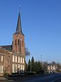
370:Church in Aalst
368:
359:
343:
331:East Brabantian
276:
248:
143:
141:
137:
134:
129:
126:
124:
122:
121:
115:
114:
113:
112:
109:
108:
105:
104:
103:
102:
98:
81:
80:
79:
76:
75:
72:
71:
70:
69:
65:
43:
31:
24:
17:
12:
11:
5:
593:
591:
583:
582:
577:
572:
567:
557:
556:
551:
550:
543:
536:
528:
525:
524:
507:
492:
491:
475:
449:
415:
413:
410:
409:
408:
406:House in Aalst
405:
398:
396:
394:Villa in Aalst
393:
386:
384:
381:
374:
372:
369:
362:
358:
355:
342:
339:
288:
287:
284:
278:
277:
274:
272:
266:
265:
255:
245:
244:
234:
228:
227:
224:
220:
219:
216:
212:
211:
207:
206:
203:
199:
198:
195:
191:
190:
186:
185:
180:
174:
173:
168:
162:
161:
156:
152:
151:
117:
116:
106:
100:
99:
92:
91:
85:
84:
83:
82:
73:
67:
66:
59:
58:
52:
51:
50:
49:
48:
45:
44:
41:
33:
32:
29:
26:
25:
22:
15:
13:
10:
9:
6:
4:
3:
2:
592:
581:
578:
576:
573:
571:
568:
566:
563:
562:
560:
549:
544:
542:
537:
535:
530:
529:
523:
521:
517:
513:
512:North Brabant
508:
505:
501:
496:
489:
485:
479:
476:
463:
459:
453:
450:
446:
435:
431:
425:
423:
421:
417:
411:
402:
397:
390:
385:
378:
373:
366:
361:
356:
354:
352:
348:
340:
338:
336:
332:
327:
325:
321:
316:
312:
310:
306:
302:
298:
294:
285:
283:
273:
271:
263:
259:
256:
252:
242:
238:
235:
233:
225:
217:
204:
196:
184:
181:
179:
172:
171:North Brabant
169:
167:
160:
157:
148:
120:Coordinates:
89:
56:
39:
27:
20:
520:expanding it
509:
494:
478:
466:. Retrieved
461:
452:
444:
437:. Retrieved
433:
351:Valkenswaard
344:
328:
317:
313:
305:Valkenswaard
292:
291:
282:Dialing code
178:Municipality
445:two entries
270:Postal code
159:Netherlands
142: /
559:Categories
488:9012090105
412:References
301:Tongelreep
210:Population
127:51°23′47″N
347:Brabantia
297:Eindhoven
232:Time zone
202:Elevation
130:5°28′36″E
468:18 April
439:18 April
166:Province
357:Gallery
341:Economy
155:Country
30:Village
575:Waalre
486:
309:Waalre
183:Waalre
510:This
335:Dutch
293:Aalst
258:UTC+2
237:UTC+1
218:3,690
101:Aalst
68:Aalst
23:Aalst
516:stub
484:ISBN
470:2022
441:2022
275:5582
262:CEST
189:Area
337:).
286:040
251:DST
241:CET
561::
460:.
443:.
432:.
419:^
353:.
326:.
311:.
547:e
540:t
533:v
522:.
472:.
264:)
260:(
253:)
243:)
239:(
Text is available under the Creative Commons Attribution-ShareAlike License. Additional terms may apply.