36:
24:
232:
172:
93:
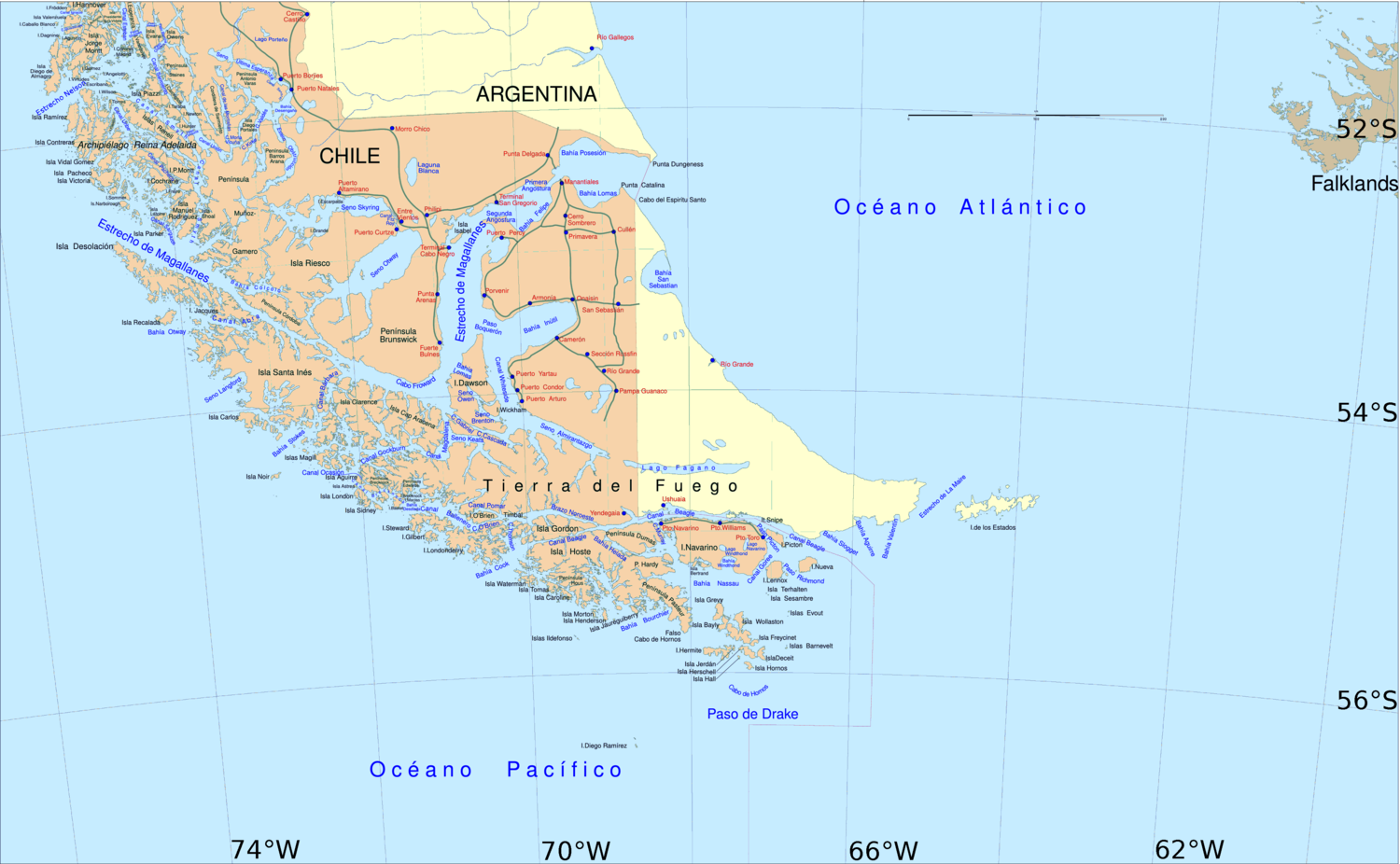
showed it to be a fine navigable passage, but no anchorages were found. It may possibly be of service to a vessel embayed in Otway Bay, enabling her to run into the strait. Abra Island, which stands in the center of the eastern entrance, is 300 feet high and covered with vegetation. The entrance is 2
176:
302:
23:
273:
101:
on it, and well marked with kelp, lies in the fairway of Abra
Channel, with center of Maycock Island bearing 305°, distant 0,75 mile, and summit of Francis Island 32°.
297:
239:
266:
43:
259:
159:
139:
South
America Pilot: Including Magellan Strait, the Falkland and Galapagos Islands. From the Rio de la Plata to the Bay of Panama
196:
292:
104:
82:
35:
187:
74:
78:
243:
231:
66:
181:
163:
49:
at the west entrance of the Strait of
Magellan. Click on the image to obtain the big map
286:
70:
137:
211:
198:
98:
89:
and ends at the Otway Bay. An incomplete examination by the
303:
Magallanes y la Antártica
Chilena Region geography stubs
247:
65:) is one of the three channels which connects
267:
8:
136:Great Britain. Hydrographic Office (1860).
94:miles wide, but it soon narrows to 1 mile.
274:
260:
34:
240:Magallanes and Antártica Chilena Region
128:
116:) because we can't see its termination
7:
298:Bodies of water of Magallanes Region
228:
226:
246:. You can help Knowledge (XXG) by
14:
160:United States Hydrographic Office
230:
175: This article incorporates
170:
22:
142:. G.E. Eyre and W. Spottiswoode
1:
81:). It is located between the
183:South American Pilot (1916)
97:A rock with a depth of 1.5
319:
225:
112:We called it the opening (
105:Pedro Sarmiento de Gamboa
212:53.383333°S 73.416667°W
242:location article is a
217:-53.383333; -73.416667
177:public domain material
208: /
164:South America Pilot
188:United States Navy
166:(1916) p. 410
30:{{{annotations}}}
255:
254:
83:Santa Inés Island
79:Magdalena Channel
63:Sea Shell Channel
310:
293:Straits of Chile
276:
269:
262:
234:
227:
223:
222:
220:
219:
218:
213:
209:
206:
205:
204:
201:
191:
174:
173:
152:
151:
149:
147:
133:
38:
26:
318:
317:
313:
312:
311:
309:
308:
307:
283:
282:
281:
280:
216:
214:
210:
207:
202:
199:
197:
195:
194:
180:
171:
156:
155:
145:
143:
135:
134:
130:
125:
75:Bárbara Channel
67:Magellan Strait
52:
51:
50:
45:
40:
39:
32:
27:
17:
12:
11:
5:
316:
314:
306:
305:
300:
295:
285:
284:
279:
278:
271:
264:
256:
253:
252:
235:
168:
167:
154:
153:
127:
126:
124:
121:
120:
119:
87:Jacques Island
42:
41:
33:
28:
21:
20:
19:
18:
15:
13:
10:
9:
6:
4:
3:
2:
315:
304:
301:
299:
296:
294:
291:
290:
288:
277:
272:
270:
265:
263:
258:
257:
251:
249:
245:
241:
236:
233:
229:
224:
221:
192:
189:
185:
184:
178:
165:
161:
158:
157:
141:
140:
132:
129:
122:
117:
115:
110:
109:
108:
106:
102:
100:
95:
92:
88:
84:
80:
76:
72:
71:Pacific Ocean
68:
64:
60:
56:
48:
44:
37:
31:
25:
248:expanding it
237:
193:
182:
169:
144:. Retrieved
138:
131:
113:
111:
103:
96:
90:
86:
73:(Others are
62:
58:
55:Abra Channel
54:
53:
47:Abra Channel
46:
29:
215: /
61:, formerly
287:Categories
203:73°25′00″W
200:53°23′00″S
123:References
59:Canal Abra
69:with the
57:(Spanish
85:and the
146:25 July
107:wrote:
99:fathoms
16:Channel
91:Sylvia
238:This
179:from
244:stub
148:2013
114:Abra
77:and
289::
186:.
162:,
275:e
268:t
261:v
250:.
190:.
150:.
118:.
Text is available under the Creative Commons Attribution-ShareAlike License. Additional terms may apply.