49:
532:
29:
56:
494:
and was used for washing the ore. Inside the town walls and outside on its way to its confluence with the Oker it drove numerous water wheels that supplied the mills or other industrial works (
455:
Along its 12.1-kilometre (7.5 mi) long course the
Abzucht descends a total of 188 metres (617 ft), which represents an average incline of 15.5
502:, etc.) with energy. The use of its name interchangeably after its confluence with the Gose is still reflected today in several road names, such as
224:
142:
599:
604:
459:. The stream drains a catchment area of 31.61 square kilometres (12.20 sq mi) before its waters pass down the Oker,
553:
48:
609:
614:
483:
Beer), the
Abzucht was heavily polluted by mining on the Rammelsberg. The name is derived from the word
441:
568:
Adelung, Grammatisch-kritisches Wörterbuch der
Hochdeutschen Mundart, Band 1. Leipzig 1793, p. 141
436:
from the left before the
Abzucht swings towards the east. After running through the Old Town (
580:
425:
557:
460:
300:
535:
Umweltkartendienst des
Niedersächsischen Ministeriums für Umwelt, Energie und Klimaschutz
413:
128:
593:
495:
491:
433:
381:
339:
90:
416:. From here the stream flows initially in a northeasterly direction. West of the
421:
417:
194:
550:
409:
264:
182:
487:
i.e. 'flushing' or 'removing' the contaminated waters of the smelting works.
239:
226:
157:
144:
490:
In the area of the Winter valley and the
Rammelsberg Mine the Abzucht drove
468:
456:
373:
369:
308:
28:
499:
385:
80:
424:. Below this pond the canalised stream passes through the area of the
429:
389:
352:
319:
464:
304:
582:
480:
445:
377:
296:
210:
444:
federal road to Goslar-Oker where it discharges into the
479:
While the water of the Gose can be used for brewing (
345:
333:
325:
314:
292:
287:
279:
271:
255:
216:
203:
193:
173:
134:
121:
113:
104:
96:
86:
76:
71:
21:
440:) of Goslar it continues on, accompanied by the
412:. Its source lies on the northeast flank of the
408:at an elevation of 722 metres (2,369 ft)
400:The Abzucht rises in the upper Winter valley (
428:and reaches the southern edge of the town of
8:
533:Environmental map service of Lower Saxony (
528:
526:
368:, is a 12.1-kilometre (7.5 mi) long,
364:, also known in its upper reaches as the
522:
388:. The stream flows through the town of
18:
546:
544:
283:31.2 km (12.0 sq mi)
7:
14:
551:Wasserrahmenrichtlinien-InfoBörse
448:from the left at an elevation of
420:the Abzucht is impounded by the
54:
47:
27:
55:
218: • coordinates
136: • coordinates
1:
584:Gewässergütebericht Oker 2002
450:192 m above NN
105:Physical characteristics
275:12.1 km (7.5 mi)
257: • elevation
209:Near Oker (Goslar) into the
175: • elevation
33:The Abzucht in the historic
432:. Here it is joined by the
263:192 m above
205: • location
181:722 m above
123: • location
631:
240:51.9123694°N 10.4856139°E
189:
109:
42:
26:
347: • right
600:Tributaries of the Oker
335: • left
605:Rivers of Lower Saxony
556:July 19, 2011, at the
245:51.9123694; 10.4856139
158:51.85425°N 10.39635°E
127:In Wintertal in the
288:Basin features
236: /
154: /
610:Rivers of the Harz
163:51.85425; 10.39635
615:Rivers of Germany
358:
357:
622:
569:
566:
560:
548:
539:
530:
451:
426:Rammelsberg Mine
422:Herzberger Teich
348:
336:
267:
251:
250:
248:
247:
246:
241:
237:
234:
233:
232:
229:
185:
176:
169:
168:
166:
165:
164:
159:
155:
152:
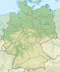
151:
150:
147:
137:
124:
58:
57:
51:
31:
19:
16:River in Germany
630:
629:
625:
624:
623:
621:
620:
619:
590:
589:
577:
572:
567:
563:
558:Wayback Machine
549:
542:
531:
524:
520:
477:
449:
398:
346:
334:
262:
258:
244:
242:
238:
235:
230:
227:
225:
223:
222:
219:
206:
180:
174:
162:
160:
156:
153:
148:
145:
143:
141:
140:
135:
122:
67:
66:
65:
64:
61:
60:
59:
38:
17:
12:
11:
5:
628:
626:
618:
617:
612:
607:
602:
592:
591:
588:
587:
576:
573:
571:
570:
561:
540:
521:
519:
516:
504:An der Abzucht
476:
473:
397:
394:
370:orographically
356:
355:
349:
343:
342:
337:
331:
330:
327:
323:
322:
316:
312:
311:
294:
290:
289:
285:
284:
281:
277:
276:
273:
269:
268:
265:sea level (NN)
259:
256:
253:
252:
220:
217:
214:
213:
207:
204:
201:
200:
197:
191:
190:
187:
186:
183:sea level (NN)
177:
171:
170:
138:
132:
131:
129:Harz Mountains
125:
119:
118:
115:
111:
110:
107:
106:
102:
101:
100:DE: 48214
98:
94:
93:
88:
84:
83:
78:
74:
73:
69:
68:
62:
53:
52:
46:
45:
44:
43:
40:
39:
32:
24:
23:
15:
13:
10:
9:
6:
4:
3:
2:
627:
616:
613:
611:
608:
606:
603:
601:
598:
597:
595:
585:
581:
579:
578:
574:
565:
562:
559:
555:
552:
547:
545:
541:
538:
536:
529:
527:
523:
517:
515:
513:
512:Abzuchtstraße
509:
505:
501:
497:
496:fulling mills
493:
488:
486:
482:
474:
472:
470:
466:
462:
458:
453:
447:
443:
439:
435:
431:
427:
423:
419:
415:
411:
407:
406:Wintertalbach
403:
395:
393:
391:
387:
383:
379:
375:
371:
367:
366:Wintertalbach
363:
354:
350:
344:
341:
338:
332:
328:
324:
321:
318:Large towns:
317:
313:
310:
306:
302:
298:
295:
291:
286:
282:
278:
274:
270:
266:
260:
254:
249:
221:
215:
212:
208:
202:
198:
196:
192:
188:
184:
178:
172:
167:
139:
133:
130:
126:
120:
116:
112:
108:
103:
99:
97:Reference no.
95:
92:
89:
85:
82:
79:
75:
70:
50:
41:
36:
30:
25:
20:
583:
564:
534:
511:
507:
503:
492:water wheels
489:
484:
478:
454:
437:
405:
401:
399:
382:Lower Saxony
365:
361:
359:
91:Lower Saxony
34:
508:An der Gose
418:Rammelsberg
372:left-hand,
326:Tributaries
293:Progression
243: /
161: /
594:Categories
518:References
280:Basin size
231:10°29′08″E
228:51°54′45″N
149:10°23′47″E
146:51°51′15″N
500:saw mills
469:North Sea
404:) as the
402:Wintertal
396:Geography
374:tributary
315:Landmarks
309:North Sea
261:ca.
179:ca.
37:of Goslar
554:Archived
485:Abziehen
438:Altstadt
351:Dörpke,
72:Location
35:Altstadt
586:, 2002.
575:Sources
475:History
467:to the
414:Schalke
386:Germany
376:of the
362:Abzucht
81:Germany
77:Country
22:Abzucht
430:Goslar
390:Goslar
353:Gelmke
329:
320:Goslar
272:Length
199:
117:
114:Source
465:Weser
461:Aller
442:B 498
305:Weser
301:Aller
195:Mouth
87:State
63:Mouth
481:Gose
463:and
446:Oker
434:Gose
378:Oker
360:The
340:Gose
297:Oker
211:Oker
510:or
380:in
596::
543:^
525:^
514:.
506:,
498:,
471:.
452:.
410:NN
392:.
384:,
307:→
303:→
299:→
537:)
457:‰
Text is available under the Creative Commons Attribution-ShareAlike License. Additional terms may apply.