59:
87:
39:
94:
66:
268:
of
Sungyot. The 200-hectare (490-acre) cove is the location of large tracts of fishponds, as well as the Santo Tomas Anchorage and Fish Port. On the park's northern portion in Santa Rita is the 75-hectare (190-acre) Agoo Eco-Tourism World of Fun, an eco-tourism park developed by the local government,
58:
682:
502:
288:
Mangroves dominate the foreshore area which provide spawning and nursery grounds for fishes and crustaceans, and habitat for both local and migratory birds. Mangrove species in the area include:
86:
143:
495:
260:. It is fed by three rivers, namely the Agoo, Bani and Cupang Rivers. The park includes the Santo Tomas Cove (also known as Damortis Cove) in Santo Tomas formed by a
702:
196:
488:
697:
657:
520:
692:
533:
601:
606:
687:
28:
269:
which contains a lagoon for fishing, kayaking and other water sport activities, and bicycle lanes along the park's seawall.
232:. It covers approximately 30 kilometres (19 mi) of the coastline of Lingayen Gulf shared between the municipalities of
570:
554:
528:
596:
591:
586:
463:
433:
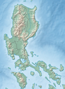
216:, Philippines. It was established in 2000 to protect 10,648.94 hectares (26,314.1 acres) of coastal area, including
677:
366:
273:
131:
388:
410:
237:
334:
314:
308:
459:
241:
44:
264:
and bank on the western side which extends for 4 kilometres (2.5 mi) southwards in the
349:
are some species of fish in the area. Vast expanse of seagrass is also found in the area.
302:
38:
480:
296:
233:
217:
671:
512:
225:
209:
256:
in southern La Union from Santa Rita in Agoo to the border with the province of
121:
272:
The park is just 50 kilometres (31 mi) south of the provincial capital of
538:
346:
342:
257:
158:
145:
322:
290:
261:
437:
224:
beds and stretches of fine black sand beaches. It was first gazetted as a
326:
253:
221:
213:
117:
338:
93:
65:
277:
330:
265:
484:
683:
369:. Official Gazette of the Republic of the Philippines
631:
615:
579:
563:
547:
519:
436:. Provincial Government of La Union. Archived from
192:
182:
174:
137:
127:
113:
21:
188:April 23, 2000 (Protected landscape and seascape)
252:The Agoo–Damortis park is located in 25 coastal
411:"United States coast pilot, Philippine Islands"
197:Department of Environment and Natural Resources
206:Agoo–Damortis Protected Landscape and Seascape
22:Agoo–Damortis Protected Landscape and Seascape
496:
8:
503:
489:
481:
276:and 230 kilometres (140 mi) north of
18:
358:
43:The coast of Damortis as seen from the
703:1965 establishments in the Philippines
16:National park in La Union, Philippines
432:Rudio, Israel O. (2 September 2014).
7:
460:"State of the Mangroves in La Union"
230:Agoo–Damortis National Seashore Park
112:
698:Protected areas established in 1965
178:10,648.94 hectares (26,314.1 acres)
658:Protected areas of the Philippines
616:Protected landscapes and seascapes
208:is located on the eastern side of
14:
413:. U.S. Coast and Geodetic Survey
92:
85:
64:
57:
37:
31:V (protected landscape/seascape)
693:Tourist attractions in La Union
367:"Proclamation No. 277, s. 2000"
181:
126:
1:
228:in 1965 and was known as the
186:June 19, 1965 (National park)
464:Ateneo de Manila University
101:Location in the Philippines
719:
534:Northern Luzon Heroes Hill
654:
632:Watershed forest reserves
51:
36:
26:
511:Protected areas in the
389:"Republic Act No. 4570"
104:Show map of Philippines
159:16.35278°N 120.34361°E
132:San Fernando, La Union
688:Geography of La Union
434:"Agoo boosts tourism"
580:Protected landscapes
315:Rhizophora mucronata
309:Rhizophora apiculata
193:Governing body
164:16.35278; 120.34361
155: /
638:Ilocos Norte Metro
391:. The Corpus Juris
665:
664:
564:Natural monuments
202:
201:
128:Nearest city
76:Show map of Luzon
73:Location in Luzon
45:Manila North Road
710:
602:Manleluag Spring
555:Kalbario-Patapat
505:
498:
491:
482:
475:
474:
472:
470:
456:
450:
449:
447:
445:
429:
423:
422:
420:
418:
407:
401:
400:
398:
396:
385:
379:
378:
376:
374:
363:
170:
169:
167:
166:
165:
160:
156:
153:
152:
151:
148:
105:
96:
95:
89:
77:
68:
67:
61:
41:
19:
718:
717:
713:
712:
711:
709:
708:
707:
678:IUCN Category V
668:
667:
666:
661:
650:
627:
611:
575:
559:
543:
529:Hundred Islands
515:
509:
479:
478:
468:
466:
458:
457:
453:
443:
441:
440:on 6 April 2016
431:
430:
426:
416:
414:
409:
408:
404:
394:
392:
387:
386:
382:
372:
370:
365:
364:
360:
355:
303:Pemphis acidula
286:
284:Flora and fauna
250:
218:mangrove swamps
187:
163:
161:
157:
154:
149:
146:
144:
142:
141:
109:
108:
107:
106:
103:
102:
99:
98:
97:
80:
79:
78:
75:
74:
71:
70:
69:
47:
32:
17:
12:
11:
5:
716:
714:
706:
705:
700:
695:
690:
685:
680:
670:
669:
663:
662:
655:
652:
651:
649:
648:
645:
642:
639:
635:
633:
629:
628:
626:
625:
619:
617:
613:
612:
610:
609:
604:
599:
594:
589:
583:
581:
577:
576:
574:
573:
567:
565:
561:
560:
558:
557:
551:
549:
545:
544:
542:
541:
536:
531:
525:
523:
521:National parks
517:
516:
510:
508:
507:
500:
493:
485:
477:
476:
451:
424:
402:
380:
357:
356:
354:
351:
297:Nipa fruticans
291:Avicennia spp.
285:
282:
249:
246:
200:
199:
194:
190:
189:
184:
180:
179:
176:
172:
171:
139:
135:
134:
129:
125:
124:
115:
111:
110:
100:
91:
90:
84:
83:
82:
81:
72:
63:
62:
56:
55:
54:
53:
52:
49:
48:
42:
34:
33:
27:
24:
23:
15:
13:
10:
9:
6:
4:
3:
2:
715:
704:
701:
699:
696:
694:
691:
689:
686:
684:
681:
679:
676:
675:
673:
660:
659:
653:
646:
643:
640:
637:
636:
634:
630:
624:
623:Agoo–Damortis
621:
620:
618:
614:
608:
605:
603:
600:
598:
595:
593:
590:
588:
585:
584:
582:
578:
572:
569:
568:
566:
562:
556:
553:
552:
550:
548:Natural parks
546:
540:
537:
535:
532:
530:
527:
526:
524:
522:
518:
514:
513:Ilocos Region
506:
501:
499:
494:
492:
487:
486:
483:
465:
461:
455:
452:
439:
435:
428:
425:
412:
406:
403:
390:
384:
381:
368:
362:
359:
352:
350:
348:
344:
340:
336:
332:
328:
324:
319:
317:
316:
311:
310:
305:
304:
299:
298:
293:
292:
283:
281:
279:
275:
270:
267:
263:
259:
255:
247:
245:
243:
239:
235:
231:
227:
226:national park
223:
219:
215:
211:
210:Lingayen Gulf
207:
198:
195:
191:
185:
177:
173:
168:
140:
136:
133:
130:
123:
119:
116:
88:
60:
50:
46:
40:
35:
30:
29:IUCN category
25:
20:
656:
622:
571:Bessang Pass
467:. Retrieved
454:
442:. Retrieved
438:the original
427:
415:. Retrieved
405:
393:. Retrieved
383:
371:. Retrieved
361:
320:
313:
307:
301:
295:
289:
287:
274:San Fernando
271:
251:
229:
212:in southern
205:
203:
607:Santa Lucia
248:Description
238:Santo Tomas
183:Established
162: /
150:120°20′37″E
138:Coordinates
122:Philippines
672:Categories
539:Paoay Lake
353:References
347:rabbitfish
343:tigerperch
258:Pangasinan
147:16°21′10″N
641:Naguilian
323:slipmouth
262:sand spit
254:barangays
597:Lidlidda
469:24 March
444:24 March
417:24 March
395:24 March
373:24 March
327:goatfish
222:seagrass
214:La Union
118:La Union
114:Location
592:Libunao
587:Bigbiga
339:grouper
335:snapper
242:Rosario
312:; and
278:Manila
647:Tanap
644:Santa
331:bream
266:sitio
471:2016
446:2016
419:2016
397:2016
375:2016
345:and
321:The
240:and
234:Agoo
204:The
175:Area
674::
462:.
341:,
337:,
333:,
329:,
325:,
318:.
306:;
300:;
294:;
280:.
244:.
236:,
220:,
120:,
504:e
497:t
490:v
473:.
448:.
421:.
399:.
377:.
Text is available under the Creative Commons Attribution-ShareAlike License. Additional terms may apply.