119:
644:
53:
86:
341:
430:
36:
418:
547:
126:
93:
60:
356:
333:
The area is 10.2 km². The island features a volcano with a crater of about 1.1 km in diameter and an altitude of 289 m. The second highest is Montaña de Lobos at 256 m and following La
Rapagura. The northern portion is mainly flat.
579:
572:
565:
454:
118:
732:
737:
711:
161:
383:
is located in the eastern part of
Alegranza. The lighthouse was built between 1861 and 1865 and was designated a historic monument (
52:
514:
458:
380:
235:
643:
410:
85:
385:
340:
401:
because he felt joy upon spotting land. The island has been owned by the Jordán-Martinón family since the 1940s.
668:
259:
706:
264:
306:
252:
551:
479:
658:
398:
369:
322:
318:
196:
247:
557:
491:
22:
397:
Its name, derived from the
Spanish word for "joy," was given, according to some scholars, by
673:
293:
683:
519:
678:
589:
434:
355:
310:
298:
240:
726:
603:
690:
608:
422:
35:
515:"Los dueños de Alegranza proponen gestionar el uso público del islote la zona"
176:
163:
623:
618:
613:
502:
429:
546:
633:
628:
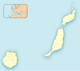
317:. It is the northernmost point in the Canary Islands, and part of the
302:
314:
226:
346:
561:
699:
651:
596:
275:
270:
258:
246:
234:
218:
210:
202:
192:
155:
150:
16:Uninhabited Spanish island in the Atlantic Ocean
573:
8:
321:. The island is part of the municipality of
28:
376:). There are no inhabitants on the island.
580:
566:
558:
34:
27:
446:
374:Parque Natural del Archipiélago Chinijo
336:
206:10.202 km (3.939 sq mi)
72:Location in the province of Las Palmas
292:
7:
297:) is an uninhabited island in the
75:Show map of Province of Las Palmas
14:
503:Municipios De Lanzarote (Teguise)
141:Show map of Spain, Canary Islands
138:Alegranza (Spain, Canary Islands)
125:
92:
59:
642:
545:
428:
416:
354:
339:
124:
117:
91:
84:
58:
51:
1:
733:Islands of the Canary Islands
588:Islands and provinces of the
411:Geology of the Canary Islands
738:Uninhabited islands of Spain
349:satellite image of Alegranza
523:(in Spanish). 15 March 2010
480:Boletín Oficial de Canarias
301:, located off the coast of
40:An aerial view of Alegranza
754:
492:Boletín Oficial del Estado
368:The island is part of the
305:and is in the province of
108:Show map of Canary Islands
105:Alegranza (Canary Islands)
20:
640:
455:"Protected Natural Areas"
223:
45:
33:
386:Bien de Interés Cultural
381:Punta Delgada Lighthouse
214:289 m (948 ft)
482:, pages 9723 and 9865-7
712:Santa Cruz de Tenerife
290:Spanish pronunciation:
211:Highest elevation
329:Geographical overview
554:at Wikimedia Commons
294:[aleˈɣɾanθa]
236:Autonomous Community
659:Chinijo Archipelago
399:Jean de Bethencourt
370:Chinijo Archipelago
319:Chinijo Archipelago
197:Chinijo Archipelago
173: /
30:
21:For the album, see
435:Islands portal
720:
719:
550:Media related to
283:
282:
177:29.399°N 13.512°W
23:Alegranza (album)
745:
646:
582:
575:
568:
559:
549:
533:
532:
530:
528:
511:
505:
500:
494:
489:
483:
477:
471:
470:
468:
466:
461:on 17 April 2015
457:. Archived from
451:
433:
432:
423:Spain portal
421:
420:
419:
358:
343:
296:
291:
188:
187:
185:
184:
183:
178:
174:
171:
170:
169:
166:
142:
128:
127:
121:
109:
95:
94:
88:
76:
62:
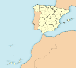
61:
55:
38:
31:
753:
752:
748:
747:
746:
744:
743:
742:
723:
722:
721:
716:
695:
684:Roque del Oeste
647:
638:
592:
586:
542:
537:
536:
526:
524:
513:
512:
508:
501:
497:
490:
486:
478:
474:
464:
462:
453:
452:
448:
443:
427:
417:
415:
407:
395:
366:
359:
350:
344:
331:
289:
230:
182:29.399; -13.512
181:
179:
175:
172:
167:
164:
162:
160:
159:
146:
145:
144:
143:
140:
139:
136:
135:
134:
133:
129:
112:
111:
110:
107:
106:
103:
102:
101:
100:
96:
79:
78:
77:
74:
73:
70:
69:
68:
67:
63:
41:
26:
17:
12:
11:
5:
751:
749:
741:
740:
735:
725:
724:
718:
717:
715:
714:
709:
703:
701:
697:
696:
694:
693:
688:
687:
686:
681:
679:Roque del Este
676:
671:
666:
655:
653:
649:
648:
641:
639:
637:
636:
631:
626:
621:
616:
611:
606:
600:
598:
594:
593:
590:Canary Islands
587:
585:
584:
577:
570:
562:
556:
555:
541:
540:External links
538:
535:
534:
506:
495:
484:
472:
445:
444:
442:
439:
438:
437:
425:
413:
406:
403:
394:
391:
372:Natural Park (
365:
362:
361:
360:
353:
351:
345:
338:
330:
327:
325:on Lanzarote.
311:Canary Islands
299:Atlantic Ocean
281:
280:
277:
273:
272:
268:
267:
262:
256:
255:
250:
244:
243:
241:Canary Islands
238:
232:
231:
224:
221:
220:
219:Administration
216:
215:
212:
208:
207:
204:
200:
199:
194:
190:
189:
157:
153:
152:
148:
147:
137:
131:
130:
123:
122:
116:
115:
114:
113:
104:
98:
97:
90:
89:
83:
82:
81:
80:
71:
65:
64:
57:
56:
50:
49:
48:
47:
46:
43:
42:
39:
15:
13:
10:
9:
6:
4:
3:
2:
750:
739:
736:
734:
731:
730:
728:
713:
710:
708:
705:
704:
702:
698:
692:
689:
685:
682:
680:
677:
675:
674:Montaña Clara
672:
670:
667:
665:
662:
661:
660:
657:
656:
654:
652:Other islands
650:
645:
635:
632:
630:
627:
625:
622:
620:
617:
615:
612:
610:
607:
605:
604:Fuerteventura
602:
601:
599:
595:
591:
583:
578:
576:
571:
569:
564:
563:
560:
553:
548:
544:
543:
539:
522:
521:
516:
510:
507:
504:
499:
496:
493:
488:
485:
481:
476:
473:
460:
456:
450:
447:
440:
436:
431:
426:
424:
414:
412:
409:
408:
404:
402:
400:
392:
390:
388:
387:
382:
377:
375:
371:
363:
357:
352:
348:
342:
337:
335:
328:
326:
324:
320:
316:
312:
308:
304:
300:
295:
287:
278:
274:
269:
266:
263:
261:
257:
254:
251:
249:
245:
242:
239:
237:
233:
229:
228:
222:
217:
213:
209:
205:
201:
198:
195:
191:
186:
158:
154:
149:
120:
87:
54:
44:
37:
32:
24:
19:
663:
609:Gran Canaria
597:Main islands
525:. Retrieved
518:
509:
498:
487:
475:
463:. Retrieved
459:the original
449:
396:
384:
378:
373:
367:
364:Conservation
332:
285:
284:
271:Demographics
260:Municipality
225:
18:
389:) in 2002.
193:Archipelago
180: /
156:Coordinates
727:Categories
707:Las Palmas
441:References
307:Las Palmas
276:Population
253:Las Palmas
168:13°30′43″W
165:29°23′56″N
700:Provinces
664:Alegranza
624:Lanzarote
619:El Hierro
614:La Gomera
552:Alegranza
286:Alegranza
151:Geography
132:Alegranza
99:Alegranza
66:Alegranza
29:Alegranza
669:Graciosa
634:Tenerife
629:La Palma
527:19 March
465:24 April
405:See also
279:0 (2013)
248:Province
393:History
323:Teguise
309:in the
265:Teguise
303:Africa
691:Lobos
315:Spain
227:Spain
529:2012
467:2014
379:The
347:NASA
203:Area
520:ABC
729::
517:.
313:,
581:e
574:t
567:v
531:.
469:.
288:(
25:.
Text is available under the Creative Commons Attribution-ShareAlike License. Additional terms may apply.