65:
95:
939:
125:
48:
951:
483:
928:
280:
was built about 1778 by John Harris, whose family owned land in the area since at least 1655. The house was extensively renovated in 1976, but elements of its 18th-century origins are still discernible. The farmhouse was used by the estate caretaker when the property was part of the
Brandegee Estate. The farm is the last working farm in both communities, a reminder of the area's agrarian origins.
132:
102:
72:
279:
The interior of the farm property is accessed from the
Brandegee Estate's main drive off Newton Street, and includes a cluster farm outbuildings, dating to the late 19th century, that have been converted to other uses. The original farmhouse is set in a grove of trees, well back from the road. It
566:
874:
869:
864:
497:
256:. The main farm house, built c. 1778 and extensively remodeled in 1976, is one of Brookline's few 18th-century houses. The farm is the last working farm in both communities; it was added to the National Register of Historic Places in 1985.
562:
542:
537:
532:
502:
552:
522:
424:
297:
557:
547:
527:
507:
896:
517:
512:
976:
901:
849:
729:
683:
616:
779:
754:
714:
642:
611:
590:
991:
859:
795:
764:
719:
704:
699:
292:
854:
759:
749:
652:
769:
744:
734:
709:
662:
647:
637:
621:
595:
805:
800:
774:
739:
724:
667:
657:
417:
831:
826:
931:
433:
410:
996:
821:
906:
472:
462:
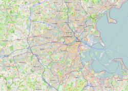
272:'s southwest side. It covers about 105 acres (42 ha), bounded on the west by Newton Street and the south and east by Allandale Road. It is bounded on the north by the
64:
911:
986:
943:
283:
Since 2022 the retail workers of
Allandale Farm have been represented by Allandale Workers United, a homegrown and independently formed labor union.
94:
457:
169:
124:
325:
34:
276:, of which it was once a part. The farmstand that serves the public is located on Allandale Road, along with a cluster of greenhouses.
253:
209:
392:
397:
981:
402:
452:
467:
447:
330:
265:
955:
157:
273:
47:
225:
970:
347:
298:
National
Register of Historic Places listings in southern Boston, Massachusetts
184:
171:
482:
264:
Allandale Farm is located astride the border between
Chestnut Hill and the
368:
293:
National
Register of Historic Places listings in Brookline, Massachusetts
269:
977:
Farms on the
National Register of Historic Places in Massachusetts
320:
992:
National
Register of Historic Places in Brookline, Massachusetts
406:
434:
U.S. National
Register of Historic Places in Massachusetts
889:
842:
814:
788:
692:
676:
630:
604:
583:
576:
490:
463:
History of the
National Register of Historic Places
440:
231:
218:
208:
200:
163:
153:
348:"NRHP nomination for John Harris House and Farm"
944:National Register of Historic Places portal
997:National Register of Historic Places in Boston
369:"Allandale Workers United Board Certification"
252:, is an historic farm at 284 Newton Street in
52:The pond behind the farm stand and greenhouses
418:
8:
580:
425:
411:
403:
46:
35:U.S. National Register of Historic Places
309:
342:
340:
321:"National Register Information System"
315:
313:
131:
101:
71:
18:
7:
326:National Register of Historic Places
987:Houses in Brookline, Massachusetts
14:
949:
937:
927:
926:
481:
371:. National Labor Relations Board
130:
123:
100:
93:
70:
63:
350:. Commonwealth of Massachusetts
84:Show map of Greater Boston area
220:
1:
144:Show map of the United States
254:Chestnut Hill, Massachusetts
16:United States historic place
907:National Historic Landmarks
1013:
902:Cape Cod National Seashore
246:John Harris House and Farm
27:John Harris House and Farm
922:
479:
219:NRHP reference
114:Show map of Massachusetts
57:
45:
41:
32:
25:
21:
956:United States portal
398:Allandale Workers United
260:Description and history
453:Keeper of the Register
204:105 acres (42 ha)
468:National Park Service
448:Contributing property
331:National Park Service
185:42.30528°N 71.14333°W
244:, also known as the
190:42.30528; -71.14333
181: /
964:
963:
885:
884:
584:Barnstable County
458:Historic district
333:. April 15, 2008.
239:
238:
158:Chestnut Hill, MA
1004:
982:Houses in Boston
954:
953:
952:
942:
941:
940:
930:
929:
843:Worcester County
693:Middlesex County
581:
485:
427:
420:
413:
404:
380:
379:
377:
376:
365:
359:
358:
356:
355:
344:
335:
334:
317:
274:Brandegee Estate
268:neighborhood on
235:October 17, 1985
222:
196:
195:
193:
192:
191:
186:
182:
179:
178:
177:
174:
145:
134:
133:
127:
115:
104:
103:
97:
85:
74:
73:
67:
50:
19:
1012:
1011:
1007:
1006:
1005:
1003:
1002:
1001:
967:
966:
965:
960:
950:
948:
938:
936:
918:
881:
838:
810:
784:
688:
672:
626:
600:
572:
491:Lists by county
486:
477:
436:
431:
389:
384:
383:
374:
372:
367:
366:
362:
353:
351:
346:
345:
338:
319:
318:
311:
306:
289:
262:
189:
187:
183:
180:
175:
172:
170:
168:
167:
149:
148:
147:
146:
143:
142:
141:
140:
139:
135:
118:
117:
116:
113:
112:
111:
110:
109:
105:
88:
87:
86:
83:
82:
81:
80:
79:
75:
53:
37:
28:
17:
12:
11:
5:
1010:
1008:
1000:
999:
994:
989:
984:
979:
969:
968:
962:
961:
959:
958:
946:
934:
923:
920:
919:
917:
916:
915:
914:
904:
899:
893:
891:
887:
886:
883:
882:
880:
879:
878:
877:
872:
867:
857:
852:
846:
844:
840:
839:
837:
836:
835:
834:
829:
818:
816:
815:Suffolk County
812:
811:
809:
808:
803:
798:
792:
790:
789:Norfolk County
786:
785:
783:
782:
777:
772:
767:
762:
757:
752:
747:
742:
737:
732:
727:
722:
717:
712:
707:
702:
696:
694:
690:
689:
687:
686:
680:
678:
677:Hampden County
674:
673:
671:
670:
665:
660:
655:
650:
645:
640:
634:
632:
628:
627:
625:
624:
619:
614:
608:
606:
605:Bristol County
602:
601:
599:
598:
593:
587:
585:
578:
574:
573:
571:
570:
560:
555:
550:
545:
540:
535:
530:
525:
520:
515:
510:
505:
500:
494:
492:
488:
487:
480:
478:
476:
475:
473:Property types
470:
465:
460:
455:
450:
444:
442:
438:
437:
432:
430:
429:
422:
415:
407:
401:
400:
395:
393:Allandale Farm
388:
387:External links
385:
382:
381:
360:
336:
308:
307:
305:
302:
301:
300:
295:
288:
285:
261:
258:
248:, and once as
242:Allandale Farm
237:
236:
233:
229:
228:
223:
216:
215:
212:
206:
205:
202:
198:
197:
165:
161:
160:
155:
151:
150:
138:Allandale Farm
137:
136:
129:
128:
122:
121:
120:
119:
108:Allandale Farm
107:
106:
99:
98:
92:
91:
90:
89:
78:Allandale Farm
77:
76:
69:
68:
62:
61:
60:
59:
58:
55:
54:
51:
43:
42:
39:
38:
33:
30:
29:
26:
23:
22:
15:
13:
10:
9:
6:
4:
3:
2:
1009:
998:
995:
993:
990:
988:
985:
983:
980:
978:
975:
974:
972:
957:
947:
945:
935:
933:
925:
924:
921:
913:
910:
909:
908:
905:
903:
900:
898:
895:
894:
892:
888:
876:
873:
871:
868:
866:
863:
862:
861:
858:
856:
853:
851:
848:
847:
845:
841:
833:
830:
828:
825:
824:
823:
820:
819:
817:
813:
807:
804:
802:
799:
797:
794:
793:
791:
787:
781:
778:
776:
773:
771:
768:
766:
763:
761:
758:
756:
753:
751:
748:
746:
743:
741:
738:
736:
733:
731:
728:
726:
723:
721:
718:
716:
713:
711:
708:
706:
703:
701:
698:
697:
695:
691:
685:
682:
681:
679:
675:
669:
666:
664:
661:
659:
656:
654:
651:
649:
646:
644:
641:
639:
636:
635:
633:
629:
623:
620:
618:
615:
613:
610:
609:
607:
603:
597:
594:
592:
589:
588:
586:
582:
579:
577:Lists by city
575:
568:
564:
561:
559:
556:
554:
551:
549:
546:
544:
541:
539:
536:
534:
531:
529:
526:
524:
521:
519:
516:
514:
511:
509:
506:
504:
501:
499:
496:
495:
493:
489:
484:
474:
471:
469:
466:
464:
461:
459:
456:
454:
451:
449:
446:
445:
443:
439:
435:
428:
423:
421:
416:
414:
409:
408:
405:
399:
396:
394:
391:
390:
386:
370:
364:
361:
349:
343:
341:
337:
332:
328:
327:
322:
316:
314:
310:
303:
299:
296:
294:
291:
290:
286:
284:
281:
277:
275:
271:
267:
266:Jamaica Plain
259:
257:
255:
251:
250:Faulkner Farm
247:
243:
234:
232:Added to NRHP
230:
227:
224:
217:
214:Brookline MRA
213:
211:
207:
203:
199:
194:
166:
162:
159:
156:
152:
126:
96:
66:
56:
49:
44:
40:
36:
31:
24:
20:
875:southwestern
870:northwestern
631:Essex County
373:. Retrieved
363:
352:. Retrieved
324:
282:
278:
263:
249:
245:
241:
240:
890:Other lists
850:Southbridge
730:Marlborough
684:Springfield
617:New Bedford
188: /
164:Coordinates
971:Categories
780:Winchester
755:Somerville
715:Framingham
643:Gloucester
612:Fall River
591:Barnstable
498:Barnstable
375:2023-08-17
354:2014-05-15
304:References
173:42°18′19″N
860:Worcester
796:Brookline
765:Wakefield
720:Lexington
705:Cambridge
700:Arlington
563:Worcester
543:Nantucket
538:Middlesex
533:Hampshire
503:Berkshire
176:71°8′36″W
932:Category
855:Uxbridge
832:southern
827:northern
760:Stoneham
750:Sherborn
653:Lawrence
567:northern
553:Plymouth
523:Franklin
287:See also
226:85003246
154:Location
897:Bridges
865:eastern
770:Waltham
745:Reading
735:Medford
710:Concord
663:Methuen
648:Ipswich
638:Andover
622:Taunton
596:Harwich
558:Suffolk
548:Norfolk
528:Hampden
508:Bristol
912:Boston
822:Boston
806:Quincy
801:Milton
775:Weston
740:Newton
725:Lowell
441:Topics
270:Boston
668:Salem
518:Essex
513:Dukes
658:Lynn
201:Area
221:No.
210:MPS
973::
339:^
329:.
323:.
312:^
569:)
565:(
426:e
419:t
412:v
378:.
357:.
Text is available under the Creative Commons Attribution-ShareAlike License. Additional terms may apply.