73:
1522:
536:
1413:
198:
90:
556:. José María Amador panned the creek, but his primary success was providing supplies that he brought from his rancheria in the San Ramon area. José María Amador left the group after six months, returning to his rancheria. The rancheria had suffered during his absence, and he needed to care for his ailing wife. José María Amador must have made a significant impression among the other panners. The creek, city and County eventually carried the name "Amador", the city taking its name from the county.
123:
45:
962:
218:
130:
97:
980:, another example of the beautiful brickwork of California's past. A bridge replacement project completed in 2014 has beautified and revitalized the center of the city, providing patio dining at the Imperial Hotel, new public restrooms and improved access to the many quaint shops, wine tasting rooms and purveyors of unique, tasty comestibles.
999:— located in one of the oldest commercial buildings in town, dating back 1860, the museum collects and displays items related to history and culture of the Mother Lode region. The museum is named after Mr. Whitney, an antique dealer, that bequeathed the building to the city of Amador to be used as a museum.
975:
the traveler can see signs of abandonment in this once thriving city, a contrast to the time when the placers and underground mines produced in abundance. An abandoned brick building stands next to the
Fleehart Store, a beautiful reflection of the stone masonry of the time. Also on Main Street is the
819:
Amador City had a population of 185. The population density was 589.6 inhabitants per square mile (227.6/km). The racial makeup of Amador City was 171 (92.4%) White, 0 (0.0%) African
American, 4 (2.2%) Native American, 2 (1.1%) Asian, 0 (0.0%) Pacific Islander, 2 (1.1%) from other races, and 6 (3.2%)
845:
There were 108 housing units at an average density of 344.2 units per square mile (132.9 units/km), of which 85 were occupied, 54 (63.5%) by the owners and 31 (36.5%) by renters. The homeowner vacancy rate was 6.9%; the rental vacancy rate was 8.8%. 111 people (60.0% of the population) lived in
866:
There were 85 households, 23.5% had children under the age of 18 living with them, 43.5% were married couples living together, 15.3% had a female householder with no husband present, and 35.3% were non-families. 27.1% of households were made up of individuals, and 10.6% had someone living alone who
841:
The age distribution was 37 people (20.0%) under the age of 18, 18 people (9.7%) aged 18 to 24, 40 people (21.6%) aged 25 to 44, 65 people (35.1%) aged 45 to 64, and 25 people (13.5%) who were 65 or older. The median age was 43.5 years. For every 100 females, there were 94.7 males. For every 100
870:
The age distribution was 19.4% under the age of 18, 7.7% from 18 to 24, 27.0% from 25 to 44, 32.7% from 45 to 64, and 13.3% 65 or older. The median age was 42 years. For every 100 females, there were 92.2 males. For every 100 females age 18 and over, there were 100.0 males.
874:
The median household income was $ 45,625 and the median family income was $ 39,861. Males had a median income of $ 30,313 versus $ 16,250 for females. The per capita income for the city was $ 17,963. About 14.0% of families and 22.9% of the population were below the
551:
Amador City was originally settled in 1849 at what is now Turner Road and Amador Creek (an old wagon road between
Drytown and Sutter Creek) by several groups of gold panners who were drawn to the area. One of the groups was the Sunol Group. The Sunol group included
858:
there were 196 people in 85 households, including 54 families, in the city. The population density was 601.7 inhabitants per square mile (232.3/km). There were 91 housing units at an average density of 279.4 units per square mile (107.9 units/km). The
72:
838:. 26 households (30.6%) were one person and 9 (10.6%) had someone living alone who was 65 or older. The average household size was 2.18. There were 47 families (55.3% of households); the average family size was 2.74.
567:
were brought in to process the hard quartz that the gold veins were embedded in. By
September two stamp mills were erected along Amador Creek. These stamp mills were so remarkable that it drew the attention of
987:— Remnants remain of an incredibly-detailed G-Scale model train set in a garden that featured miniature mines and mills and turn-of-the-century full-size mining equipment. It is currently unused.
1788:
1440:
860:
1793:
993:— located behind the Imperial Hotel. Visitors can take a self-guided tour of the 1.25-acre (5,100 m) cemetery that dates back to the beginning of the town.
1783:
158:
904:
287:
863:
of the city was 90.82% White, 1.02% Native
American, 4.08% from other races, and 4.08% from two or more races. Hispanic or Latino of any race were 9.18%.
1798:
830:
living together, 9 (10.6%) had a female householder with no husband present, 3 (3.5%) had a male householder with no wife present. There were 10 (11.8%)
923:
305:
892:
269:
1183:
1433:
436:
1323:
1685:
1551:
1483:
1252:
919:
503:, up from 185 in 2010, making it the least populous incorporated city in California. Amador City is also noted for being the smallest city in
1680:
1665:
1592:
943:
912:
292:
1303:
89:
35:
122:
1582:
1546:
1174:
446:
1426:
1021:
1017:
44:
1556:
1147:
927:
823:
The whole population lived in households, no one lived in non-institutionalized group quarters and no one was institutionalized.
314:
1179:
1418:
1216:
230:
1561:
888:
1710:
1282:
977:
965:
908:
896:
520:
296:
278:
523:, the city has a total area of 0.3 square miles (0.78 km), all of which is land, making it the smallest city in
1670:
1753:
1450:
972:
855:
816:
789:
774:
759:
744:
729:
714:
699:
684:
669:
654:
639:
624:
609:
500:
492:
235:
1705:
1541:
1511:
516:
424:
190:
1392:
1169:
456:
452:
1647:
1637:
1607:
1533:
553:
540:
535:
1725:
1720:
1675:
1642:
1602:
1571:
1700:
1695:
835:
242:
826:
There were 85 households, 22 (25.9%) had children under the age of 18 living in them, 35 (41.2%) were
1760:
1690:
1576:
1506:
1256:
399:
1632:
1622:
1612:
1597:
1587:
1566:
1501:
1472:
519:
on Old
Highway 49, Amador City is the state's smallest incorporated city by area. According to the
1730:
1310:
950:
569:
274:
1230:
961:
389:
1496:
867:
was 65 or older. The average household size was 2.31 and the average family size was 2.76.
1715:
1344:
900:
1412:
1025:
949:
There are currently no schools within Amador City's boundaries. The city is serviced by
559:
Early in 1851 gold quartz veins were discovered along the same creek but further west.
1204:
931:
310:
1777:
572:. He photographed the area and 3D images taken in 1851 were made of the stamp mills.
429:
203:
1393:
U.S. Geological Survey
Geographic Names Information System: Amador City, California
1212:
876:
846:
owner-occupied housing units and 74 people (40.0%) lived in rental housing units.
1465:
1369:
1125:
1126:"California's 5th Congressional District - Representatives & District Map"
1050:
879:, including 42.5% of those under the age of 18 and none of those 65 and older.
1657:
820:
from two or more races. Hispanic or Latino of any race were 11 people (5.9%).
564:
544:
524:
504:
496:
223:
210:
173:
160:
380:
1100:
827:
560:
831:
1253:"2010 Census Interactive Population Search: CA - Amador City city"
960:
534:
406:
385:
258:
942:
Amador City is within the sole school district in Amador County:
1304:"2020 CENSUS - SCHOOL DISTRICT REFERENCE MAP: Amador County, CA"
1075:
1422:
1744:‡This CDP also has portions in an adjacent county or counties
1406:
467:
1520:
1278:
575:
Amador City was incorporated as a city on June 2, 1915.
1334:
Division of Mines, The
Motherlode Country, Bulletin 141
563:
were brought to the area to crush the quartz. Shortly
1209:
1500 California Place Names: Their Origin and
Meaning
77:
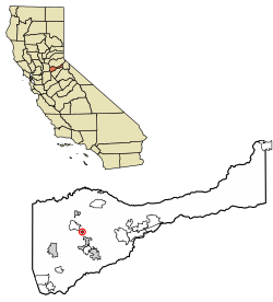
Location of Amador City in Amador County, California.
1739:
1656:
1621:
1532:
1482:
462:
445:
435:
423:
413:
396:
379:
371:
363:
358:
350:
342:
334:
326:
321:
303:
285:
267:
256:
251:
241:
229:
209:
189:
65:"Essence of the California Gold & Wine Country"
26:
1345:"Amador County's Pioneer Cemeteries | Amador City"
499:, United States. The population was 200 as of the
842:females age 18 and over, there were 100.0 males.
953:, Ione Junior High and Sutter Creek Elementary.
1434:
8:
346:0.00 sq mi (0.00 km) 0%
1789:Incorporated cities and towns in California
1095:
1093:
1441:
1427:
1419:
1411:
1120:
1118:
582:
23:
1521:
1070:
1068:
1018:"California Cities by Incorporation Date"
547:miner who found gold in the area in 1848.
1184:United States Department of the Interior
924:California's 5th congressional district
836:same-sex married couples or partnerships
1009:
461:
434:
412:
378:
357:
349:
320:
250:
188:
153:
81:
69:
53:
41:
920:United States House of Representatives
602:
1370:"Amador City ~ Amador Whitney Museum"
944:Amador County Unified School District
444:
422:
395:
370:
362:
341:
333:
325:
302:
284:
266:
255:
240:
228:
208:
61:
7:
1794:Populated places established in 1853
1255:. U.S. Census Bureau. Archived from
1784:Cities in Amador County, California
1175:Geographic Names Information System
832:unmarried opposite-sex partnerships
338:0.31 sq mi (0.80 km)
330:0.31 sq mi (0.80 km)
129:
96:
1449:Municipalities and communities of
1231:"Census of Population and Housing"
1022:Local Agency Formation Commissions
592:
515:Only two miles (3.2 km) from
14:
1799:1853 establishments in California
49:Historic buildings in Amador City
21:City in California, United States
16:City in California, United States
216:
196:
128:
121:
95:
88:
71:
57:The gold country's hidden nugget
43:
1180:United States Geological Survey
142:Amador City (the United States)
1217:University of California Press
1:
1150:. United States Census Bureau
375:645.16/sq mi (249.46/km)
145:Show map of the United States
1020:. California Association of
971:Traveling the two blocks on
889:California State Legislature
828:opposite-sex married couples
1283:United States Census Bureau
1148:"2020 U.S. Gazetteer Files"
539:Amador City is named after
521:United States Census Bureau
1815:
905:the 5th Assembly District
1749:
1518:
1463:
1452:Amador County, California
803:
788:
773:
758:
743:
728:
713:
698:
683:
668:
653:
638:
623:
608:
601:
596:
591:
588:
154:
82:
70:
62:
54:
42:
33:
1051:"Amador City Government"
893:the 8th Senate District
354:919 ft (280 m)
883:Government and politics
1526:
985:Little Amador Railroad
968:
548:
174:38.41944°N 120.82417°W
112:Show map of California
109:Location in California
1524:
1279:"U.S. Census website"
1103:. State of California
1078:. State of California
997:Amador Whitney Museum
964:
804:U.S. Decennial Census
584:Historical population
538:
398: • Summer (
1762:United States portal
1623:Other unincorporated
1557:Camanche North Shore
1259:on December 25, 2016
1128:. Civic Impulse, LLC
991:Amador City Cemetery
922:, Amador City is in
891:, Amador City is in
372: • Density
179:38.41944; -120.82417
1031:on November 3, 2014
585:
288:State Assembly
170: /
1527:
1311:U.S. Census Bureau
1101:"Members Assembly"
969:
966:The Imperial Hotel
957:Points of interest
951:Amador High School
583:
570:Eadweard Muybridge
549:
364: • Total
343: • Water
327: • Total
275:Marie Alvarado-Gil
1771:
1770:
1755:California portal
1525:Amador County map
1349:historichwy49.com
926:, represented by
907:, represented by
895:, represented by
808:
807:
554:José María Amador
541:José María Amador
478:
477:
335: • Land
1806:
1763:
1756:
1562:Camanche Village
1523:
1475:
1468:
1458:
1453:
1443:
1436:
1429:
1420:
1415:
1410:
1409:
1407:Official website
1385:
1384:
1382:
1380:
1366:
1360:
1359:
1357:
1355:
1341:
1335:
1332:
1326:
1321:
1319:
1317:
1308:
1300:
1294:
1293:
1291:
1289:
1275:
1269:
1268:
1266:
1264:
1249:
1243:
1242:
1240:
1238:
1227:
1221:
1220:
1201:
1195:
1194:
1192:
1190:
1166:
1160:
1159:
1157:
1155:
1144:
1138:
1137:
1135:
1133:
1122:
1113:
1112:
1110:
1108:
1097:
1088:
1087:
1085:
1083:
1072:
1063:
1062:
1060:
1058:
1053:. Amador City CA
1047:
1041:
1040:
1038:
1036:
1030:
1024:. Archived from
1014:
604:
599:
594:
586:
474:
471:
469:
403:
222:
220:
219:
202:
200:
199:
185:
184:
182:
181:
180:
175:
171:
168:
167:
166:
163:
146:
132:
131:
125:
113:
99:
98:
92:
75:
47:
24:
1814:
1813:
1809:
1808:
1807:
1805:
1804:
1803:
1774:
1773:
1772:
1767:
1761:
1754:
1745:
1735:
1711:Lower Rancheria
1652:
1624:
1617:
1528:
1516:
1478:
1473:
1466:
1459:
1456:
1451:
1447:
1405:
1404:
1401:
1389:
1388:
1378:
1376:
1374:amador-city.com
1368:
1367:
1363:
1353:
1351:
1343:
1342:
1338:
1333:
1329:
1315:
1313:
1306:
1302:
1301:
1297:
1287:
1285:
1277:
1276:
1272:
1262:
1260:
1251:
1250:
1246:
1236:
1234:
1229:
1228:
1224:
1205:Bright, William
1203:
1202:
1198:
1188:
1186:
1168:
1167:
1163:
1153:
1151:
1146:
1145:
1141:
1131:
1129:
1124:
1123:
1116:
1106:
1104:
1099:
1098:
1091:
1081:
1079:
1074:
1073:
1066:
1056:
1054:
1049:
1048:
1044:
1034:
1032:
1028:
1016:
1015:
1011:
1006:
959:
940:
901:Angelique Ashby
885:
852:
813:
597:
581:
533:
513:
491:) is a city in
485:Amadore's Creek
466:
419:
397:
217:
215:
197:
195:
178:
176:
172:
169:
164:
161:
159:
157:
156:
150:
149:
148:
147:
144:
143:
140:
139:
138:
137:
133:
116:
115:
114:
111:
110:
107:
106:
105:
104:
100:
78:
66:
58:
55:Nickname:
50:
38:
29:
22:
17:
12:
11:
5:
1812:
1810:
1802:
1801:
1796:
1791:
1786:
1776:
1775:
1769:
1768:
1766:
1765:
1758:
1750:
1747:
1746:
1743:
1741:
1737:
1736:
1734:
1733:
1728:
1723:
1718:
1713:
1708:
1703:
1698:
1693:
1688:
1683:
1678:
1673:
1668:
1662:
1660:
1654:
1653:
1651:
1650:
1645:
1640:
1635:
1629:
1627:
1619:
1618:
1616:
1615:
1610:
1605:
1600:
1595:
1590:
1585:
1580:
1574:
1569:
1564:
1559:
1554:
1549:
1544:
1538:
1536:
1530:
1529:
1519:
1517:
1515:
1514:
1509:
1504:
1499:
1494:
1488:
1486:
1480:
1479:
1464:
1461:
1460:
1448:
1446:
1445:
1438:
1431:
1423:
1417:
1416:
1400:
1399:External links
1397:
1396:
1395:
1387:
1386:
1361:
1336:
1327:
1295:
1270:
1244:
1222:
1196:
1161:
1139:
1114:
1089:
1064:
1042:
1008:
1007:
1005:
1002:
1001:
1000:
994:
988:
978:Imperial Hotel
958:
955:
939:
936:
932:Tom McClintock
884:
881:
851:
848:
812:
809:
806:
805:
801:
800:
797:
795:
792:
786:
785:
782:
780:
777:
771:
770:
767:
765:
762:
756:
755:
752:
750:
747:
741:
740:
737:
735:
732:
726:
725:
722:
720:
717:
711:
710:
707:
705:
702:
696:
695:
692:
690:
687:
681:
680:
677:
675:
672:
666:
665:
662:
660:
657:
651:
650:
647:
645:
642:
636:
635:
632:
630:
627:
621:
620:
617:
615:
612:
606:
605:
600:
595:
590:
580:
577:
532:
529:
512:
509:
476:
475:
464:
460:
459:
450:
443:
442:
439:
433:
432:
427:
421:
420:
417:
415:
411:
410:
404:
394:
393:
383:
377:
376:
373:
369:
368:
365:
361:
360:
356:
355:
352:
348:
347:
344:
340:
339:
336:
332:
331:
328:
324:
323:
319:
318:
311:Tom McClintock
308:
306:U. S. Congress
301:
300:
290:
283:
282:
272:
265:
264:
263:Sandra Staples
261:
254:
253:
249:
248:
245:
239:
238:
233:
227:
226:
213:
207:
206:
193:
187:
186:
152:
151:
141:
135:
134:
127:
126:
120:
119:
118:
117:
108:
102:
101:
94:
93:
87:
86:
85:
84:
83:
80:
79:
76:
68:
67:
64:
60:
59:
56:
52:
51:
48:
40:
39:
34:
31:
30:
27:
20:
15:
13:
10:
9:
6:
4:
3:
2:
1811:
1800:
1797:
1795:
1792:
1790:
1787:
1785:
1782:
1781:
1779:
1764:
1759:
1757:
1752:
1751:
1748:
1742:
1738:
1732:
1729:
1727:
1724:
1722:
1719:
1717:
1714:
1712:
1709:
1707:
1704:
1702:
1699:
1697:
1694:
1692:
1689:
1687:
1684:
1682:
1679:
1677:
1674:
1672:
1669:
1667:
1664:
1663:
1661:
1659:
1655:
1649:
1646:
1644:
1641:
1639:
1636:
1634:
1631:
1630:
1628:
1626:
1620:
1614:
1611:
1609:
1606:
1604:
1601:
1599:
1596:
1594:
1591:
1589:
1586:
1584:
1581:
1578:
1575:
1573:
1570:
1568:
1565:
1563:
1560:
1558:
1555:
1553:
1550:
1548:
1545:
1543:
1540:
1539:
1537:
1535:
1531:
1513:
1510:
1508:
1505:
1503:
1500:
1498:
1495:
1493:
1490:
1489:
1487:
1485:
1481:
1477:
1476:
1469:
1462:
1457:United States
1454:
1444:
1439:
1437:
1432:
1430:
1425:
1424:
1421:
1414:
1408:
1403:
1402:
1398:
1394:
1391:
1390:
1379:September 15,
1375:
1371:
1365:
1362:
1354:September 15,
1350:
1346:
1340:
1337:
1331:
1328:
1325:
1312:
1305:
1299:
1296:
1284:
1280:
1274:
1271:
1258:
1254:
1248:
1245:
1232:
1226:
1223:
1218:
1214:
1210:
1206:
1200:
1197:
1185:
1181:
1177:
1176:
1171:
1165:
1162:
1149:
1143:
1140:
1127:
1121:
1119:
1115:
1102:
1096:
1094:
1090:
1077:
1071:
1069:
1065:
1052:
1046:
1043:
1027:
1023:
1019:
1013:
1010:
1003:
998:
995:
992:
989:
986:
983:
982:
981:
979:
974:
967:
963:
956:
954:
952:
947:
945:
937:
935:
933:
929:
925:
921:
916:
914:
913:Joe Patterson
910:
906:
902:
898:
894:
890:
882:
880:
878:
872:
868:
864:
862:
861:racial makeup
857:
849:
847:
843:
839:
837:
834:, and 0 (0%)
833:
829:
824:
821:
818:
810:
802:
798:
796:
793:
791:
787:
783:
781:
778:
776:
772:
768:
766:
763:
761:
757:
753:
751:
748:
746:
742:
738:
736:
733:
731:
727:
723:
721:
718:
716:
712:
708:
706:
703:
701:
697:
693:
691:
688:
686:
682:
678:
676:
673:
671:
667:
663:
661:
658:
656:
652:
648:
646:
643:
641:
637:
633:
631:
628:
626:
622:
618:
616:
613:
611:
607:
587:
578:
576:
573:
571:
566:
562:
557:
555:
546:
542:
537:
530:
528:
526:
522:
518:
510:
508:
506:
502:
498:
494:
493:Amador County
490:
486:
482:
473:
465:
458:
454:
451:
448:
440:
438:
431:
428:
426:
416:
408:
405:
401:
391:
387:
384:
382:
374:
366:
353:
345:
337:
329:
316:
312:
309:
307:
304: •
298:
294:
293:Joe Patterson
291:
289:
286: •
280:
276:
273:
271:
268: •
262:
260:
257: •
246:
244:
237:
234:
232:
225:
214:
212:
205:
204:United States
194:
192:
183:
155:Coordinates:
124:
91:
74:
46:
37:
32:
25:
19:
1706:Lancha Plana
1542:Amador Pines
1512:Sutter Creek
1491:
1471:
1377:. Retrieved
1373:
1364:
1352:. Retrieved
1348:
1339:
1330:
1316:November 25,
1314:. Retrieved
1298:
1286:. Retrieved
1273:
1261:. Retrieved
1257:the original
1247:
1235:. Retrieved
1233:. Census.gov
1225:
1213:Berkeley, CA
1208:
1199:
1187:. Retrieved
1173:
1164:
1152:. Retrieved
1142:
1130:. Retrieved
1105:. Retrieved
1080:. Retrieved
1057:February 11,
1055:. Retrieved
1045:
1033:. Retrieved
1026:the original
1012:
996:
990:
984:
970:
948:
941:
917:
886:
877:poverty line
873:
869:
865:
853:
844:
840:
825:
822:
814:
579:Demographics
574:
565:stamps mills
558:
550:
517:Sutter Creek
514:
489:South Amador
488:
484:
480:
479:
470:.amador-city
270:State Senate
247:June 2, 1915
243:Incorporated
63:Motto:
18:
1686:Forest Home
1671:Camp O'pera
1658:Ghost towns
1648:Sutter Hill
1638:New Chicago
1625:communities
1608:River Pines
1552:Buena Vista
1492:Amador City
1467:County seat
1288:January 31,
1154:October 30,
856:2000 census
817:2010 census
501:2020 census
481:Amador City
449:feature IDs
177: /
165:120°49′27″W
136:Amador City
103:Amador City
28:Amador City
1778:Categories
1726:Pokerville
1721:Middle Bar
1681:Enterprise
1676:Carbondale
1666:Butte City
1643:Pine Acres
1603:Red Corral
1593:Pine Grove
1572:Fiddletown
1076:"Senators"
1004:References
973:Highway 49
928:Republican
909:Republican
545:Californio
525:California
505:California
497:California
483:(formerly
359:Population
252:Government
224:California
162:38°25′10″N
1740:Footnotes
1701:Irishtown
1696:Fort John
1324:Text list
1132:April 10,
1107:March 18,
1082:March 18,
1035:March 27,
938:Education
903:, and in
561:Arrastras
527:by size.
511:Geography
507:by area.
437:FIPS code
425:Area code
381:Time zone
351:Elevation
1691:Fort Ann
1583:Lockwood
1577:Kirkwood
1547:Buckhorn
1507:Plymouth
1263:July 12,
1207:(1998).
1170:"Amador"
897:Democrat
441:06-01514
414:ZIP code
1633:Clinton
1613:Volcano
1598:Pioneer
1588:Martell
1567:Drytown
1502:Jackson
1474:Jackson
1237:June 4,
1189:May 24,
918:In the
887:In the
854:At the
815:At the
531:History
463:Website
457:2409693
453:1657922
191:Country
1731:Yeomet
1484:Cities
1029:(Word)
739:−12.8%
724:−22.8%
694:−39.4%
664:−54.6%
589:Census
313: (
295: (
277: (
236:Amador
231:County
221:
201:
1307:(PDF)
930:
911:
899:
784:−5.6%
754:44.1%
709:33.8%
679:45.6%
634:19.4%
418:95601
409:(PDT)
407:UTC-7
386:UTC-8
259:Mayor
211:State
1534:CDPs
1497:Ione
1381:2024
1356:2024
1318:2023
1290:2008
1265:2014
1239:2015
1191:2007
1156:2021
1134:2023
1109:2013
1084:2013
1059:2024
1037:2013
976:old
850:2000
811:2010
799:8.1%
790:2020
775:2010
769:0.0%
760:2000
745:1990
730:1980
715:1970
700:1960
685:1950
670:1940
655:1930
640:1920
625:1890
610:1880
598:Note
593:Pop.
543:, a
472:.com
447:GNIS
322:Area
36:City
1716:May
794:200
779:185
764:196
749:196
734:136
719:156
704:202
689:151
674:249
659:171
644:377
629:984
614:824
487:or
468:www
430:209
400:DST
390:PST
367:200
1780::
1470::
1455:,
1372:.
1347:.
1322:-
1309:.
1281:.
1215::
1211:.
1182:,
1178:.
1172:.
1117:^
1092:^
1067:^
946:.
934:.
915:.
603:%±
495:,
455:,
1579:‡
1442:e
1435:t
1428:v
1383:.
1358:.
1320:.
1292:.
1267:.
1241:.
1219:.
1193:.
1158:.
1136:.
1111:.
1086:.
1061:.
1039:.
649:—
619:—
402:)
392:)
388:(
317:)
315:R
299:)
297:R
281:)
279:R
Text is available under the Creative Commons Attribution-ShareAlike License. Additional terms may apply.