42:
58:
367:
126:
65:
180:
from 1885 to 1887 and of the French occupation from 1914 to 1920. Aného remains an important intellectual center for Togo, though it has not grown as rapidly as Togo’s other major cities. Its estimated population in 2005 was 25,400.
323:
427:
408:
331:
254:, dating from 1898. These buildings were together added to the UNESCO Tentative List on December 12, 2000, in the Cultural category.
251:
41:
89:
437:
223:
in 1887. It gradually declined in importance after the capital was transferred to Lomé in 1897, a decline exacerbated by
401:
311:
247:
57:
432:
243:
394:
205:
239:
378:
176:(now in Ghana), Aného developed as a slave port and commercial center. It was the capital of
224:
220:
197:
141:
136:
189:
161:
421:
306:
216:
291:
271:
366:
346:
333:
104:
91:
193:
125:
177:
169:
235:
231:
208:
185:
173:
17:
165:
374:
212:
157:
129:
168:. Founded in the late 17th century by Ane people fleeing from
292:
Agglomération Aného-Glidji - UNESCO World
Heritage Centre
382:
135:
120:
32:
184:It is situated 45 km east of the capital
402:
8:
409:
395:
29:
263:
119:
84:
50:
38:
134:
7:
363:
361:
428:Populated places in Maritime Region
381:. You can help Knowledge (XXG) by
25:
238:, while it is still a center for
365:
124:
63:
56:
40:
252:Roman Catholic Diocese of Aného
230:The town's main industries are
200:. Historically it was known as
1:
242:. Notable buildings include
64:
156:, is a town in southeastern
248:Aneho Peter and Paul Church
454:
360:
312:Slave Coast of West Africa
85:
51:
39:
244:Aneho Protestant Church
27:Place in Maritime, Togo
377:location article is a
211:. The nearby town of
438:Togo geography stubs
246:(built in 1895) and
152:previously known as
343: /
250:, cathedral of the
164:near the border of
105:6.23333°N 1.60000°E
101: /
215:became the second
390:
389:
147:
146:
16:(Redirected from
445:
411:
404:
397:
369:
362:
358:
357:
355:
354:
353:
348:
344:
341:
340:
339:
336:
294:
289:
283:
282:
280:
278:
268:
128:
116:
115:
113:
112:
111:
110:6.23333; 1.60000
106:
102:
99:
98:
97:
94:
77:Location in Togo
67:
66:
60:
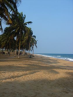
46:A beach in Aného
44:
30:
21:
453:
452:
448:
447:
446:
444:
443:
442:
433:Cantons of Togo
418:
417:
416:
415:
351:
349:
347:6.233°N 1.600°E
345:
342:
337:
334:
332:
330:
329:
320:
303:
298:
297:
290:
286:
276:
274:
270:
269:
265:
260:
225:coastal erosion
221:German Togoland
198:Maritime Region
178:German Togoland
160:, lying on the
109:
107:
103:
100:
95:
92:
90:
88:
87:
81:
80:
79:
78:
75:
74:
73:
72:
68:
47:
35:
28:
23:
22:
15:
12:
11:
5:
451:
449:
441:
440:
435:
430:
420:
419:
414:
413:
406:
399:
391:
388:
387:
370:
327:
326:
319:
318:External links
316:
315:
314:
309:
302:
299:
296:
295:
284:
262:
261:
259:
256:
190:Atlantic Ocean
188:, between the
162:Gulf of Guinea
145:
144:
139:
133:
132:
122:
118:
117:
83:
82:
76:
70:
69:
62:
61:
55:
54:
53:
52:
49:
48:
45:
37:
36:
33:
26:
24:
14:
13:
10:
9:
6:
4:
3:
2:
450:
439:
436:
434:
431:
429:
426:
425:
423:
412:
407:
405:
400:
398:
393:
392:
386:
384:
380:
376:
371:
368:
364:
359:
356:
325:
324:Communes page
322:
321:
317:
313:
310:
308:
305:
304:
300:
293:
288:
285:
273:
267:
264:
257:
255:
253:
249:
245:
241:
237:
233:
228:
226:
222:
218:
214:
210:
207:
204:and it had a
203:
199:
195:
191:
187:
182:
179:
175:
171:
167:
163:
159:
155:
151:
143:
140:
138:
131:
127:
123:
114:
86:Coordinates:
59:
43:
31:
19:
383:expanding it
372:
352:6.233; 1.600
328:
287:
275:. Retrieved
266:
229:
209:slave market
201:
183:
153:
149:
148:
350: /
172:attacks in
108: /
422:Categories
307:Woold Homé
258:References
206:Portuguese
202:Petit Popo
194:Lake Togo
301:See also
277:13 March
170:Denkyira
142:Maritime
96:1°36′0″E
93:6°14′0″N
236:fishing
232:farming
217:capital
121:Country
338:1°36′E
335:6°14′N
272:"Togo"
240:Voodoo
174:Elmina
154:Anecho
150:Aného,
137:Region
373:This
166:Benin
71:Aného
34:Aného
18:Aneho
379:stub
375:Togo
279:2018
234:and
213:Zebe
192:and
186:Lomé
158:Togo
130:Togo
219:of
196:in
424::
227:.
410:e
403:t
396:v
385:.
281:.
20:)
Text is available under the Creative Commons Attribution-ShareAlike License. Additional terms may apply.