36:
253:
43:
197:
in Japan. The dam is used for flood control. The catchment area of the dam is 19 km. The dam impounds about 16 ha of land when full and can store 2139 thousand cubic meters of water. The construction of the dam was completed in 1972.
35:
294:
83:
318:
313:
287:
280:
207:
184:
260:
194:
70:
227:
264:
157:
307:
98:
85:
252:
171:
268:
166:
156:
148:
143:
135:
127:
122:
114:
77:
66:
58:
24:
288:
8:
295:
281:
21:
259:This article about a dam or floodgate in
42:
219:
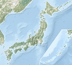
50:Location of Arasawa No. 1 Dam in Japan
7:
249:
247:
228:"Arasawa No. 1 Dam - Dams in Japan"
14:
251:
41:
34:
19:Dam in Iwate Prefecture, Japan
16:Dam in Iwate Prefecture, Japan
1:
193:is a rockfill dam located in
267:. You can help Knowledge by
335:
246:
152:2139 thousand cubic meters
188:
29:
314:Dams in Iwate Prefecture
319:Tōhoku region dam stubs
263:of Honshu, Japan is a
99:40.01472°N 140.93417°E
208:List of dams in Japan
158:Catchment area
149:Total capacity
104:40.01472; 140.93417
95: /
276:
275:
180:Arasawa No. 1 Dam
177:
176:
167:Surface area
123:Dam and spillways
115:Opening date
25:Arasawa No. 1 Dam
326:
297:
290:
283:
255:
248:
238:
237:
235:
234:
224:
195:Iwate Prefecture
192:
190:
110:
109:
107:
106:
105:
100:
96:
93:
92:
91:
88:
71:Iwate Prefecture
45:
44:
38:
22:
334:
333:
329:
328:
327:
325:
324:
323:
304:
303:
302:
301:
244:
242:
241:
232:
230:
226:
225:
221:
216:
204:
182:
103:
101:
97:
94:
89:
86:
84:
82:
81:
54:
53:
52:
51:
48:
47:
46:
20:
17:
12:
11:
5:
332:
330:
322:
321:
316:
306:
305:
300:
299:
292:
285:
277:
274:
273:
256:
240:
239:
218:
217:
215:
212:
211:
210:
203:
200:
175:
174:
168:
164:
163:
160:
154:
153:
150:
146:
145:
141:
140:
137:
133:
132:
129:
125:
124:
120:
119:
116:
112:
111:
79:
75:
74:
68:
64:
63:
60:
56:
55:
49:
40:
39:
33:
32:
31:
30:
27:
26:
18:
15:
13:
10:
9:
6:
4:
3:
2:
331:
320:
317:
315:
312:
311:
309:
298:
293:
291:
286:
284:
279:
278:
272:
270:
266:
262:
261:Tōhoku region
257:
254:
250:
245:
229:
223:
220:
213:
209:
206:
205:
201:
199:
196:
186:
181:
173:
169:
165:
161:
159:
155:
151:
147:
142:
138:
134:
130:
126:
121:
117:
113:
108:
80:
76:
72:
69:
65:
61:
59:Official name
57:
37:
28:
23:
269:expanding it
258:
243:
231:. Retrieved
222:
179:
178:
102: /
90:140°56′03″E
78:Coordinates
308:Categories
233:2022-02-22
214:References
162:19 sq. km
144:Reservoir
87:40°0′53″N
202:See also
185:Japanese
172:hectares
67:Location
73:, Japan
189:荒沢1号ダム
139:157.7m
136:Length
128:Height
62:荒沢1号ダム
265:stub
118:1972
170:16
131:38m
310::
187::
296:e
289:t
282:v
271:.
236:.
191:)
183:(
Text is available under the Creative Commons Attribution-ShareAlike License. Additional terms may apply.