102:
86:
439:, Arundel recorded a population of 9,575 people, 51.7% female and 48.3% male. The median age of the Arundel population was 36 years, 1 year below the national median of 37. 60.9% of people living in Arundel were born in Australia. The other top responses for country of birth were New Zealand 9.7%, England 5.5%, China 1.3%, South Africa 1.2%, Korea, Republic of 1.2%. 80% of people spoke only English at home; the next most common languages were 1.6% Korean, 1.5% Mandarin, 1.2% Japanese, 0.8% Cantonese, 0.5% Greek.
883:
849:
725:
453:, Arundel recorded a population of 11,171 people, 51.2% female and 48.8% male. The median age of the Arundel population was 41 years, 3 years above the national median of 38. 59.5% of people living in Arundel were born in Australia. The other top responses for country of birth were New Zealand 8%, England 5.3%, China 3.1%, India 1.9%, Philippines 1.5%. 74.9% of people spoke only English at home; the next most common languages were 3.9% Mandarin, 1.4% Japanese, 0.9% Korean, 0.8% Cantonese, 0.7% Arabic.
663:
109:
138:
524:
285:
273:
477:
919:
1250:
1052:
514:). In 2022, the school had an enrolment of 1066 students with 78 teachers (71 full-time equivalent) and 41 non-teaching staff (28.2 full-time equivalent). It includes a
1350:
1711:
561:). In 2022, the school had an enrolment of 1598 students with 104 teachers (102.3 full-time equivalent) and 92 non-teaching staff (77.6 full-time equivalent).
1178:
737:
794:
643:
and motocross venue on Kendor Street, off
Captain Cook Drive (lot 10). The track has held significant events in the past, including the final of the
1610:
1243:
600:
101:
261:
1405:
370:
1236:
911:
394:
1650:
1360:
861:
827:
703:
1044:
624:
769:
1325:
1635:
1390:
1385:
648:
644:
612:
474:
Arundel State School is a government primary (Prep-6) school for boys and girls at Cnr Napper Road & Arundel Drive (
278:
246:
131:
23:
1455:
1340:
573:
565:
521:
A B Paterson
College is a private primary and secondary (Prep-12) school for boys and girls at 10 A B Paterson Drive (
1595:
1565:
1525:
1510:
1480:
1335:
1300:
1259:
676:
616:
318:
1665:
1660:
1600:
1555:
1475:
1425:
581:
402:
1191:
593:
465:
120 - 124 Allied Drive: former
Burleigh Police Station, former Tallebudgera Police Station, Nui Dat House
424:
A.B. Paterson
College opened on 1 January 1991. In 2021, A.B. Paterson College celebrated its 30th anniversary.
1645:
1545:
1500:
421:
In
September 1989, Arundel was officially named a suburb and has since grown into a series of housing estates.
1675:
1670:
1620:
1605:
1590:
1580:
1440:
1435:
1365:
1290:
1270:
1186:
802:
1680:
1560:
1505:
1495:
1465:
1445:
1420:
1320:
971:
945:
865:
831:
707:
608:
450:
443:
436:
382:
340:
308:
199:
183:
85:
72:
50:
1630:
1625:
1615:
1520:
1470:
1430:
1380:
1355:
1315:
915:
773:
745:
577:
569:
406:
350:
313:
240:
45:
1228:
997:
1570:
1550:
1485:
1460:
1450:
1275:
604:
398:
345:
333:
40:
1575:
1530:
1410:
1395:
1375:
1345:
1330:
1310:
1305:
1285:
1023:
640:
620:
1690:
1640:
1585:
1540:
1515:
1295:
564:
There is no government secondary school in
Arundel. The nearest government secondary schools are
374:
290:
266:
1655:
1490:
1400:
668:
515:
410:
325:
217:
1535:
1099:
882:
848:
724:
1705:
35:
596:, which has its own golf course. As of 24 May 2022, the country club has closed.
1149:
658:
378:
226:
76:
1124:
540:
526:
493:
479:
154:
140:
1685:
1370:
1019:
1217:
252:
1415:
1074:
628:
1224:. Centre for the Government of Queensland, University of Queensland.
461:
There are a number of heritage-listed sites in
Arundel, including:
599:
Other major facilities are located in adjacent suburbs, including
639:
The Mike
Hatcher Raceway (formerly the Gold Coast Speedway) is a
222:
1232:
993:
967:
941:
413:
is located in
Arundel, for the purpose of flood mitigation.
580:
to the south-east, and
Pacific Pines State High School in
894:
Gold Coast Local Heritage Register - A to M, pp. 17-18
738:"Arundel – suburb in City of Gold Coast (entry 49865)"
1260:
Suburbs and localities, Gold Coast City, Queensland
284:
272:
260:
233:
216:
208:
198:
190:
178:
130:
66:
1045:"Gold Coast's Arundel Hills to close immediately"
770:"Opening and closing dates of Queensland Schools"
906:
904:
902:
900:
297:
427:Arundel State School opened on 1 January 1994.
1244:
1179:"Gold Coast Local Heritage Register - A to M"
446:, Arundel had a population of 10,246 people.
385:, Arundel had a population of 11,171 people.
8:
822:
820:
698:
696:
694:
692:
61:Suburb of Gold Coast, Queensland, Australia
1251:
1237:
1229:
881:
847:
723:
84:
63:
968:"Arundel SS - Special Education Program"
688:
1712:Suburbs of the Gold Coast, Queensland
1055:from the original on 26 December 2023
338:
323:
306:
299:
7:
1100:"Individual Australian Championship"
1000:from the original on 9 November 2018
912:"State and non-state school details"
764:
762:
592:Situated within the suburb was the
1125:"The Australian Solo Championship"
974:from the original on 15 April 2021
948:from the original on 15 April 2021
212:10.3 km (4.0 sq mi)
14:
922:from the original on 8 April 2023
795:"Queensland school anniversaries"
251:66.9 km (42 mi) NNW of
661:
395:Coombabah Lake Conservation Park
245:12.1 km (8 mi) NNW of
107:
100:
862:Australian Bureau of Statistics
828:Australian Bureau of Statistics
704:Australian Bureau of Statistics
108:
651:six times, from 2000 to 2008.
625:Gold Coast University Hospital
239:8.2 km (5 mi) NW of
1:
801:. 1 July 2016. Archived from
393:Located in the suburb is the
1611:Southern Moreton Bay Islands
649:Queensland Solo Championship
645:Australian Solo Championship
613:Harbour Town Shopping Centre
574:Southport State High School
566:Coombabah State High School
403:Ivan Gibbs Wetlands Reserve
194:1,085/km (2,809/sq mi)
51:GPX (secondary coordinates)
1728:
1075:"Where Champions are born"
677:List of Gold Coast suburbs
601:Helensvale railway station
594:Arundel Hills Country Club
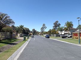
166:Arundel (centre of suburb)
1266:
1104:Historia Sportu Zuzlowego
629:G:link light rail service
356:
300:
296:
126:
95:
83:
46:GPX (primary coordinates)
21:Map all coordinates using
832:"Arundel (State Suburb)"
29:Download coordinates as:
1606:South Stradbroke Island
1187:Gold Coast City Council
1154:Motorcycling Queensland
302:Suburbs around Arundel:
994:"A B Paterson College"
942:"Arundel State School"
870:2016 Census QuickStats
836:2011 Census QuickStats
742:Queensland Place Names
712:2021 Census QuickStats
916:Queensland Government
774:Queensland Government
746:Queensland Government
90:Greenacre Drive, 2015
41:GPX (all coordinates)
1079:Mike Hatcher Raceway
799:Education Queensland
605:Westfield Helensvale
552:A B Paterson College
541:27.9276°S 153.3603°E
505:Arundel State School
494:27.9450°S 153.3658°E
401:and adjacent to the
381:, Australia. In the
155:27.9386°S 153.3638°E
1651:Tallebudgera Valley
1361:Clear Island Waters
1024:State of Queensland
830:(31 October 2012).
805:on 16 February 2018
641:motorcycle speedway
621:Griffith University
536: /
489: /
286:Federal division(s)
274:State electorate(s)
150: /
1020:"Queensland Globe"
546:-27.9276; 153.3603
499:-27.9450; 153.3658
375:City of Gold Coast
267:City of Gold Coast
160:-27.9386; 153.3638
1699:
1698:
1326:Broadbeach Waters
1222:Queensland Places
1197:on 26 August 2020
669:Queensland portal
516:special education
457:Heritage listings
411:Biggera Creek Dam
364:
363:
360:
359:
1719:
1636:Surfers Paradise
1391:Currumbin Waters
1386:Currumbin Valley
1253:
1246:
1239:
1230:
1225:
1206:
1204:
1202:
1196:
1190:. Archived from
1183:
1165:
1164:
1162:
1160:
1146:
1140:
1139:
1137:
1135:
1129:Vintage Speedway
1121:
1115:
1114:
1112:
1110:
1096:
1090:
1089:
1087:
1085:
1071:
1065:
1064:
1062:
1060:
1041:
1035:
1034:
1032:
1030:
1016:
1010:
1009:
1007:
1005:
990:
984:
983:
981:
979:
964:
958:
957:
955:
953:
938:
932:
931:
929:
927:
908:
895:
892:
886:
885:
880:
878:
876:
864:(27 June 2017).
858:
852:
851:
846:
844:
842:
824:
815:
814:
812:
810:
791:
785:
784:
782:
780:
766:
757:
756:
754:
752:
734:
728:
727:
722:
720:
718:
706:(28 June 2022).
700:
671:
666:
665:
664:
647:in 2004 and the
576:in neighbouring
568:in neighbouring
560:
559:
557:
556:
555:
553:
548:
547:
542:
537:
534:
533:
532:
529:
513:
512:
510:
509:
508:
506:
501:
500:
495:
490:
487:
486:
485:
482:
298:
247:Surfers Paradise
174:
173:
171:
170:
169:
167:
162:
161:
156:
151:
148:
147:
146:
143:
111:
110:
104:
88:
79:
69:
64:
1727:
1726:
1722:
1721:
1720:
1718:
1717:
1716:
1702:
1701:
1700:
1695:
1536:Numinbah Valley
1456:Lower Beechmont
1341:Burleigh Waters
1262:
1257:
1216:
1213:
1200:
1198:
1194:
1181:
1177:
1174:
1169:
1168:
1158:
1156:
1148:
1147:
1143:
1133:
1131:
1123:
1122:
1118:
1108:
1106:
1098:
1097:
1093:
1083:
1081:
1073:
1072:
1068:
1058:
1056:
1051:. 25 May 2022.
1043:
1042:
1038:
1028:
1026:
1018:
1017:
1013:
1003:
1001:
992:
991:
987:
977:
975:
966:
965:
961:
951:
949:
940:
939:
935:
925:
923:
910:
909:
898:
893:
889:
874:
872:
866:"Arundel (SSC)"
860:
859:
855:
840:
838:
826:
825:
818:
808:
806:
793:
792:
788:
778:
776:
768:
767:
760:
750:
748:
736:
735:
731:
716:
714:
708:"Arundel (SAL)"
702:
701:
690:
685:
667:
662:
660:
657:
637:
590:
551:
549:
545:
543:
539:
538:
535:
530:
527:
525:
523:
522:
504:
502:
498:
496:
492:
491:
488:
483:
480:
478:
476:
475:
472:
459:
433:
419:
399:Coombabah Creek
391:
191: • Density
165:
163:
159:
157:
153:
152:
149:
144:
141:
139:
137:
136:
122:
121:
120:
119:
118:
117:
116:
112:
91:
71:
70:
67:
62:
59:
58:
57:
56:
55:
12:
11:
5:
1725:
1723:
1715:
1714:
1704:
1703:
1697:
1696:
1694:
1693:
1688:
1683:
1678:
1673:
1668:
1663:
1658:
1653:
1648:
1643:
1638:
1633:
1628:
1623:
1618:
1613:
1608:
1603:
1598:
1596:Sanctuary Cove
1593:
1588:
1583:
1578:
1573:
1568:
1566:Paradise Point
1563:
1558:
1553:
1548:
1543:
1538:
1533:
1528:
1526:North Burleigh
1523:
1518:
1513:
1511:Natural Bridge
1508:
1503:
1498:
1493:
1488:
1483:
1481:Mermaid Waters
1478:
1473:
1468:
1463:
1458:
1453:
1448:
1443:
1438:
1433:
1428:
1423:
1418:
1413:
1408:
1403:
1398:
1393:
1388:
1383:
1378:
1373:
1368:
1363:
1358:
1353:
1348:
1343:
1338:
1336:Burleigh Heads
1333:
1328:
1323:
1318:
1313:
1308:
1303:
1301:Biggera Waters
1298:
1293:
1288:
1283:
1278:
1273:
1267:
1264:
1263:
1258:
1256:
1255:
1248:
1241:
1233:
1227:
1226:
1212:
1211:External links
1209:
1208:
1207:
1173:
1170:
1167:
1166:
1141:
1116:
1091:
1066:
1049:Golf Australia
1036:
1011:
985:
959:
933:
896:
887:
853:
816:
786:
758:
729:
687:
686:
684:
681:
680:
679:
673:
672:
656:
653:
636:
633:
617:Biggera Waters
589:
586:
572:to the north,
471:
468:
467:
466:
458:
455:
432:
429:
418:
415:
397:, bordered by
390:
387:
362:
361:
358:
357:
354:
353:
348:
343:
337:
336:
331:
328:
322:
321:
319:Biggera Waters
316:
311:
305:
304:
294:
293:
288:
282:
281:
276:
270:
269:
264:
258:
257:
256:
255:
249:
243:
235:
231:
230:
220:
214:
213:
210:
206:
205:
202:
196:
195:
192:
188:
187:
180:
176:
175:
134:
128:
127:
124:
123:
114:
113:
106:
105:
99:
98:
97:
96:
93:
92:
89:
81:
80:
60:
54:
53:
48:
43:
38:
32:
26:
19:
18:
17:
13:
10:
9:
6:
4:
3:
2:
1724:
1713:
1710:
1709:
1707:
1692:
1689:
1687:
1684:
1682:
1679:
1677:
1674:
1672:
1669:
1667:
1666:Varsity Lakes
1664:
1662:
1661:Upper Coomera
1659:
1657:
1654:
1652:
1649:
1647:
1644:
1642:
1639:
1637:
1634:
1632:
1629:
1627:
1624:
1622:
1619:
1617:
1614:
1612:
1609:
1607:
1604:
1602:
1601:Santa Barbara
1599:
1597:
1594:
1592:
1589:
1587:
1584:
1582:
1579:
1577:
1574:
1572:
1569:
1567:
1564:
1562:
1559:
1557:
1556:Pacific Pines
1554:
1552:
1549:
1547:
1544:
1542:
1539:
1537:
1534:
1532:
1529:
1527:
1524:
1522:
1519:
1517:
1514:
1512:
1509:
1507:
1504:
1502:
1499:
1497:
1494:
1492:
1489:
1487:
1484:
1482:
1479:
1477:
1476:Mermaid Beach
1474:
1472:
1469:
1467:
1464:
1462:
1459:
1457:
1454:
1452:
1449:
1447:
1444:
1442:
1439:
1437:
1434:
1432:
1429:
1427:
1426:Highland Park
1424:
1422:
1419:
1417:
1414:
1412:
1409:
1407:
1404:
1402:
1399:
1397:
1394:
1392:
1389:
1387:
1384:
1382:
1379:
1377:
1374:
1372:
1369:
1367:
1364:
1362:
1359:
1357:
1354:
1352:
1349:
1347:
1344:
1342:
1339:
1337:
1334:
1332:
1329:
1327:
1324:
1322:
1319:
1317:
1314:
1312:
1309:
1307:
1304:
1302:
1299:
1297:
1294:
1292:
1289:
1287:
1284:
1282:
1279:
1277:
1274:
1272:
1269:
1268:
1265:
1261:
1254:
1249:
1247:
1242:
1240:
1235:
1234:
1231:
1223:
1219:
1215:
1214:
1210:
1193:
1189:
1188:
1180:
1176:
1175:
1171:
1155:
1151:
1145:
1142:
1130:
1126:
1120:
1117:
1105:
1101:
1095:
1092:
1080:
1076:
1070:
1067:
1054:
1050:
1046:
1040:
1037:
1025:
1021:
1015:
1012:
999:
995:
989:
986:
973:
969:
963:
960:
947:
943:
937:
934:
921:
917:
913:
907:
905:
903:
901:
897:
891:
888:
884:
871:
867:
863:
857:
854:
850:
837:
833:
829:
823:
821:
817:
804:
800:
796:
790:
787:
775:
771:
765:
763:
759:
747:
743:
739:
733:
730:
726:
713:
709:
705:
699:
697:
695:
693:
689:
682:
678:
675:
674:
670:
659:
654:
652:
650:
646:
642:
634:
632:
630:
626:
622:
618:
614:
610:
606:
602:
597:
595:
587:
585:
584:to the west.
583:
582:Pacific Pines
579:
575:
571:
567:
562:
558:
519:
517:
511:
469:
464:
463:
462:
456:
454:
452:
447:
445:
440:
438:
430:
428:
425:
422:
416:
414:
412:
408:
404:
400:
396:
388:
386:
384:
380:
376:
372:
368:
355:
352:
349:
347:
344:
342:
339:
335:
332:
329:
327:
324:
320:
317:
315:
312:
310:
307:
303:
295:
292:
289:
287:
283:
280:
277:
275:
271:
268:
265:
263:
259:
254:
250:
248:
244:
242:
238:
237:
236:
232:
228:
224:
221:
219:
215:
211:
207:
203:
201:
197:
193:
189:
185:
182:11,171 (
181:
177:
172:
135:
133:
129:
125:
103:
94:
87:
82:
78:
74:
65:
52:
49:
47:
44:
42:
39:
37:
34:
33:
31:
30:
25:
24:OpenStreetMap
22:
16:
1646:Tallebudgera
1546:Ormeau Hills
1501:Mount Nathan
1280:
1221:
1199:. Retrieved
1192:the original
1185:
1157:. Retrieved
1153:
1144:
1132:. Retrieved
1128:
1119:
1107:. Retrieved
1103:
1094:
1082:. Retrieved
1078:
1069:
1057:. Retrieved
1048:
1039:
1027:. Retrieved
1014:
1002:. Retrieved
988:
976:. Retrieved
962:
950:. Retrieved
936:
924:. Retrieved
890:
873:. Retrieved
869:
856:
839:. Retrieved
835:
807:. Retrieved
803:the original
798:
789:
777:. Retrieved
751:18 September
749:. Retrieved
741:
732:
715:. Retrieved
711:
638:
598:
591:
563:
520:
473:
460:
448:
441:
434:
431:Demographics
426:
423:
420:
392:
366:
365:
301:
28:
27:
20:
15:
1676:Wongawallan
1671:Willow Vale
1621:Springbrook
1591:Runaway Bay
1581:Reedy Creek
1441:Jacobs Well
1436:Hope Island
1366:Coolangatta
1351:Cedar Creek
1291:Austinville
1271:Advancetown
1134:19 February
1109:19 February
1084:19 February
1059:26 December
1004:21 November
926:26 December
717:28 February
544: /
531:153°21′37″E
497: /
484:153°21′57″E
451:2021 census
444:2016 census
437:2011 census
383:2021 census
200:Postcode(s)
184:2021 census
158: /
145:153°21′50″E
132:Coordinates
1681:Woongoolba
1561:Palm Beach
1506:Mudgeeraba
1496:Molendinar
1466:Main Beach
1446:Kingsholme
1421:Helensvale
1321:Broadbeach
1150:"Speedway"
1029:17 October
875:20 October
683:References
609:Helensvale
550: (
528:27°55′39″S
503: (
481:27°56′42″S
379:Queensland
341:Molendinar
309:Helensvale
179:Population
164: (
142:27°56′19″S
77:Queensland
73:Gold Coast
1686:Worongary
1631:Steiglitz
1626:Stapylton
1616:Southport
1521:Neranwood
1471:Maudsland
1431:Hollywell
1406:Gilberton
1381:Currumbin
1371:Coombabah
1356:Clagiraba
1316:Boykambil
1218:"Arundel"
1201:26 August
588:Amenities
578:Southport
570:Coombabah
518:program.
470:Education
407:Coombabah
389:Geography
351:Southport
314:Coombabah
241:Southport
227:UTC+10:00
218:Time zone
1706:Category
1571:Parkwood
1551:Oxenford
1486:Merrimac
1461:Luscombe
1451:Labrador
1276:Alberton
1159:2 August
1053:Archived
998:Archived
978:26 March
972:Archived
952:26 March
946:Archived
920:Archived
918:. 2022.
809:12 March
779:18 April
655:See also
627:and the
346:Parkwood
334:Labrador
253:Brisbane
234:Location
1576:Pimpama
1531:Norwell
1416:Guanaba
1411:Gilston
1396:Elanora
1376:Coomera
1346:Carrara
1331:Bundall
1311:Bonogin
1306:Bilinga
1286:Ashmore
1281:Arundel
1172:Sources
449:In the
442:In the
435:In the
417:History
373:in the
367:Arundel
330:Arundel
115:Arundel
75:,
68:Arundel
1691:Yatala
1641:Tallai
1586:Robina
1541:Ormeau
1516:Nerang
1296:Benowa
841:6 July
619:) and
409:. The
371:suburb
291:Fadden
279:Bonney
262:LGA(s)
1656:Tugun
1491:Miami
1401:Gaven
1195:(PDF)
1182:(PDF)
635:Sport
369:is a
326:Gaven
1203:2020
1161:2023
1136:2024
1111:2024
1086:2024
1061:2023
1031:2020
1006:2018
980:2021
954:2021
928:2023
877:2018
843:2014
811:2018
781:2019
753:2020
719:2023
603:and
223:AEST
209:Area
204:4214
611:),
405:in
36:KML
1708::
1220:.
1184:.
1152:.
1127:.
1102:.
1077:.
1047:.
1022:.
996:.
970:.
944:.
914:.
899:^
868:.
834:.
819:^
797:.
772:.
761:^
744:.
740:.
710:.
691:^
631:.
623:,
377:,
1252:e
1245:t
1238:v
1205:.
1163:.
1138:.
1113:.
1088:.
1063:.
1033:.
1008:.
982:.
956:.
930:.
879:.
845:.
813:.
783:.
755:.
721:.
615:(
607:(
554:)
507:)
229:)
225:(
186:)
168:)
Text is available under the Creative Commons Attribution-ShareAlike License. Additional terms may apply.