294:, the river Reutenbach diverges from the Buxach. Only very little water flows through that direct connection; the Reutenbach is mostly fed by the outflow of the Buxheimer Weiher, which is 200 meters (660 ft) away. The Reutenbach flows northwards through Buxheim and feeds a fish pond near Egelsee (district of Memmingen), then also flows into the river Iller. The mouth of the Reutenbach in the Iller is about 2.3 kilometres (1.4 mi) north from the mouth of the Buxach.
29:
282:
In former times, the Buxach also fed the
Memminger municipal pond southward of Hart. The pond was drained around 1900, today still the name of the street "Am Stadtweiher" ("at the municipal pond") is a reminder. Especially in Hart and Buxach, the river was used for industry. In Hart, there was a
279:. The water of the Buxheimer Weiher does not flow back into the Buxach, but into the Reutenbach. The Buxach itself flows west from Buxheim on the Illerstadion into the Iller.
150:
264:), most of its course it flows freely. The river banks are surrounded by forests and villages as well as meadows. The Buxach feeds the
341:
351:
346:
303:
322:
265:
283:
copper hammer, and several mills and copper hammers existed in Buxach. At the east of
Kronburg, an
260:
Heißenschwende. The Buxach is straightened only few places in Hart and Buxach (two districts of
245:
and about 16.7 kilometres (10.4 mi) long. Its source is southeast of the municipality of
58:
250:
276:
136:
270:
335:
117:
188:
106:
165:
152:
261:
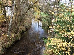
219:
28:
255:
284:
246:
93:
235:
231:
63:
51:
215:
34:
325:
by the
Bavarian State Office for the Environment (xls, 10.3 MB)
242:
211:
132:
207:
202:
194:
181:
142:
126:
116:
99:
86:
78:
69:
57:
47:
42:
21:
323:Complete table of the Bavarian Waterbody Register
8:
241:The Buxbach is a right tributary of the
315:
105:about 700 metres (2,300 ft) above
18:
7:
14:
187:573 metres (1,880 ft) above
27:
144: • coordinates
1:
290:At Buxheim, west of the pond
70:Physical characteristics
198:16.7 km (10.4 mi)
183: • elevation
101: • elevation
128: • location
88: • location
368:
304:List of rivers of Bavaria
112:
74:
26:
342:Tributaries of the Iller
275:, a reservoir north of
203:Basin features
166:47.9991°N 10.1222°E
162: /
352:Rivers of Germany
347:Rivers of Bavaria
225:
224:
359:
326:
320:
292:Buxheimer Weiher
274:
266:Buxheimer Weiher
259:
177:
176:
174:
173:
172:
171:47.9991; 10.1222
167:
163:
160:
159:
158:
155:
102:
89:
31:
19:
16:River in Germany
367:
366:
362:
361:
360:
358:
357:
356:
332:
331:
330:
329:
321:
317:
312:
300:
268:
253:
184:
170:
168:
164:
161:
156:
153:
151:
149:
148:
145:
129:
100:
87:
38:
17:
12:
11:
5:
365:
363:
355:
354:
349:
344:
334:
333:
328:
327:
314:
313:
311:
308:
307:
306:
299:
296:
287:was operated.
230:is a river of
223:
222:
209:
205:
204:
200:
199:
196:
192:
191:
185:
182:
179:
178:
146:
143:
140:
139:
130:
127:
124:
123:
120:
114:
113:
110:
109:
103:
97:
96:
90:
84:
83:
80:
76:
75:
72:
71:
67:
66:
61:
55:
54:
49:
45:
44:
40:
39:
32:
24:
23:
15:
13:
10:
9:
6:
4:
3:
2:
364:
353:
350:
348:
345:
343:
340:
339:
337:
324:
319:
316:
309:
305:
302:
301:
297:
295:
293:
288:
286:
280:
278:
272:
267:
263:
257:
252:
248:
244:
239:
237:
233:
229:
221:
217:
213:
210:
206:
201:
197:
193:
190:
186:
180:
175:
147:
141:
138:
134:
131:
125:
121:
119:
115:
111:
108:
104:
98:
95:
91:
85:
81:
77:
73:
68:
65:
62:
60:
56:
53:
50:
46:
41:
36:
30:
25:
20:
318:
291:
289:
281:
240:
227:
226:
269: [
254: [
249:, near the
208:Progression
169: /
37:, Memmingen
336:Categories
310:References
157:10°07′20″E
154:47°59′57″N
33:Buxach in
262:Memmingen
220:Black Sea
298:See also
285:oil mill
247:Kronburg
94:Kronburg
43:Location
277:Buxheim
236:Germany
232:Bavaria
137:Buxheim
64:Bavaria
52:Germany
48:Country
251:Einöde
228:Buxach
216:Danube
195:Length
122:
82:
79:Source
35:Buxach
22:Buxach
273:]
258:]
243:Iller
212:Iller
133:Iller
118:Mouth
59:State
135:at
92:at
338::
271:de
256:de
238:.
234:,
218:→
214:→
189:NN
107:NN
Text is available under the Creative Commons Attribution-ShareAlike License. Additional terms may apply.